

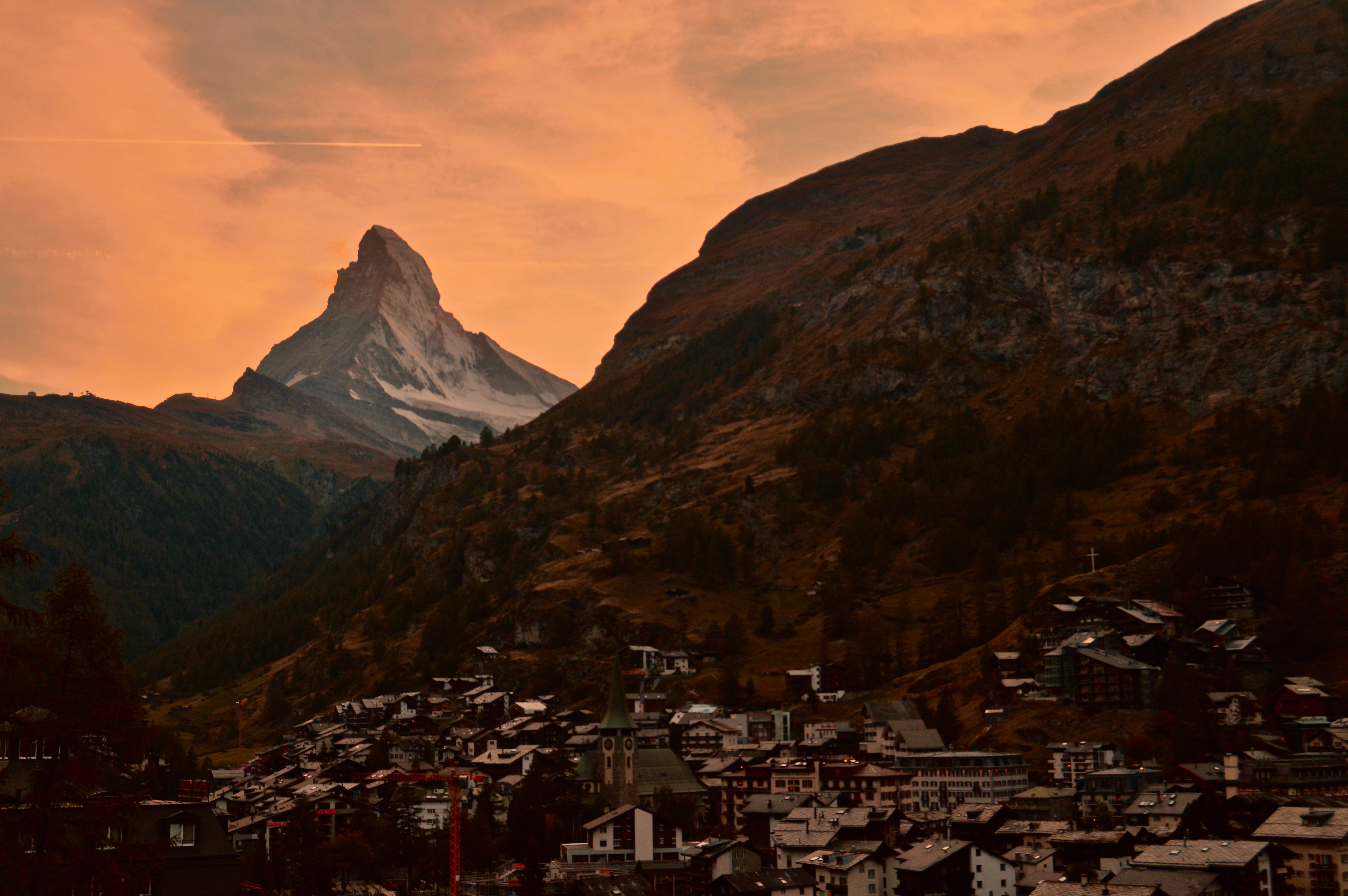
If you are anywhere near Zermatt, the Matterhorn acts like a magnet, always pulling your gaze towards it. On a clear day, which is pretty rare, the iconic peak can be viewed from almost anywhere in town, as well as the neighboring mountainsides.
Zermatt is a tourist hub where most people visiting have one goal in mind: to see the Matterhorn. As a result, there is no shortage on tours or expensive trains/cable cars that will take you high up to some of the most scenic viewpoints of the mountain. That is, if you’re willing to pay the price; for example, the Gonergrat Glacier train, probably the most popular option, will set you back between 50-100 USD. Fortunately, if you are like me and on a tight budget (based on my budget I shouldn’t even be in Zermatt, but it has been a dream of mine to see the Matterhorn since the first time I rode the Disneyland version of it as a child), there are a few cheap–and free–options to get equally incredible views. Just be prepared to walk a little.
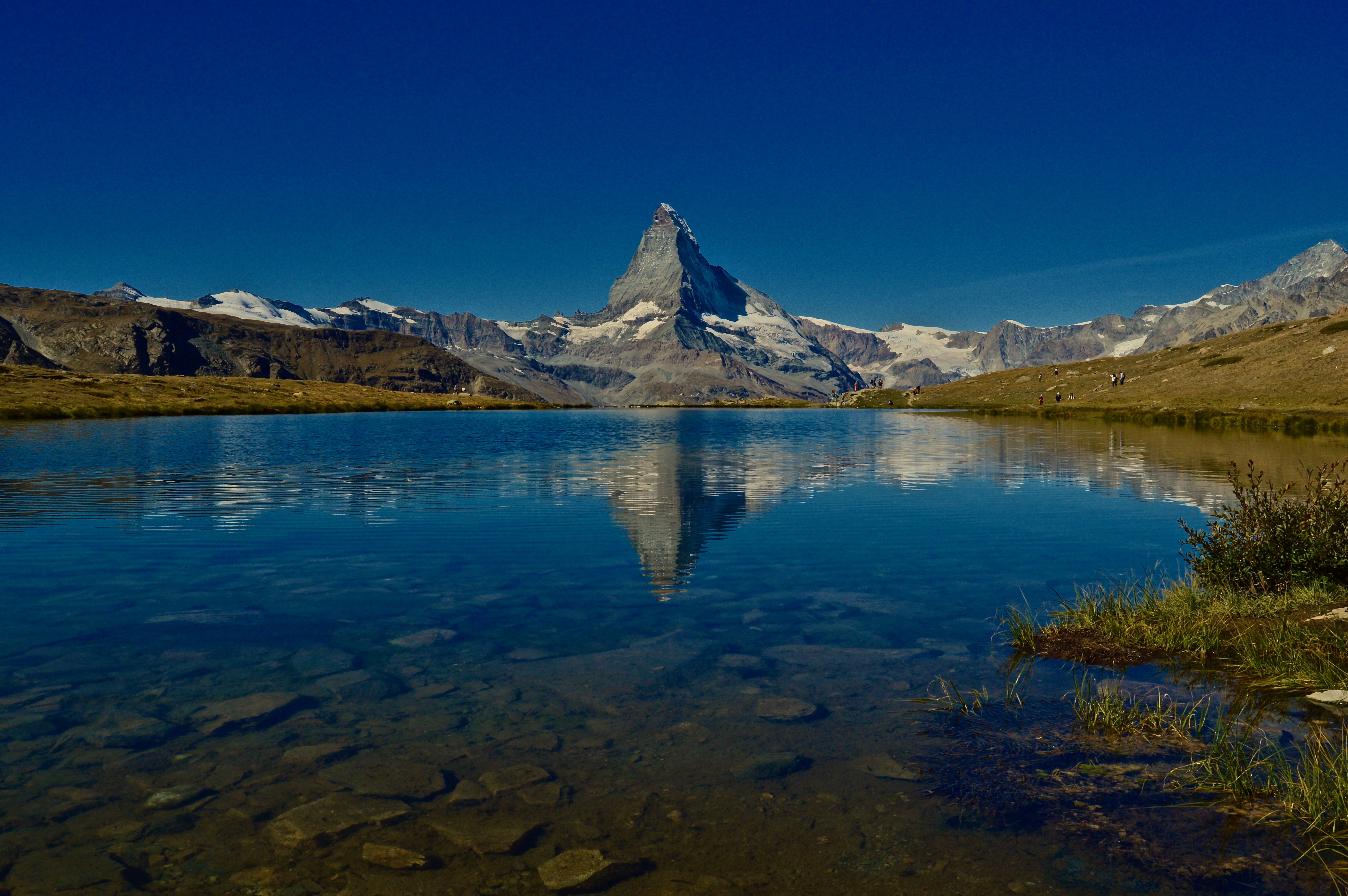
1. Hike to Stellisee
If I had to recommend one place to view and shoot the Matterhorn, Stellisee would be it. Try to get there in the morning (before 11am), and on a clear day, to catch the reflection of the peak in the lake.


How to get there:
You can either take a train-like thing (it’s not quite a train, more like a gondola on tracks…idk) up to Sunegga for 16 CHF one-way, or walk from Zermatt to Sunegga–about 2 hours–for free. From there, follow the trail to Stellisee (Trail #8) for about one hour. Stellisee is the last lake along the 5 seenweg (5 lakes trail–Trail #11), but it is quicker to take the trail that follows alongside the gondola.

On the way back, either take the same trail back to Sunegga (#8), or take the more scenic (about 1.5 hours longer) 5 seenweg trail (#11) and stop at four more lakes along the way. From Sunegga, it is an hour and a half downhill back to Zermatt.
2. Matterhorn Trail from Zermatt
The Matterhorn Trail (Trail #29) can be easily accessed from the center of Zermatt and provides great views as you walk towards the Matterhorn. For a long climb, take the trail all the way around, or for a shorter hike, take the trail towards Furi once you hit Zmutt. Both ways will lead you back to Zermatt.


3. Overlooking town
The shortest and easiest spot is located on the road just above Zermatt (it is actually the same road you would hike up/down to Sunegga) and is the perfect location to catch the sunset as it sets over the Matterhorn and the town. And of course, it is completely free!

Over my ten days spent in Switzerland, I had a difficult time comprehending the jaw-dropping, eye-popping, awe-inspiring immensity of the Swiss Alps. From iconic peaks like the Matterhorn, Eiger, Mönch and Jungfrau, to the sleepy, quaint, frozen-in-time villages that dot the hillsides in their shadow, the landscapes of Switzerland were magic to the eye. Here are a few of my favorite shots during my stay:
Featured: The high alpine lake Stellisee reflects the image of the Matterhorn on a clear sunny morning.
1. The sun sets over Zermatt as the Matterhorn looms above.
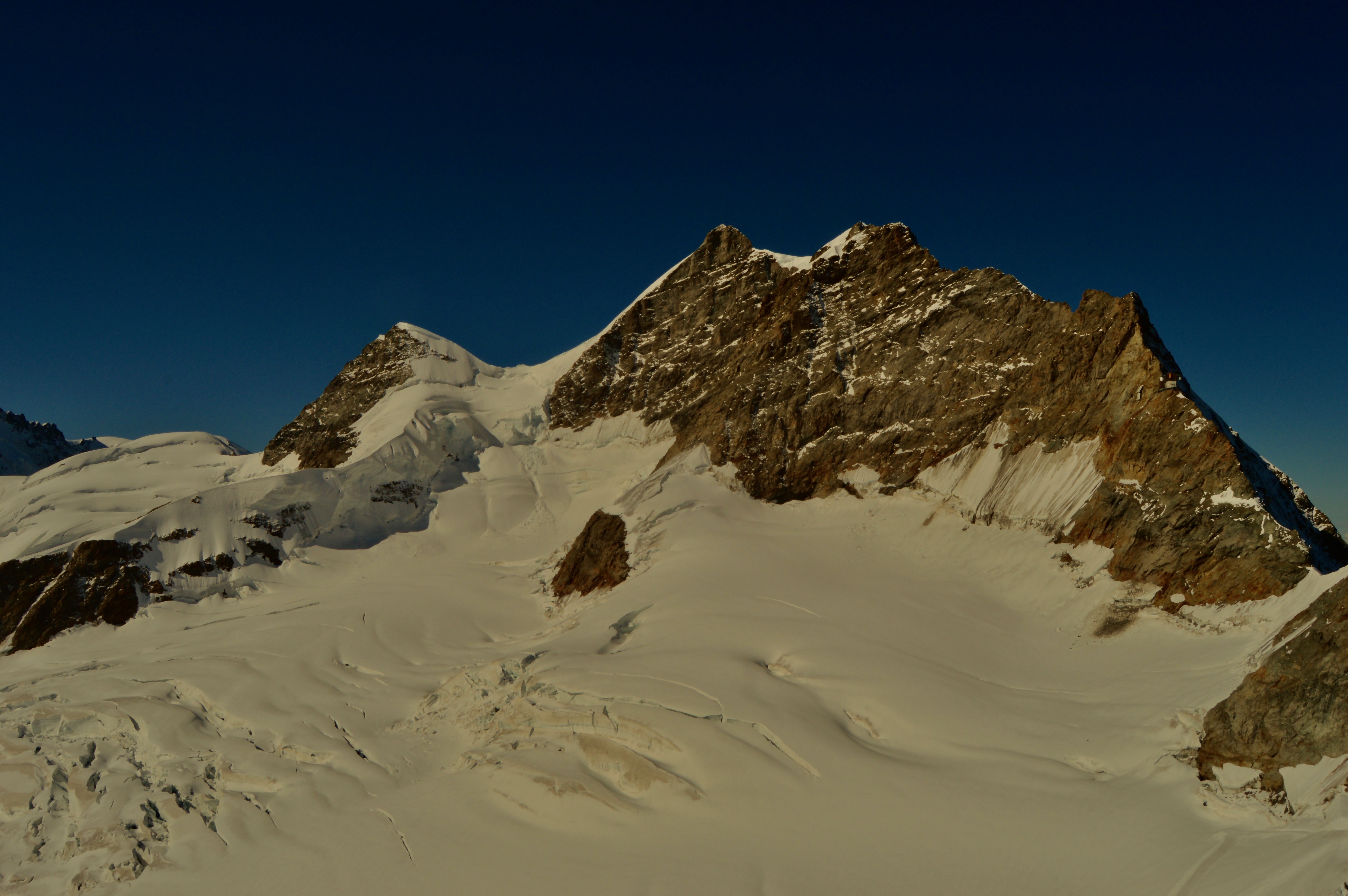
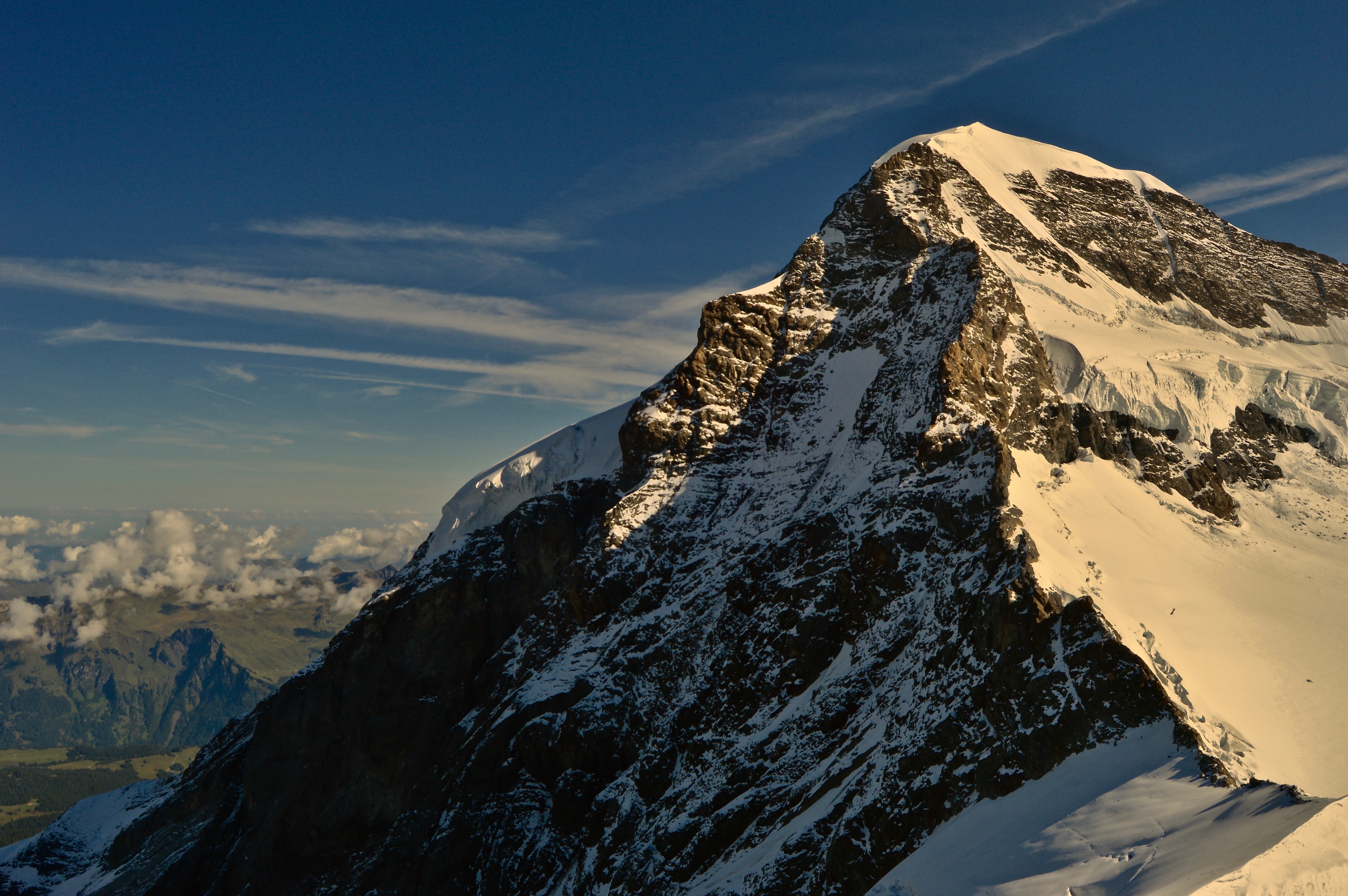
2. Jungfrau, one of the main summits of the Bernese Alps, and the highest peak of the massif that includes Mönch and Eiger.
3. Mönch sits adjacent to Jungfrau, towering over Grindelwald below.
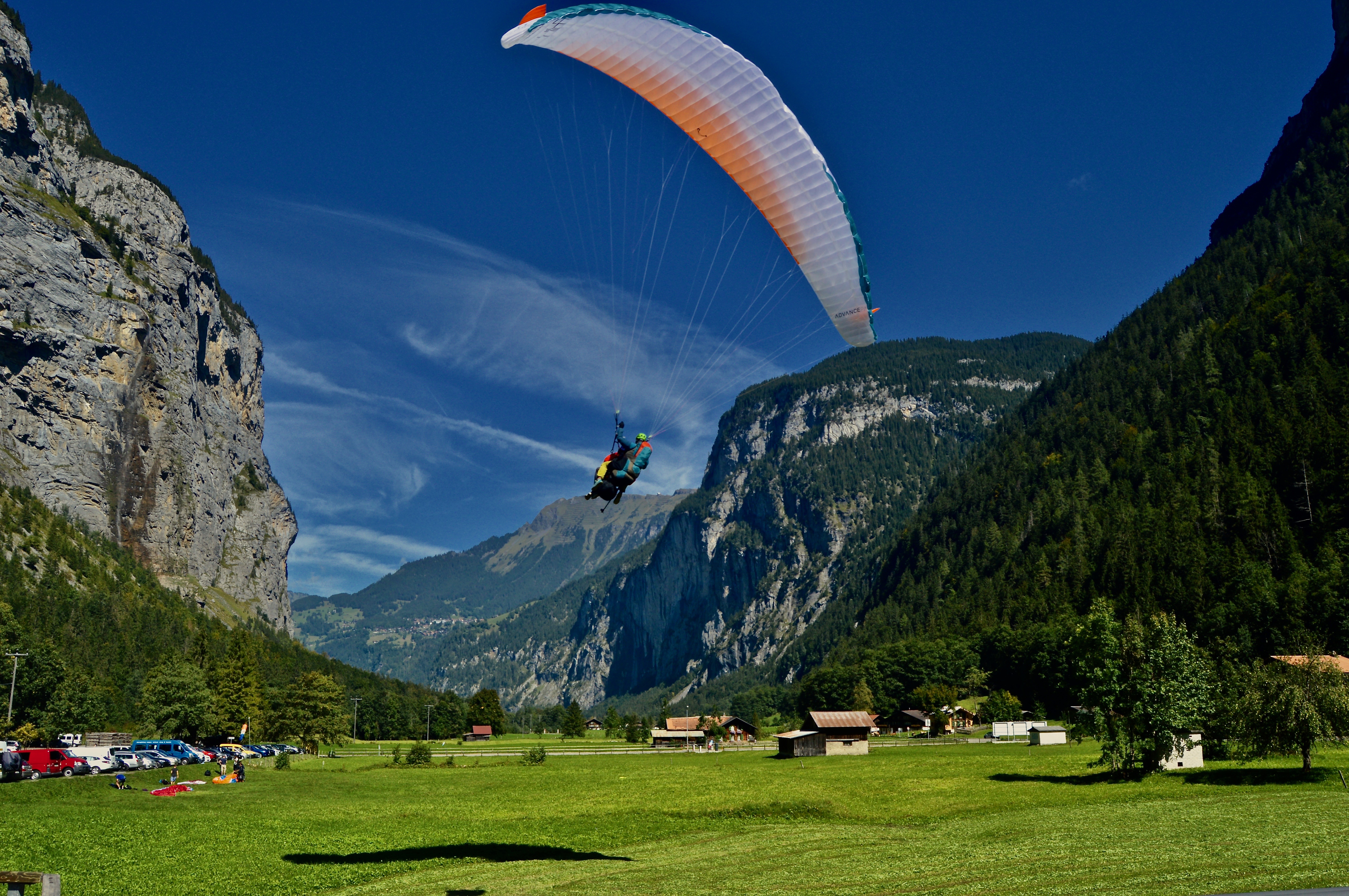
4. A paraglider prepares to land after soaring over the Lauterbrunnen valley.
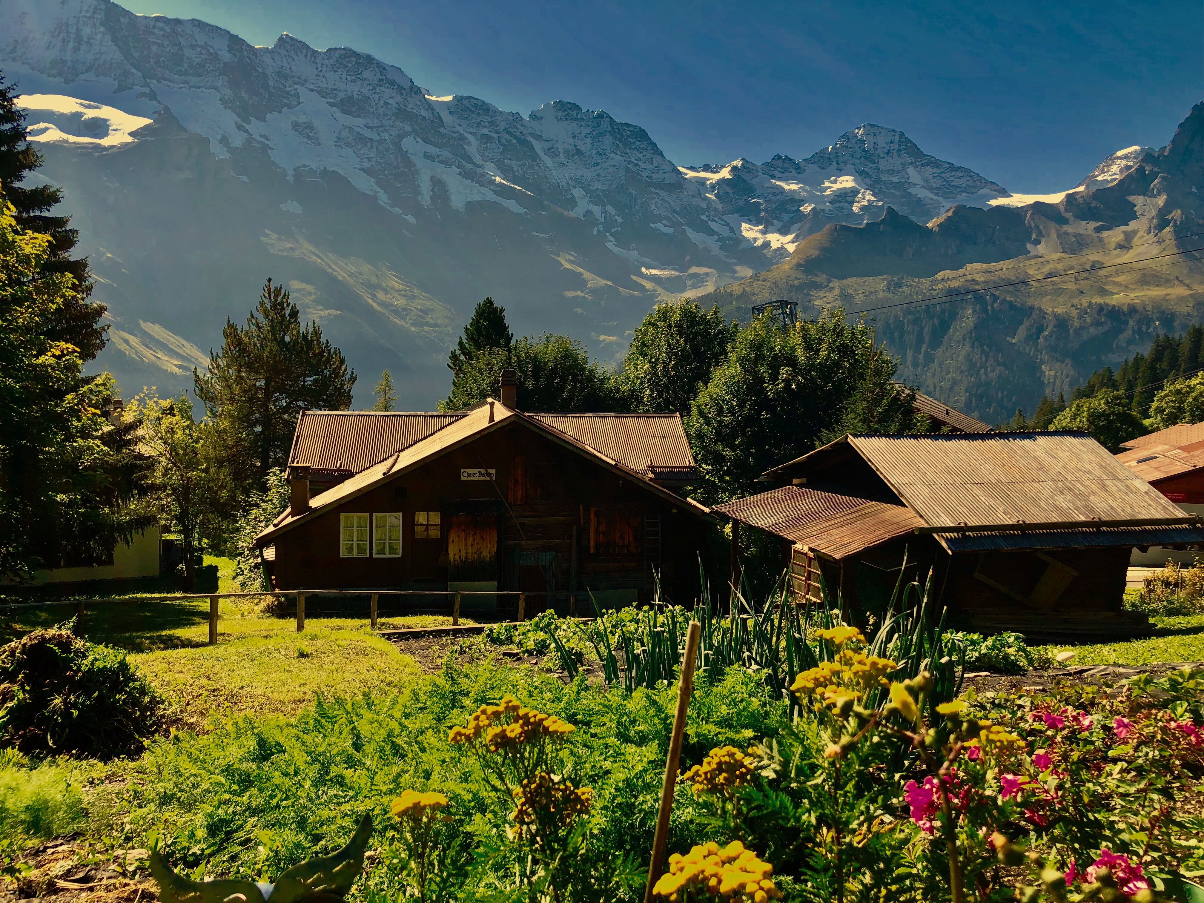
5. The village of Mürren exemplifies the best in traditional Swiss architecture with amazing mountain views.
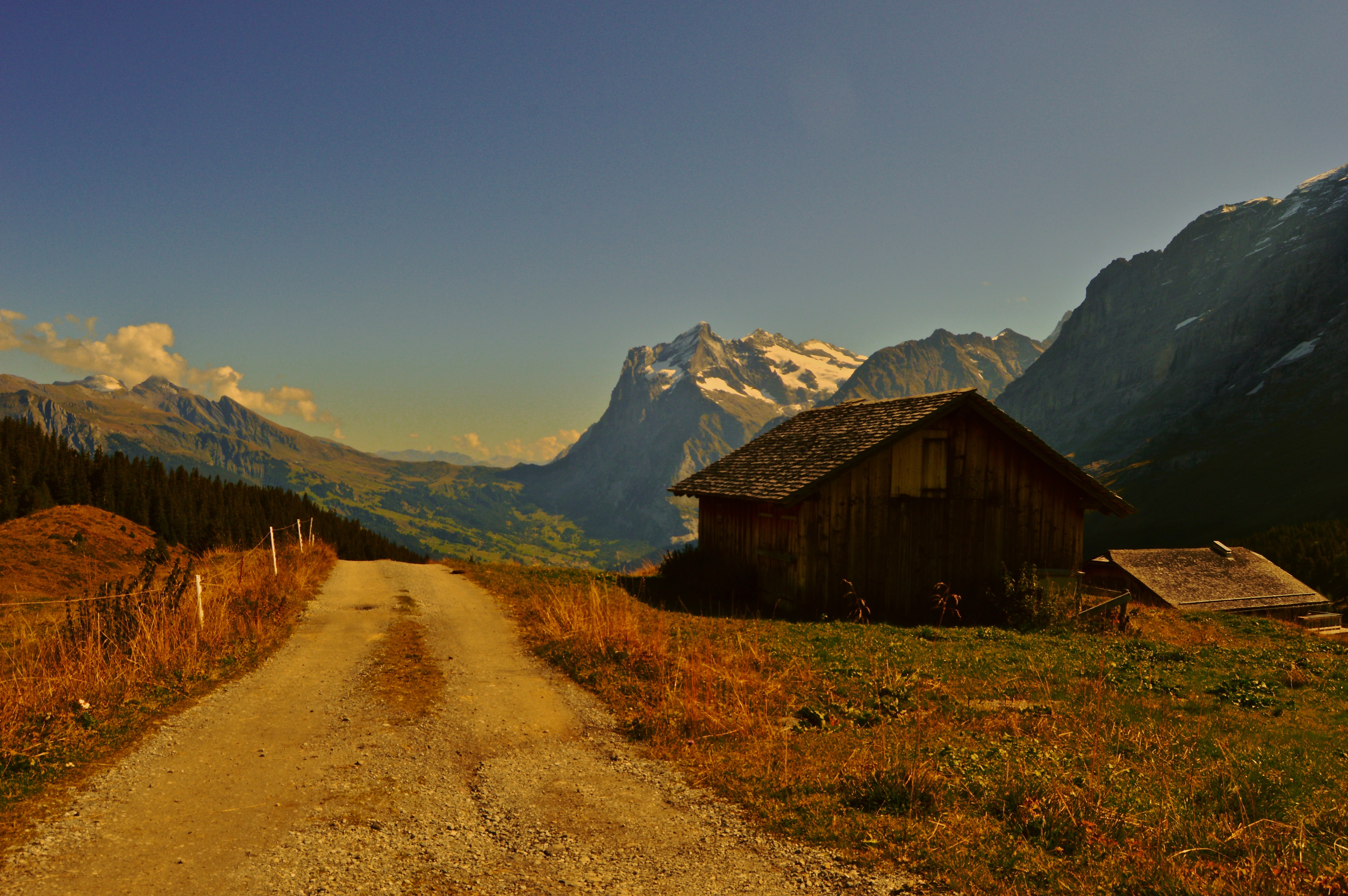
6. A small farmhouse sits on the slopes above Grindelwald with a view of the valley.
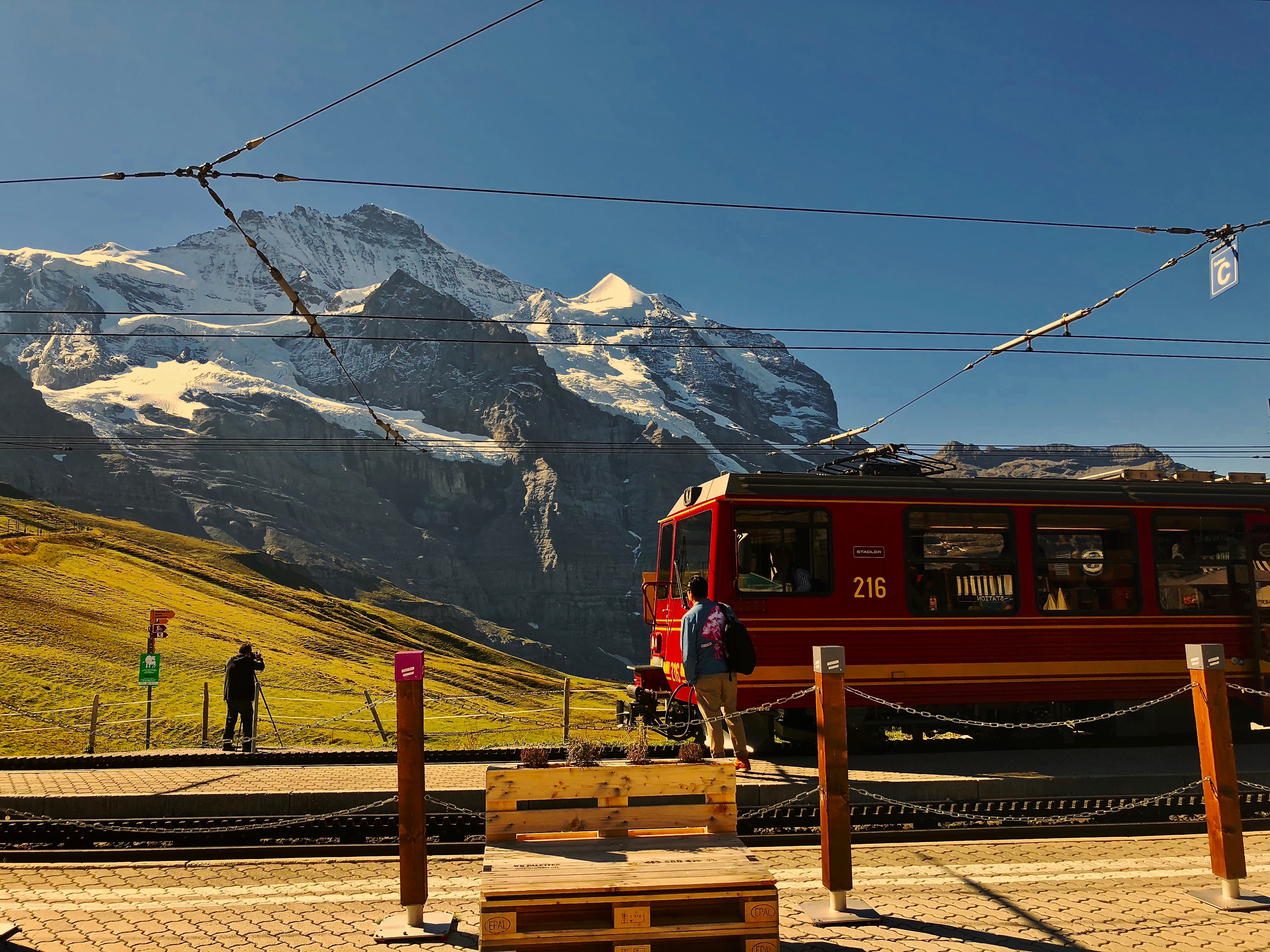
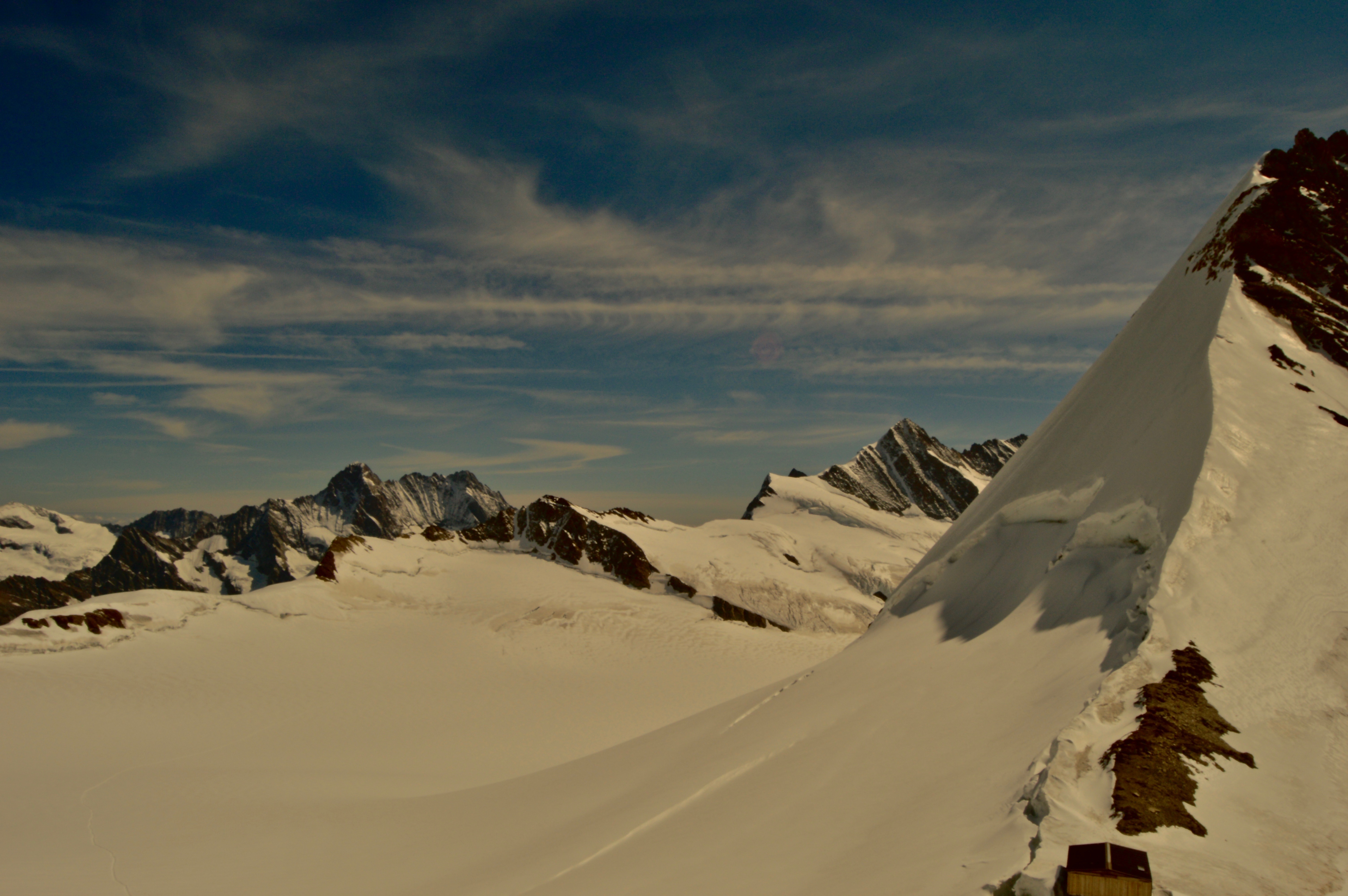
The train chugged along at 11,000 feet high, slowly climbing at a steep angle. As I was sitting facing the back of the train, gravity pulled me forward and I struggled to keep from falling into the lap of the passenger across from me. It was a brilliant, clear, sunny day, and the immensity of the Bernese Alps in western Switzerland was in full force as the series of 12,000+ feet peaks could be seen penetrating the sky from miles away. However, at that particular moment, even though I was a mere couple thousand feet away from these majestic mountains, the only view out the window was of a wall of rock and darkness.
I was traveling on the famous mountain train to Jungfraujoch—the highest place in Europe that can be accessed by car or train, at a comfy 11,333 feet, nestled on the bench between the iconic peaks of Mönch and Jungfrau. Departing from Grindelwald in the valley below, the train begins ascending towards the base of the Eiger, the most prominent peak viewed from Grindelwald–whose colossal north face casts a constant shadow over part of the town, and finally disappears into darkness in a long tunnel cutting through the heart of the Eiger and Mönch before eventually reaching its destination at Jungfraujoch.

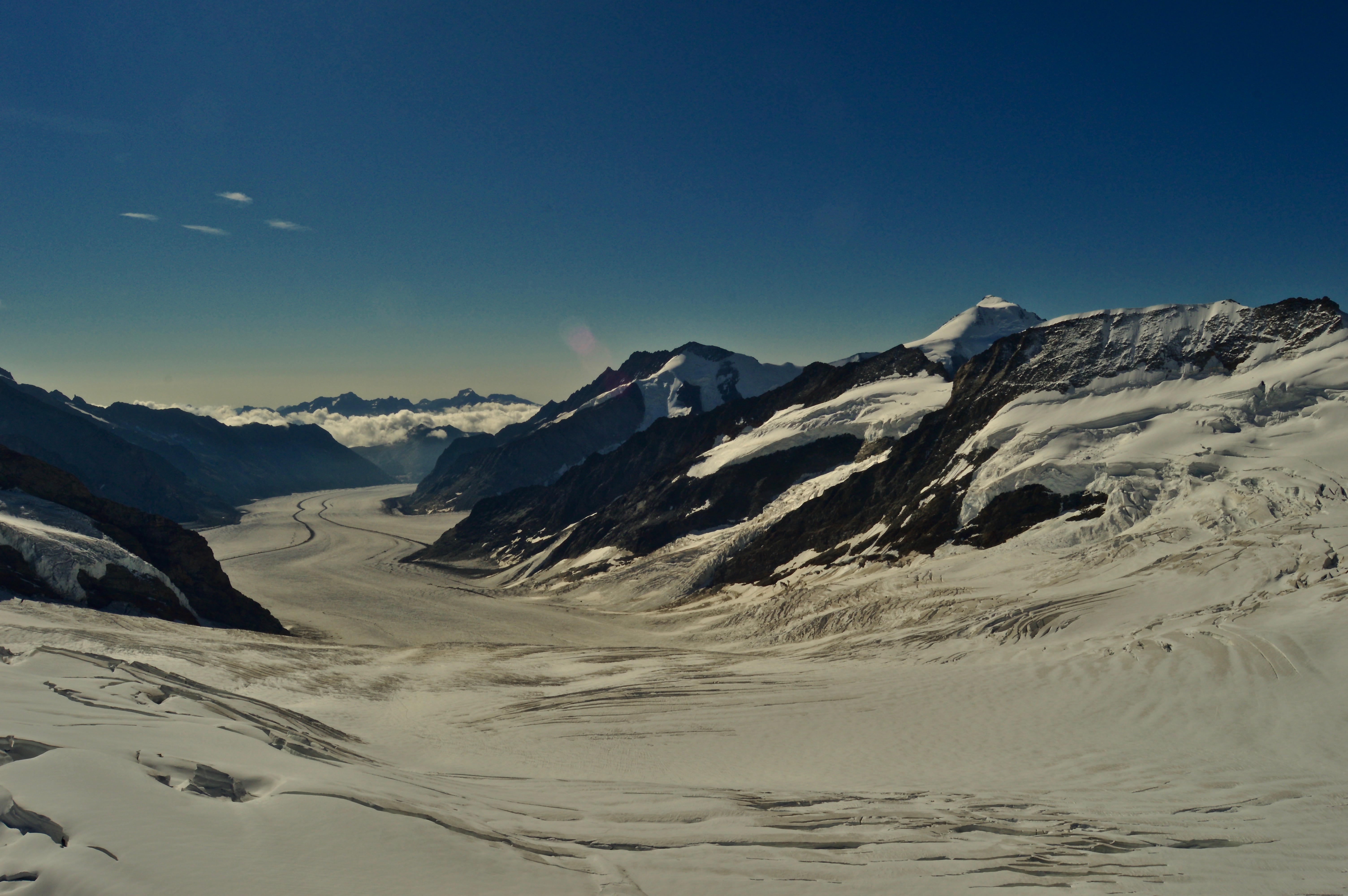
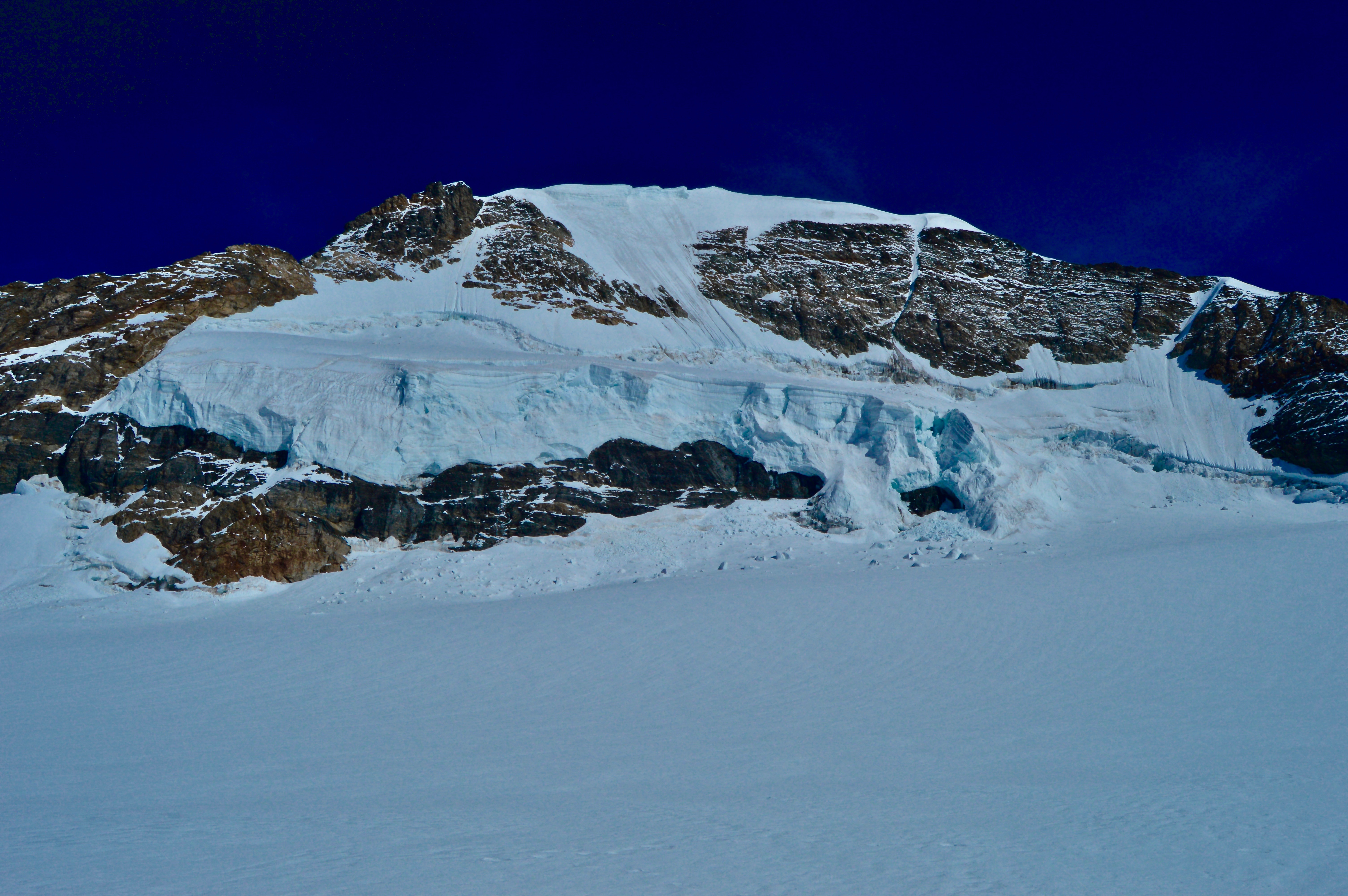
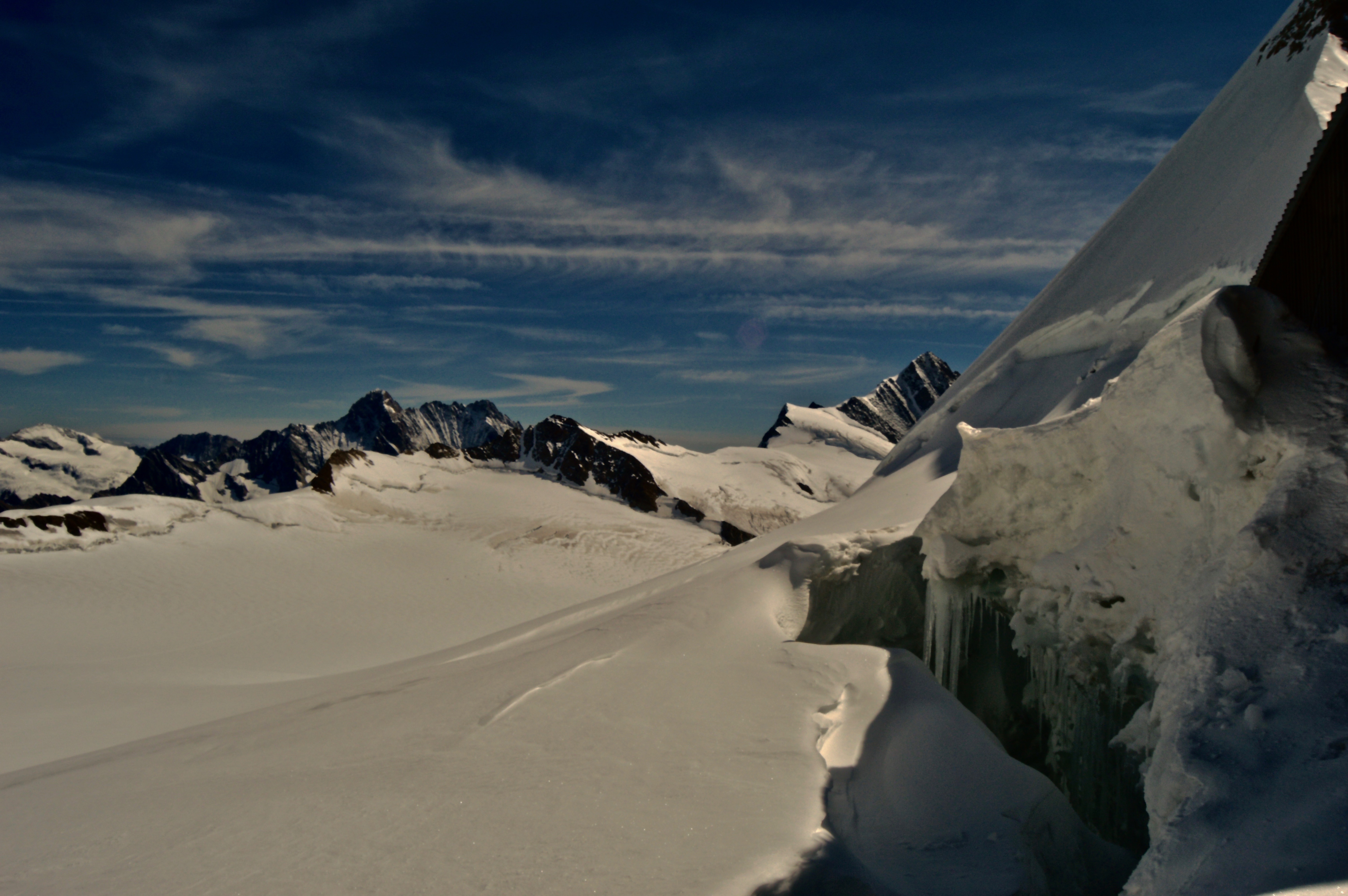
The main center at Jungfraujoch is a multiple story building built inside a rocky peak on the bench between the two mountains, and consists of restaurants, gift shops, and an interactive tour. An elevator took us from the bottom level, where the railroad ends, to the top platform deck that provides a 360-degree panoramic view of the most incredible mountain vista I had ever seen. Great snowcapped limestone giants rose into the sky directly above me, their base giving way to a vast, flat glacier that meandered down the landscape like an icy highway, disappearing over the horizon into the next valley. The traditional Swiss cabins dotting the hillsides of Grindelwald could be spotted 8,000 feet below. Whether it was the beauty of the mountains, ice, and rock, or the effects of the altitude (likely a combination of both), I found myself breathless as I took it all in.

The great views only lasted for a few fleeting moments though, as anonymous heads popped in front of my line of vision left and right, squeezing into any available space to get their pictures taken in front of the mountains, fighting through crowds, pushing and shoving to get the best view. Selfie sticks waved aimlessly and haphazardly about, whacking unsuspecting heads and jabbing oblivious ribcages. Tour groups wandered in massive groups like grazing cattle, taking photos here and there, hurrying to catch up with the group so to not be left behind. The amusement park Disney-like feel was overwhelming at first and almost detrimental to the experience. At one point, I even forgot I was supposedly “in nature” as I was all too consumed in the chaos and commotion around me.
We eventually made our way outside where there was a short mile-and-a-half hike along a groomed trail across the glacier to Mönchsjoch Hut—the highest altitude serviced hut in Switzerland, at about 12,000 feet high, at the base of Mönch. While the hike was short and only gained about 700 feet, at that elevation, it felt much longer and steeper. It was just difficult enough to deter most of the crowds, leaving me a chance to finally breathe again, deeply inhaling that crisp, sharp mountain air. The sun was warm, reflecting off the bright, snowy surface, forcing me to strip to just my base layer as I made my way over the glacier. At the hut, we enjoyed a hearty lunch and rested our oxygen-starved lungs, while lounging on the deck and watching several climbing parties begin to ascend the south face of Mönch.

After lunch, we walked back to Jungfraujoch and finished the interactive tour, which included an ice cave, an Edelweiss themed gallery, and a history of the railroad. The stories and photos of how it was built was what most fascinated me. Construction started in 1896 at the base of Eiger, and for the next 16 years, workers chiseled a tunnel through the middle of Eiger and Mönch, reaching all the way to its current location. How they were able to complete such a task in that short of time with nothing more than pick axes and hammers is unbelievable. Almost more unbelievable, is that someone was mad enough to even think it would be possible to build something of the sort in 1896. Of course, dozens died in the process, for which there is a meager memorial along the tour dedicated to the men who lost their lives so people like me can have an epic tourist experience.

The question is, however, should tourists be able to visit a place like this in the first place? Sure, the railroad is an example of human will and achievement, but just because we can do it, should we? Should the (relatively) wealthy be able to pay for a train to take them to the top of a mountain? Should beautiful destinations like this one be turned into amusement parks where anyone can have their photo taken in front of majestic mountains if they have the means to pay for it? My first instinct is to say no. The environmentalist and wilderness advocate in me believes these places should be kept wild and free from development, that only those with the devotion and ability to climb to these rewarding views should be allowed to enjoy them.
On the other hand, it is unlikely I would ever make the climb myself, nor would 99% of the people that come up here. What the Jungfraujoch railroad does do is provide access to an extraordinary place for people who would otherwise never be able to see it. As most of the visitors were elderly, or unaccustomed to this type of outdoor experience, this was the only way for them to have such an experience. We can only hope that the visitors gain a new appreciation and respect for natural places and, as a result of their experience, join the movement to help protect them.
No, we should not start constructing railroads to the tops of mountains all around the world (this would surely spark outrage, especially in the U.S.), but maybe it is okay to have just one Jungfraujoch, if it means allowing ordinary people to get close to nature, so they may gain a better understanding and appreciation for it. Or maybe there is a better way that benefits both tourists and nature. I’ll let you decide for yourself.
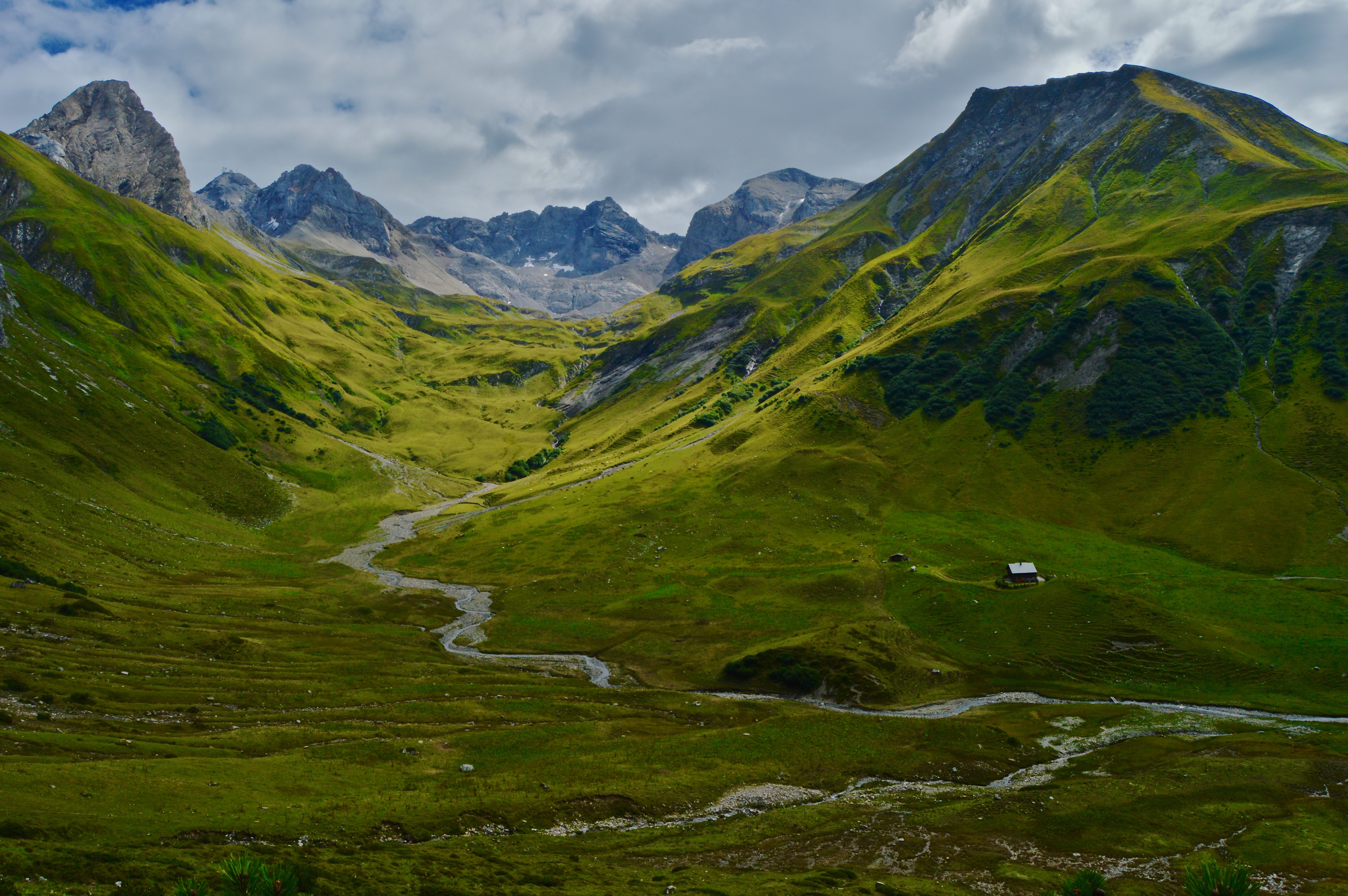
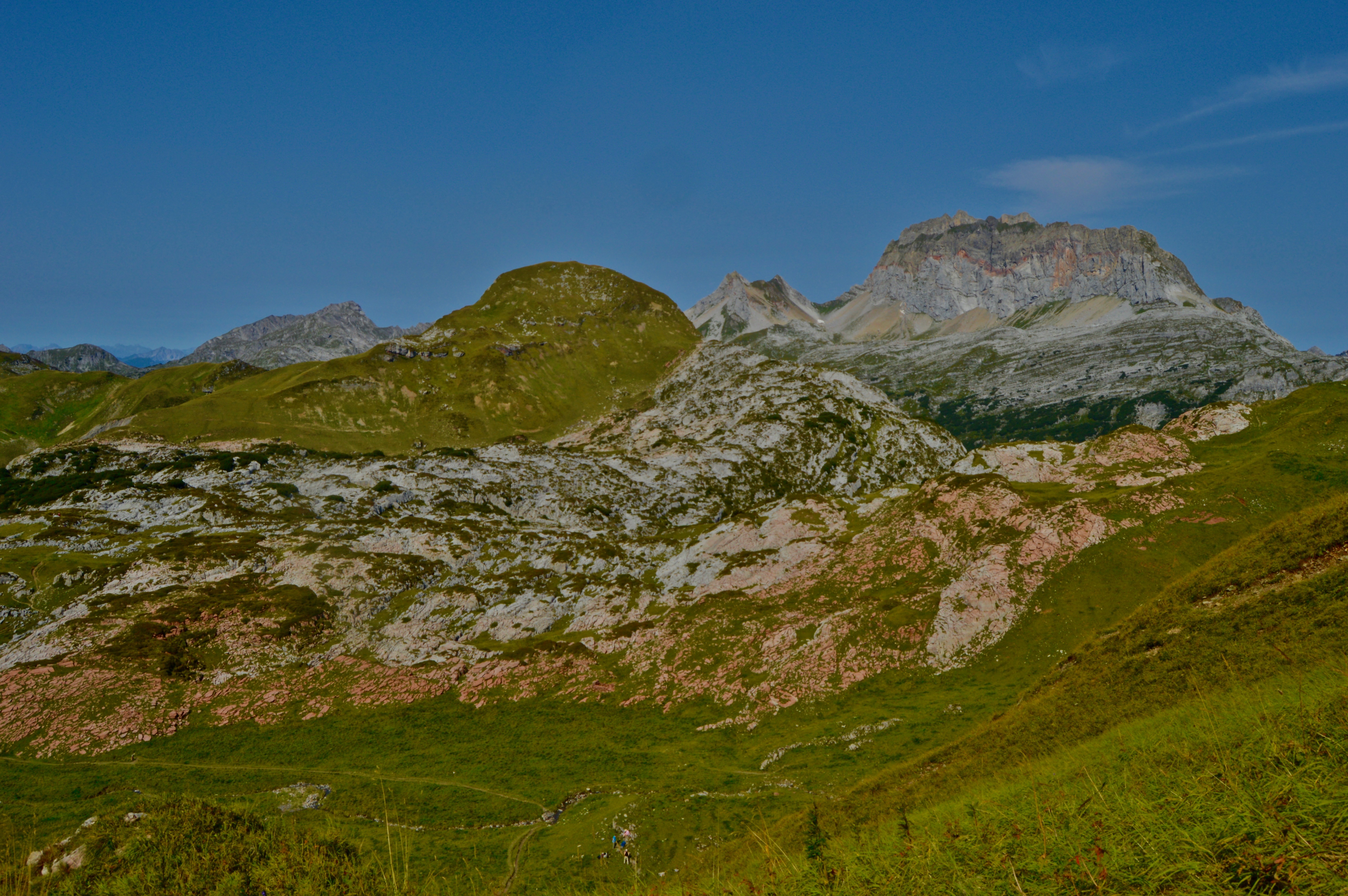
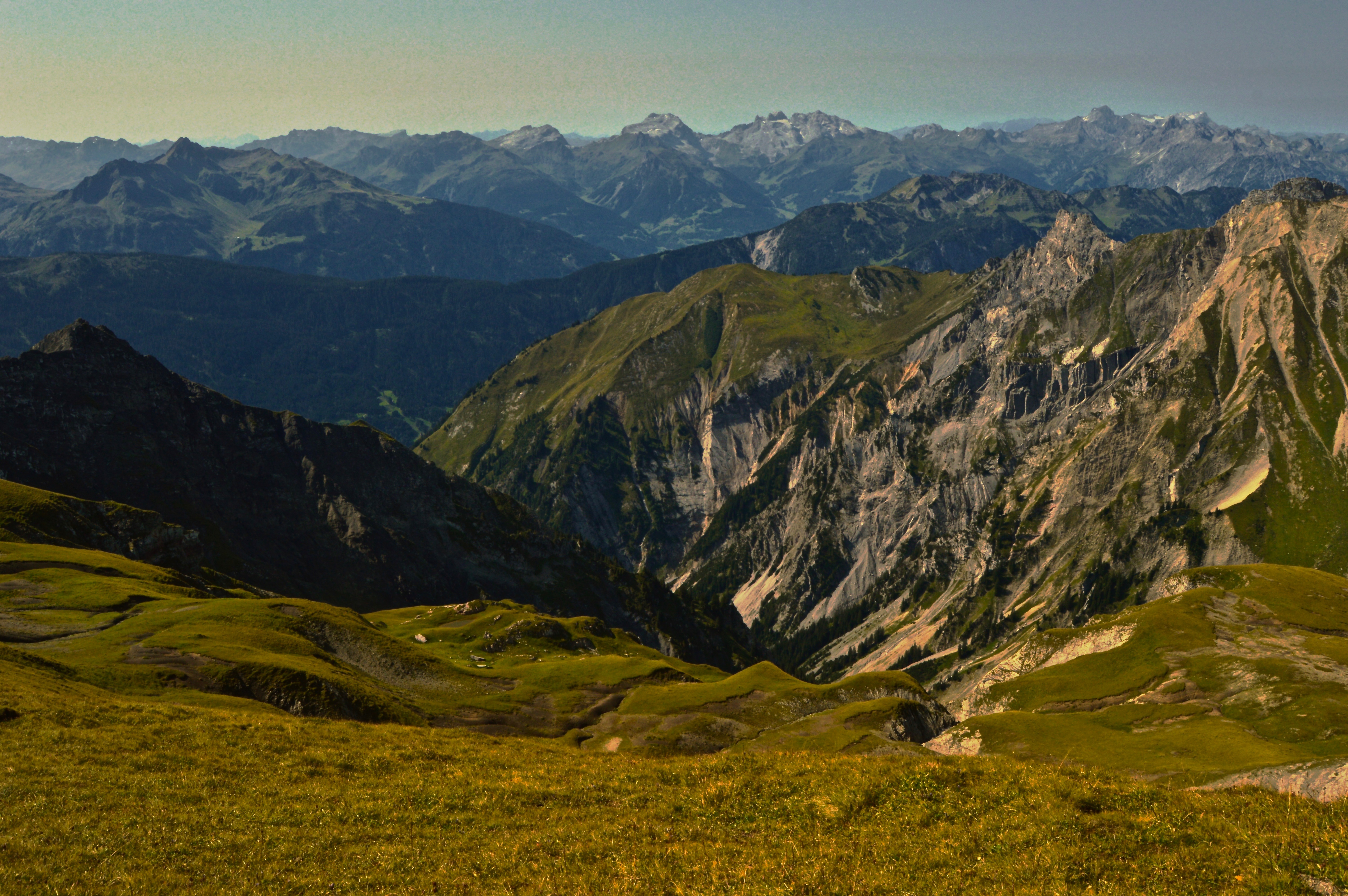
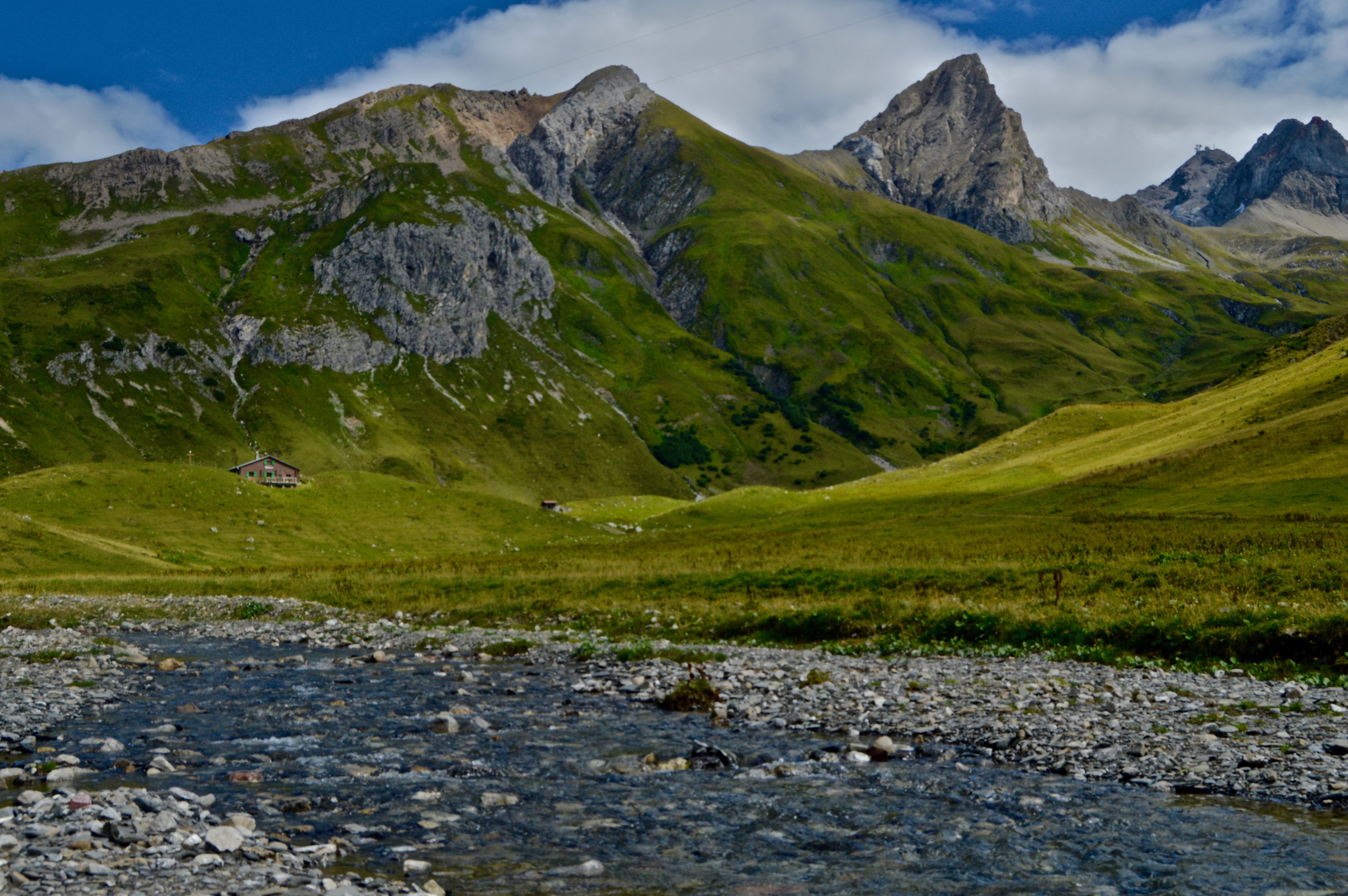
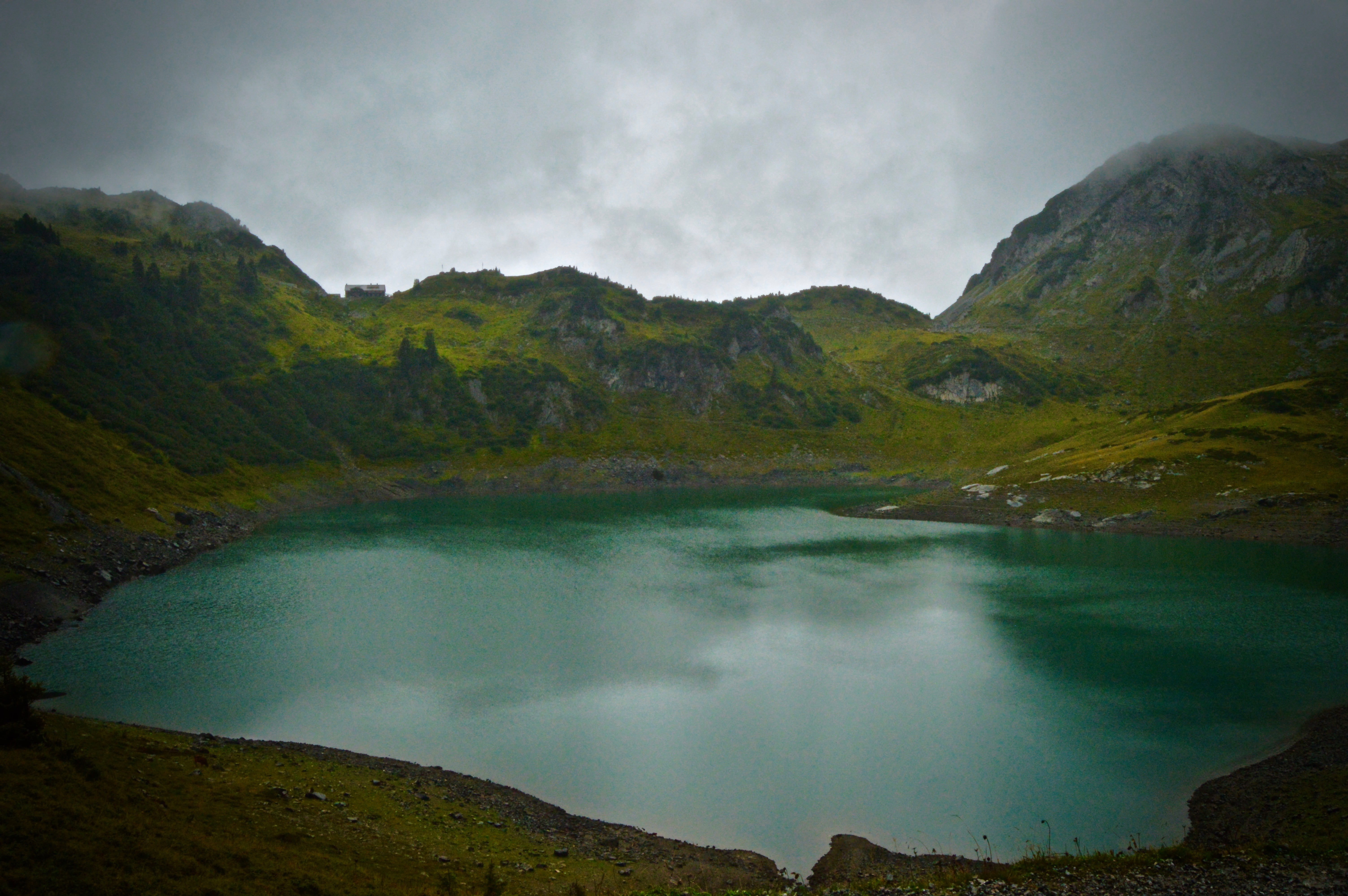
Lech, Austria is a picturesque tourist town situated at the base of the Arlberg massif of the Austrian Alps. Known more as a winter ski destination, Lech, and the surrounding towns, still offer ample opportunities for recreation in the summer months as well. I spent my week in Lech hiking several of the many trails in the area, ranging from “easy valley hikes” to “very difficult mountain hikes.” A sophisticated bus and gondola/chairlift system provides easy access to the high elevation trails, saving the legs a couple thousand feet of climbing.
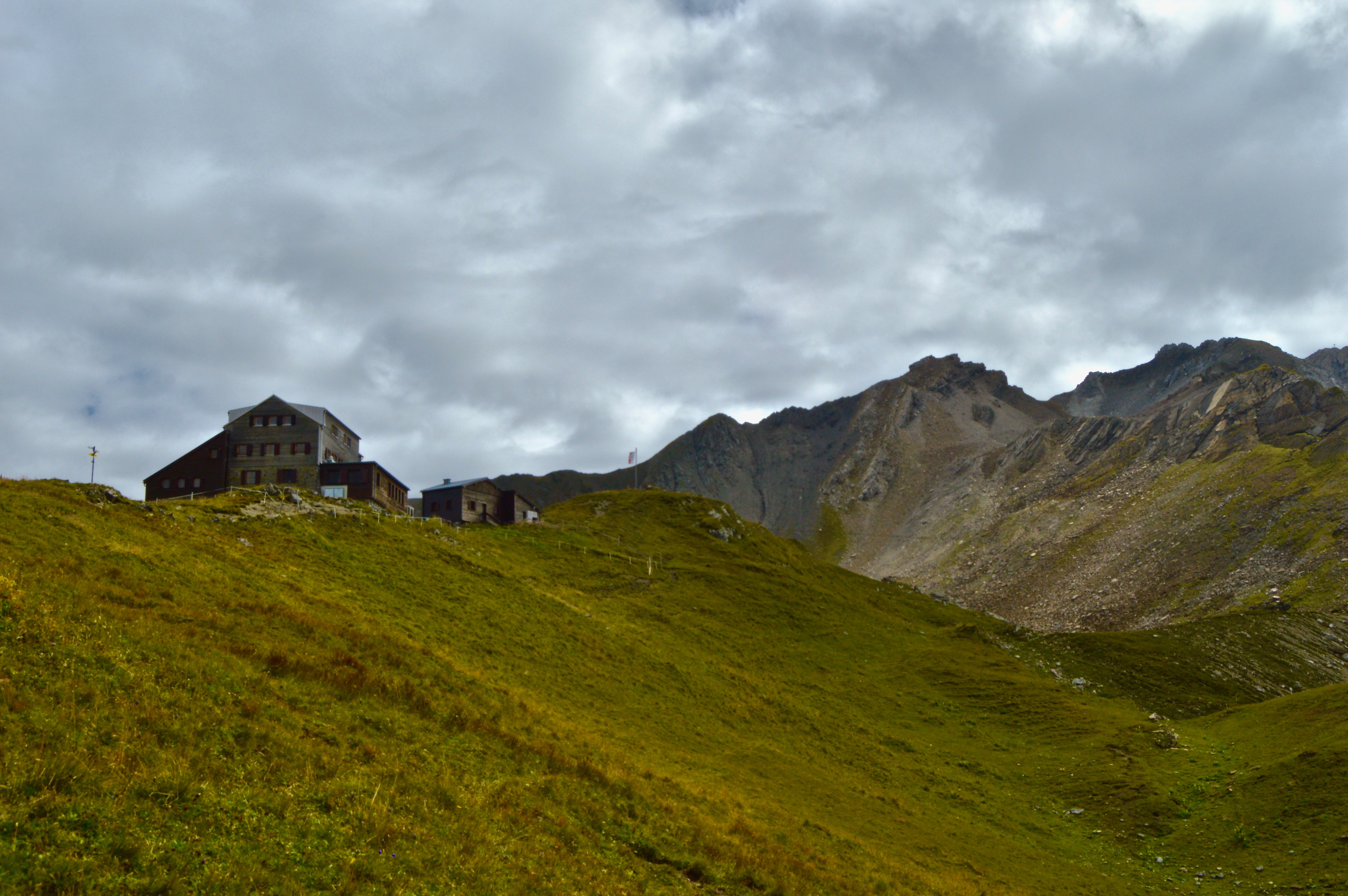
The best part–in my opinion–of hiking in Austria (and the Alps in general) is that the majority of trails leads to a mountain hut fit with electricity, flush-toilets, warm food, cold beer, and of course, scenic views. While not exactly a true ‘wilderness experience,’ having luxury is nice every now and then. There certainly aren’t many places in the States that offer such deluxe accommodations on a hike. For meat lovers, most huts have the traditional dishes of sausage and sauerkraut, or my personal favorite, Wiener schnitzel, on the menu. For the best Wiener schnitzel you’ll ever have (Disclaimer: I did just hike 11+ miles, gaining and losing 2000 feet in elevation, and at that point, anything would have tasted delicious), go to Ravensburger Hut at Spullersee. The tender, breaded and golden-fried pork steak, accompanied by fresh cranberry jam, the crispiest, herb-topped, melt-in-your-mouth potato fries, and a cold Austrian lager to wash it all down, was the perfect way to end a long, demanding hike.
I hiked and exercised a lot in Austria, but I also ate so well I’m not sure if I lost or gained weight during my time there! Here’s a picture of the Wiener schnitzel below to wet your appetite…

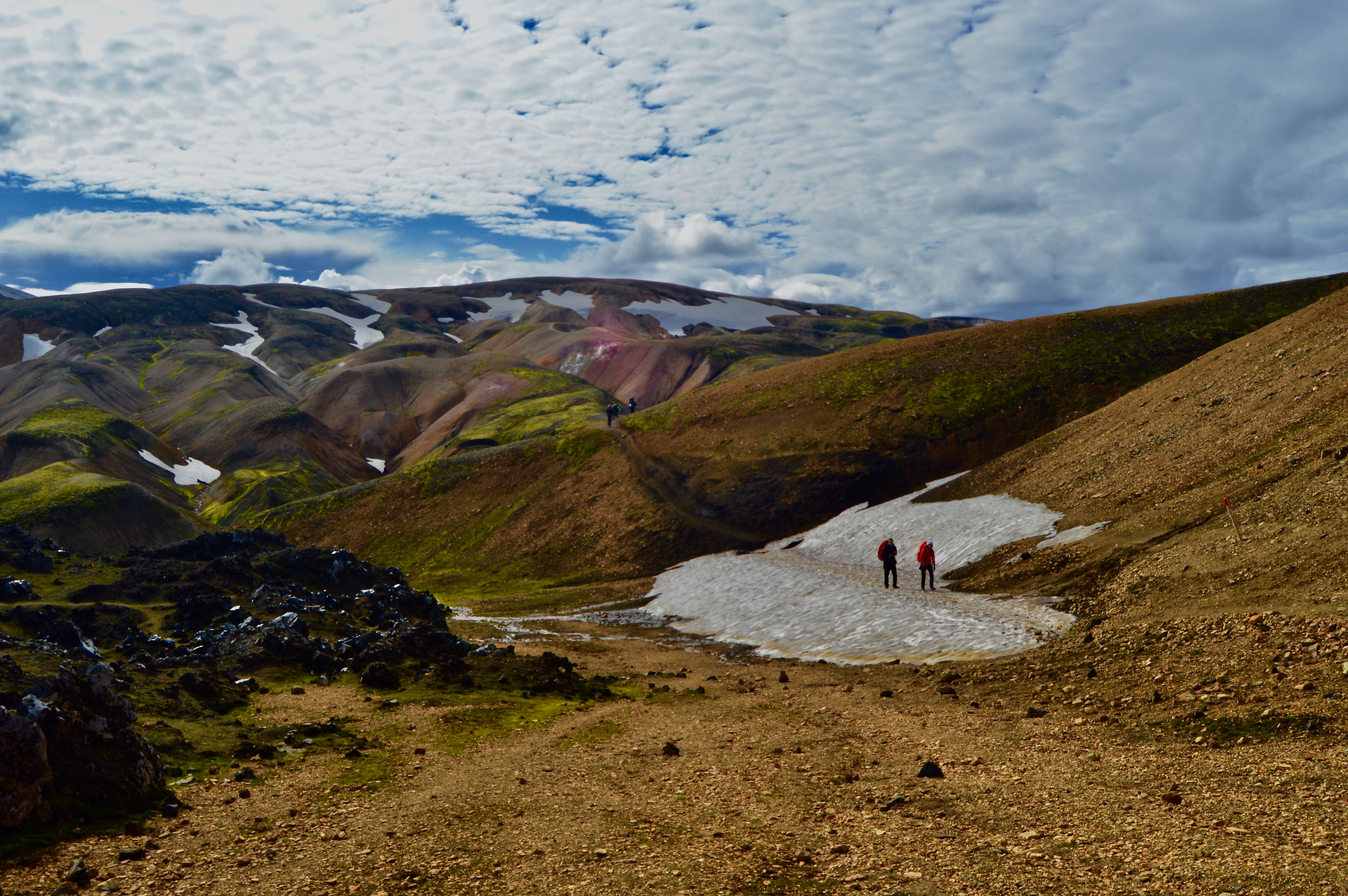
I’m going to start out by mentioning that I try not to overuse the word beautiful, instead reserving it only for things I truly find beautiful, namely Natalie Portman, a plate of fresh sashimi, Ken Griffey Jr.’s left-handed swing, and now Iceland. Even though I only spent five days in Iceland and saw hardly a fraction of the country, the landscapes I were able to visit completely blew me away. From majestic waterfalls spilling over cliff sides, to volcanic black sand beaches, immense glaciers, and rainbow colored ridges, Iceland boasts a combination of natural landscapes that cannot be found anywhere else on Earth. This is due to the unique characteristics that have shaped the island, including volcanic activity, a latitude equal to parts of Greenland and Alaska, and the Gulf stream current that flows from the Gulf of Mexico up to the North Atlantic keeping Iceland’s climate more moderate than it otherwise would be.
The highlight of my short-lived trip was hiking in the central highlands, deep in the island’s interior, which I describe here. Enjoy!
Bus from Reykjavik to Landmannalauger
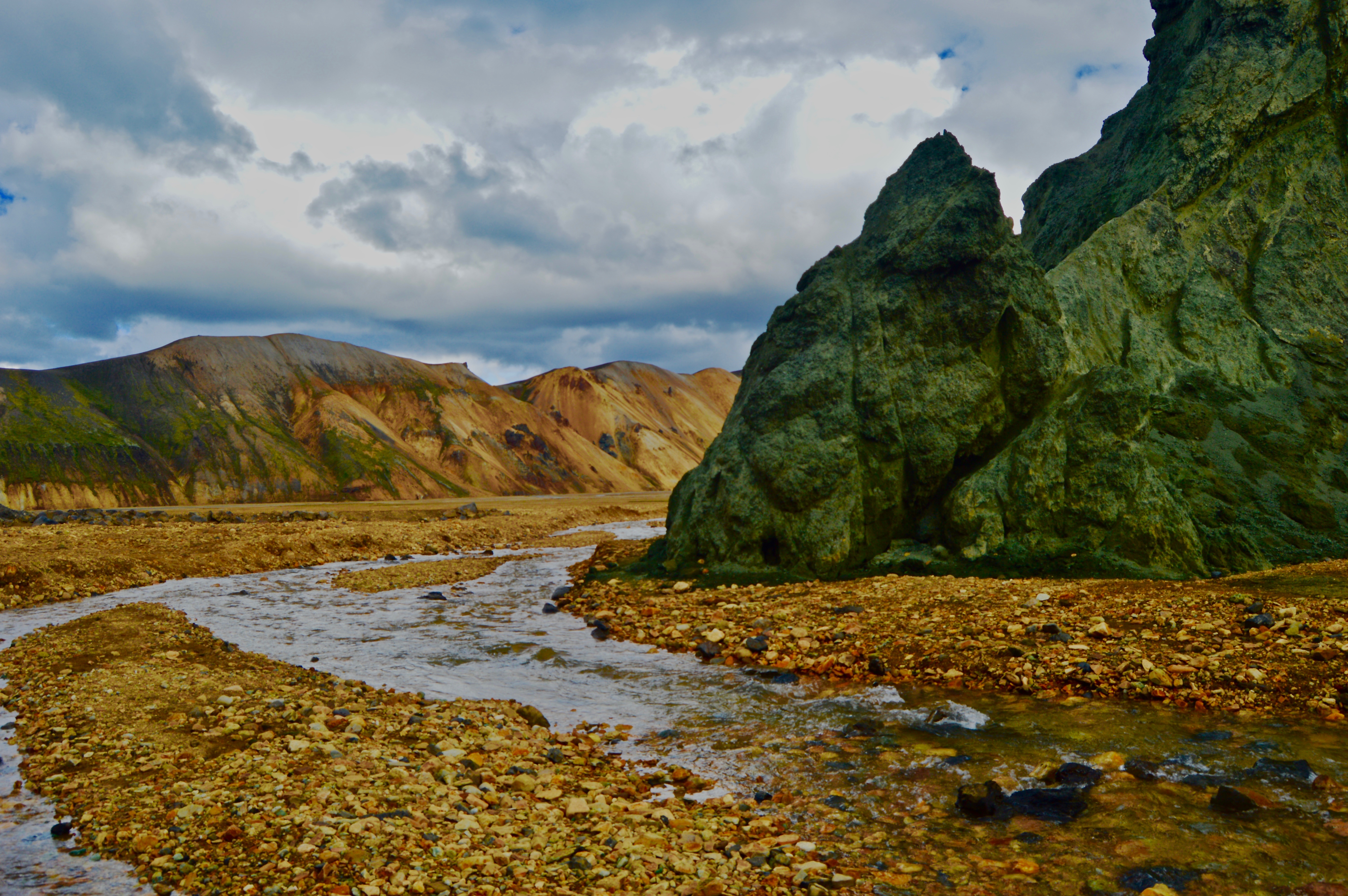
We caught a bus from the Harpa Concert Hall in downtown Reykjavik to Landmannalauger base camp with the Sterna Travel company. The bus departs Reykjavik at 7:15am and returns around 10pm (it’s a loooong day, but well worth it!). The drive takes about four-and-a-half hours, of which the last hour is spent on a dirt road that travels across an other-worldy landscape left in the wake of several eruptions from nearby Hekla volcano (the most active volcano in Iceland) and fords several river crossings (quite an experience in a 60 passenger coach bus!). The surface is covered by a deep black mixture of lava rock, sand, and ash, and prohibits the growth of any plant life, save for a few mosses and grasses. As a result, hardly any life survives in Iceland’s interior–flora, fauna, or human. Although, it is common local knowledge that trolls inhabit the hills and will capture and eat you if you wander off too far…


Landmannalauger Base Camp
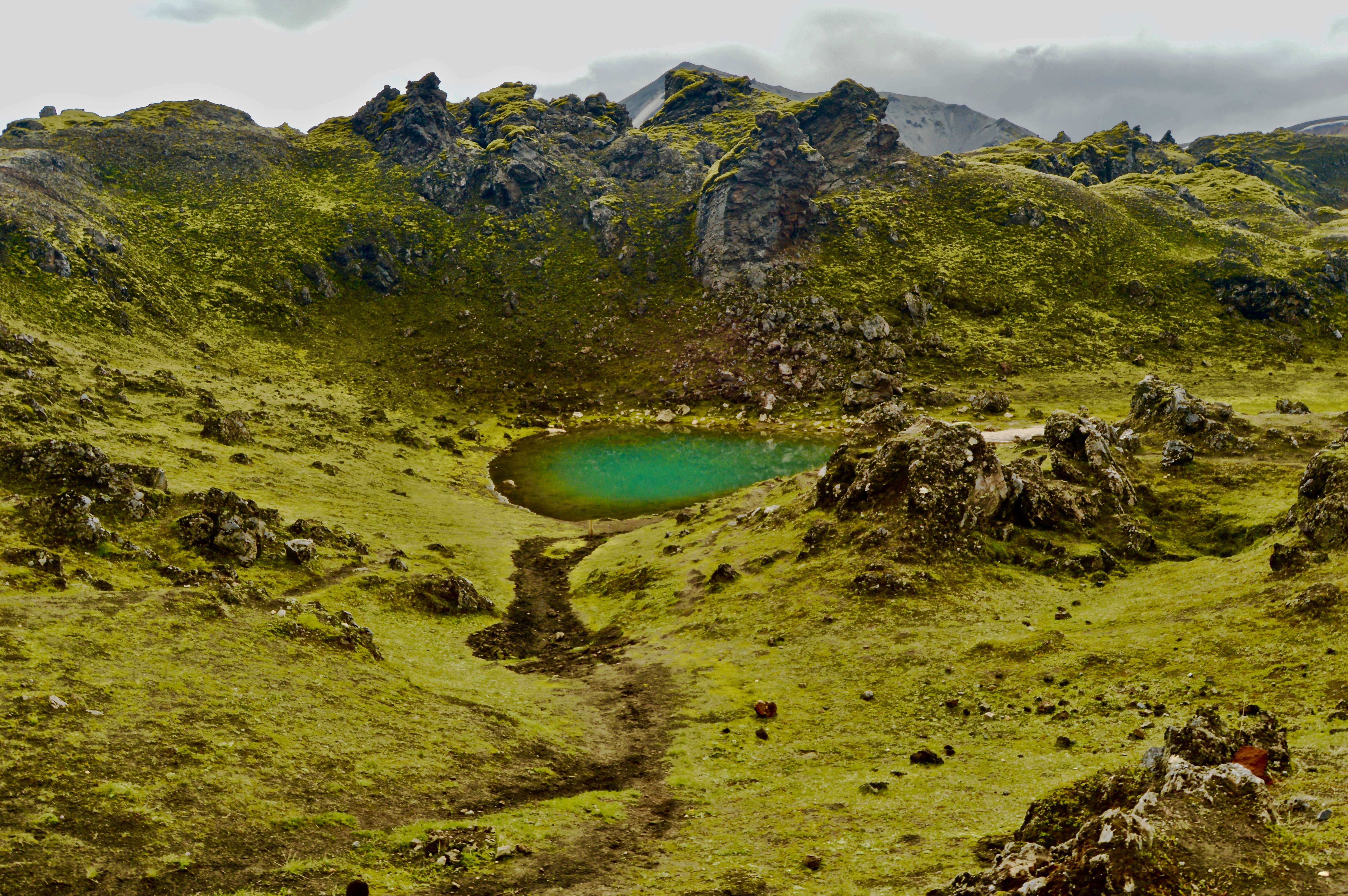
At noon, we arrived in Landmannalauger, located in the Fjallabak Nature Reserve and starting point for many hikes the area. The camp has a backpacker hut, campground, washrooms, and a natural hot springs, as well as information for the various hikes. There are several popular day hikes, ranging from easy strolls to climbing steep peaks, and a multi-day through hike on the Laugavegur trail. We decided on an intermediate four hour (5-6 miles) hike that climbed Mt. Brennisteinsalda.


Hiking
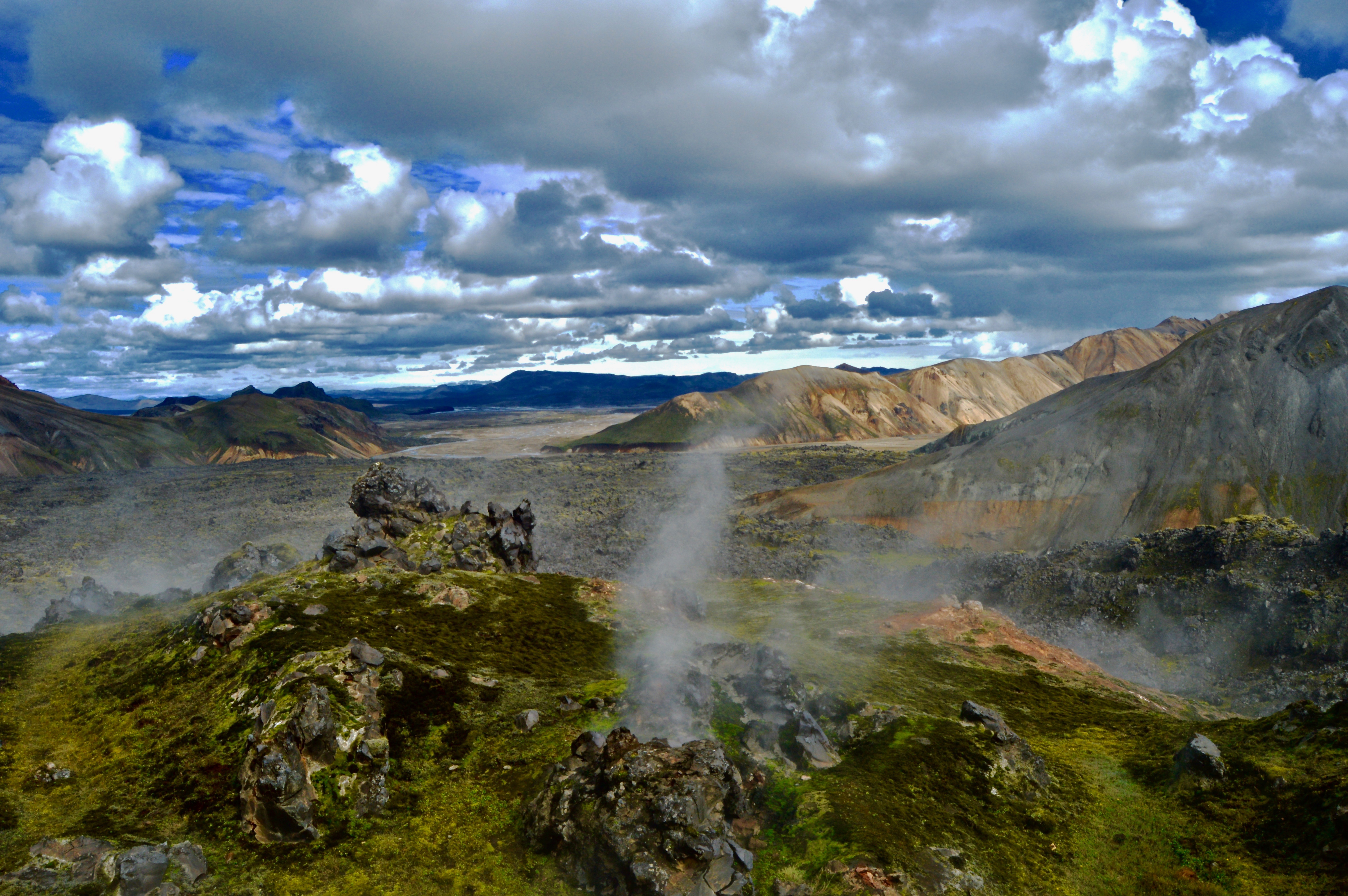
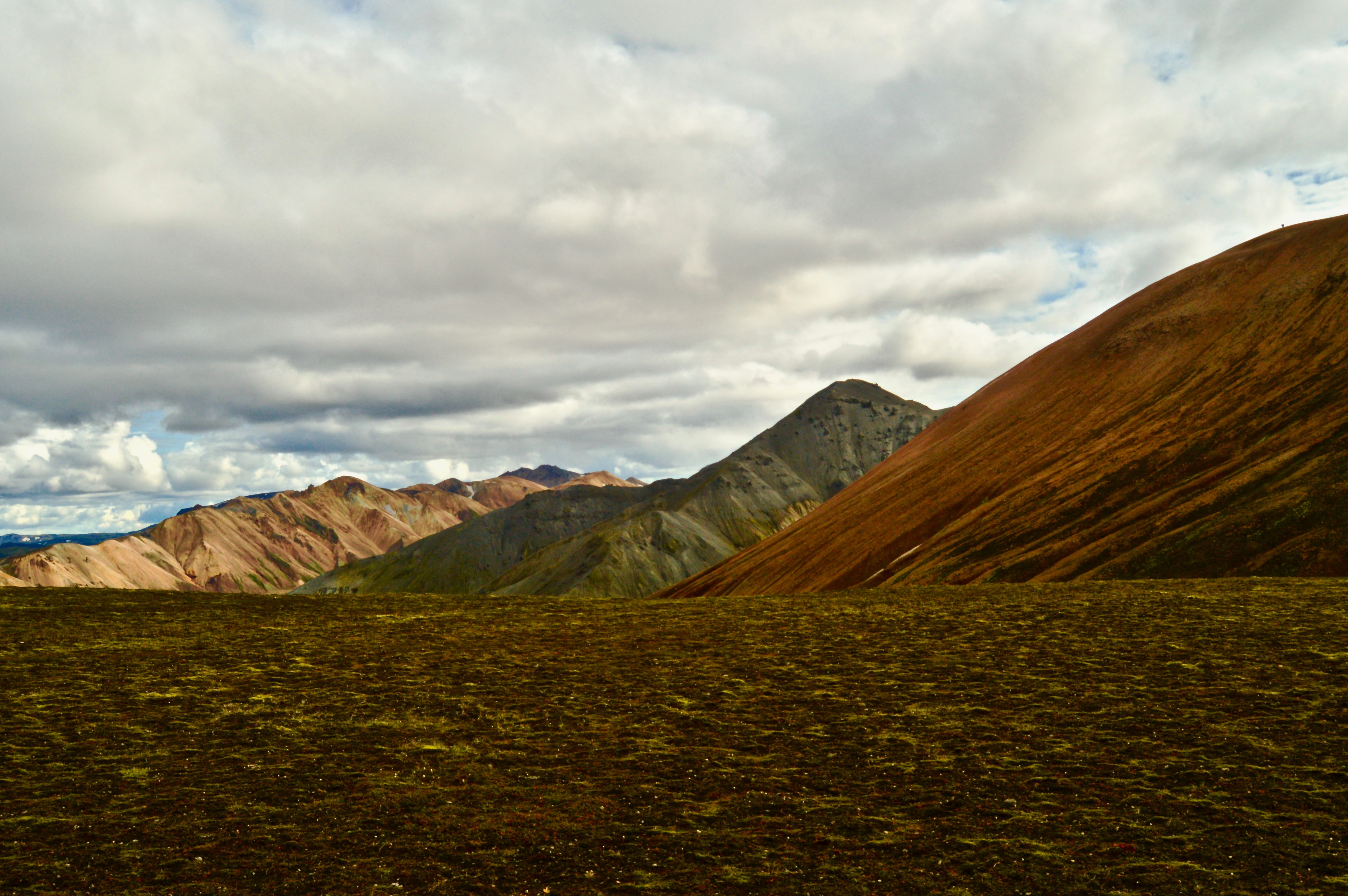
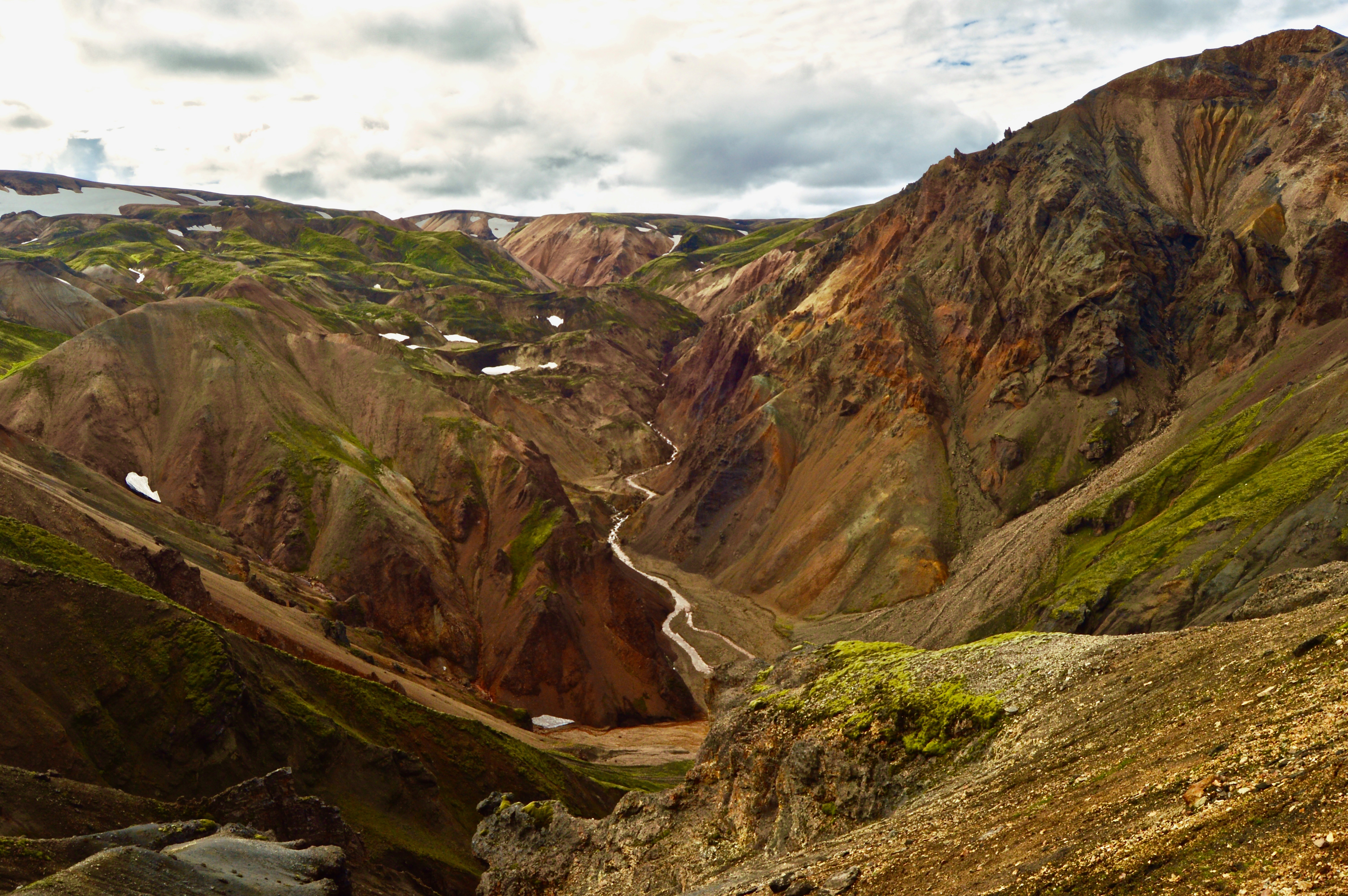
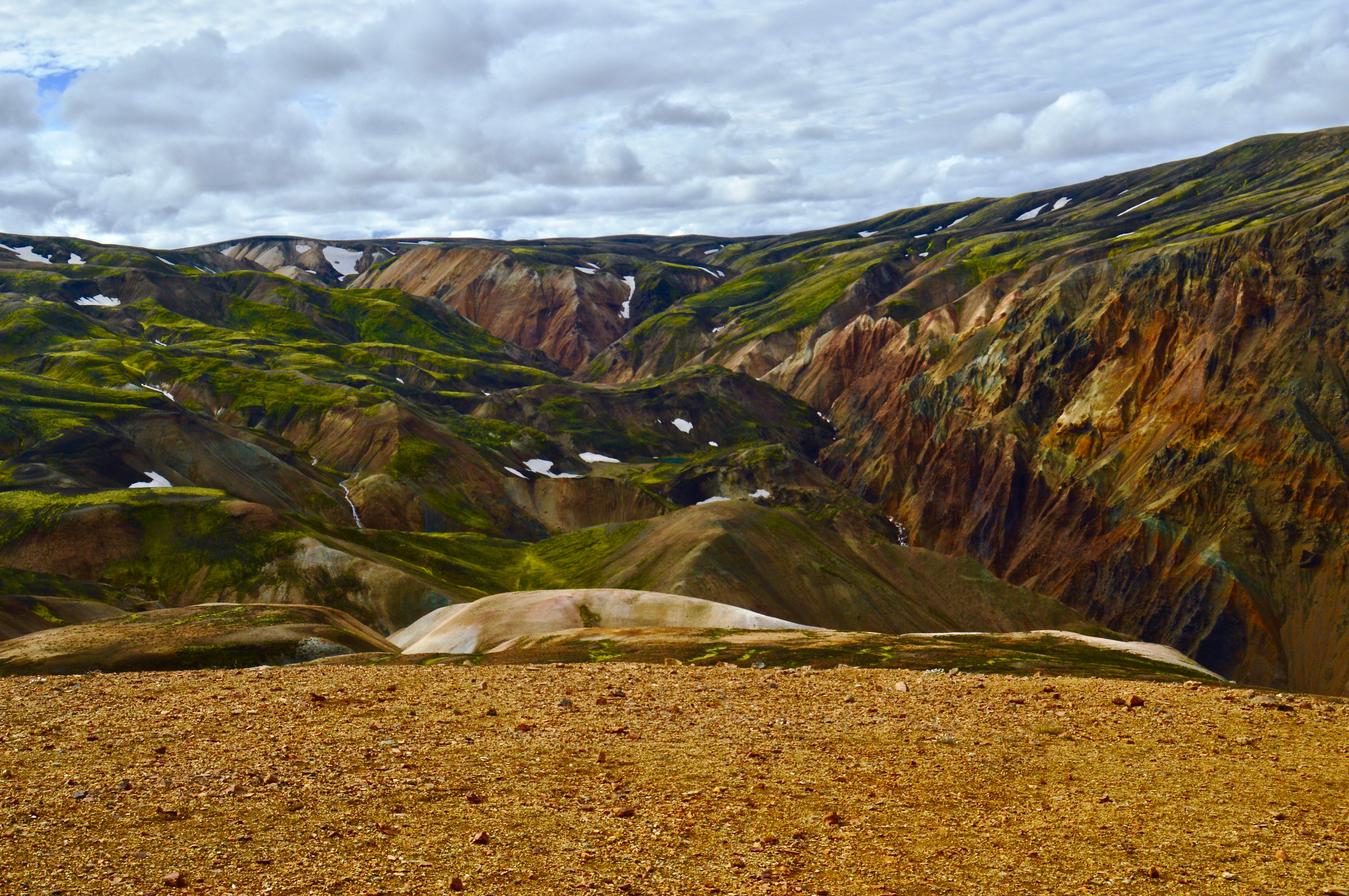
The hike we went on took us across lava fields, past geysers and geothermal springs, over glacial valleys, up the mountain, and down through a river canyon before ending back at the camp. We started along a path that winded through an immense lava field, where bright mossy Dayglo green contrasted sharply against the volcanic obsidian black. Sickly-grey glacial streams serpentined through the flat valleys below, like snakes in a sandbox. Colorful hills of reds and greens, painted by acidic sulfur and silica, rolled beneath a backdrop of snow covered peaks. Mt. Brennisteinsalda was the most brilliant of these painted peaks as a rainbow of loose rock spilled from the summit down to the valley below. The climb up to the summit was steep, but worth the reward of a 360 degree panoramic view of the area. We were extremely lucky with the weather as clear days are hard to come by in Iceland and we were able to see from horizon to horizon.


For a day trip, this hike was the perfect length and offered views of all the best Iceland has to offer. I am hoping to make it back to the country soon to hike and photograph even more.

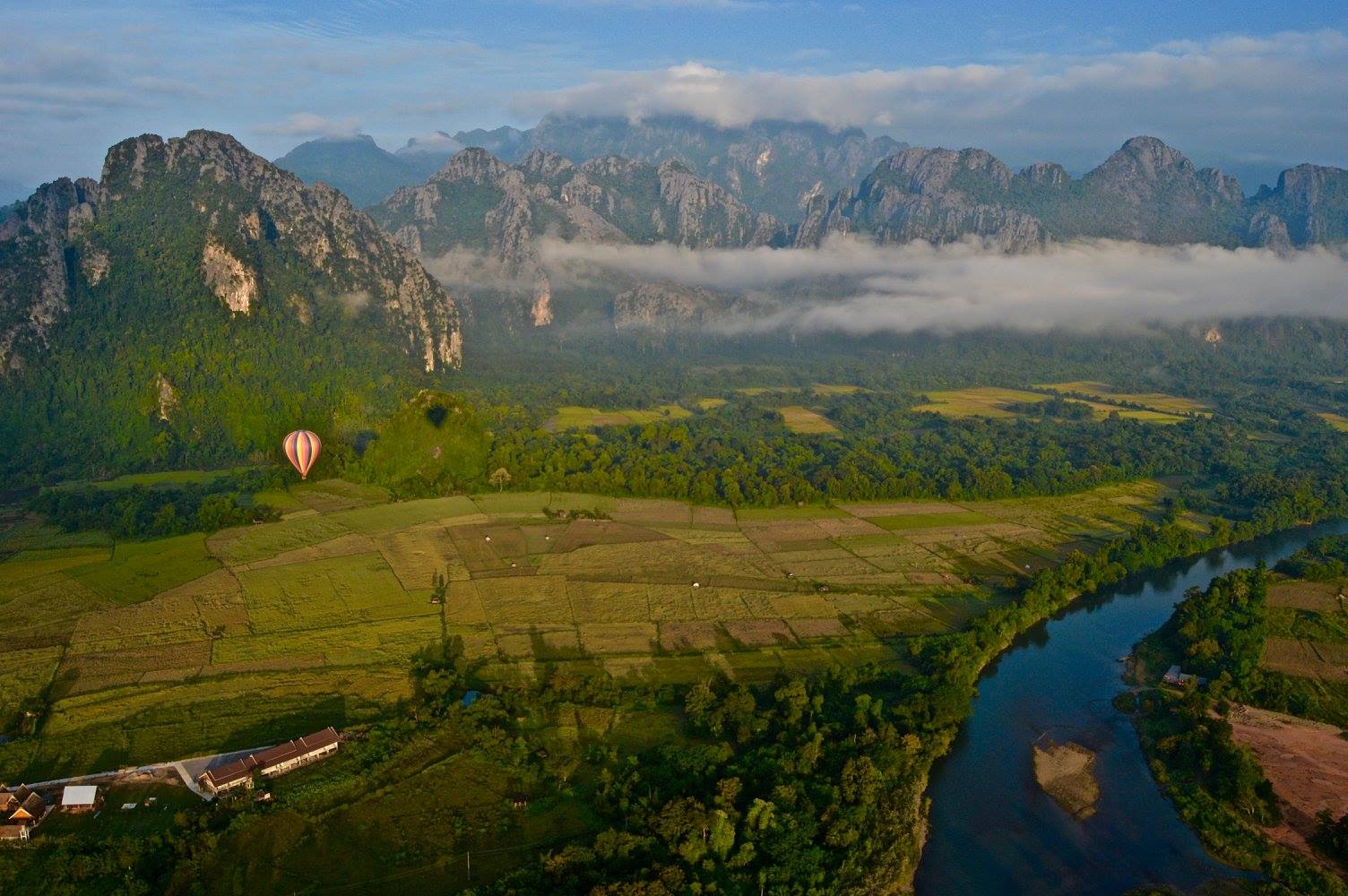
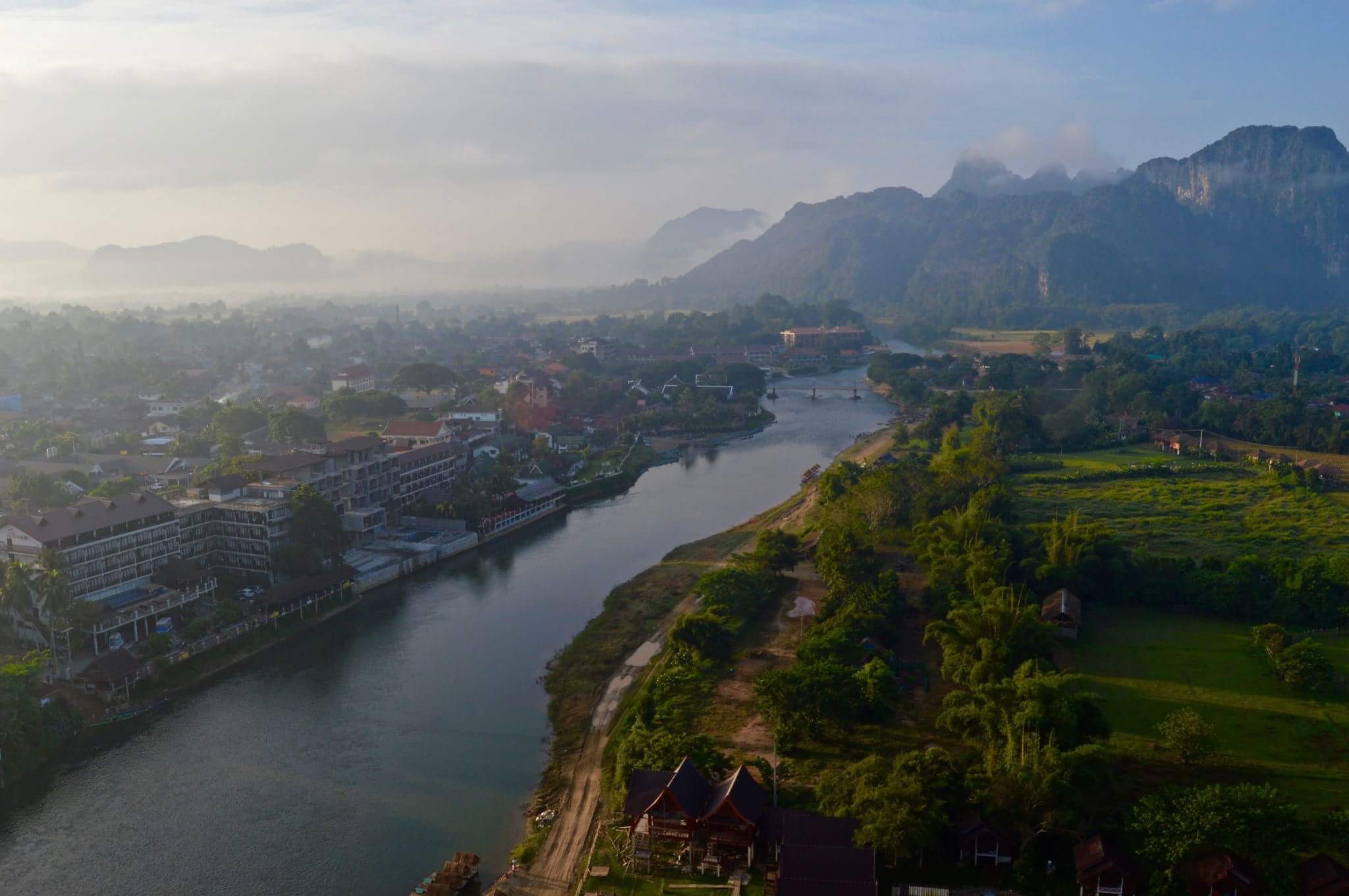
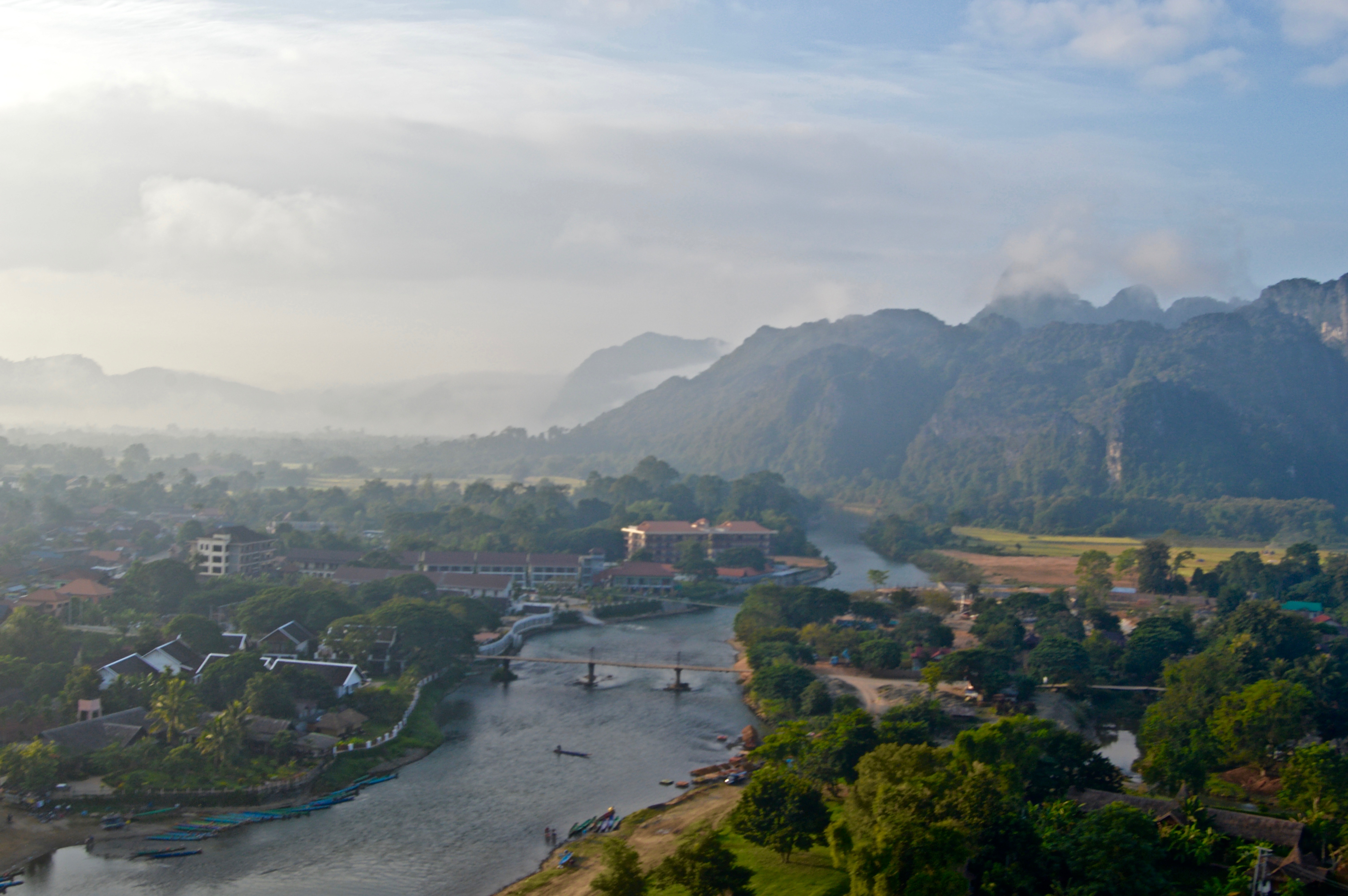
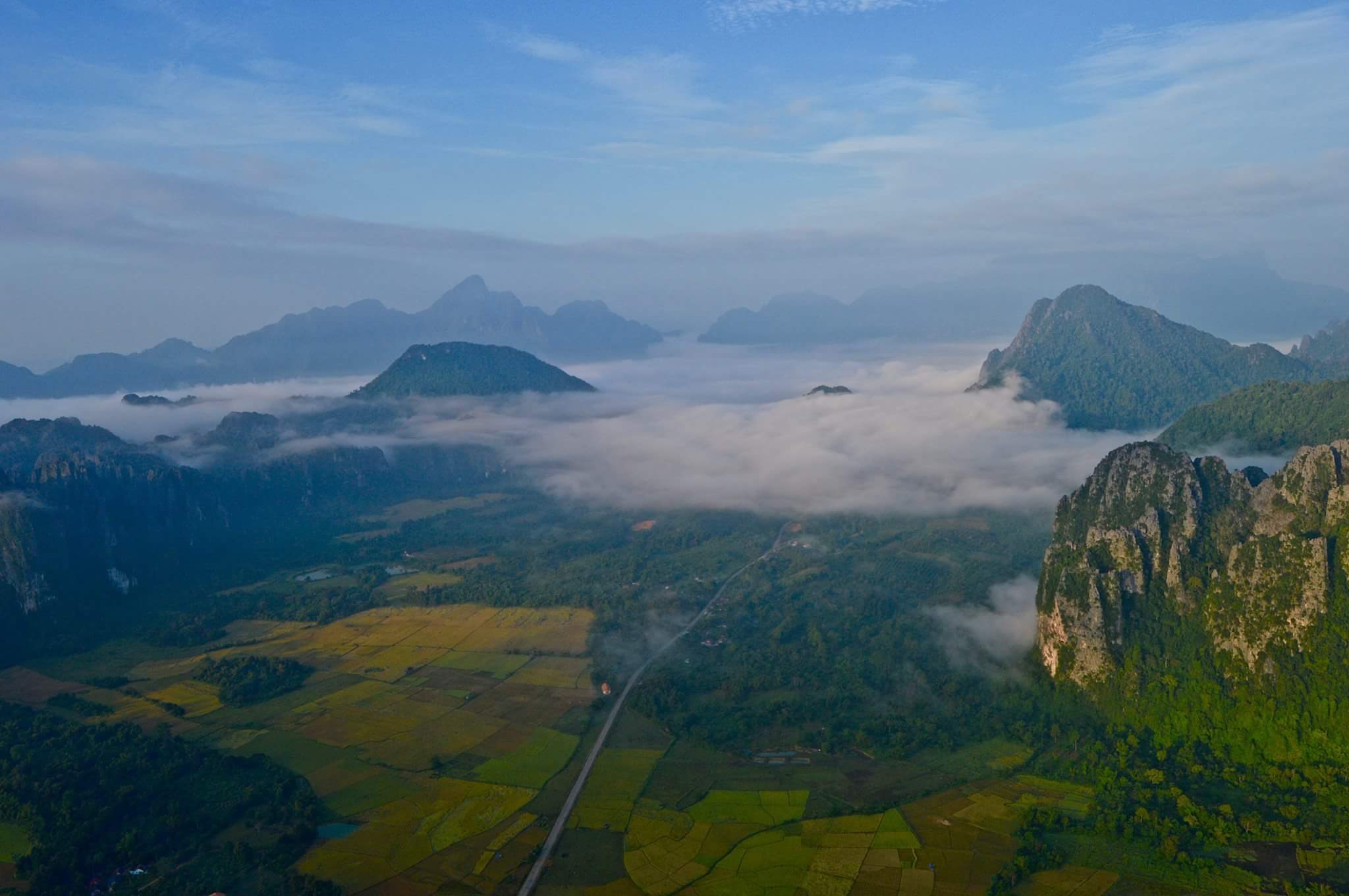
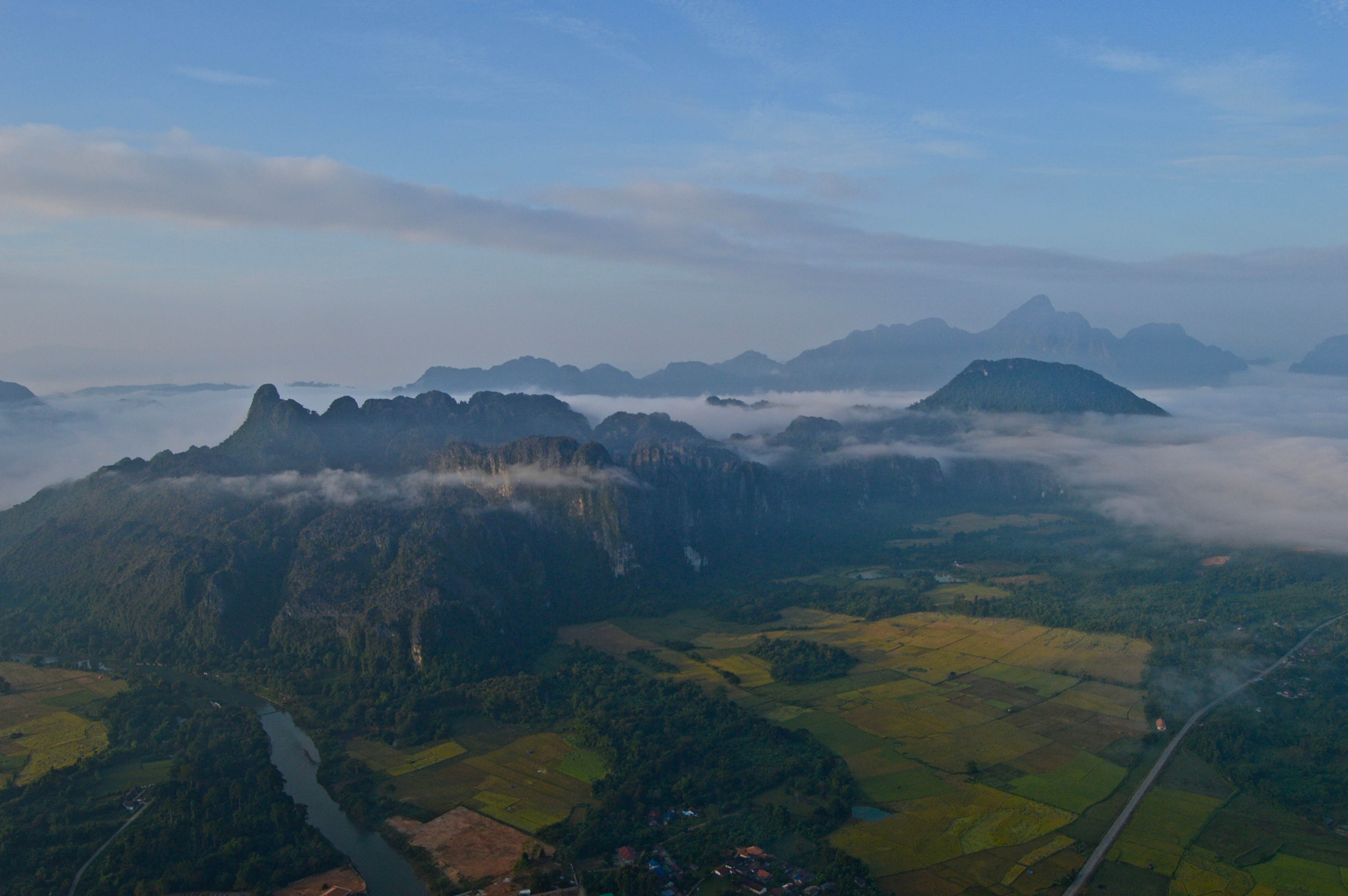
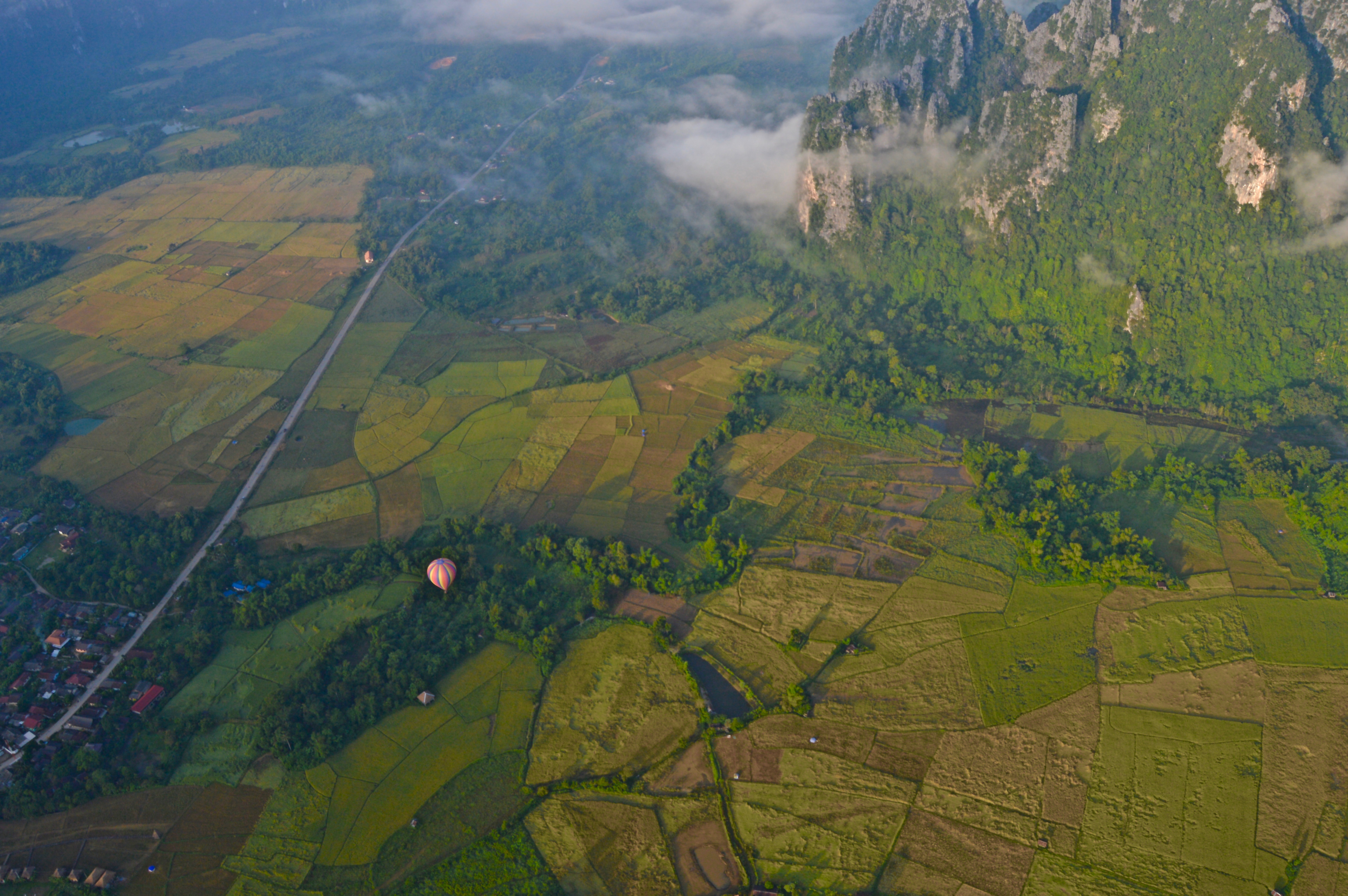
Vang Vieng is a small backpacker town located in the sleepy, land-locked, mountainous, and oft-forgotten on the Southeast-Asia-tourist-trail nation of Laos. This area, and Laos in general, boasts vast rural landscapes of rice fields stretching to all horizons, impressive steep mountainous terrain, and wild rivers cutting through narrow valleys and dense forests.
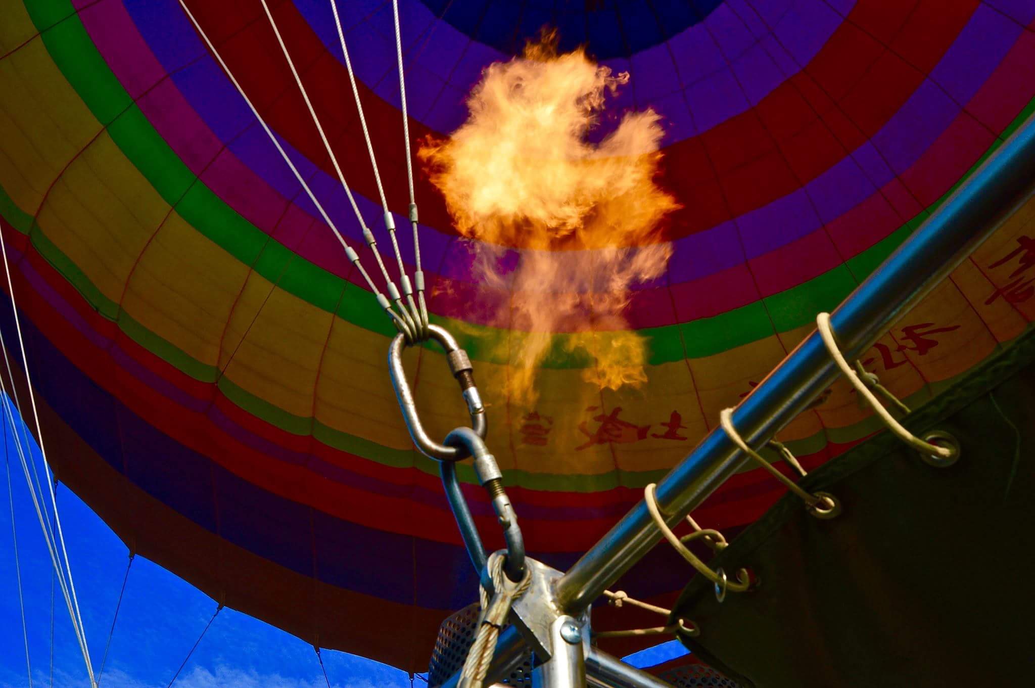
These natural landscapes have made Vang Vieng a center of outdoor recreation including hiking, climbing, and kayaking. It is also home to the cheapest hot air balloon rides in the world…which can either be a good or bad thing depending on your perspective and risk-tolerance.
I hopped on the early morning balloon ride for $90 dollars and spent the better part of an hour shooting and taking in the awe-inspiring views from 2000 feet high as the golden hues of sunrise spilled across the landscape.
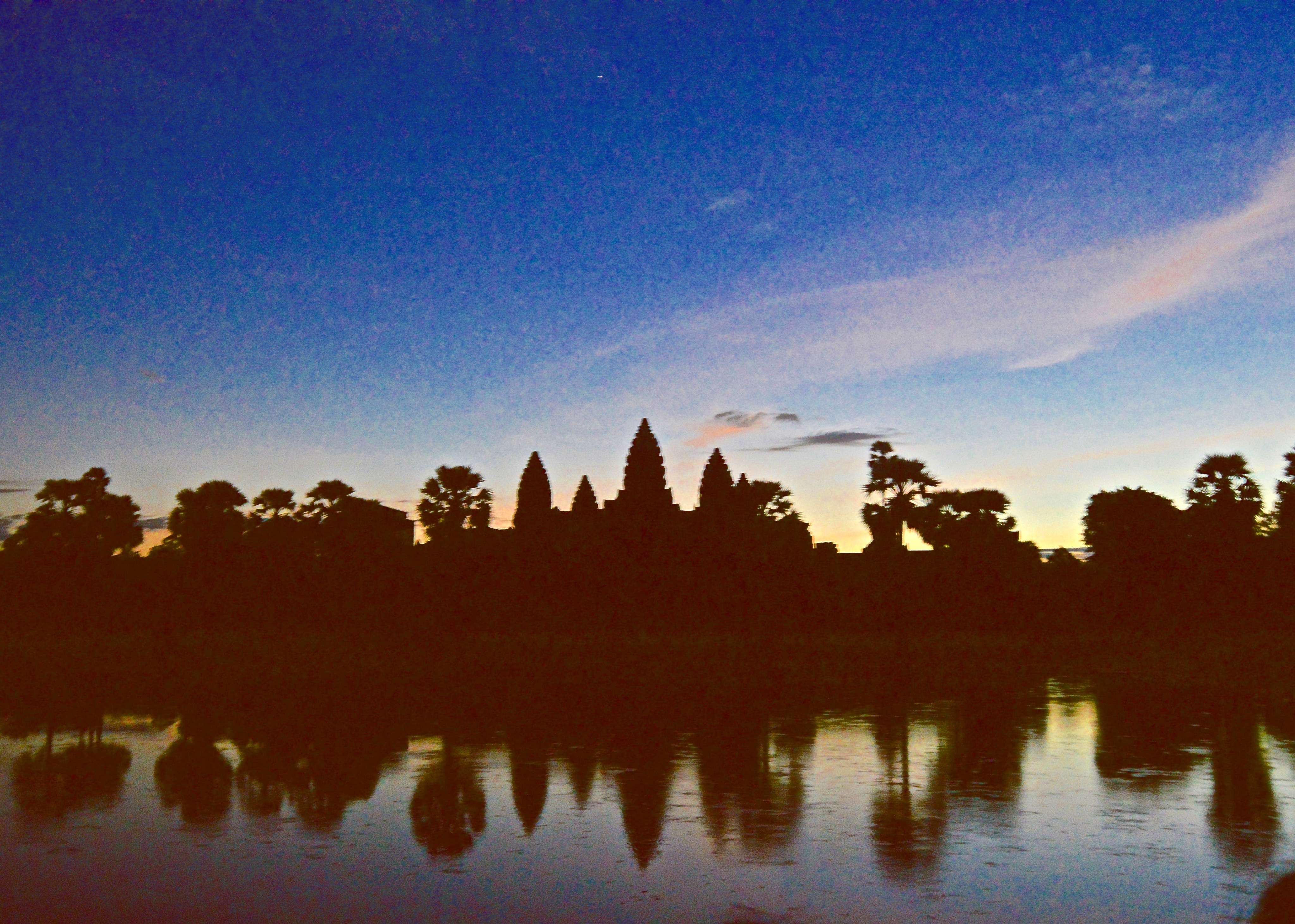
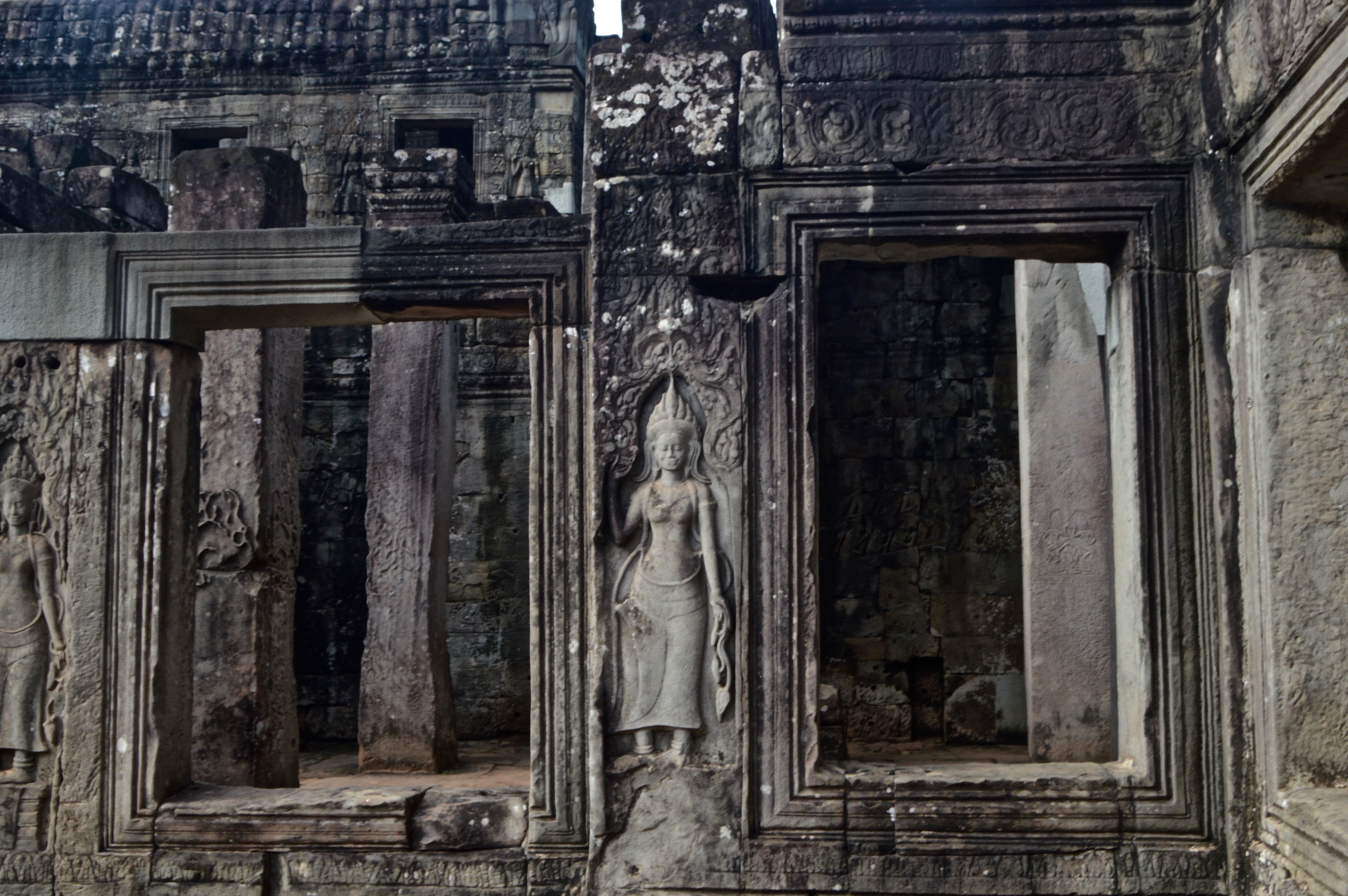
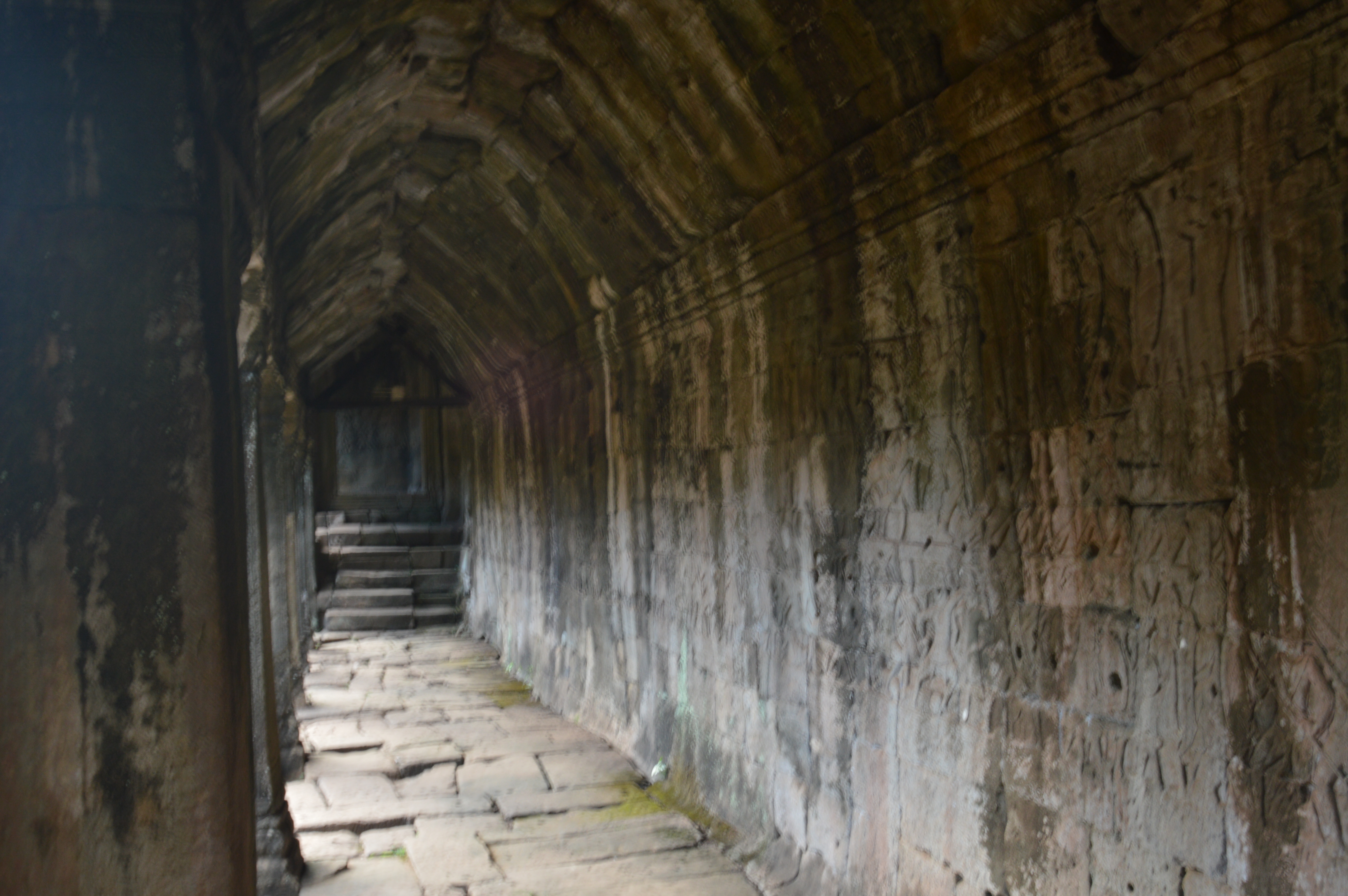
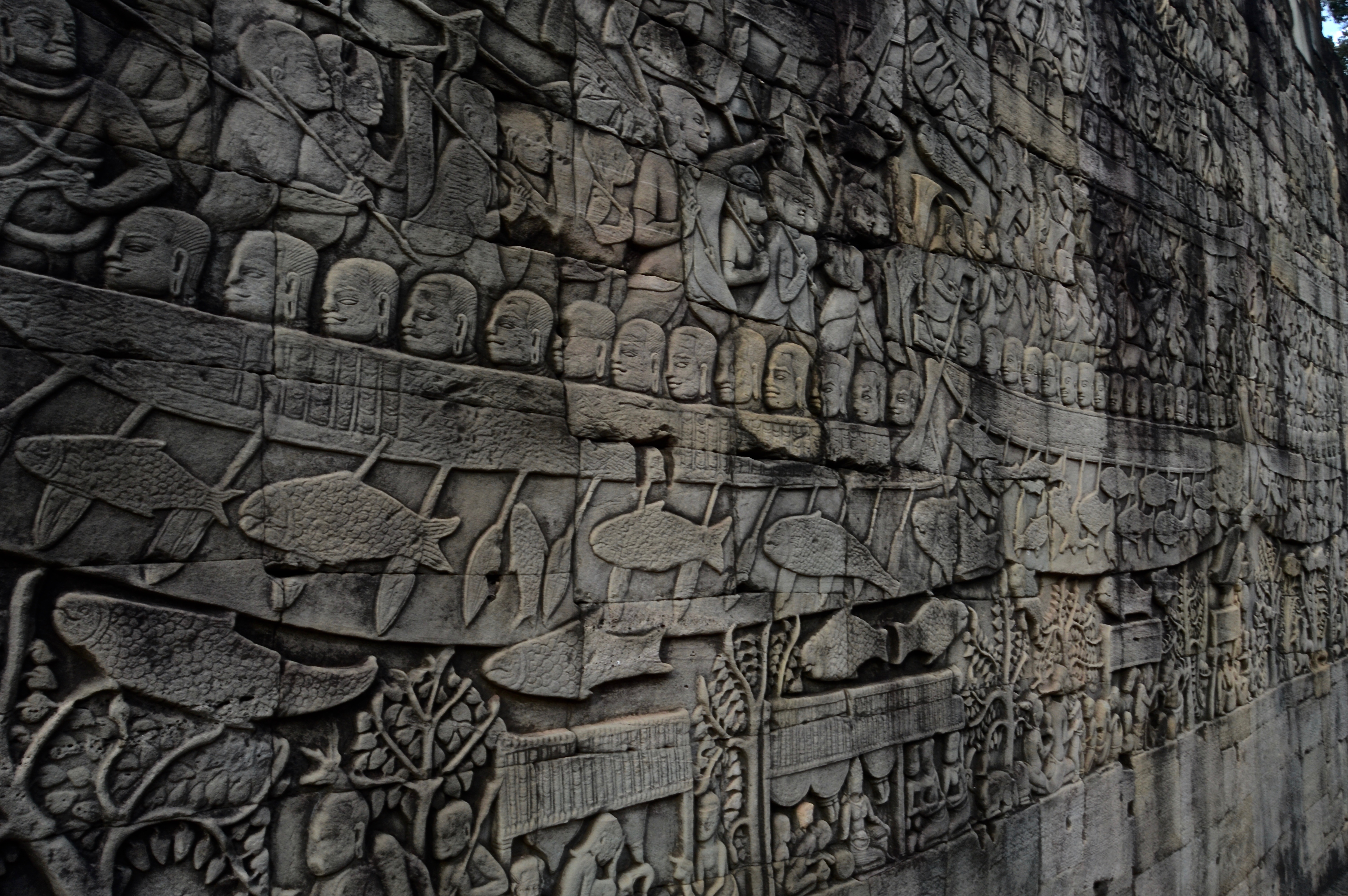
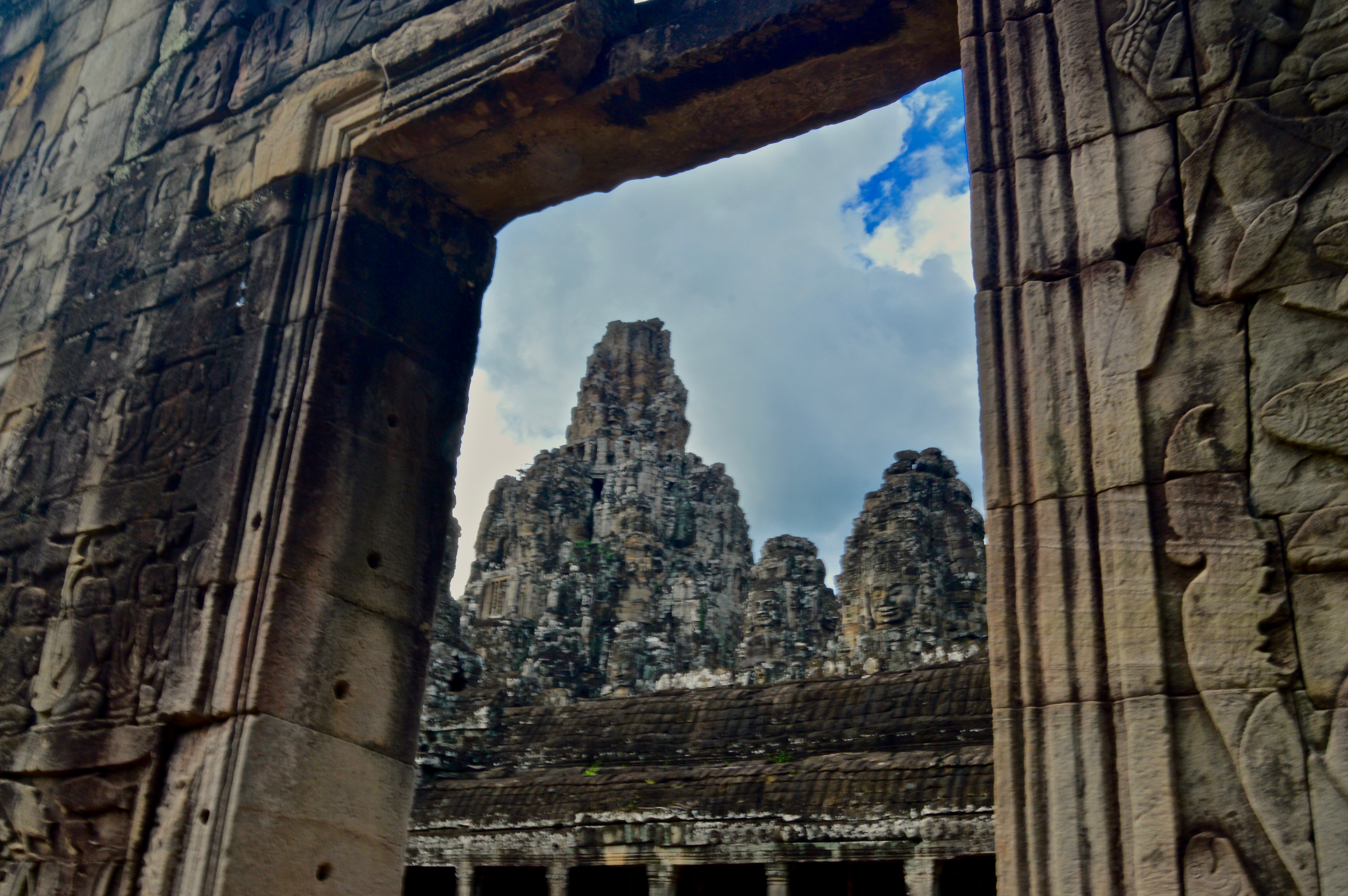
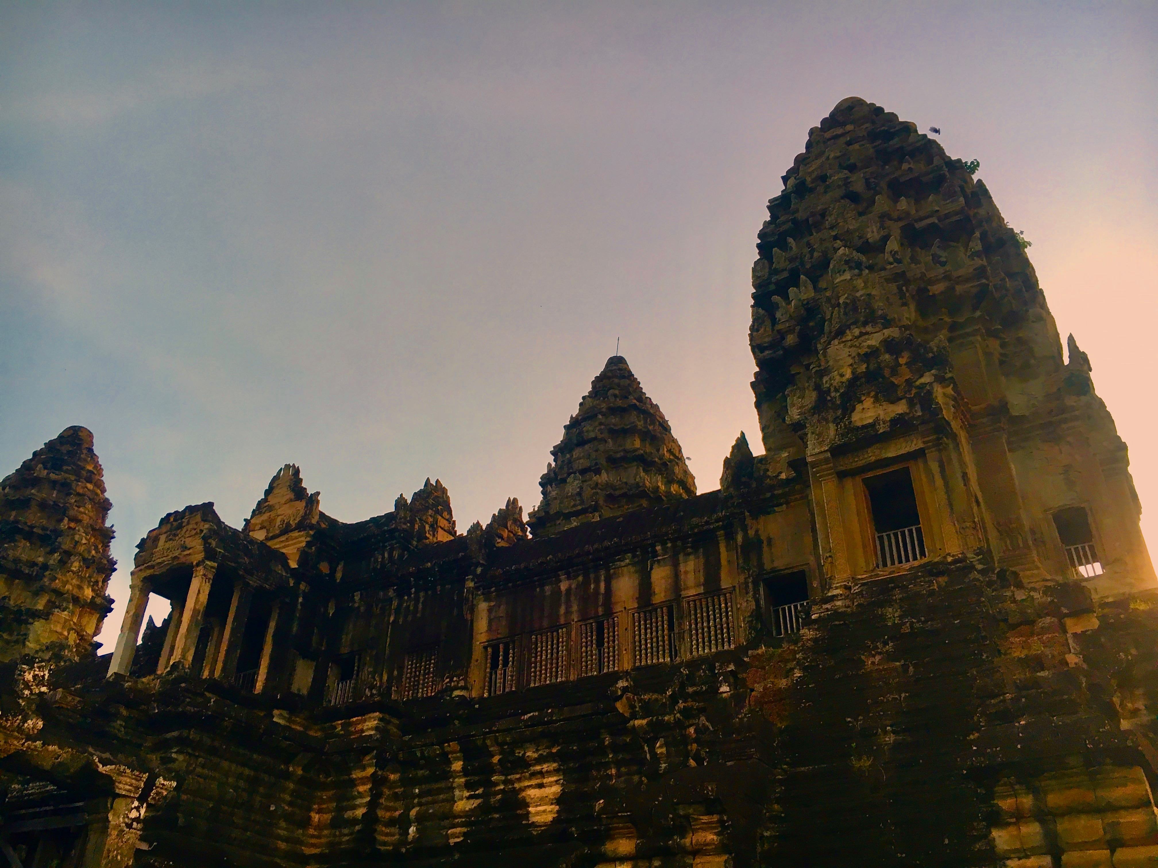
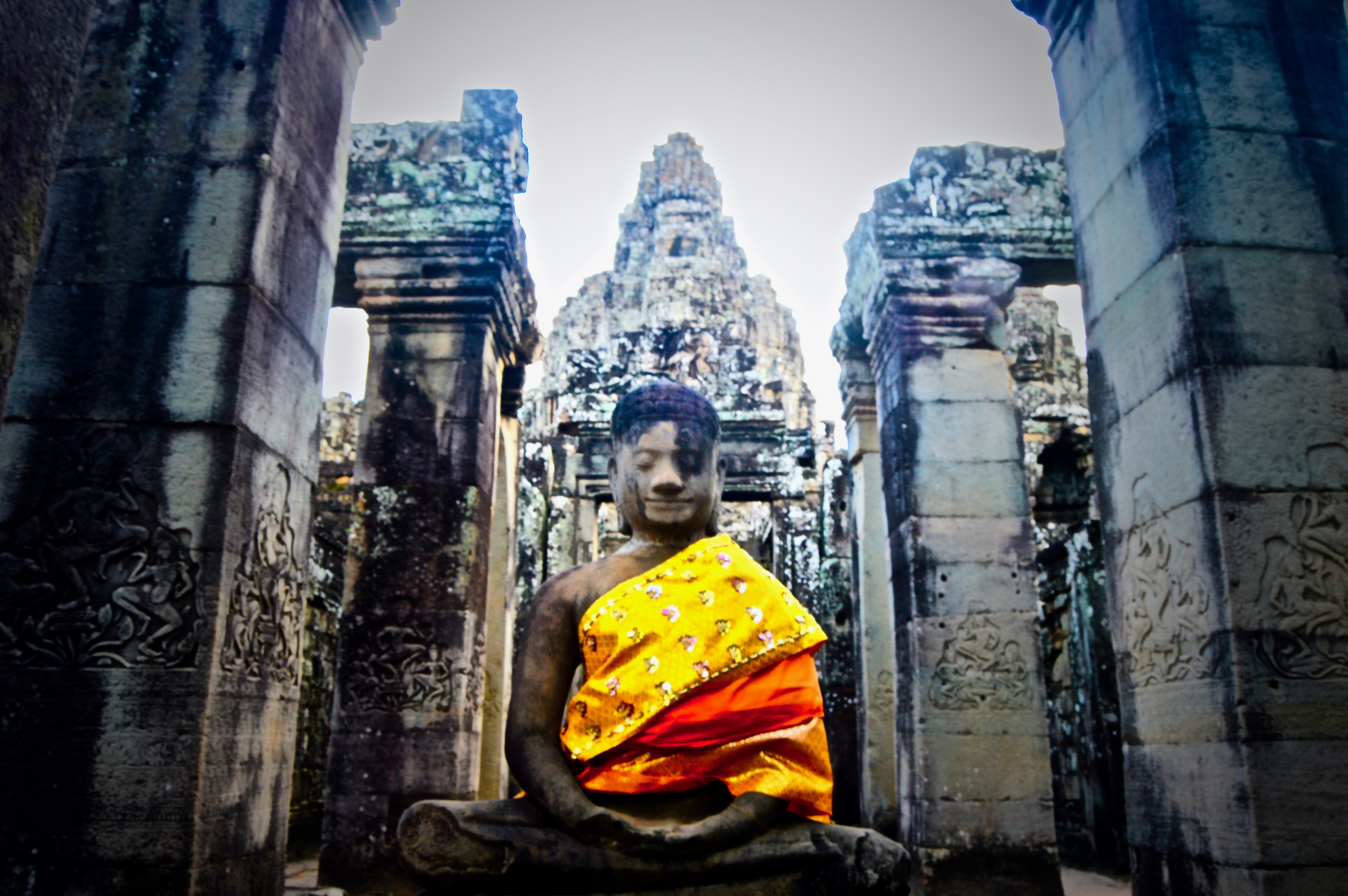
Angkor Wat is a complex of ancient temples located near Siem Reap, Cambodia. Originally built as a Hindu temple towards the end of the 12th century, it was later converted to a Buddhist temple, and is still to this day the largest religious monument in the world.
While over-run with tourists during open hours–resembling an almost Disney-esque experience of waiting in long lines under the hot, humid sun and innocent faces smiling into cameras held up by selfie-sticks–Angkor Wat is nonetheless an impressive sight boasting vast historical and architectural significance.
In order to beat the crowds, plan an early wake-up call and arrive at the temple’s opening while it’s still dark. I was one of the first to arrive when I visited and enjoyed nearly a full hour of exploring the temples in isolation and cool, dry temperatures. Oh, and I also witnessed a once-in-a-lifetime sunrise as the day’s first light rose over the main temple, pouring its golden rays across the grassy grounds and aged stone structures.
The situation I find myself in:
The world is spinning; I can’t breathe, I can’t see, I can’t hear. I am currently submerged underwater, traveling at breakneck speeds down a frigid river littered with rocks, drops, holes, and class III-IV whitewater. Picture a load of laundry mid-spin cycle: that would be my current situation, completely at the mercy of the current and the force of gravity. I reach for the surface, but I’m not entirely sure which way is up, or down for that matter. All I see in front me is the violent whirling and foaming of water, and my paddle, which thrashes wildly as I desperately attempt to hold on. How long have I been underwater?
How I found myself in this situation:
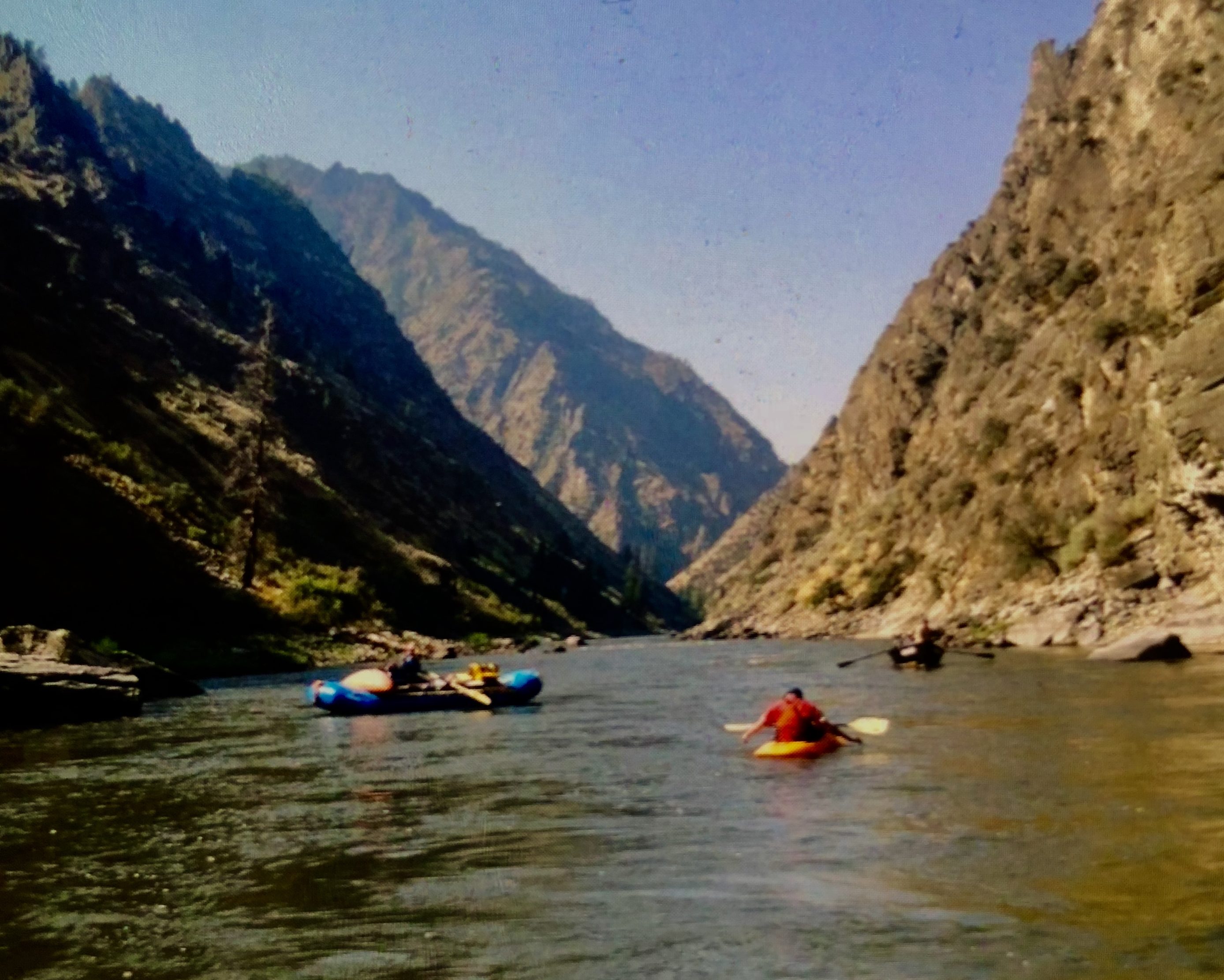
We had just put in on the Middle Fork of the Salmon River, the beginning to a weeklong rafting trip through vast forests, ceaseless canyons, and untamed wilderness. A combination of my novice-level kayaking ability and murky water due to recent thunderstorms has resulted in me flipping my kayak and swimming through a rapid within the first mile. Six days, 99 miles left to go, and I already have soggy clothes and lungs full of water. What a way to start this trip.
At the time, I was a recent high school graduate, preparing for my first year away at college. In a couple weeks, I would move from my hometown of Bend, Oregon to Idaho, where I would live away from home for the first time. That summer was spent buying books, packing boxes, and gathering all the items needed for the year ahead. I remember it all feeling so surreal, like I was leaving one life and entering another. As I am an only child, my parents were likely also anxious as I prepared for my departure. Since we had traveled extensively as a family throughout my childhood, they wanted to send me off with one final family trip, one we always dreamed of: whitewater rafting down the Middle Fork of the Salmon River.
Now, this is not an easy trip to pull off. Due to popularity that lead to high levels of traffic in the summertime, one must either apply for a permit—which can take years to receive—or join a commercial trip—which costs thousands of dollars. Furthermore, Mother Nature must be on your side. We had actually attempted to run the Middle Fork twice before, but were turned away when wildfires closed down the river. Luckily, I have an aunt and uncle who guide on the river and were able to score us discounted spots on a commercial guided trip. The fires were absent this year and it seemed like the third time really would be the charm. Except now, I find myself sopping wet and cursing myself in the middle of this unforgiving wilderness.
A question I keep asking myself:
I will be starting school soon and have no idea what to study. What will be my major? What will I do with my life? These questions rattle around in my head and become increasing louder as move-in day approaches. Additionally, it seems each person that hears I am starting college is equally curious of the answer to this question, further compounding my angst.
“What are you majoring in?” repeats a guest on the trip as I stare back blankly after the first time she asks.
“Umm…I haven’t decide for sure but I’m thinking business…yes, business.” No offense to business majors but this seems to be my default.
“So, what do you want to do with that?”
Oh, fuck. She went there. Isn’t there something else we can talk about? Anything else? I usually like to let a far-superior future version of myself decide these important life questions, but no matter how much I attempt to avoid them, they keep recurring like a bad Chainsmokers song.
A day on the Middle Fork:
A trip on the Middle Fork includes six days and fives nights of epic whitewater rafting down 100 miles of untamed river through landscapes that range from dense spruce and Lodgepole pine forests to desert canyons. Gourmet dinners of grilled salmon, roasted fresh vegetables, and Dutch oven baked desserts consume our evenings and nights are spent reminiscing on who had the best ‘swim’ of the day—which always seems to be me—before crawling into sleeping bags and dozing off under the stars.
It’s day 4, my kayaking skills have dramatically improved since that dreadful first day as I expertly navigate the first set of the Tappan rapids—one of the more notorious series of whitewater on the river, ending with Tappan Falls. I watch as my companions, one by one, successfully maneuver the rapid. First the oar rafts, followed by the paddle boat, then the kayakers; finally, it’s my turn. This is the largest waterfall I’ve run to date, but I remind myself to lean forward and keep paddling through it. As the nose of my kayak begins to drop over the lip, I make one final vertical stroke, accelerating through the air and landing at the base a few feet below. Cold water splashes all around me and the jolt of the landing throws off my center of gravity, but I remain upright. Ecstatic and brimming from ear-to-ear, I join the others, who have eddied out below the falls.
That evening, we enjoy a meal of fish tacos and margaritas at camp. This is one of the most sought after campsites on the river, as it is nestled just below the confluence of the river and Loon Creek, where a short trail leads to a natural hot springs pool along the creek. The river is littered with hot springs along its course, but this is one of the few campsites that is within close proximity to one.
As I lean back in the warm pool, I feel the muscles in my back and shoulders slacken from the tightness caused by dozens of miles of paddling. I sip a chilled PBR—my drink of choice for river trips—while chatting with my parents, my uncle, and two cousins who have joined us on the trip. My gaze wanders into the distance. The warm hues of the sunset illuminate the sky with shades of orange and smears of lavender, while a steady, yet calm breeze makes its way through the canyon, stirring the pines as it passes by. We are all quiet for a moment, absorbing the serenity of the wilderness around us.
A journal entry I wrote on wilderness:
Wilderness is an interesting concept. First, there is true wilderness—the wild, where the law of nature governs and man is just another mortal inhabitant of a deeply primitive and interconnected system. On the other end, there is legislative Wilderness; note the capital “W,” plots of public land set aside to be protected from development and human influence. The question is: does this planet really contain any land that has not been impacted in some way by humans? Is there any true wilderness left?
The Middle Fork flows through the heart of the Frank Church River of No Return Wilderness—the largest federally protected Wilderness area in the United States outside of Alaska. This place feels wild. The air is crisp; the river flows free, and wildlife roam without determent. Yet, human influence is ubiquitous. Each summer, thousands of tourists flock here to spend a week rafting and camping along the celebrated river. We pass countless other groups each day. Campsites must be reserved beforehand, and only a limited number of groups can launch per day. There are times I feel more at a theme park than a remote wilderness.
For all that, there are still moments of pure awe. This happens usually at night, whilst lying beneath an unobstructed starry night sky, listening to the crackling of a dying fire, and the distant lonely howls of wolves that lurk in the woods beyond. This is when I feel truly wild. I begin to think we need more places like this, that the world needs more places like this.
What I’ve learned as we near takeout:
On day 6, we conclude our journey as we emerge out of Impassable canyon, joining the waters of the Main Salmon as it makes its way towards the Snake, then the Columbia, before ultimately reaching the Pacific Ocean. Our takeout is a few miles below the convergence of the Middle Fork and Main Salmon.
As we float the final miles towards the takeout, I hear a faint whine in the distance. It sounds like that of a mosquito, but I can’t quite make it out. The sound grows louder and sharper as we approach, until it overpowers the acoustics of the flowing current. At that moment, a large speedboat breaks the horizon line, whizzing towards us as its engine pierces through the breeze. A group of hunters standing towards the bow give us a friendly wave as they pass us and continue their crusade upstream. Following the course of the river, cars ramble by on the highway leading back to the town of Salmon. I realize I’m no longer in the wilderness.
Over the course of the last six days of rafting, five nights of sleeping under the stars, and 100 miles of traveling by boat—entirely at the speed and mercy of the river—I find myself with a clear mind and a new perspective on the days that lay ahead. I carry the lessons of the wild with me as I re-enter the civilized world: to be patient and follow the current, eventually it will lead to your destination; to lean forward and keep paddling in times of stress; to take a moment to admire the grandeur of what is around you. It’s true that there may not be any true wilderness left, but that doesn’t mean there aren’t still places that are worth preserving. This is one of those places.
The situation I find myself in now:
At the time of this writing, I have just finished my four-year degree, graduating with a Bachelor’s of Science in Environmental Studies—a decision largely a result of that trip down the Middle Fork four years ago. I am about to depart on a one-and-a-half year journey traveling around the world where I hope to seek out more wilderness and further fine-tune my life and career path. To this day, I still carry with me a passion for wild places and for preserving them. Whoever coined the term ‘River of No Return’ got it spot on. In many ways, the person who ventures down the river does not come out the same. In others, a piece of that person stayed behind, endlessly calling him back to the wild.

This comes from a post I wrote for the ISA Student Blog back when I was studying abroad in Bangkok, Thailand in 2016. Click here for the original post.
While always full of new sights and experiences, the bustling metropolis of Bangkok, Thailand can feel a bit overwhelming at times. Sometimes we just need to escape the smog and noise of the city and relax in nature. Thailand is full of natural beauty, but many of the common postcard-worthy locations are in the north or the southern islands and require multi-day trips. If you are a busy college student and only have a day or two to spare, no need to worry, there are many options to find fresh air and outdoor activities near Bangkok. The following three locations are all within a few hours of the city and provide one-of-a-kind views and unforgettable experiences with wildlife.
Khao Yai National Park
Located north of Bangkok, Khao Yai National Park is the largest national park in Thailand. Upon arriving at the park, you will likely be immediately greeted by large groups of macaques scavenging for food or grooming each other on the side of the road. Look more closely and the park’s other primate species, gibbons, can be seen gracefully swinging between trees and vines. Other wildlife commonly found include elephant, deer, and horn bills. According to our guide, there are only ten Tigers left in the park and you would have to be extraordinarily lucky (or unlucky!) to spot one. A guided day tour in the park will include jungle trekking and visiting several majestic waterfalls. The most famous being Haew Suwat waterfall, immortalized by the film ‘The Beach’ when Leonardo DiCaprio’s character leapt dozens of feet into the pool below. Make sure to bring long pants and proper shoes for Khao Yai, as leaches are common and river crossings are often unavoidable.

Erawan Falls National Park
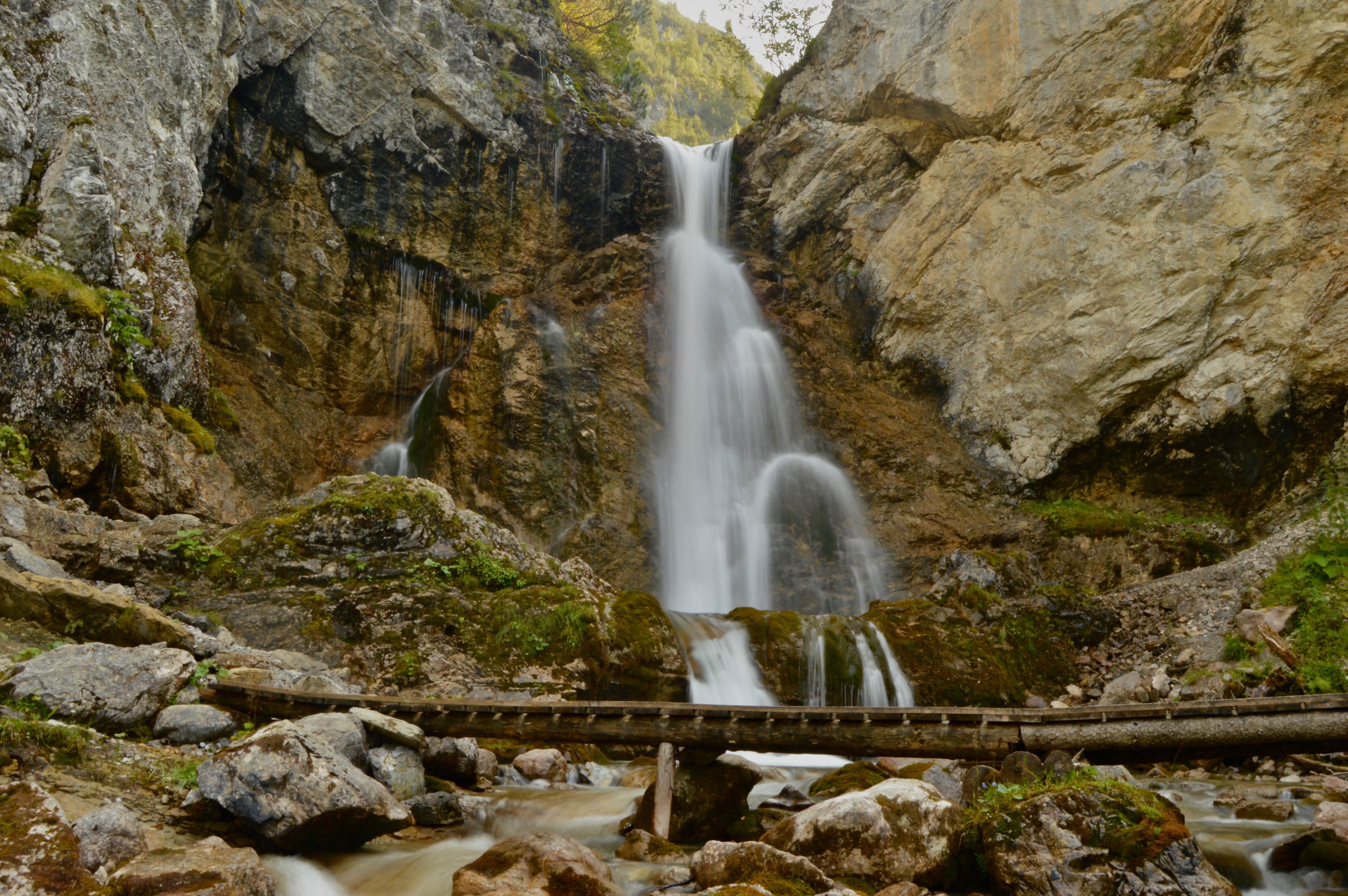
To the west of Bangkok, near Kanchanaburi, lies another of Thailand’s many national parks. Despite its proximity to Bangkok and Kanchanaburi, Erawan Falls is rarely overcrowded with tourists and can be a nice place to relax and unwind. There is a series of waterfalls along an easily walk-able path that leads to several different emerald green pools where one can escape the heat. Make sure you walk all the way to the top, as there will be less people and you might even have your own private swimming hole!

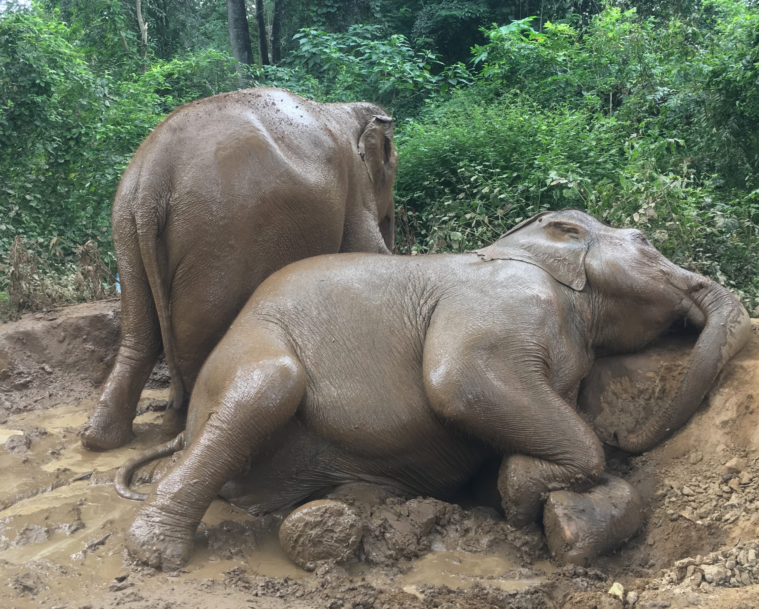
Elephant Haven Thailand
Also near Kanchanaburi is a quiet elephant sanctuary along the river called Elephant Haven. Elephants are an important symbol for Thailand and it is on almost every travelers bucket list to see one. However, many elephants have been mistreated for popular tourist activities like elephant riding and elephant shows (read why you shouldn’t ride elephants here). All the elephants at this sanctuary have been rescued from these types of events and now enjoy freedom. A day at Elephant Haven involves swimming with the elephants in the river and bathing and feeding them. Expect to completely fall in love with these magnificent creatures and to come away with an epic new profile picture!

Featured: Overlooking Hanalei Bay
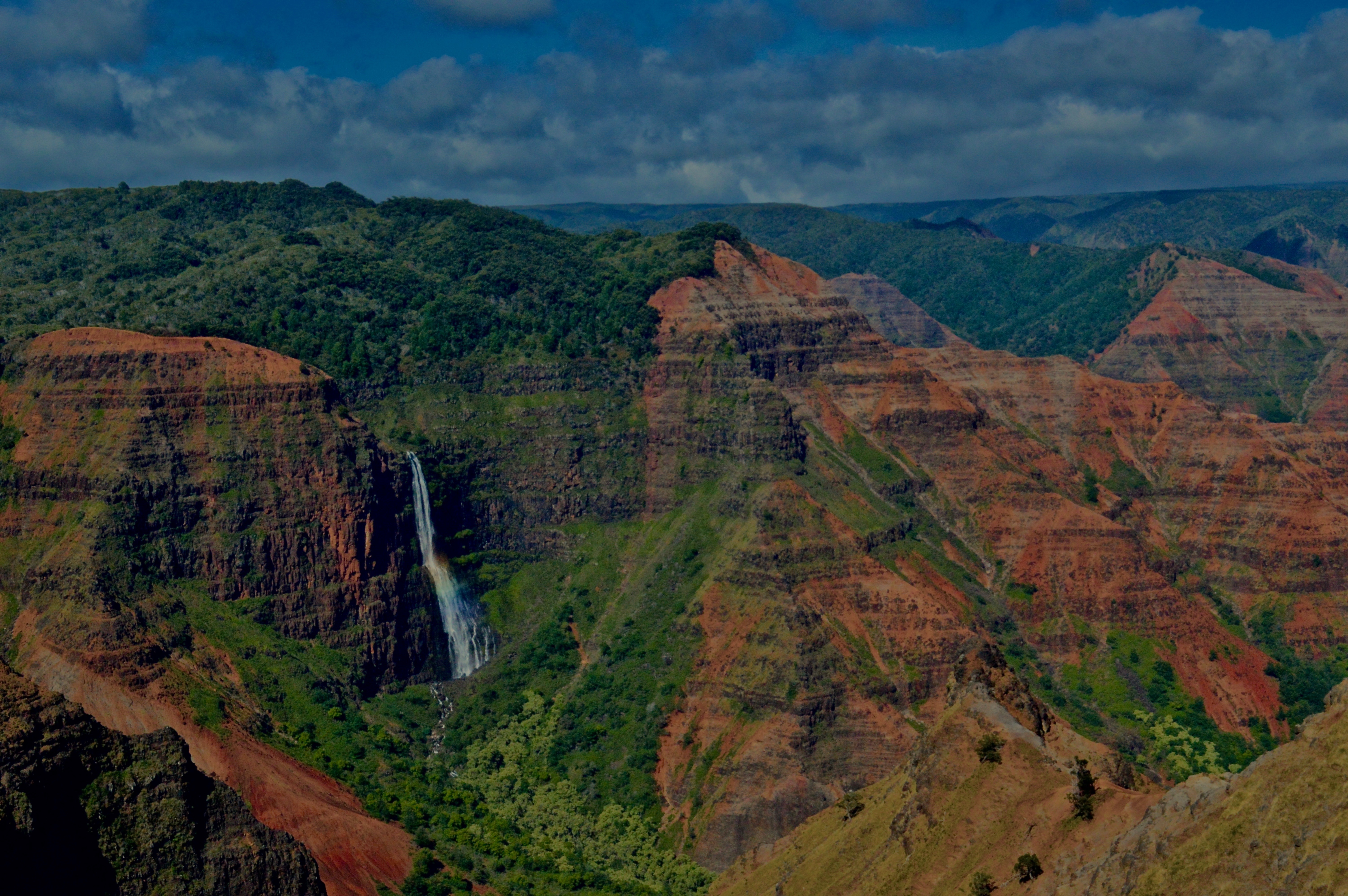
1. A waterfall glides over the cliffs of Waimea Canyon.
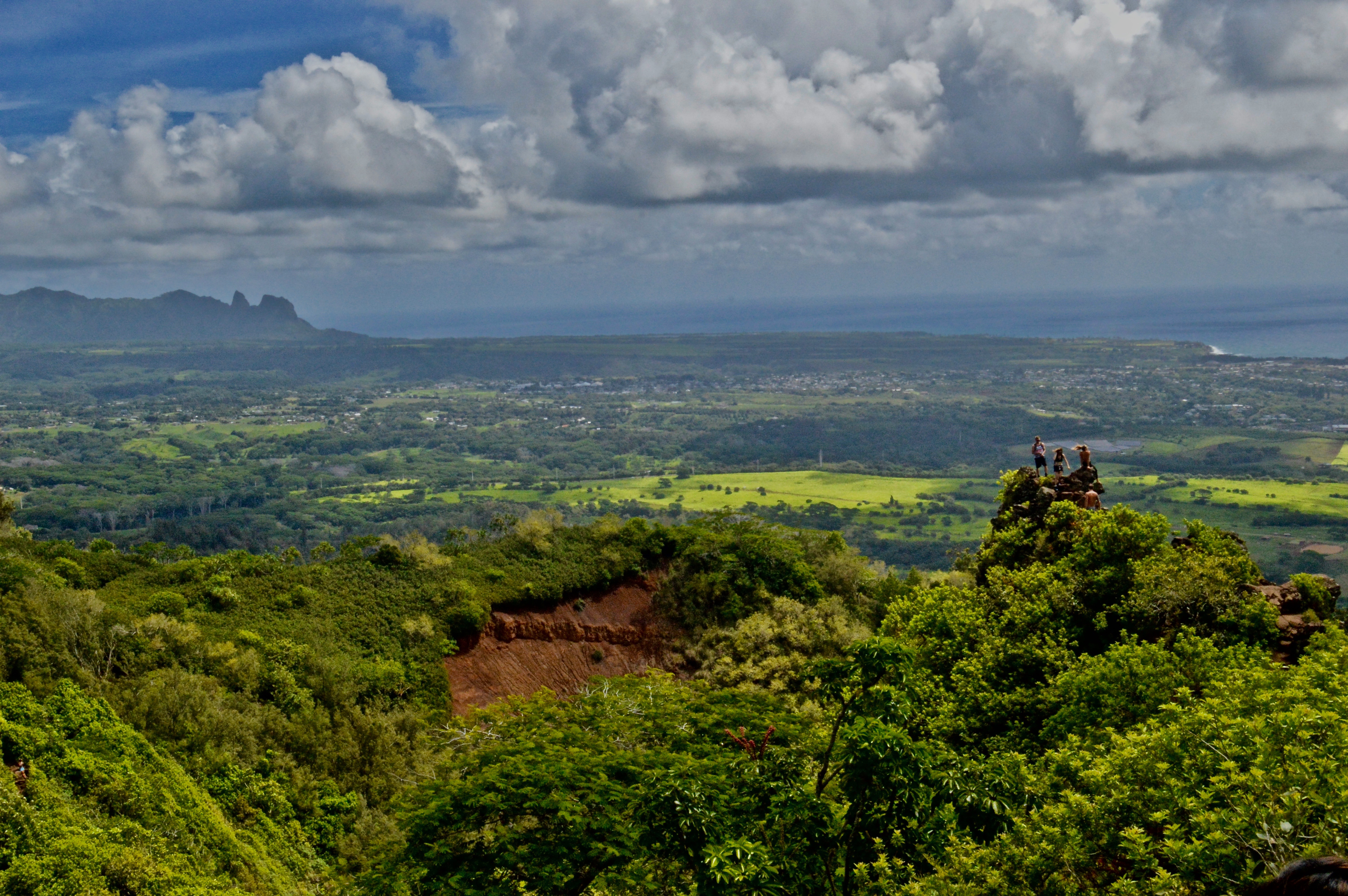
2. Hikers enjoy the view from the chin of the Sleeping Giant.
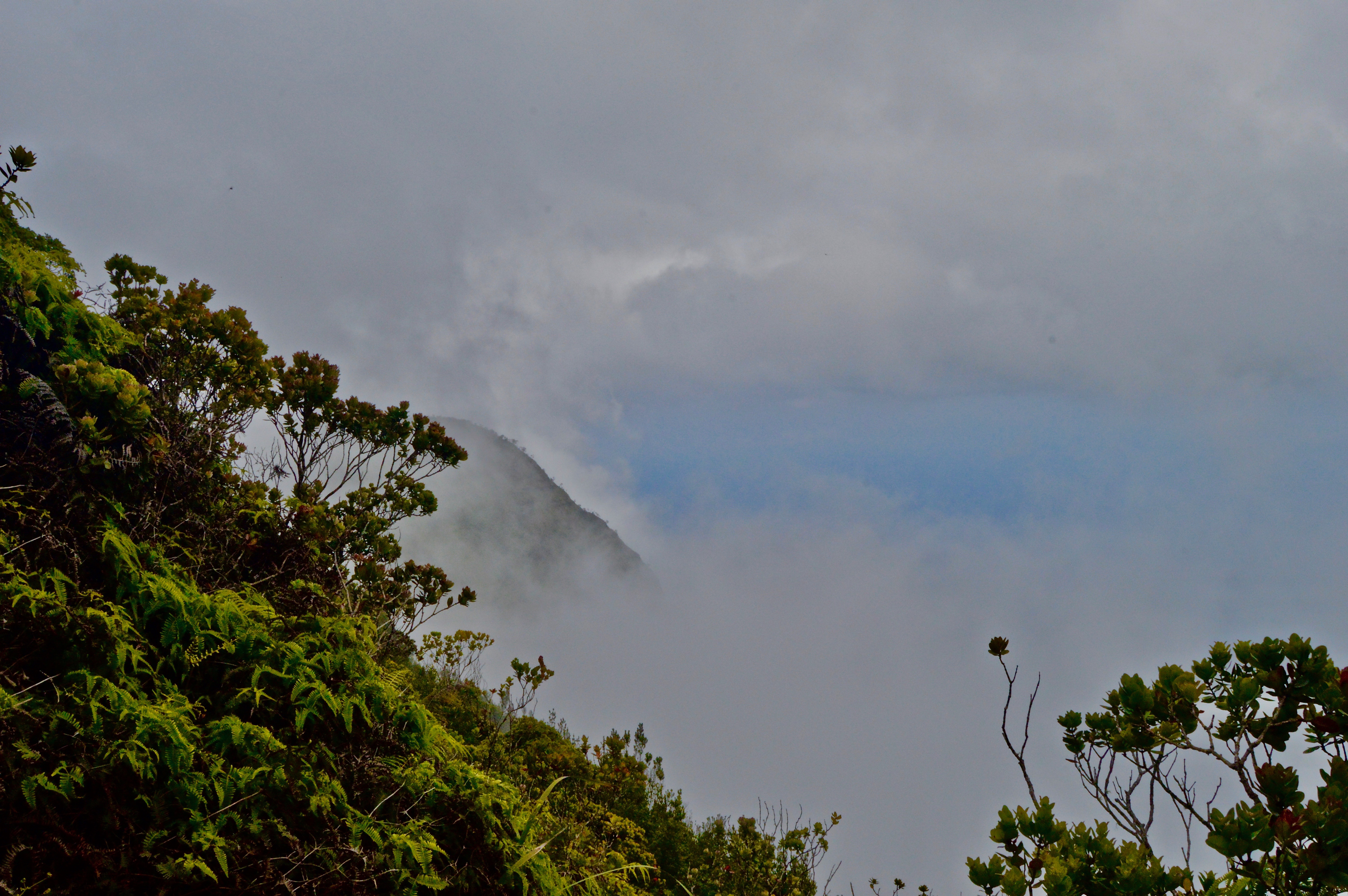
3. Morning fog on the Na Pali Coast.
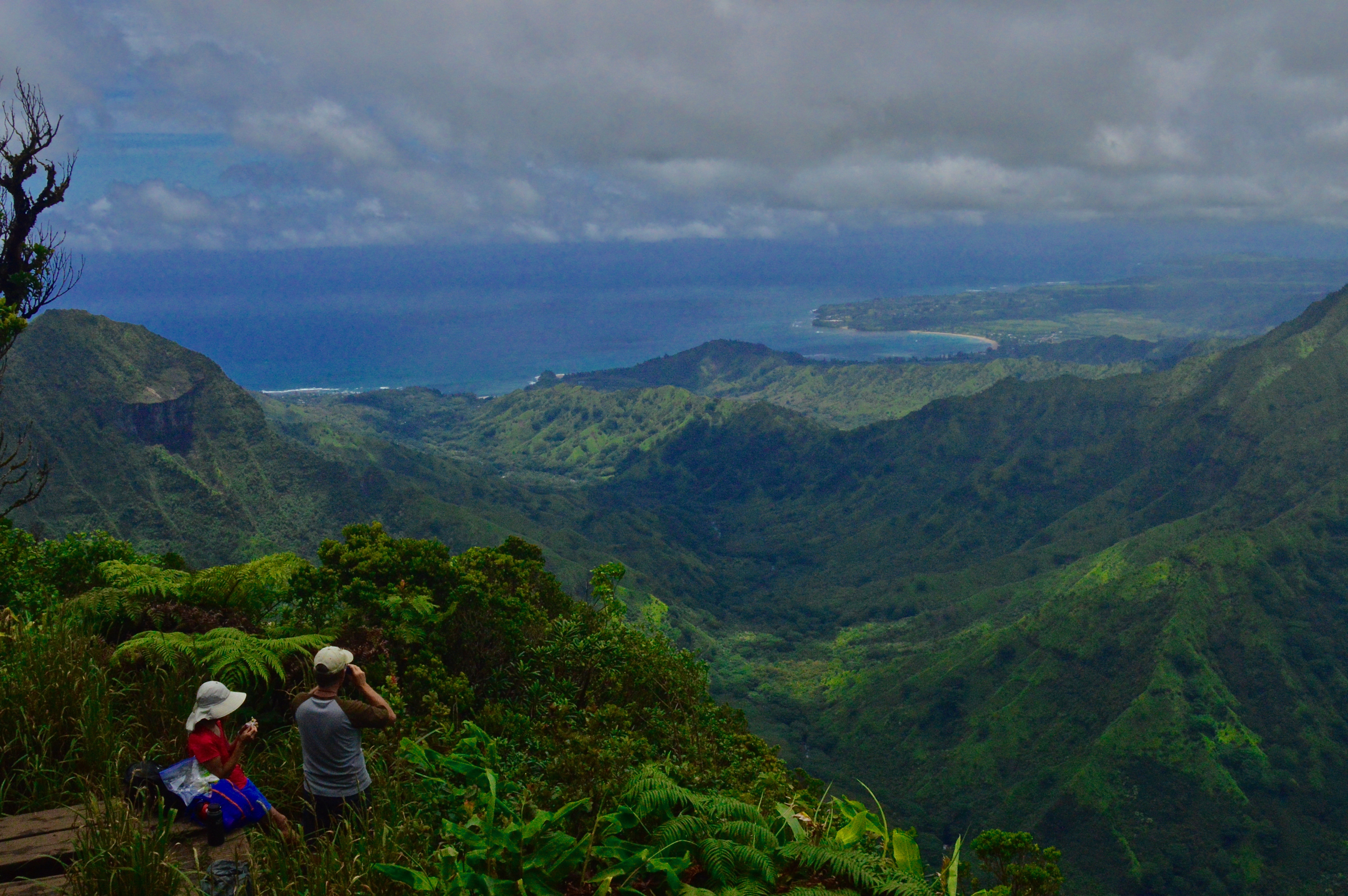
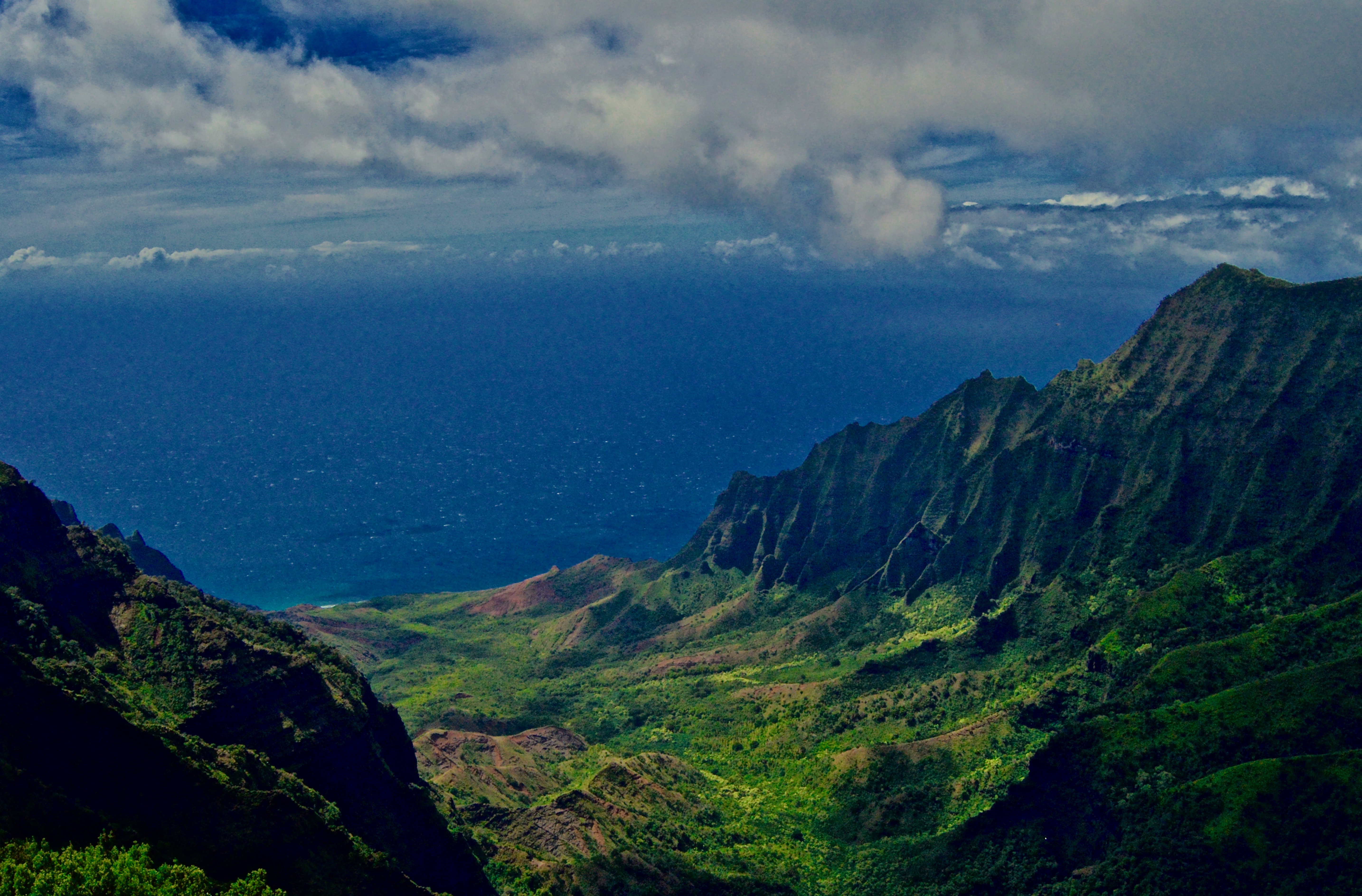
4. The view from above Kalalau Valley.
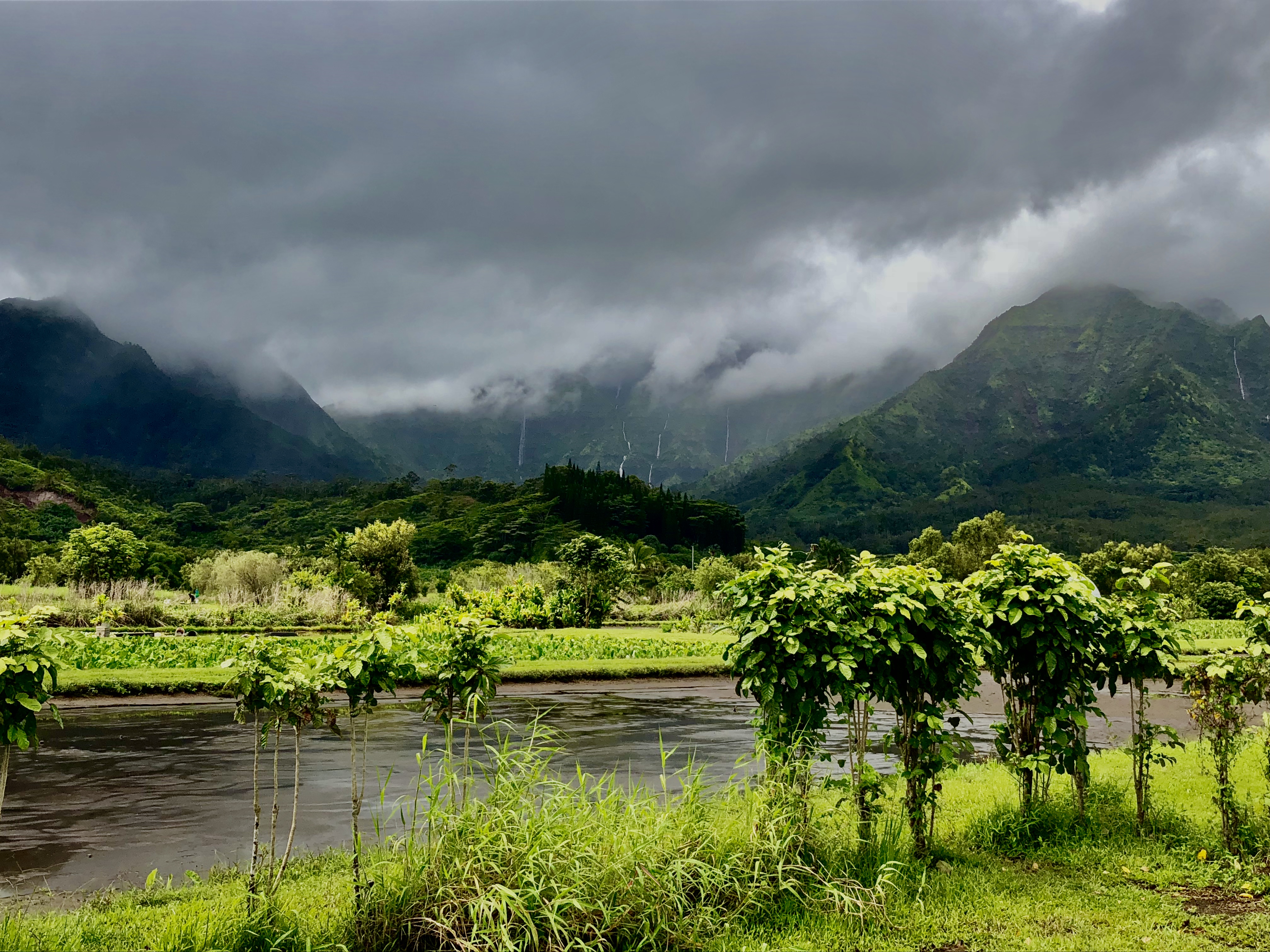
5. Looking towards the mountains from Hanalei.
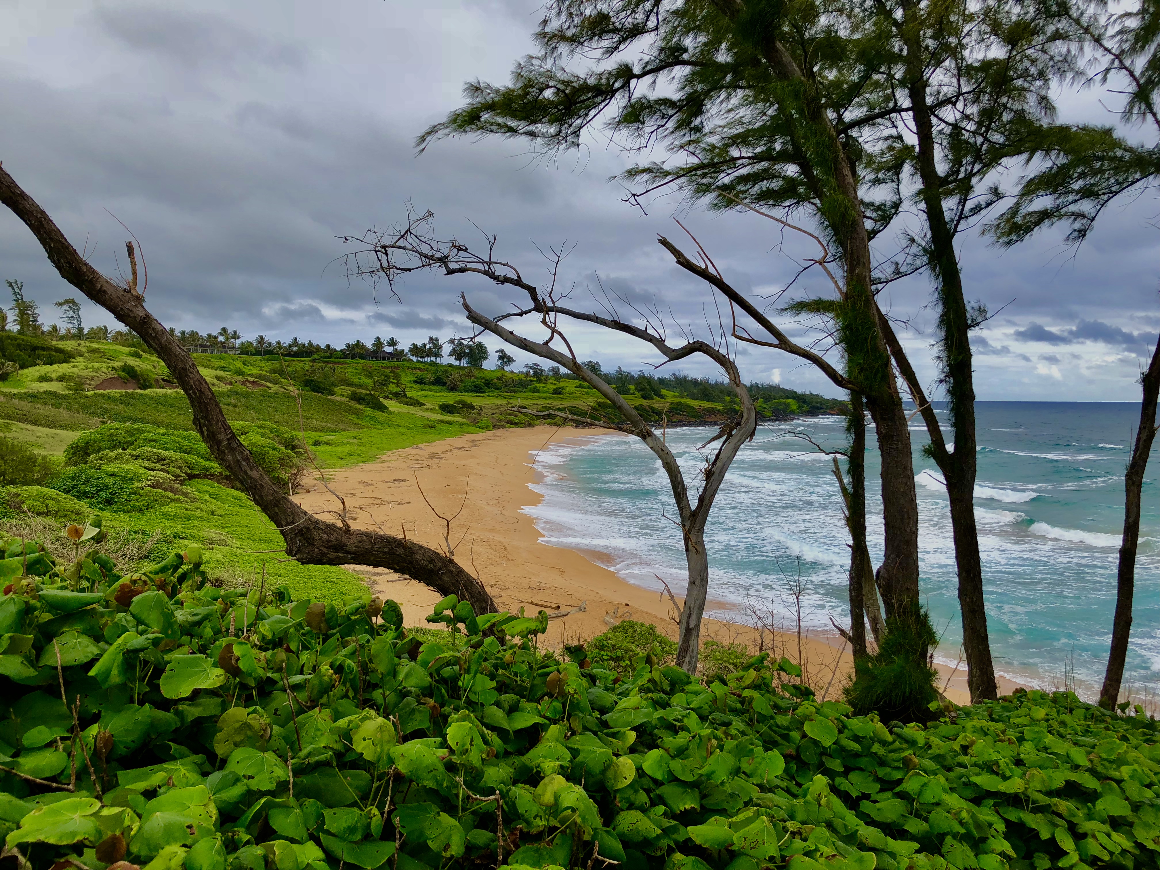
6. A secluded beach on Kauai’s eastern shore.


 Places to Get the Best Views of the Matterhorn&media=https://samijgodlove.com/wp-content/uploads/2018/09/DSC_0054.jpg)