

About the Route
New Zealand may be the ultimate road trip destination. One of the most spectacular–and least visited–road trips follows the Pacific Coast of the deep south, to the very southern point of the South Island, and back up through New Zealand’s famous southern alps and fiordlands. Towards the end of the southern hemisphere autumn, I hopped in my van and set my sights south, taking in the spirit of this historically, culturally, and ecologically rich region.
Oamaru
The Southern Scenic Route officially starts in Dunedin, but I wanted to include the coastal town of Oamaru, just an hour north, which turned out to be one of my favorite stops along the way. Famous for its 19th-Century Victorian limestone architecture, dramatic coastlines and abundance of wildlife, Oamaru is a can’t-miss destination for visitors to the South Island.
After checking in to my room at the quaint and homely local YHA, I made my way on foot to the Victorian Precinct, a small historical district comprising of a couple streets sandwiched between downtown and the harbor. Walking through the narrow streets lined with grand old buildings on either side and penny-farthings leaning against alleyways, transported me back to an earlier time. The buildings are constructed with limestone sourced from local deposits and house a variety of odd and curious shops that maintain the Victorian aesthetic. I spent my time browsing through the impressive collection at Adventure Books, home to rare editions of prints detailing early Himalayan and Antarctic explorations, as well as limited copies of Captain James Cook’s own personal sea journals. Next door, a local stonemason and artist was creating intricate and delicate sculptures from blocks of limestone.

Fitting to the Victorian theme, Oamaru is also regarded as New Zealand’s ‘steampunk capital.’ The Sci-fi genre popularized in the works of authors such as Jules Verne and H.G. Wells, steampunk is characterized by a cross between the steam engines and fashion of the British Victorian-era and futuristic fantasy worlds exploring ideas like time travel and robotic machinery. Oamaru’s Steampunk HQ is an interactive museum portraying steampunk-themed art and constructions created by New Zealand artists. Walking around the dark, eerie museum, surrounded by displays of gothic trains and submarines, and machines promising to transport me to a far away time and world, I felt as if I had stepped straight onto the set of Mad Max.
Before leaving Oamaru, don’t miss the opportunity to gorge on some mouthwatering cheese rolls–a Southland delicacy–at the Whitestone Cheese Factory.

On my second day in Oamaru, I took a day trip to the Moeraki boulders. These odd, perfectly symmetrical boulders are strewn across the long stretch of beach like golf balls clubbed by some giant with a 7-iron from miles away. They were, in fact, formed over millions of years on the sea floor as great pressure consolidated the sediment together, until the coast uplifted from the sea and the cliffs eroded away, allowing the boulders to roll free onto the beach, where they lie today. Along with these geological wonders, Moeraki provides quiet, wide stretches of sand perfect for a long early morning beach stroll.

Dunedin
The port city of Dunedin has a significant history of whaling, gold, and Scottish immigration. During the height of the central Otago gold rush, Dunedin–the closest port–was the most populated and wealthiest city in New Zealand. Today, it is known as a buzzing college town with a vibrant arts, music, and cultural scene, as well as being located next to, and within, habitats for some of the world’s rarest and most unique wildlife.
The Elm Wildlife Tour is not to be missed while in Dunedin. The half-day tour brings you within close proximity to the world’s largest sea bird–the royal albatross, the world’s rarest penguin–the yellow-eyed penguin, as well as endangered sea lions, and New Zealand fur seals. Elm’s wildlife guides are knowledgable and and will ensure you have an unforgettable experience, one that is safe for both you and the animals.


The Catlins
The Catlins, hidden in the deep bottom corner of the South Island, is one of the few relatively unspoiled places left in New Zealand. Here, native rainforest and old-growth still thrives, growing right up to the wide open beaches, rocky shores, and the vast Pacific Ocean.
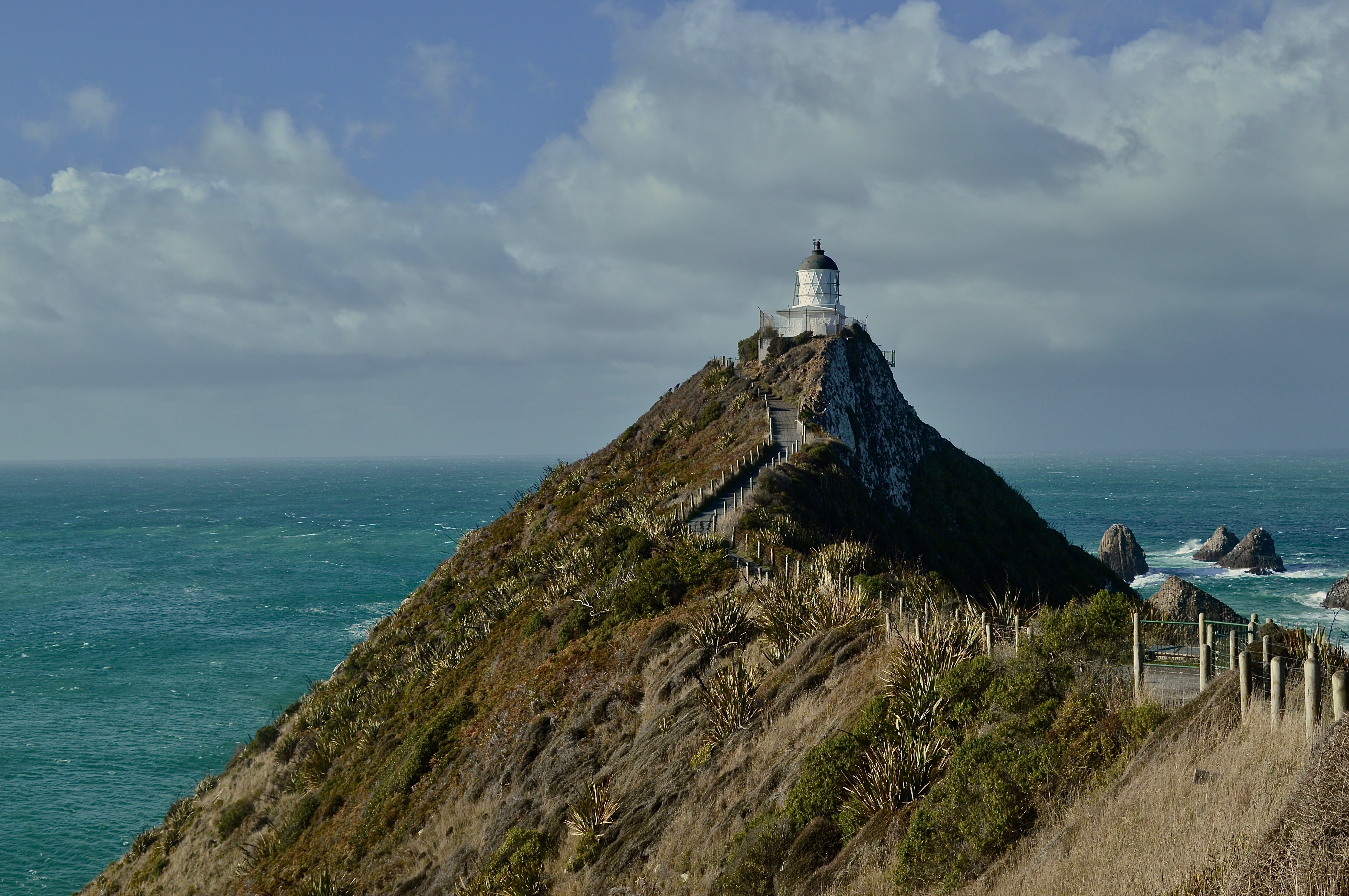
I spent two days driving through this wild and sparsely populated country, staying a night in the small town of Balclutha. Just an hour or so drive from Balclutha, is the Nugget Point lighthouse, a perfectly picturesque historic lighthouse perched on a steep cliff overlooking the shoreline. A short scenic walk takes you to this outstretched point providing views of the dramatic coastline of The Catlins and the rollicking sea below.
The next day, on my way to Invercargill, I stopped several times along the empty highway, which opened up to some of the most incredible landscapes I’ve ever seen. The highlights included Tautuku Bay, where dense old-growth forest saturated with the sound of birdsong and the pounding surf meets a stunning stretch of sand. In the middle of the forest, lies Lake Wilkie, home to a small teardrop lake with mirror-like reflections and a unique brackish habitat.
Further south along the road lies Curio Bay, where more serene coastlines, beaches, and wildlife habitat await. The rain and wind came and went all day, drenching down onto my van as I drove along one moment, and clearing up the next, revealing a new and wondrous sight with each sweep of the wiper blades.
By the time I reached Curio Bay, the downpour was relentless and the wind threatened to blow me off to sea as I climbed a hill to the top of a cliff overlooking the bay. A sense of overwhelming joy and laughter overcame me as I stood there, bracing myself against the onslaught of bullets cascading down from above. It was miserable, yet perfect.


Invercargill/Bluff
Invercargill is the southernmost major city in New Zealand, and one of the most southern cities in the world. The main reason I went here was to visit Bluff–the southernmost town in New Zealand and gateway to Stewart Island.
Bluff is famous for primarily two things: first, the ‘Edge of the World’ signpost displaying the distance to various destinations around the world and second, the oysters. Bluff oysters are sold all around New Zealand but I wanted the full experience of visiting Bluff during oyster season (March-August) to try out this delicacy.
Hailing from the Pacific Northwest, I am no stranger to good fresh oysters, but I will say these Bluff oysters were at least equal too, or maybe even surpassing the ones of my home country. The first place I stopped was at a small take-way shop along the side of the highway heading into Bluff called Fowler’s Oysters. This is one of the most popular places to sample oysters in Bluff, serving them in almost every way imaginable. I tried a half dozen fried with a serving of chips and a piece of fried Blue Cod on the side. Light and crispy on the outside and warm and tender on the inside, this savory comfort meal hit the spot after braving the rain and cold winds all day at the edge of New Zealand.
If you are really keen on getting your oyster fix, as I was, there are much more dining options in Invercargill. For dinner, I stopped in to The Rocks cafe and restaurant where I ordered another half dozen Bluff oysters, this time raw with a splash of lemon and malt vinegar–the real way to eat fresh oysters. Shooting them like tequila shots, I finished the plate in about 30 seconds, satisfied yet still contemplating placing another order.
Aside from splurging on fresh oysters, Invercargill and Bluff are also home to a number of fascinating museums including the Bill Richardson Transport World car museum and the Bluff Maritime Museum–a small exhibit displaying the history of exploration, whaling, shipping, and oyster harvesting in the Bluff region.


Te Anau
The last stop along the Southern Scenic Route before driving back to Queenstown is Te Anau, located along the shore of the massive Lake Te Anau. This small town is the gateway to Fiordland National Park and also a starting point for the Routeburn, Kepler, and Milford Tracks–three of New Zealand most famous Great Walks.
Along with these popular tracks, Te Anau offers a seemingly endless array of outdoor opportunities including day hikes, mountain biking, fly fishing, and scenic flights and helicopter rides. The town is also only a couple hour drive from Milford Sound, along what might be one of the most scenic and breathtaking highways in the world.
Upon completing the Southern Scenic Route, you will have visited three different seas–the Pacific Ocean to the east, the Southern Sea to the south in Bluff, and the Tasman Sea to the west at Milford Sound. Hopefully you were also lucky enough, as I was, to see some of the world’s rarest wildlife, most unique landscapes, sample some truly delicious local Southland cuisine, and experience a region rich with history and culture.

“Before them stood the mountains of the South: white-tipped and streaked with black. The grass-lands rolled against the hills that clustered at their feet, and flowed up into many valleys still dim and dark, untouched by the light of dawn, winding their way into the heart of the great mountains. Immediately before the travellers the widest of these glens opened like a long gulf among the hills. Far inward they glimpsed a tumbled mountain-mass with one tall peak; at the mouth of the vale there stood like a sentinel a lonely height. About its feet there flowed, as a thread of silver, the stream that issued from the dale; upon its brow they caught, still far away, a glint of the rising sun, a glimmer of gold.”
This is Tolkien’s first description of Edoras–the capital city of Rohan–in The Lord of the Rings. When crews were sent out to scout film locations for the trilogy, this is what they were looking for–grasslands, great mountains, a lonely peak, a silver stream. They spent several months searching until finally they found it, deep in the heart of the South Island, the perfect location; it was as if Tolkien was actually describing the landscape of New Zealand, rather than that of Middle Earth.
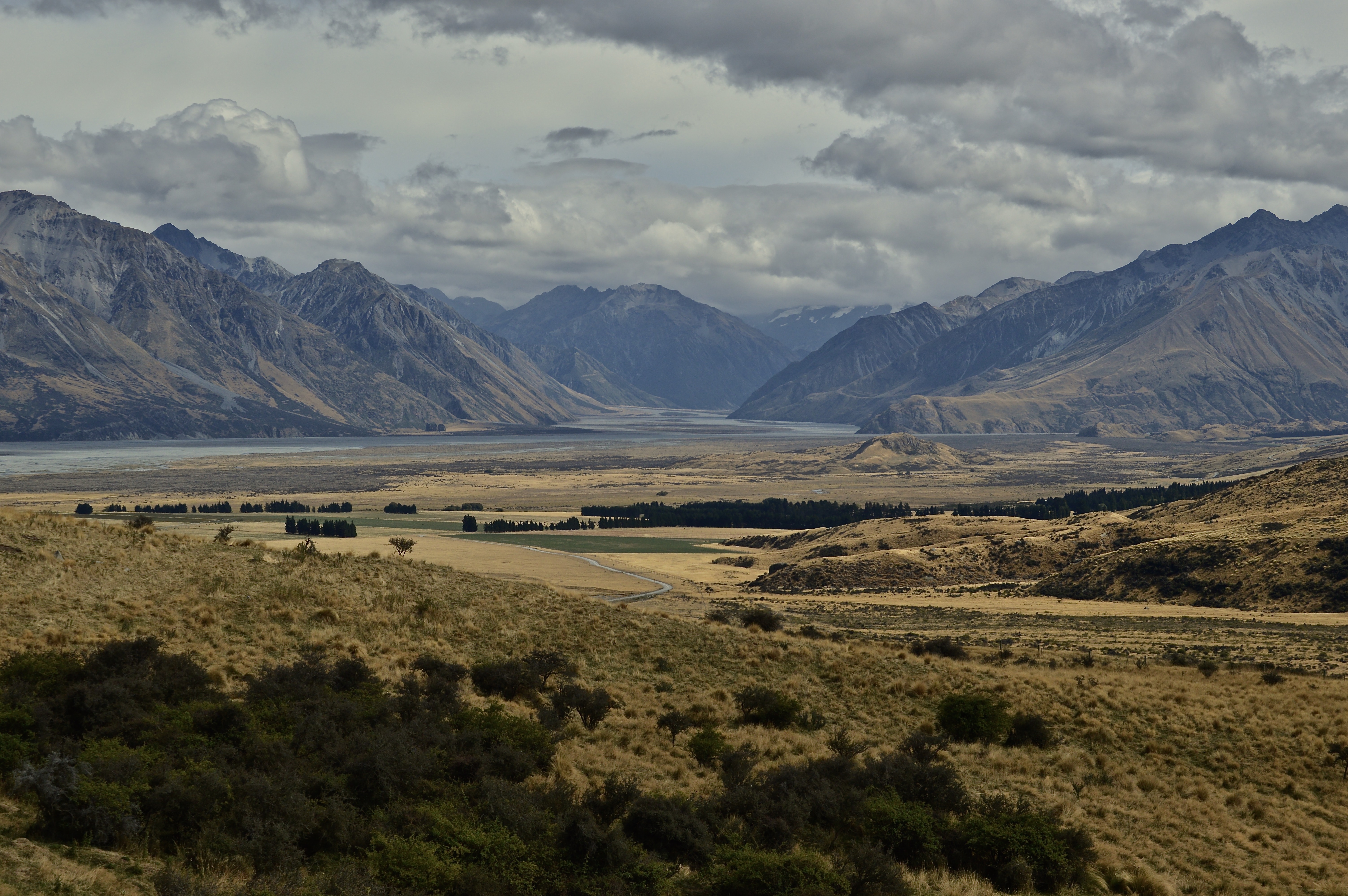
Here is the view they came across. Welcome to Rohan:

The city of Edoras itself was located on the small rocky hill at the base of the mountains, on the middle-right portion of the photo. This hill, while not really a mountain, is named Mt. Sunday and right in the center of one of the largest and most remote sheep and cattle farms in New Zealand. The location is quite difficult to access as it requires a long drive on a gravel road deep into the highlands of the South Island. It takes about two-and-half hours from Christchurch and one-and-a-half hours from Methven. Luckily for us LOTR nerds, a tour to Mt. Sunday is provided by Hassle Free Tours that picks up at either Christchurch or Methven.
The all-inclusive tour includes transportation to Mt. Sunday, lunch, behind-the-scenes photos and videos of the filming of Edoras, and a quiver of props from the movie for some epic photo opportunities.
I was the last to be picked up, in Methven, and joined about ten others on the bus who all left from Christchurch. Our little Fellowship was led by our driver and tour guide, Chris, who provided informative and entertaining commentary on the filming of the movies and New Zealand’s natural history. Along the way, we made several quick stops at viewpoints that provided remarkable scenery of the vast and open highlands landscape.

I was expecting Mt. Sunday to be packed with tourists attempting to recreate movie scenes for their Instagram shots, but to my surprise, aside from our group, we only came across four other people the entire time we were there. Again, it is difficult to get to and not quite as well-known as other film locations like Hobbiton on the North Island. Thus, I was able to recreate film scenes for my own Instagram shots in peace.

From the car park, it is a short but fairly steep walk up to the top. Of course, the constructions from the movie set are no longer there. A part of me feels that it is a shame that the incredibly detailed and intricate buildings of Edoras were taken down just days after they were built, including the great Golden Hall, where the king sat, but the other part applauds the film crew for leaving this wild and pristine landscape untouched. Despite housing the crew and actors, and hundreds of extras, as well as serving as a construction site for a fake city, there is no evidence that anyone was ever there. Even the jeep track that was used to carry the actors and equipment to the top was covered up.
We had no jeep available, so we had to hike up. Breathing heavily and starting to break a sweat, I arrived at the top and took my first look over the expanse of Rohan. A strong gust hit me head on, tunneling through the deep, mountainous valley ahead. No sign of the mighty Rohirrim galloping over the plains could be spotted, but the vista before me felt as epic and magical as Middle-Earth nonetheless. We carried up props that included King Theoden, Frodo, and Aragorn’s swords, and the banner of Rohan for the perfect photo opportunities.


After around a half hour at the top, we hiked back down and headed to Mt. Potts lodge, just 5 minutes up the road from Mt. Sunday, to enjoy a lunch of sandwiches and New Zealand sparkling wine while taking in the mountainous views one last time. From there, we made the drive back, leaving Edoras and Middle Earth behind us.
Hassle Free Tours has a monopoly on the Mt. Sunday tour, so the price is a bit steep, but take a look on Bookme to find deals (I scored my tour for half price!). Of course, if you have a car, you can drive to Mt. Sunday yourself and enjoy it for free! There’s a good chance you will have it all to yourself as well. However, your photos won’t include any swords or flags and, thus, lose about half the potential epic-ness.
For die-hard LOTR fans, or for those those looking for a scenic day trip in a remote and wild location, Mt. Sunday is well worth the trip.
Forth Eorlingas!
Luang Prabang, located at the confluence of the Mekong and Nam Khan rivers in northern Laos, is the ancient capital of the country and often referred to as its cultural capital by those who visit. Characterized by ornate Buddhist temples, French-influenced colonial architecture, scenic natural landscapes, a vibrant night market, and dozens of quaint cafés and bakeries, this sleepy town along the Mekong River is a must-visit for travelers in Southeast Asia.
I spent a week here riding motorbikes through the jungles and rice fields, eating delicious dishes (Laotian food may be my favorite in all of Southeast Asia as it is a fusion of local flavors and French-inspired cuisine. Plus, everything comes with a baguette!), and wasting away the days reading and lounging in riverside cafés along the scenic Nam Khan. Although there are many activities and day trips offered, Luang Prabang is the perfect town to relax and do absolutely nothing in, while enjoying the peaceful atmosphere of Laos.
Enjoy this photo gallery which shows but a small snippet of Luang Prabang’s beauty…
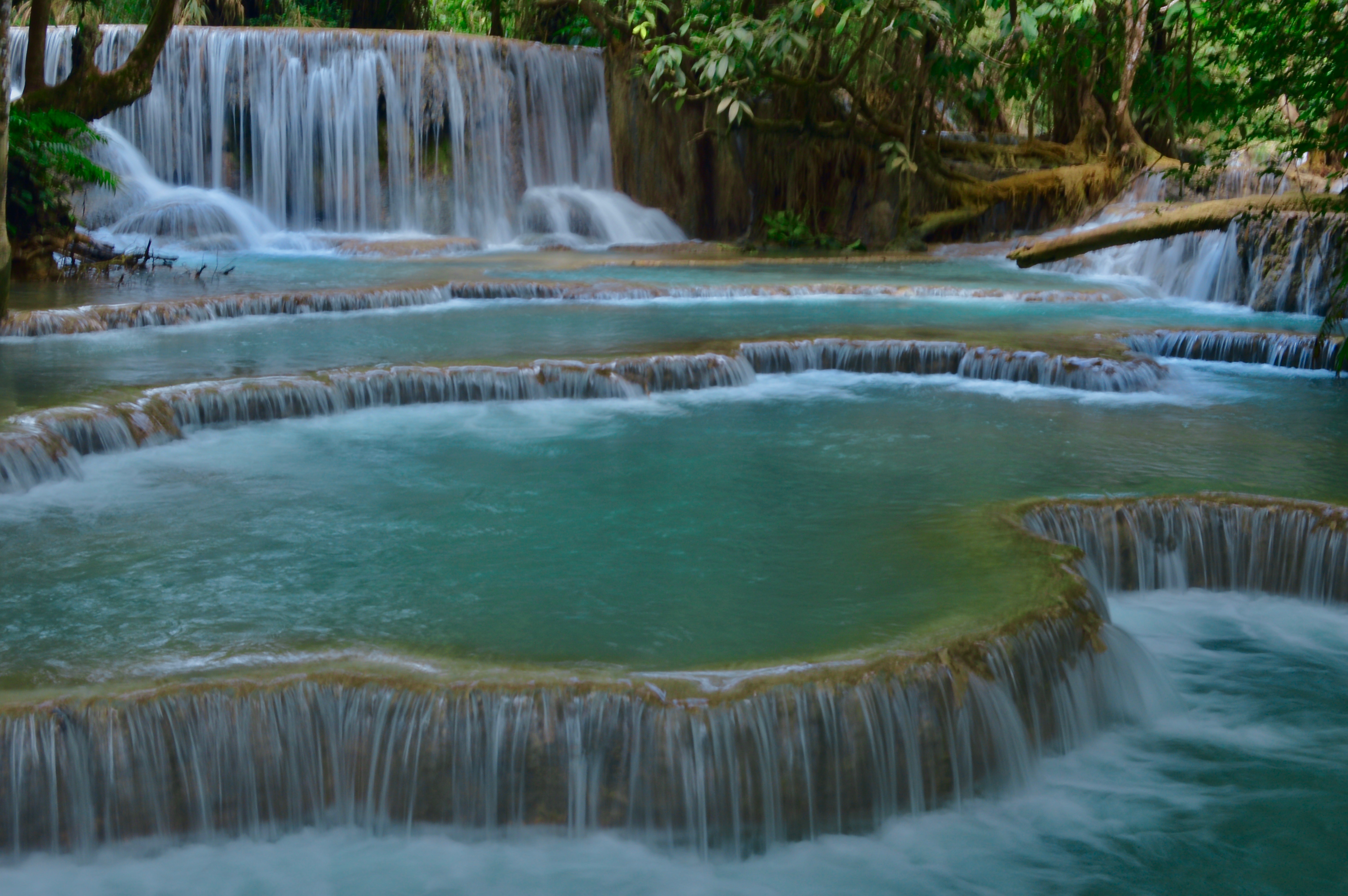
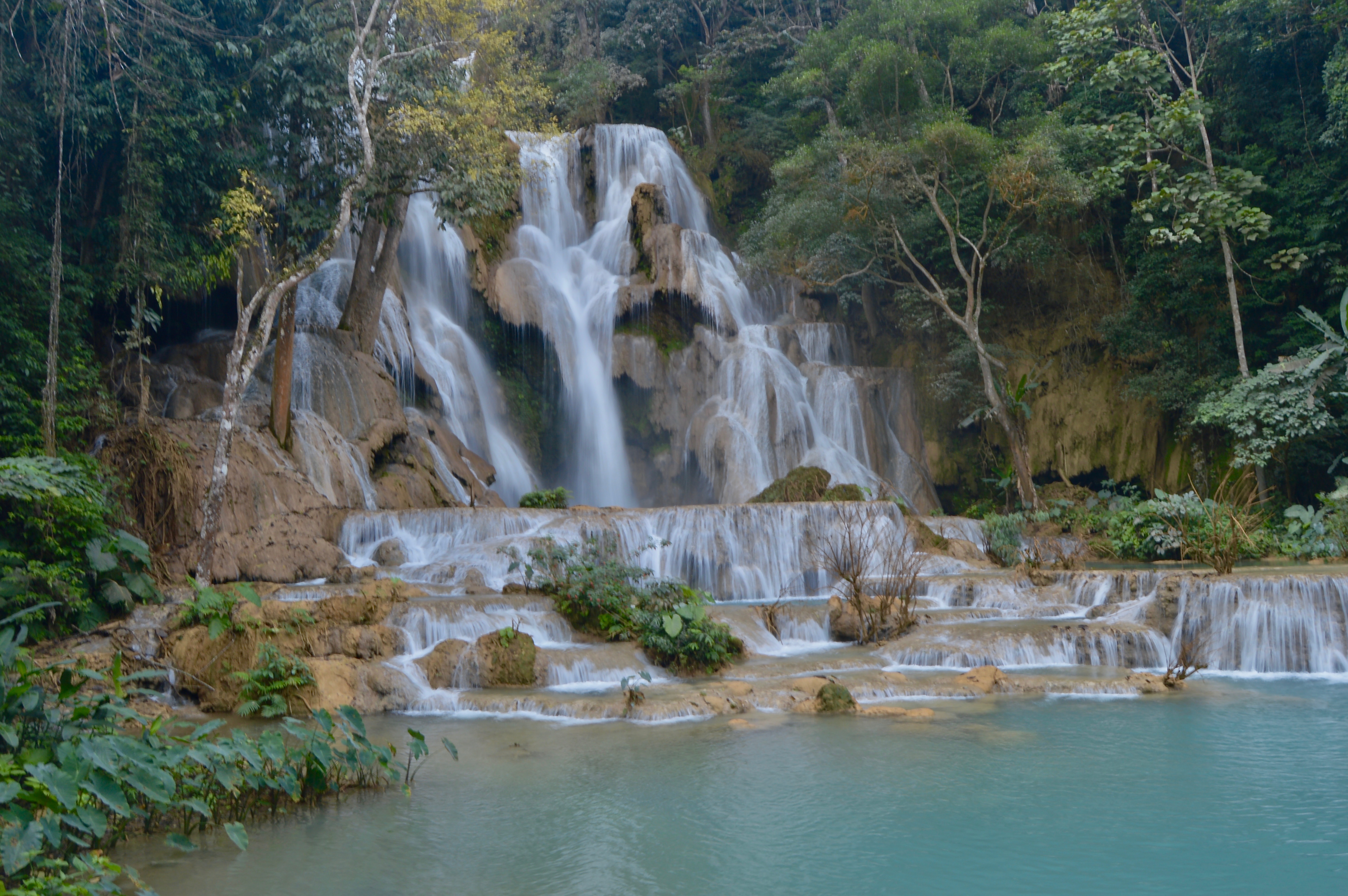
Featured Image: One of the lower falls at Kuang Si waterfall–the most popular day-trip from Luang Prabang and the one must-do activity while in the area.
Image 1: The main Kuang Si waterfall. The vibrant emerald color of the water is derived from the salts and minerals collected as the water flows over the limestone creek bed.
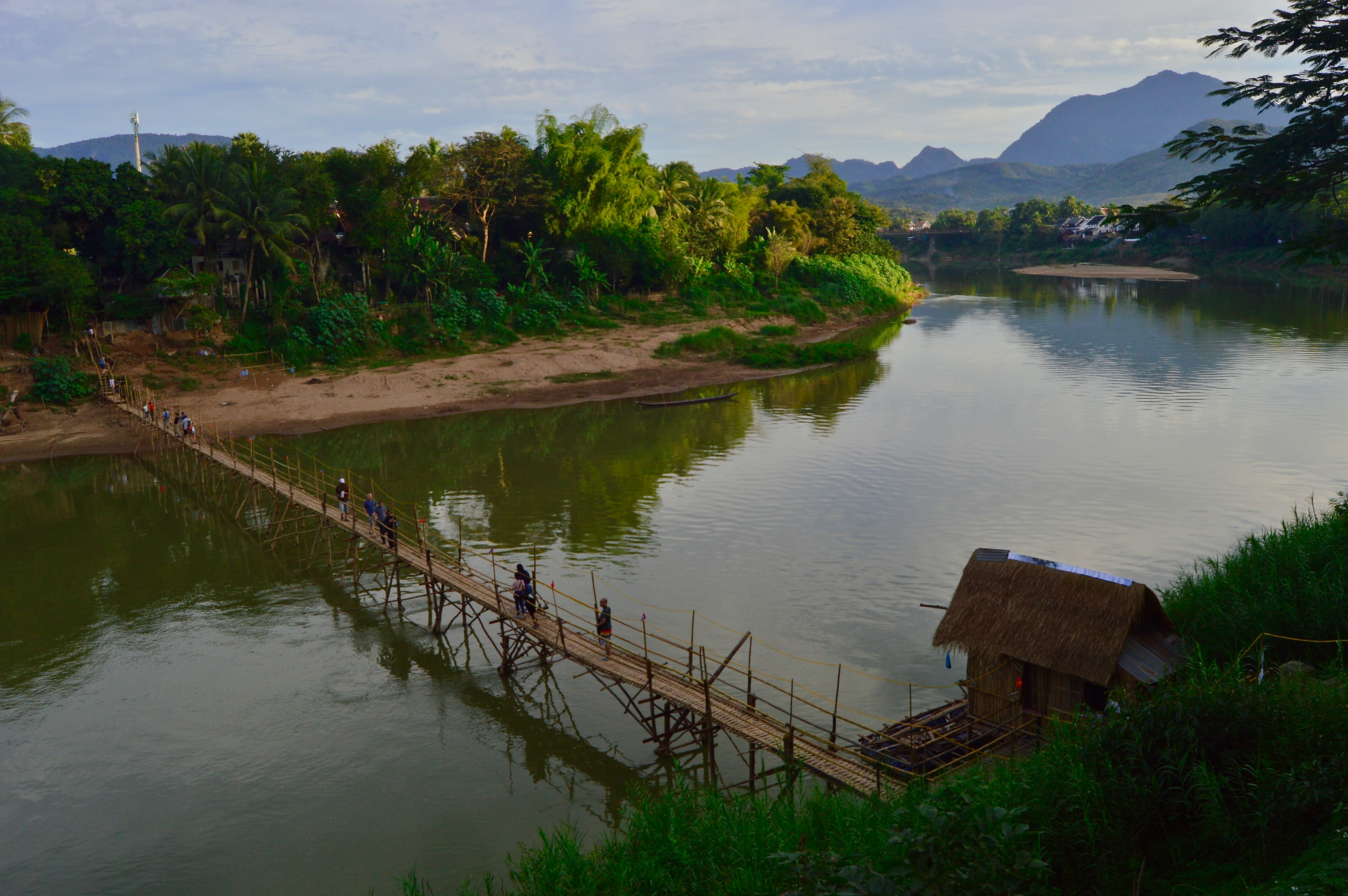
Image 2: Tourists cross the famous bamboo bridge to reach the other side of the Nam Khan river, the much quieter side of Luang Prabang. Each year, during dry season–when the river is at its lowest, locals construct this bamboo footbridge bridge across the river, taking it down ones the rains begin at the end of winter.
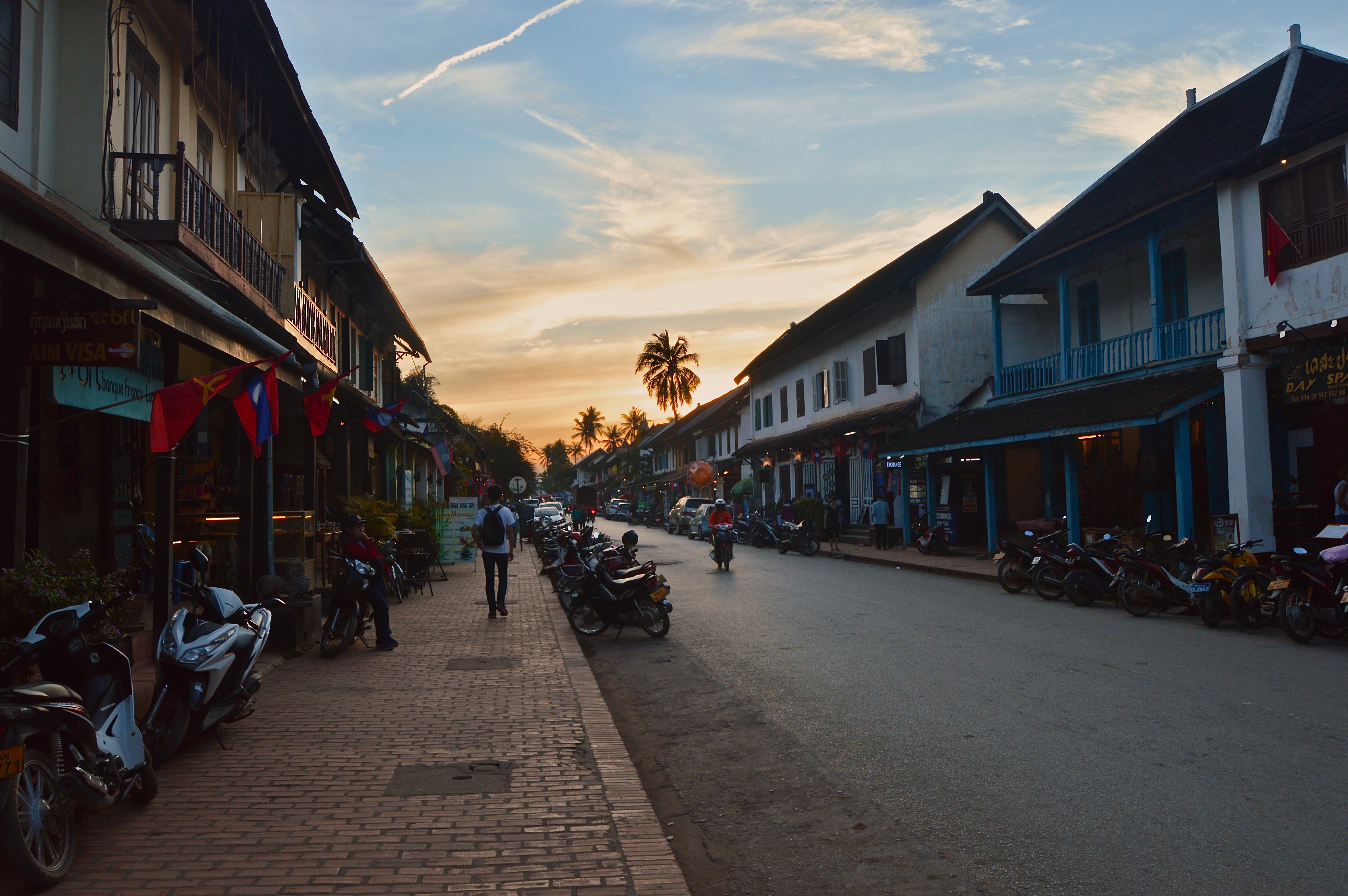
Image 3: The main street of Luang Prabang is lined with French colonial buildings and many bakeries, cafés, and restaurants offering a taste of the city’s famous food scene.
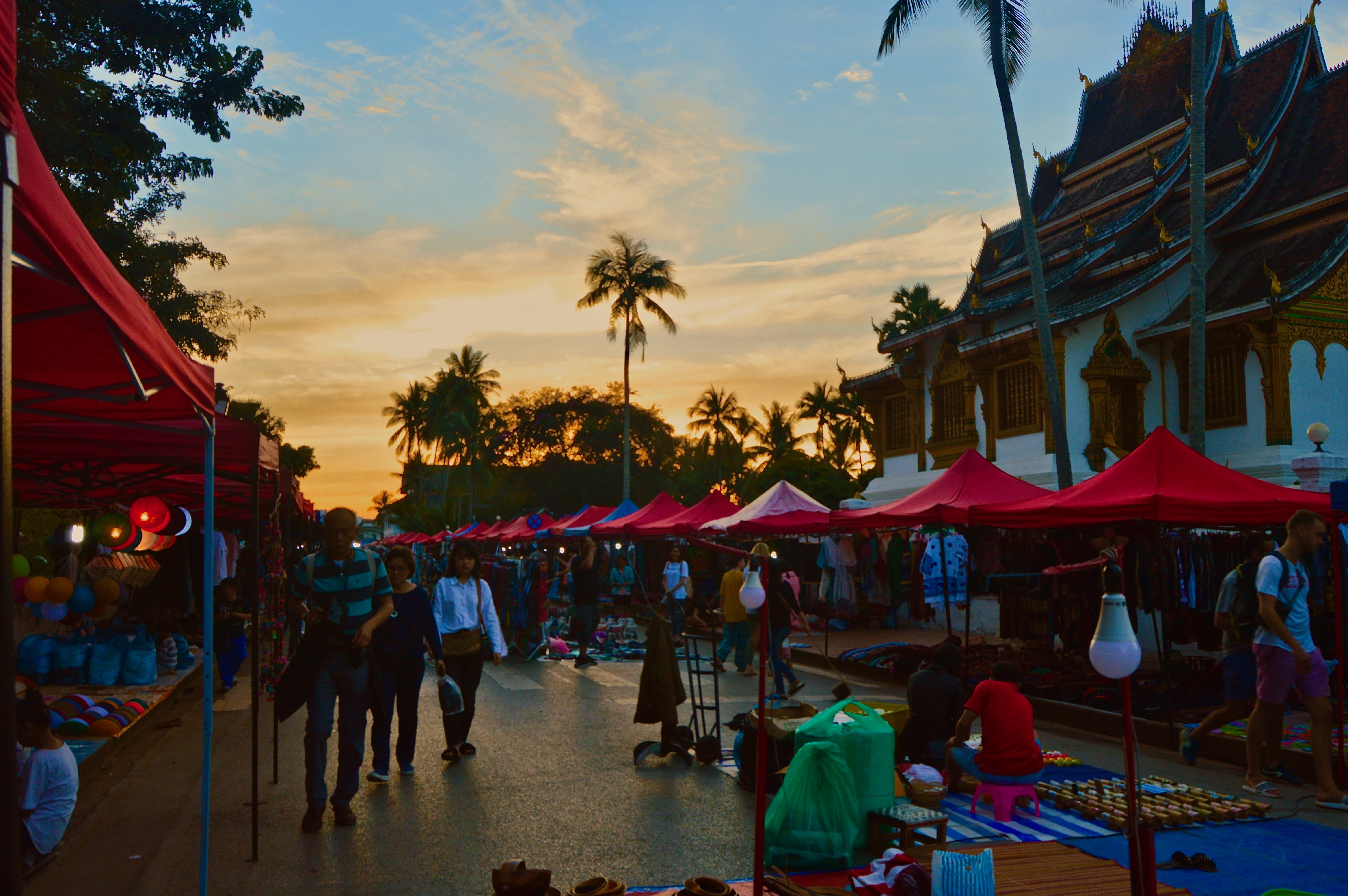
Image 4: Every evening, the night market in the town center is flooded with tourists browsing among locally produced souvenirs and handicrafts.
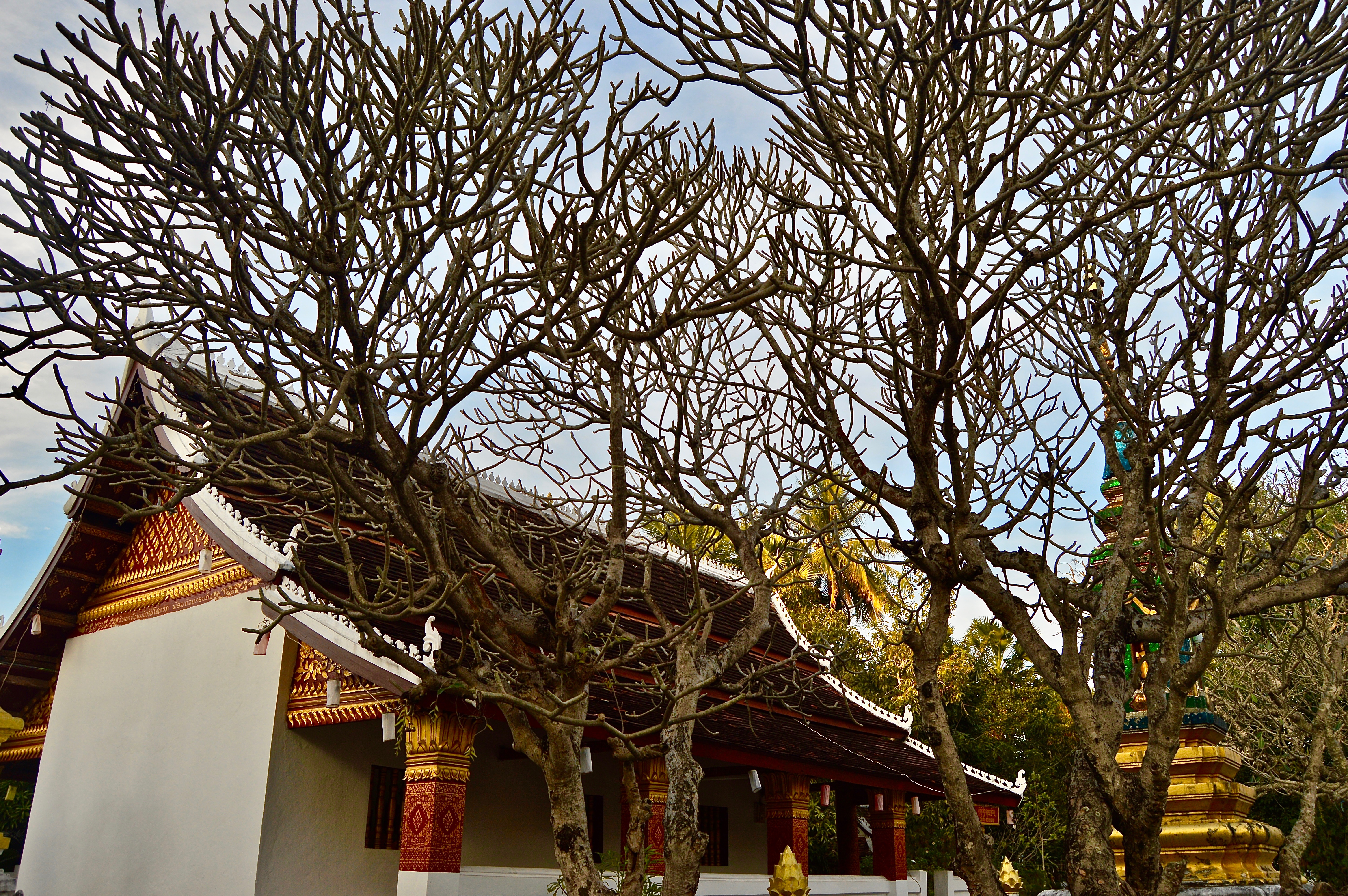
Image 5: Golden Buddhist temples can be found throughout the city.
One of the most popular tourist routes in India connects the capital city of Delhi to Agra–the home of the Taj Mahal–and the Pink City of Jaipur. As the cities are located relatively near each other and form a distinct triangle shape on a map, this route has been dubbed the “Golden Triangle.”
Full of fascinating history and sublime architecture, the Golden Triangle is abundant with sightseeing opportunities for visitors. However, this is also what makes these such crowded destinations and a breeding ground for tourist traps and scams.
If you can get past the deceitful tuk tuk drivers and aggressive street peddlers, the Golden Triangle hosts some of India’s most brilliant sights and monuments. The photos in this gallery portray some of the most popular sites along the route, though still merely a fraction of all there is to see while traveling India’s Golden Triangle.
Disclaimer: only Agra and Jaipur are featured in this gallery as I only spent a couple days in Delhi and did not have the time to visit the monuments there. Popular sites in Delhi include the Red Fort, India Gate, and Akshardham, among others.
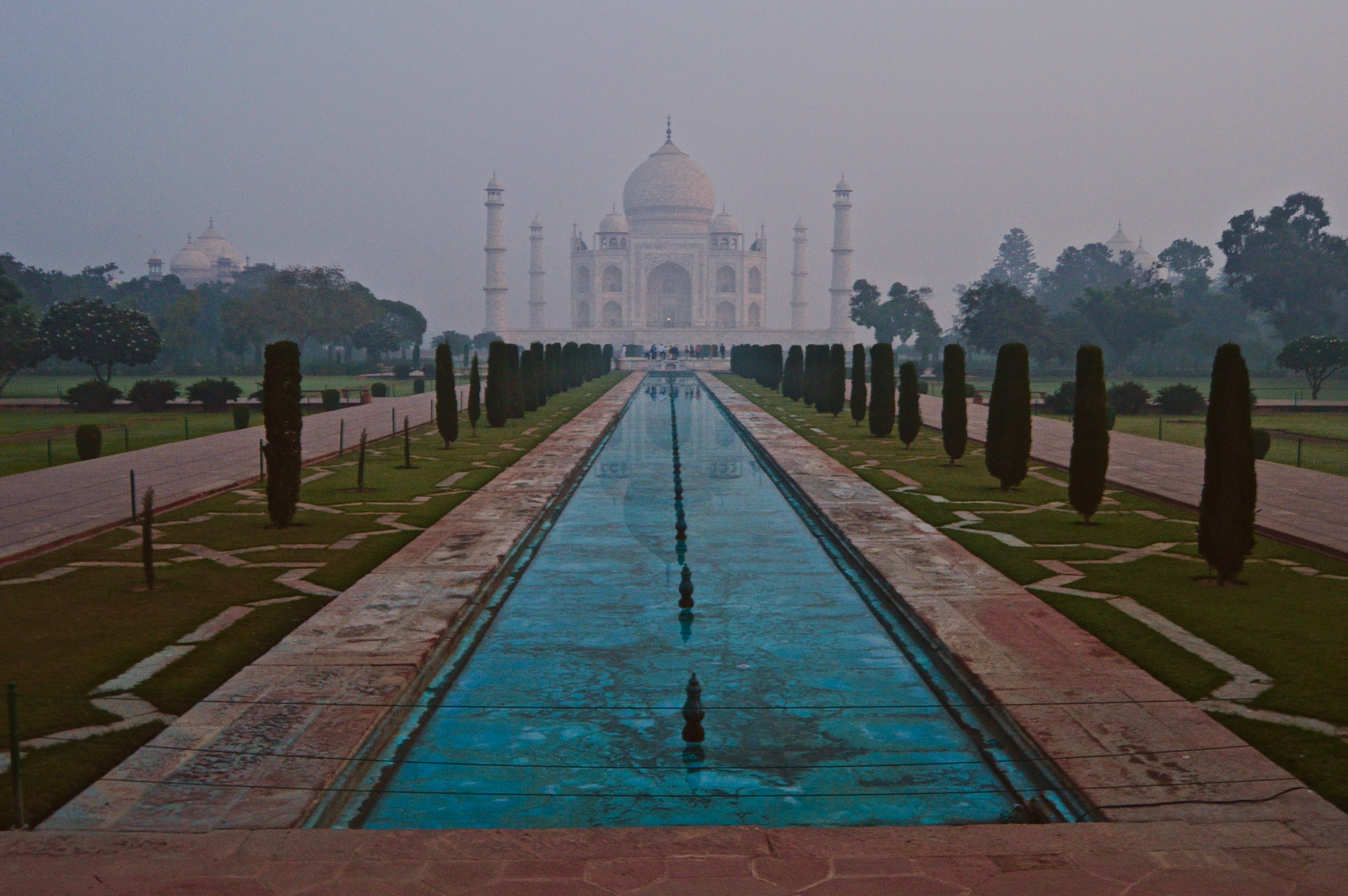
Featured: The Taj Mahal viewed just before sunrise from the main entrance gate.
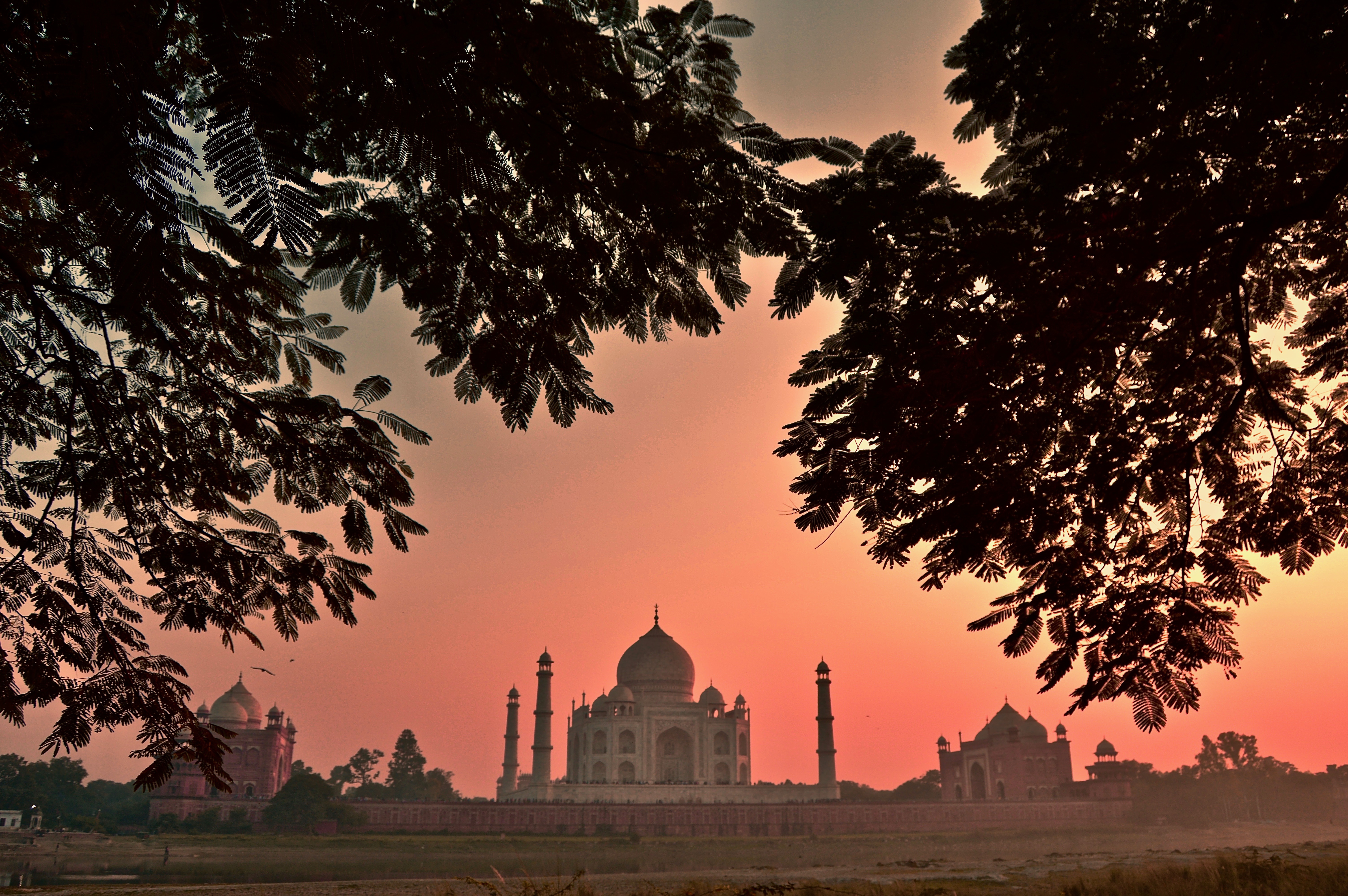
Image 1: The Taj Mahal at sunset from the opposite side of the Yamuna River.
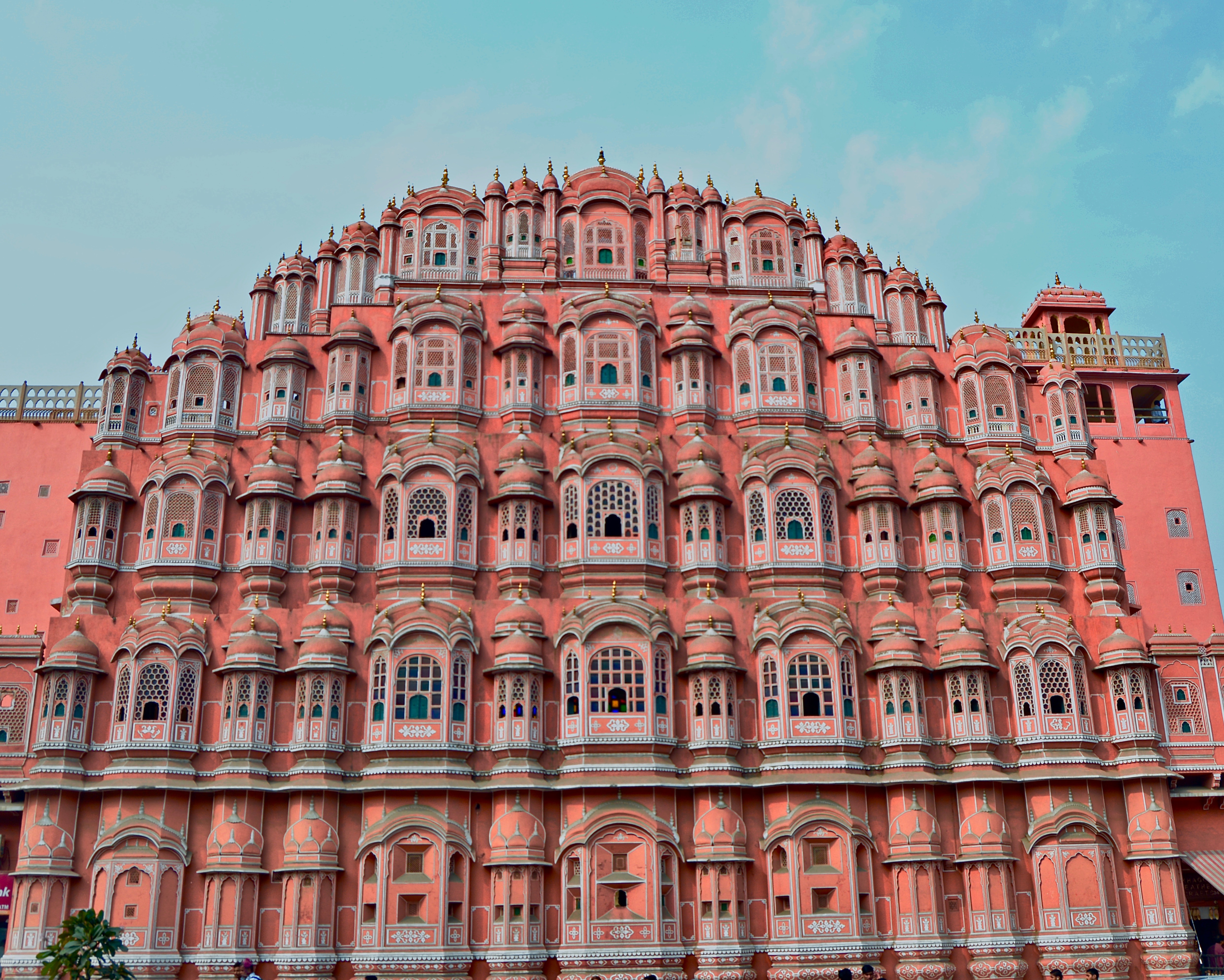
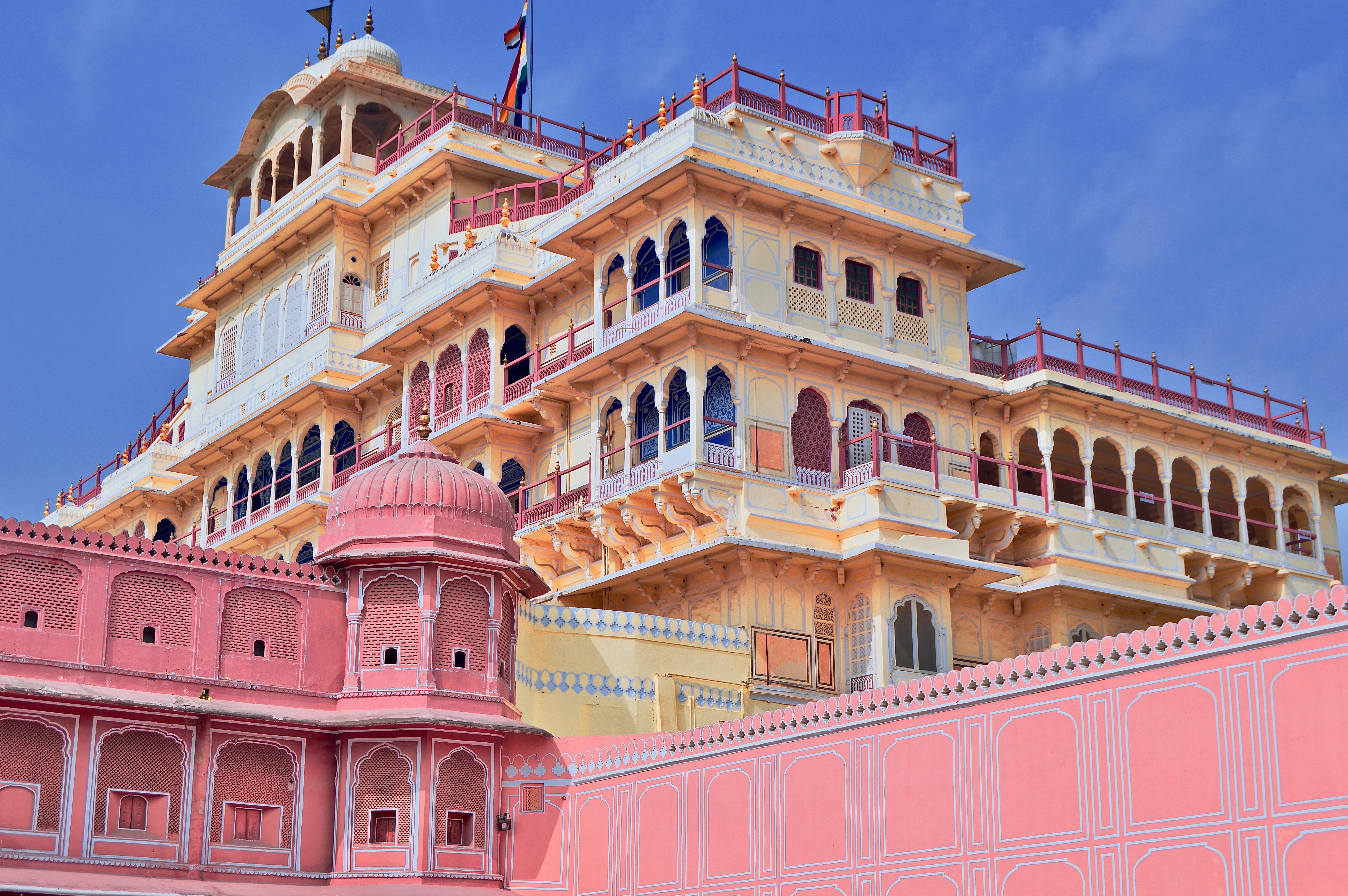
Image 2: The Hawa Mahal, or “Palace of the Winds,” in Jaipur.
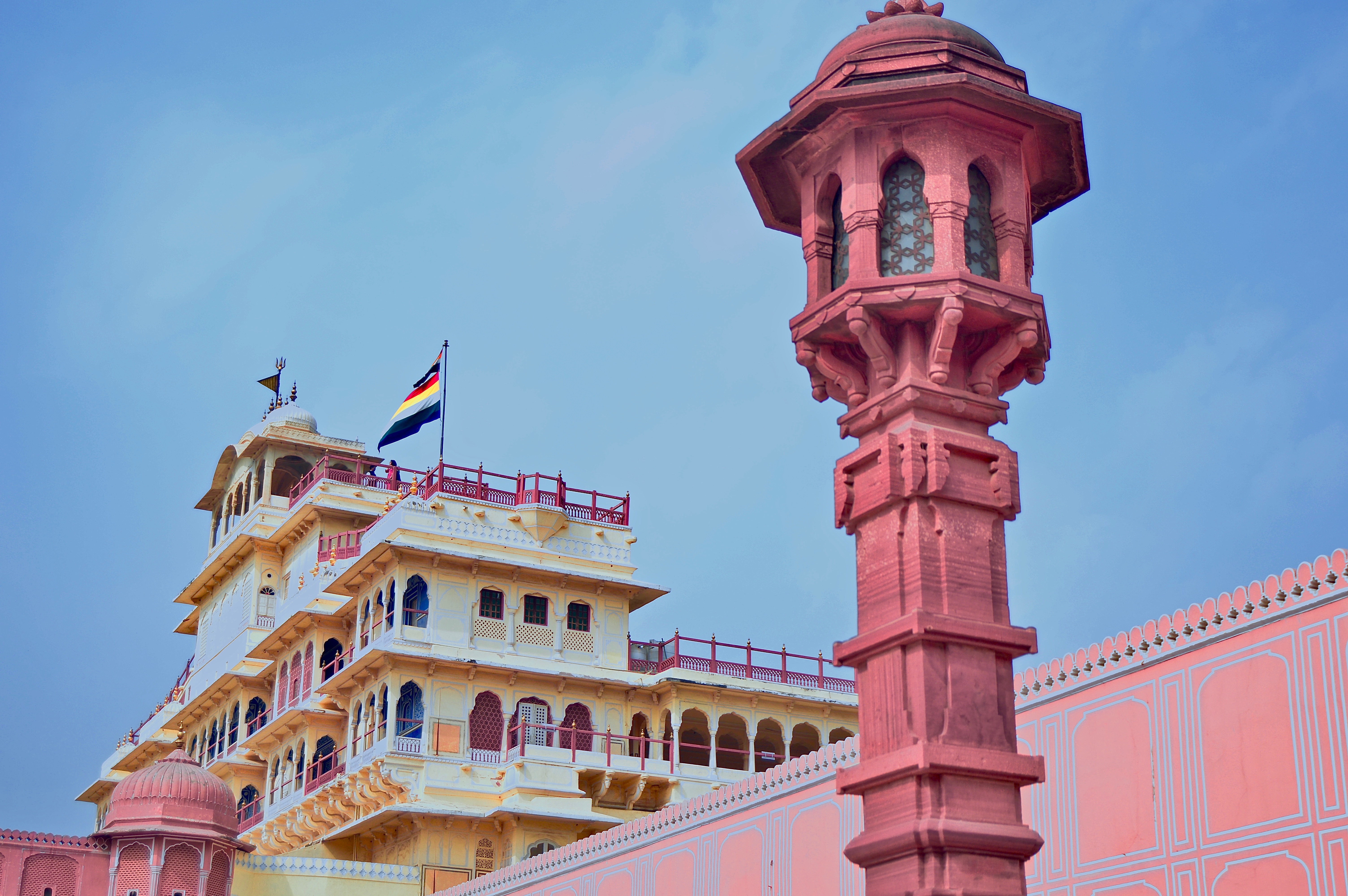
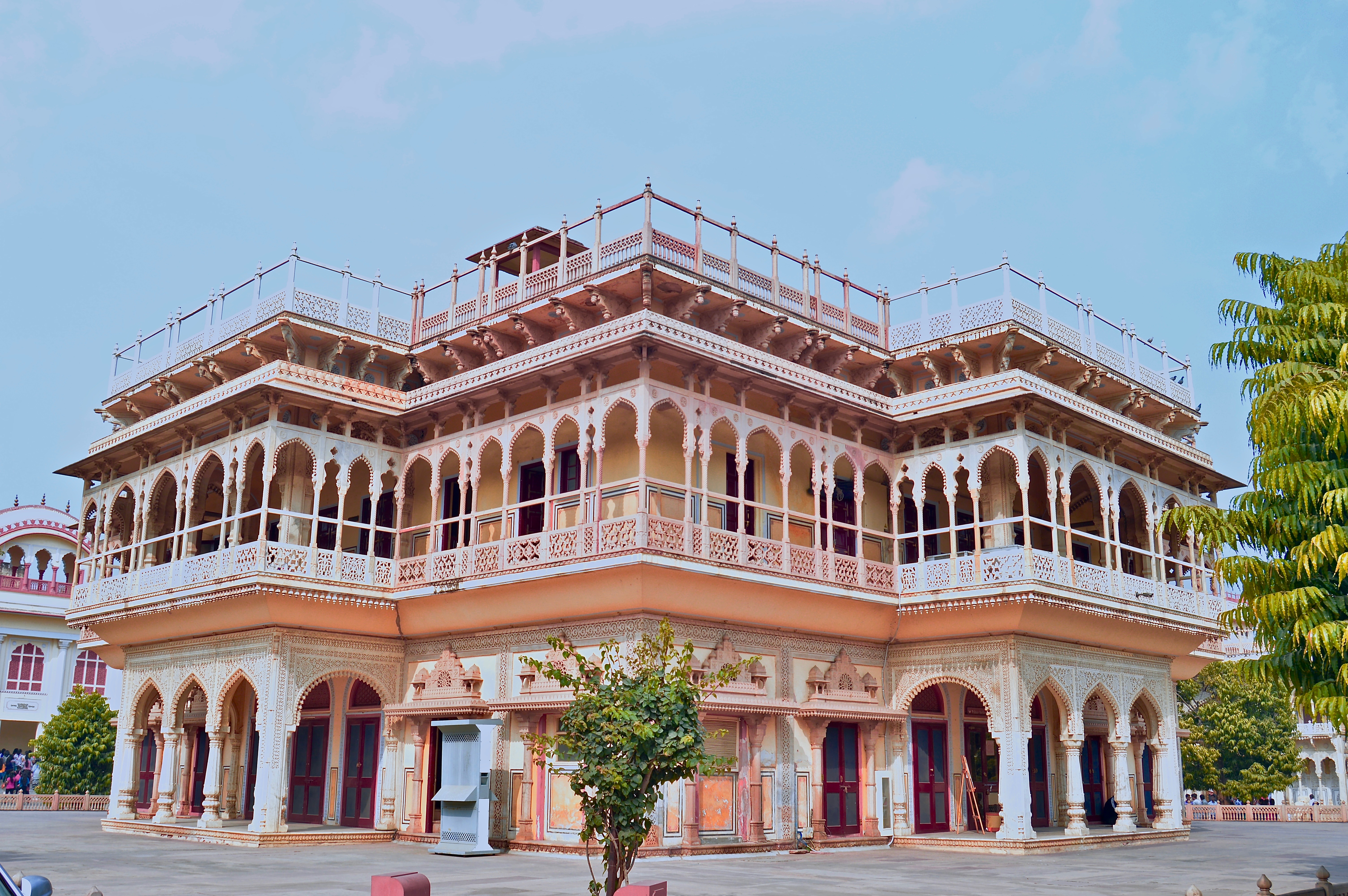
Image 3: The Chandra Mahal in Jaipur’s City Palace.
Image 4: The Mubarak Mahal, also located within Jaipur’s City Palace complex.
Image 5: It is easy to see why Jaipur is called “The Pink City.”
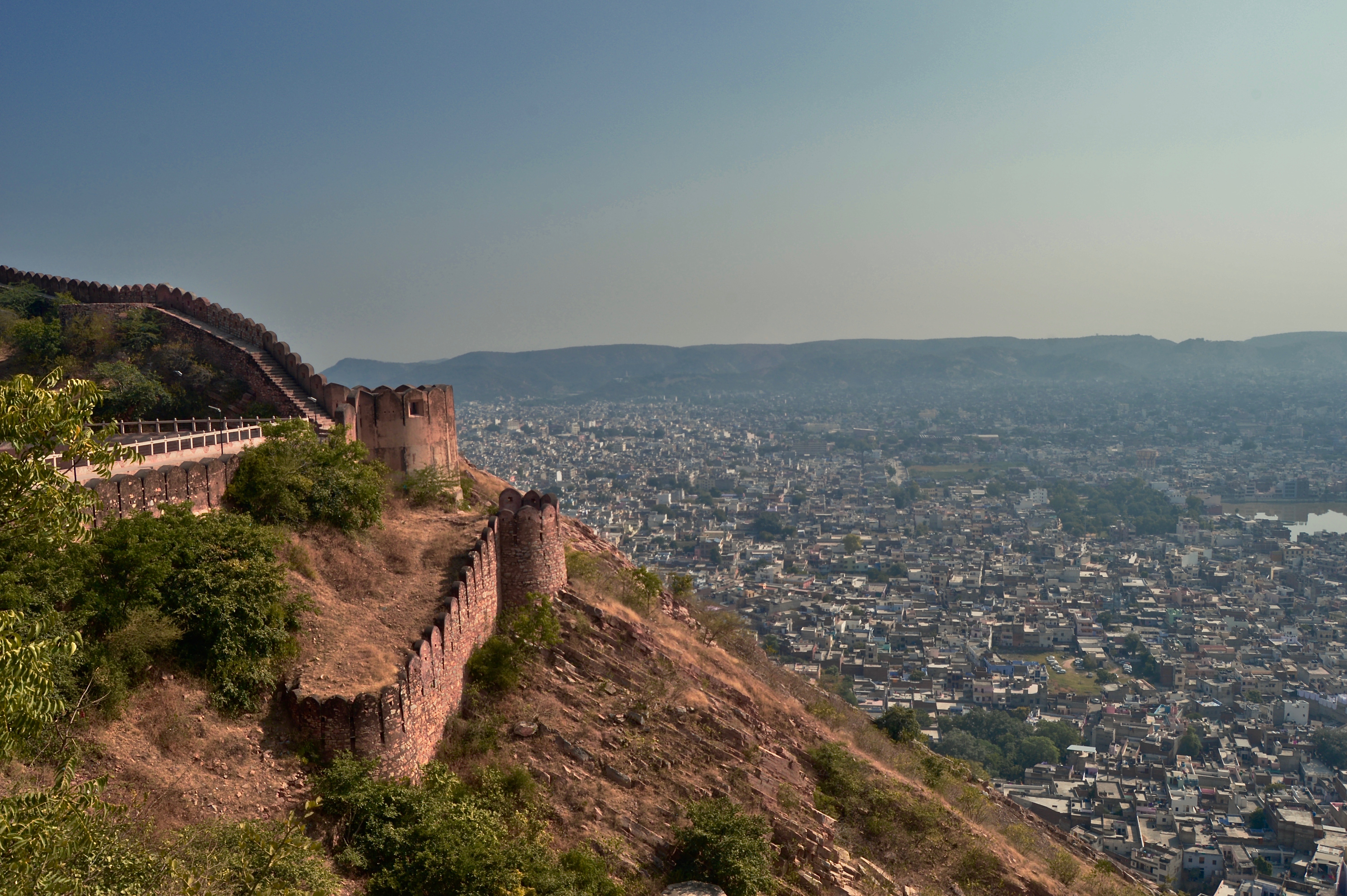
Image 6: The view from Nahargarh Fort, overlooking the city of Jaipur.
There is something romantic about the canals of Amsterdam. Whether one is gliding along on a boat, strolling on the adjacent streets, or simply sitting on the stone bridges next to the calm rippling water, these bodies of water that act as the city’s arteries bring both beauty to the city and calm to the viewer.
Here are a few shots I took of different locations along the Amsterdam canals during my one week stay in the Dutch capital. All photos taken with iPhone 8.
Featured: The calm, glassy early morning water reflects the trees and homes that line this small canal.
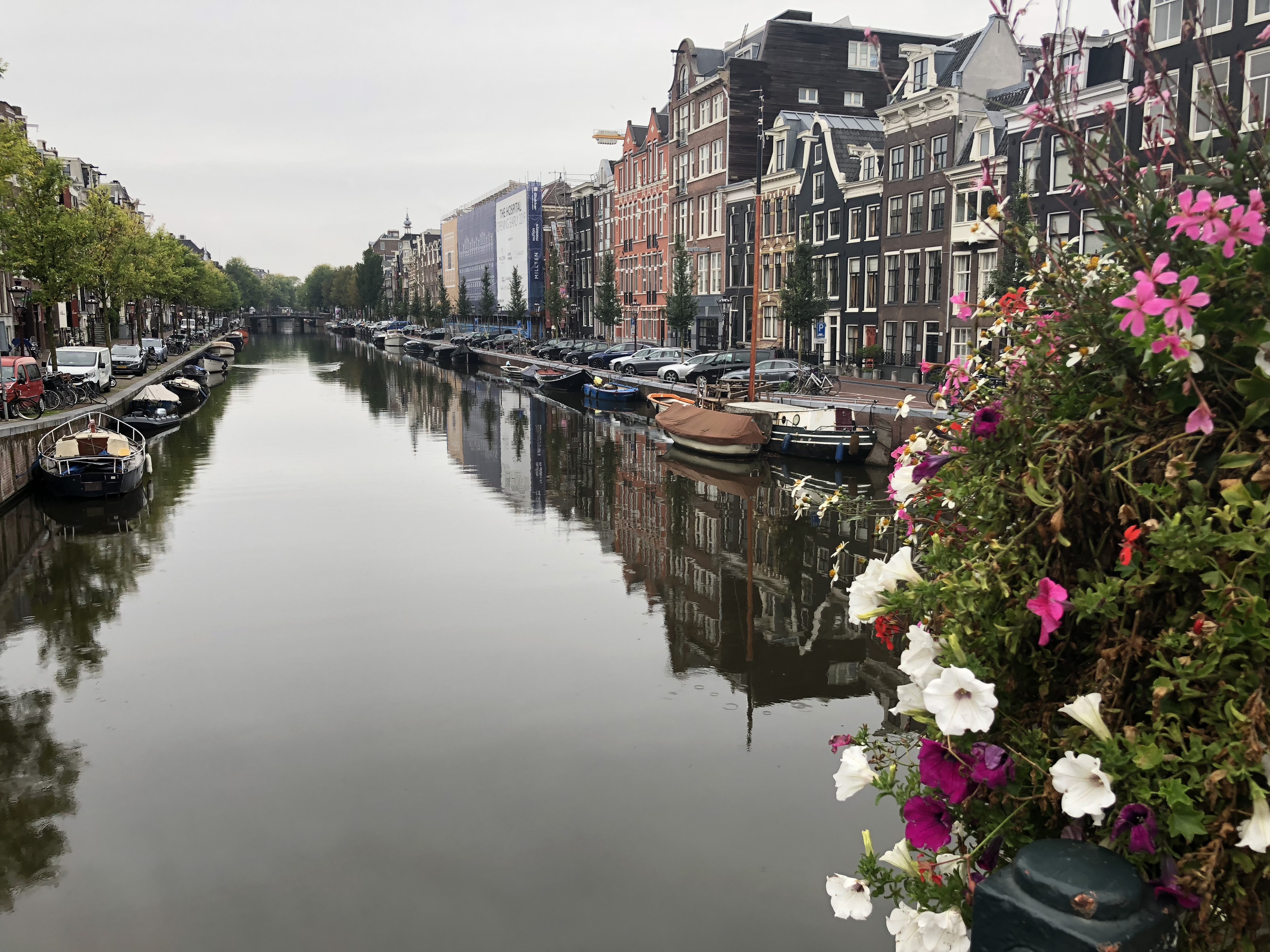
Image 1: Vibrant flowers often line the bridges that cross over the canals.
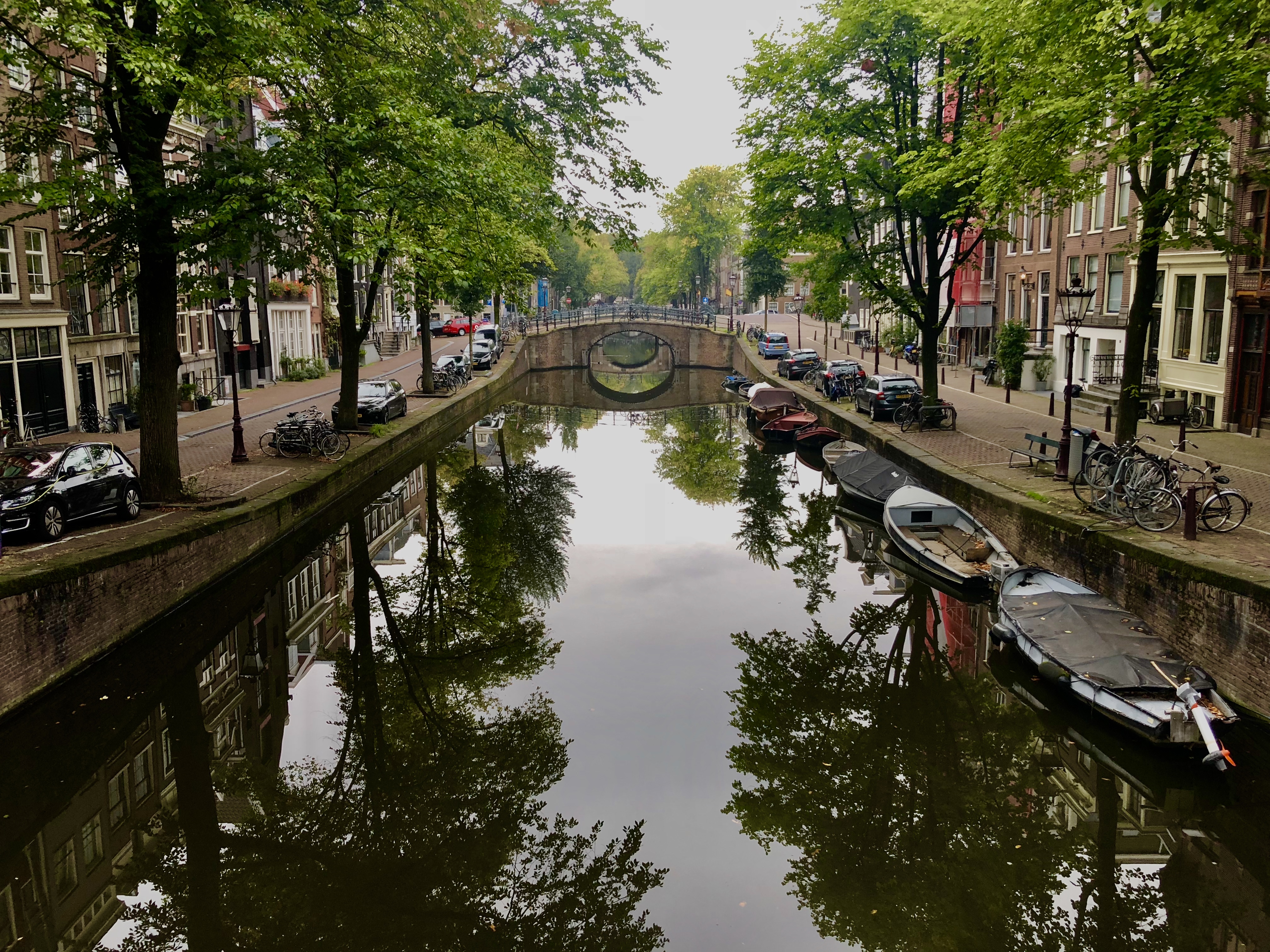
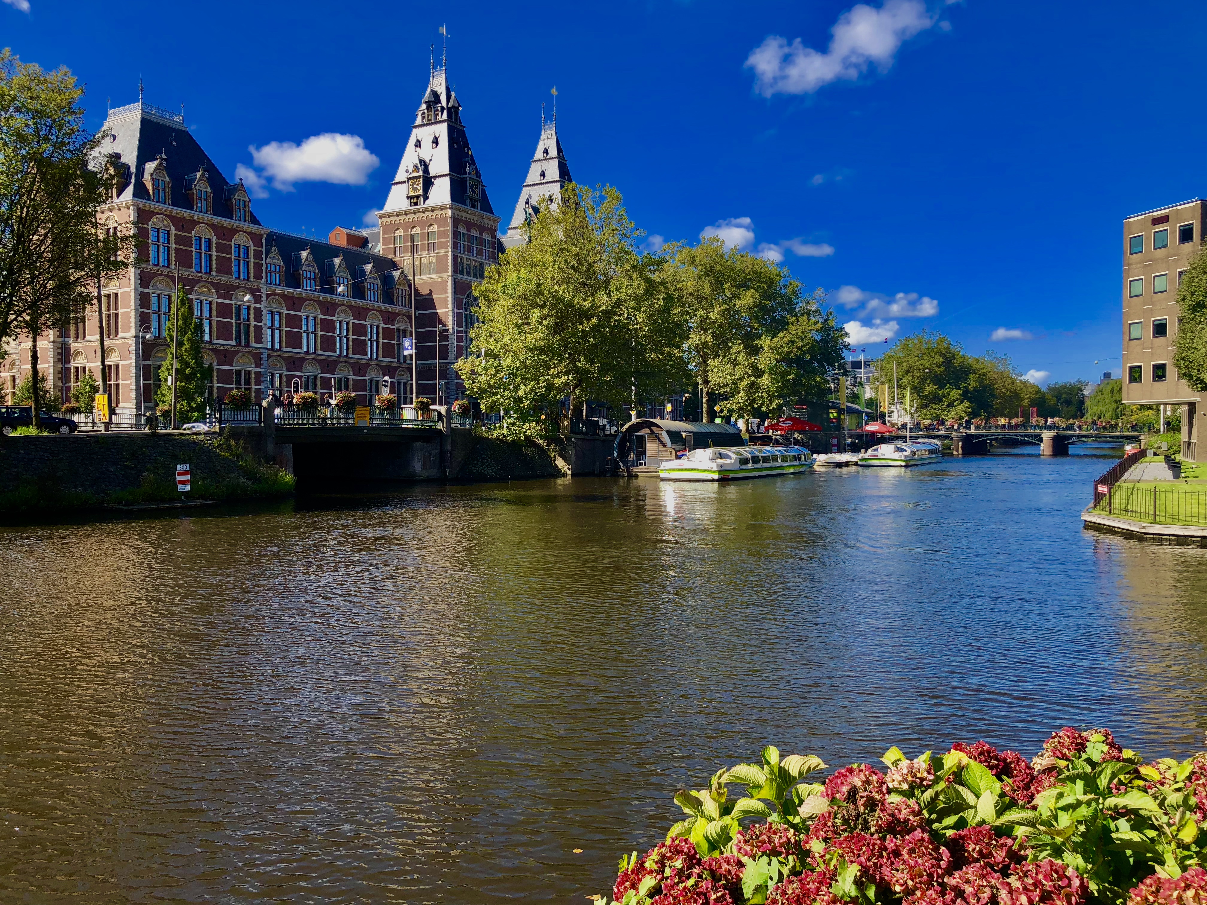
Image 2: One of the city’s larger canals that runs in front of the Rijksmuseum.
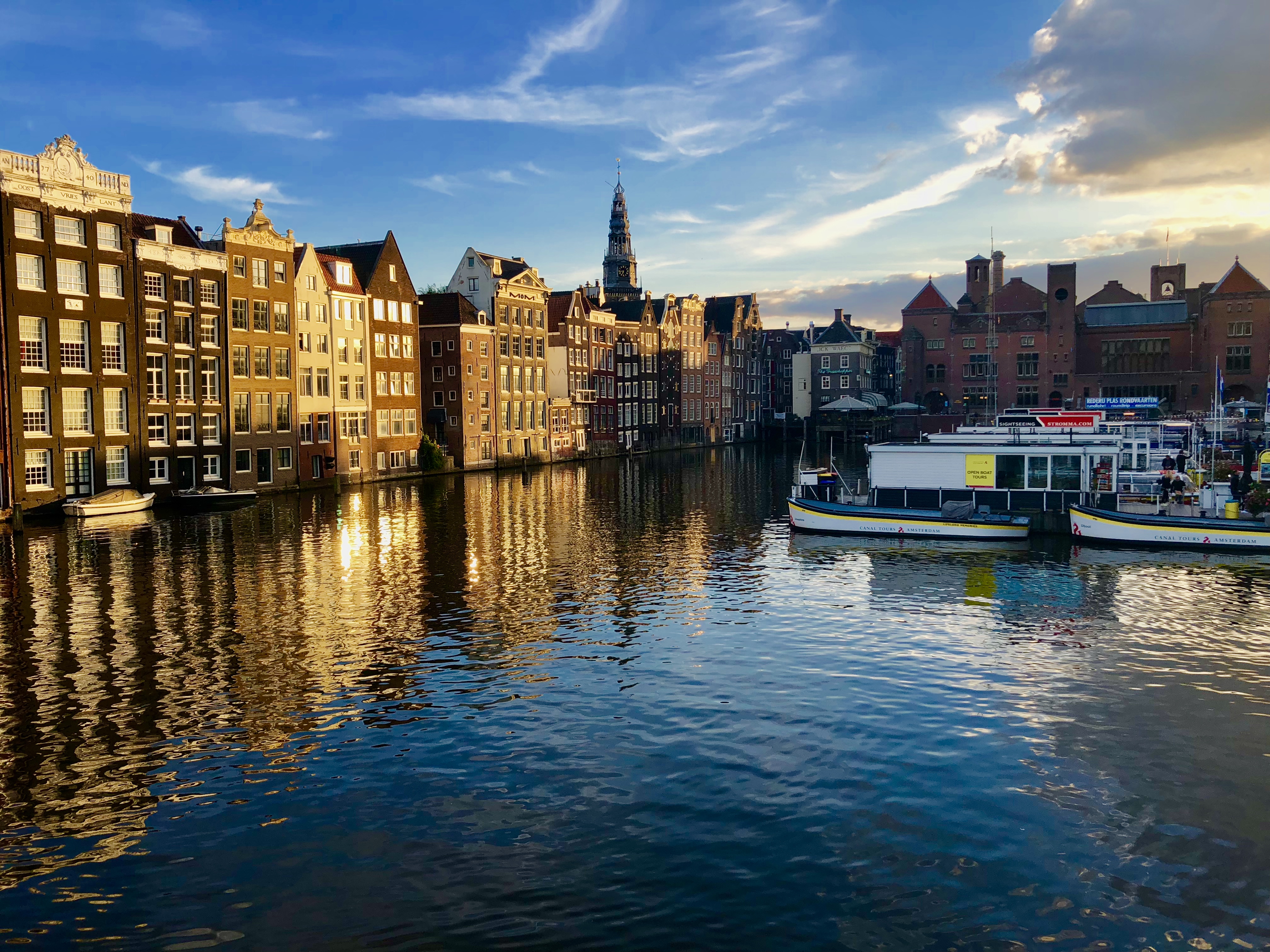
Image 3: The sun sets over the center of the city, next to the central train station.
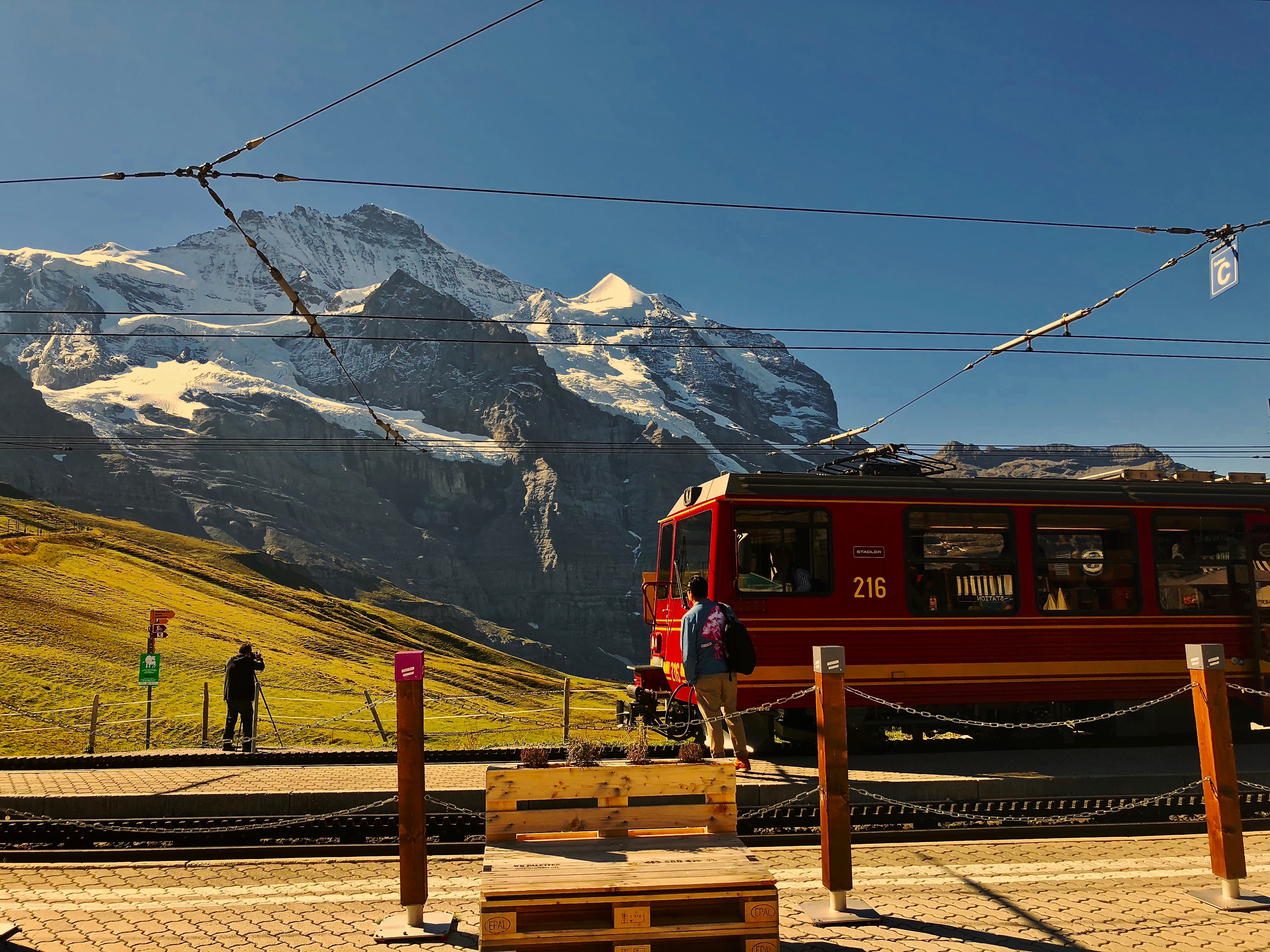
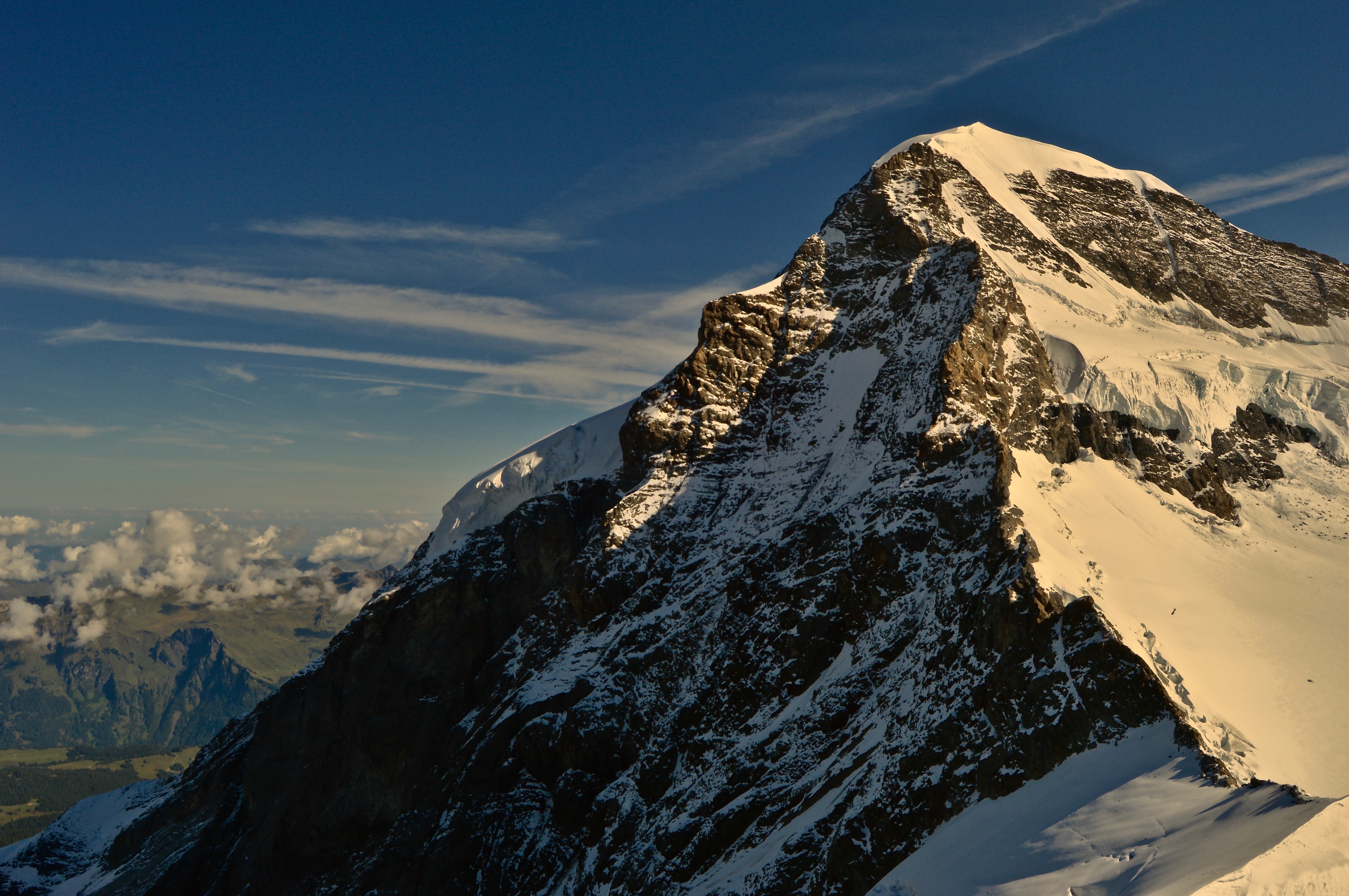
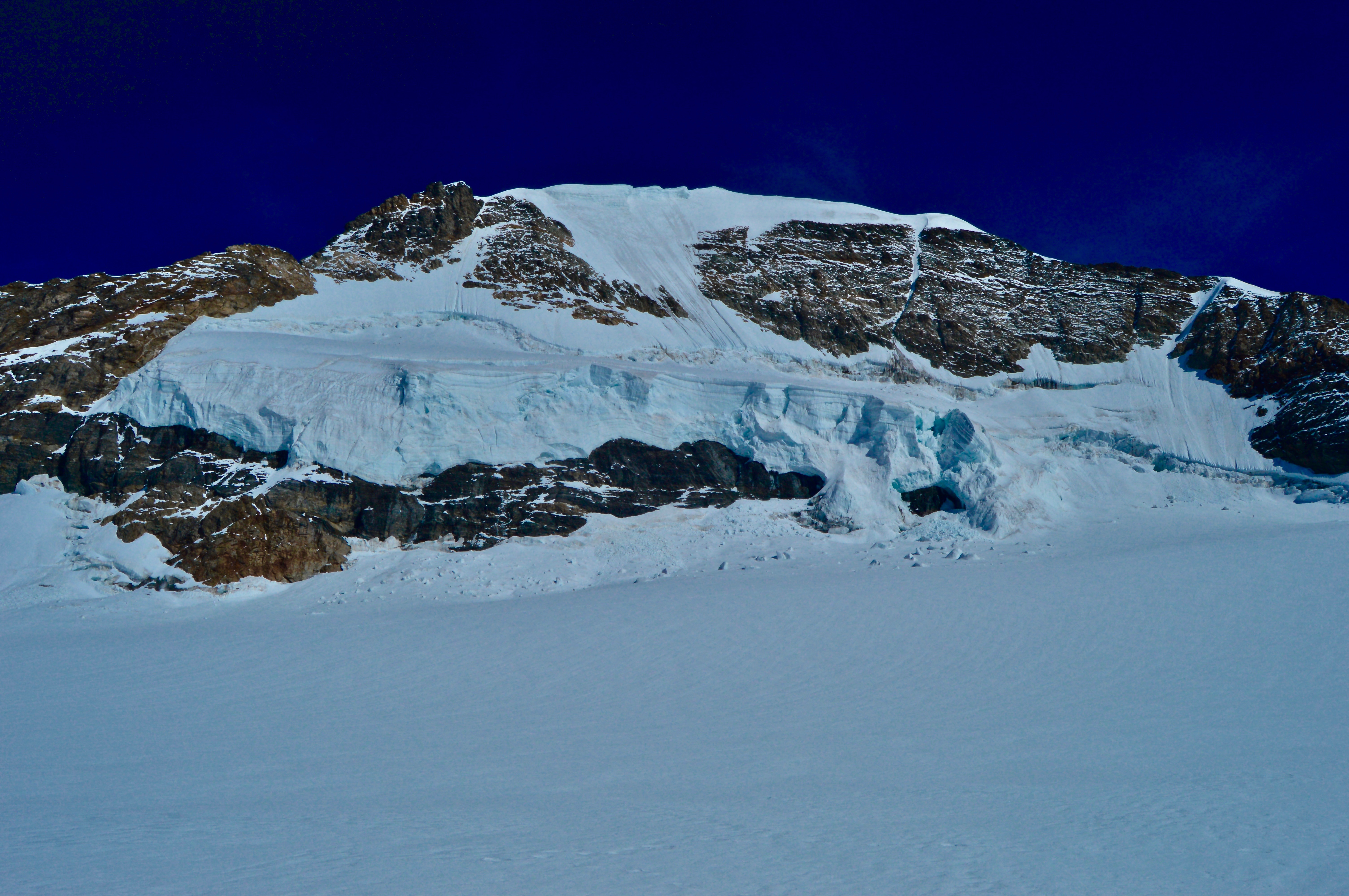
The train chugged along at 11,000 feet high, slowly climbing at a steep angle. As I was sitting facing the back of the train, gravity pulled me forward and I struggled to keep from falling into the lap of the passenger across from me. It was a brilliant, clear, sunny day, and the immensity of the Bernese Alps in western Switzerland was in full force as the series of 12,000+ feet peaks could be seen penetrating the sky from miles away. However, at that particular moment, even though I was a mere couple thousand feet away from these majestic mountains, the only view out the window was of a wall of rock and darkness.
I was traveling on the famous mountain train to Jungfraujoch—the highest place in Europe that can be accessed by car or train, at a comfy 11,333 feet, nestled on the bench between the iconic peaks of Mönch and Jungfrau. Departing from Grindelwald in the valley below, the train begins ascending towards the base of the Eiger, the most prominent peak viewed from Grindelwald–whose colossal north face casts a constant shadow over part of the town, and finally disappears into darkness in a long tunnel cutting through the heart of the Eiger and Mönch before eventually reaching its destination at Jungfraujoch.

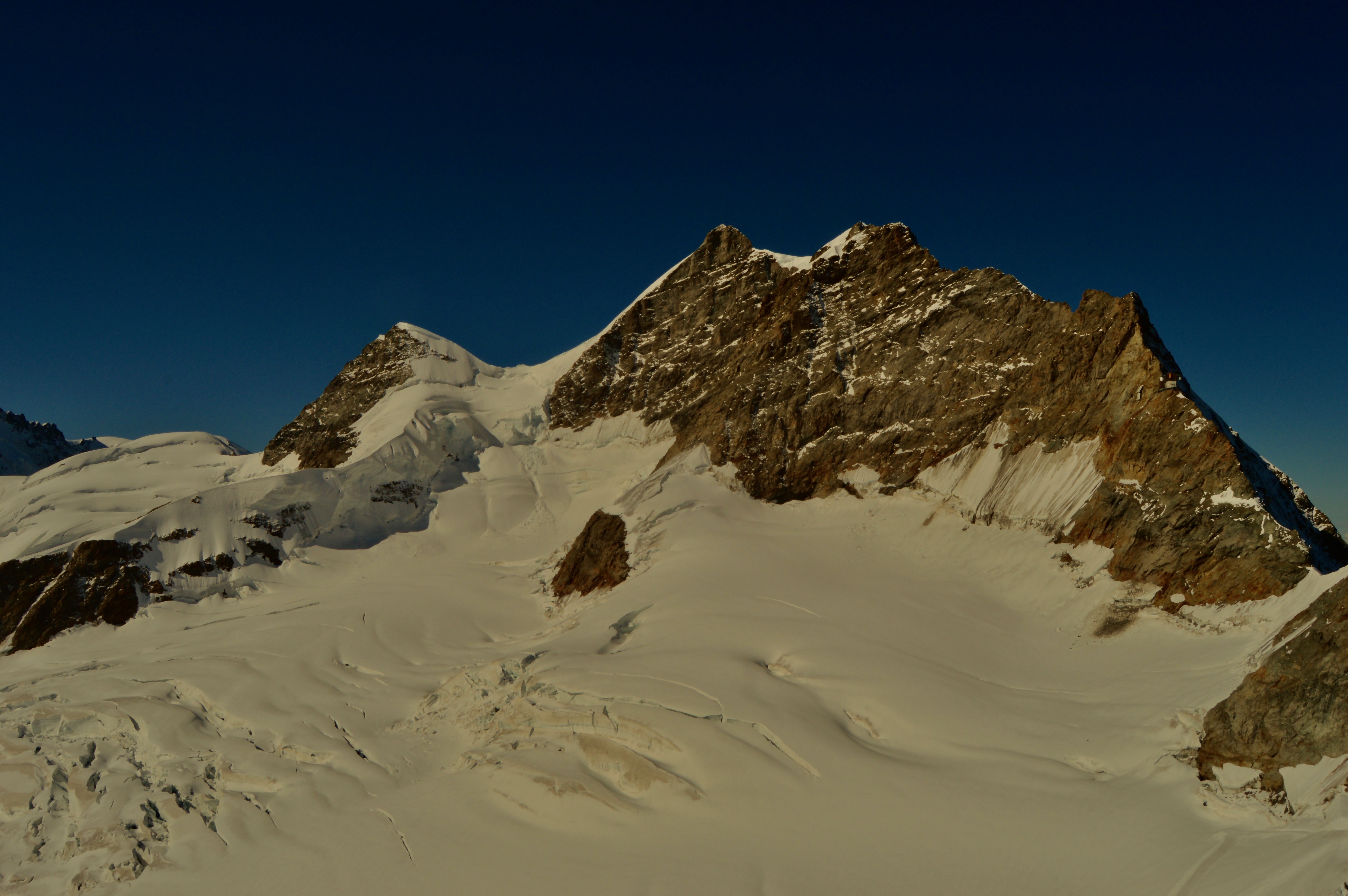
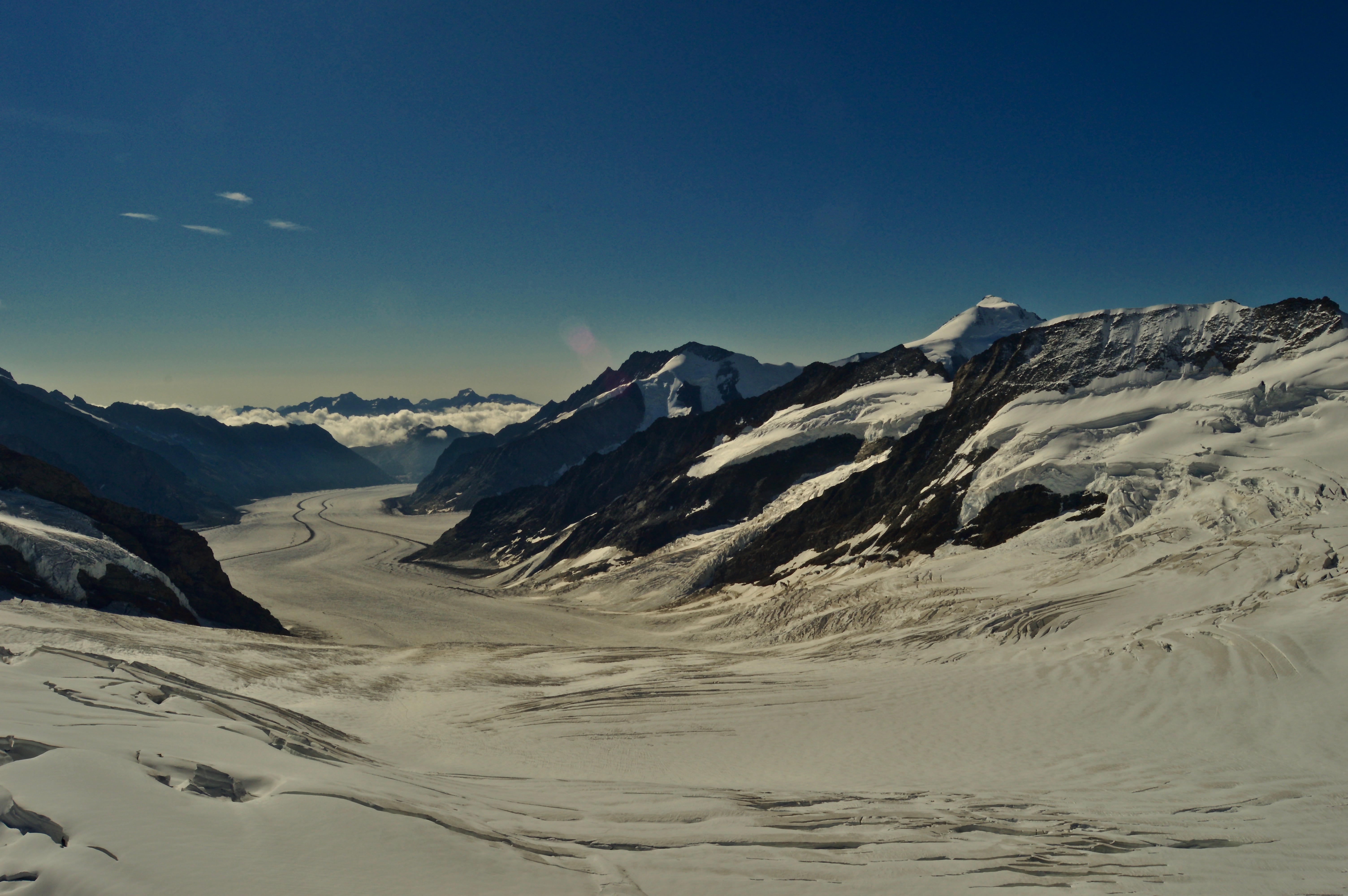
The main center at Jungfraujoch is a multiple story building built inside a rocky peak on the bench between the two mountains, and consists of restaurants, gift shops, and an interactive tour. An elevator took us from the bottom level, where the railroad ends, to the top platform deck that provides a 360-degree panoramic view of the most incredible mountain vista I had ever seen. Great snowcapped limestone giants rose into the sky directly above me, their base giving way to a vast, flat glacier that meandered down the landscape like an icy highway, disappearing over the horizon into the next valley. The traditional Swiss cabins dotting the hillsides of Grindelwald could be spotted 8,000 feet below. Whether it was the beauty of the mountains, ice, and rock, or the effects of the altitude (likely a combination of both), I found myself breathless as I took it all in.

The great views only lasted for a few fleeting moments though, as anonymous heads popped in front of my line of vision left and right, squeezing into any available space to get their pictures taken in front of the mountains, fighting through crowds, pushing and shoving to get the best view. Selfie sticks waved aimlessly and haphazardly about, whacking unsuspecting heads and jabbing oblivious ribcages. Tour groups wandered in massive groups like grazing cattle, taking photos here and there, hurrying to catch up with the group so to not be left behind. The amusement park Disney-like feel was overwhelming at first and almost detrimental to the experience. At one point, I even forgot I was supposedly “in nature” as I was all too consumed in the chaos and commotion around me.
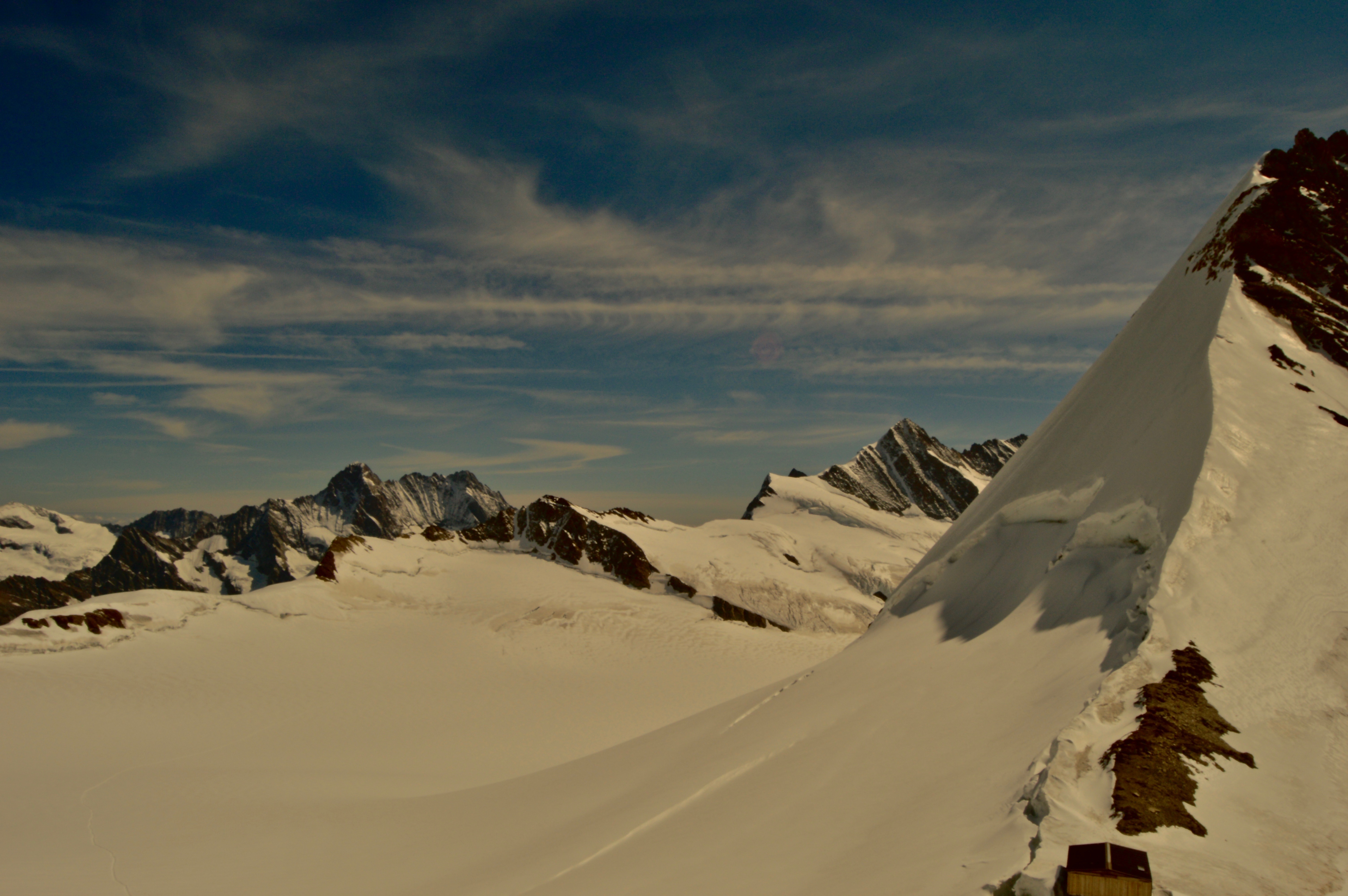
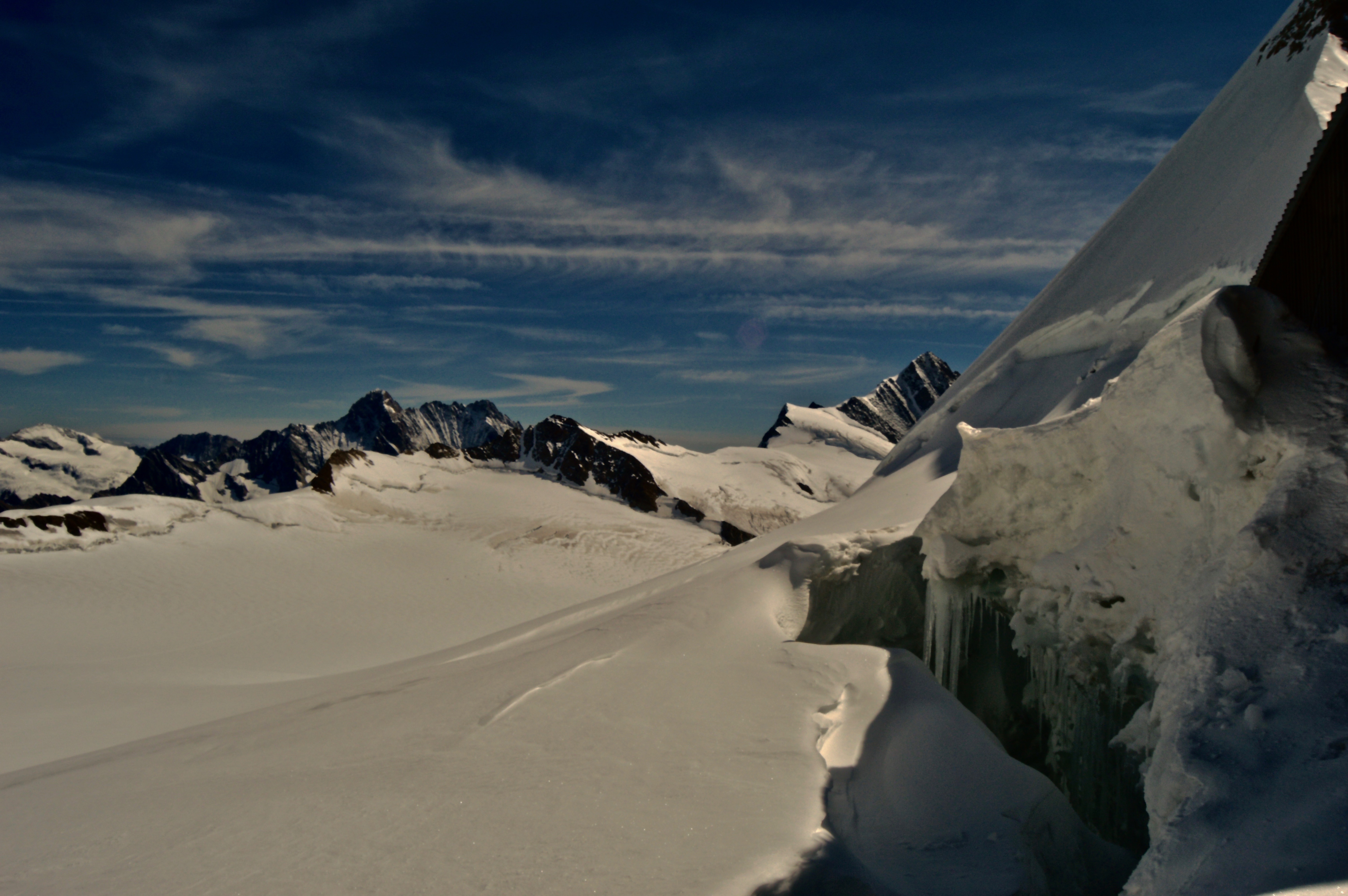
We eventually made our way outside where there was a short mile-and-a-half hike along a groomed trail across the glacier to Mönchsjoch Hut—the highest altitude serviced hut in Switzerland, at about 12,000 feet high, at the base of Mönch. While the hike was short and only gained about 700 feet, at that elevation, it felt much longer and steeper. It was just difficult enough to deter most of the crowds, leaving me a chance to finally breathe again, deeply inhaling that crisp, sharp mountain air. The sun was warm, reflecting off the bright, snowy surface, forcing me to strip to just my base layer as I made my way over the glacier. At the hut, we enjoyed a hearty lunch and rested our oxygen-starved lungs, while lounging on the deck and watching several climbing parties begin to ascend the south face of Mönch.

After lunch, we walked back to Jungfraujoch and finished the interactive tour, which included an ice cave, an Edelweiss themed gallery, and a history of the railroad. The stories and photos of how it was built was what most fascinated me. Construction started in 1896 at the base of Eiger, and for the next 16 years, workers chiseled a tunnel through the middle of Eiger and Mönch, reaching all the way to its current location. How they were able to complete such a task in that short of time with nothing more than pick axes and hammers is unbelievable. Almost more unbelievable, is that someone was mad enough to even think it would be possible to build something of the sort in 1896. Of course, dozens died in the process, for which there is a meager memorial along the tour dedicated to the men who lost their lives so people like me can have an epic tourist experience.

The question is, however, should tourists be able to visit a place like this in the first place? Sure, the railroad is an example of human will and achievement, but just because we can do it, should we? Should the (relatively) wealthy be able to pay for a train to take them to the top of a mountain? Should beautiful destinations like this one be turned into amusement parks where anyone can have their photo taken in front of majestic mountains if they have the means to pay for it? My first instinct is to say no. The environmentalist and wilderness advocate in me believes these places should be kept wild and free from development, that only those with the devotion and ability to climb to these rewarding views should be allowed to enjoy them.
On the other hand, it is unlikely I would ever make the climb myself, nor would 99% of the people that come up here. What the Jungfraujoch railroad does do is provide access to an extraordinary place for people who would otherwise never be able to see it. As most of the visitors were elderly, or unaccustomed to this type of outdoor experience, this was the only way for them to have such an experience. We can only hope that the visitors gain a new appreciation and respect for natural places and, as a result of their experience, join the movement to help protect them.
No, we should not start constructing railroads to the tops of mountains all around the world (this would surely spark outrage, especially in the U.S.), but maybe it is okay to have just one Jungfraujoch, if it means allowing ordinary people to get close to nature, so they may gain a better understanding and appreciation for it. Or maybe there is a better way that benefits both tourists and nature. I’ll let you decide for yourself.


