

Over my ten days spent in Switzerland, I had a difficult time comprehending the jaw-dropping, eye-popping, awe-inspiring immensity of the Swiss Alps. From iconic peaks like the Matterhorn, Eiger, Mönch and Jungfrau, to the sleepy, quaint, frozen-in-time villages that dot the hillsides in their shadow, the landscapes of Switzerland were magic to the eye. Here are a few of my favorite shots during my stay:
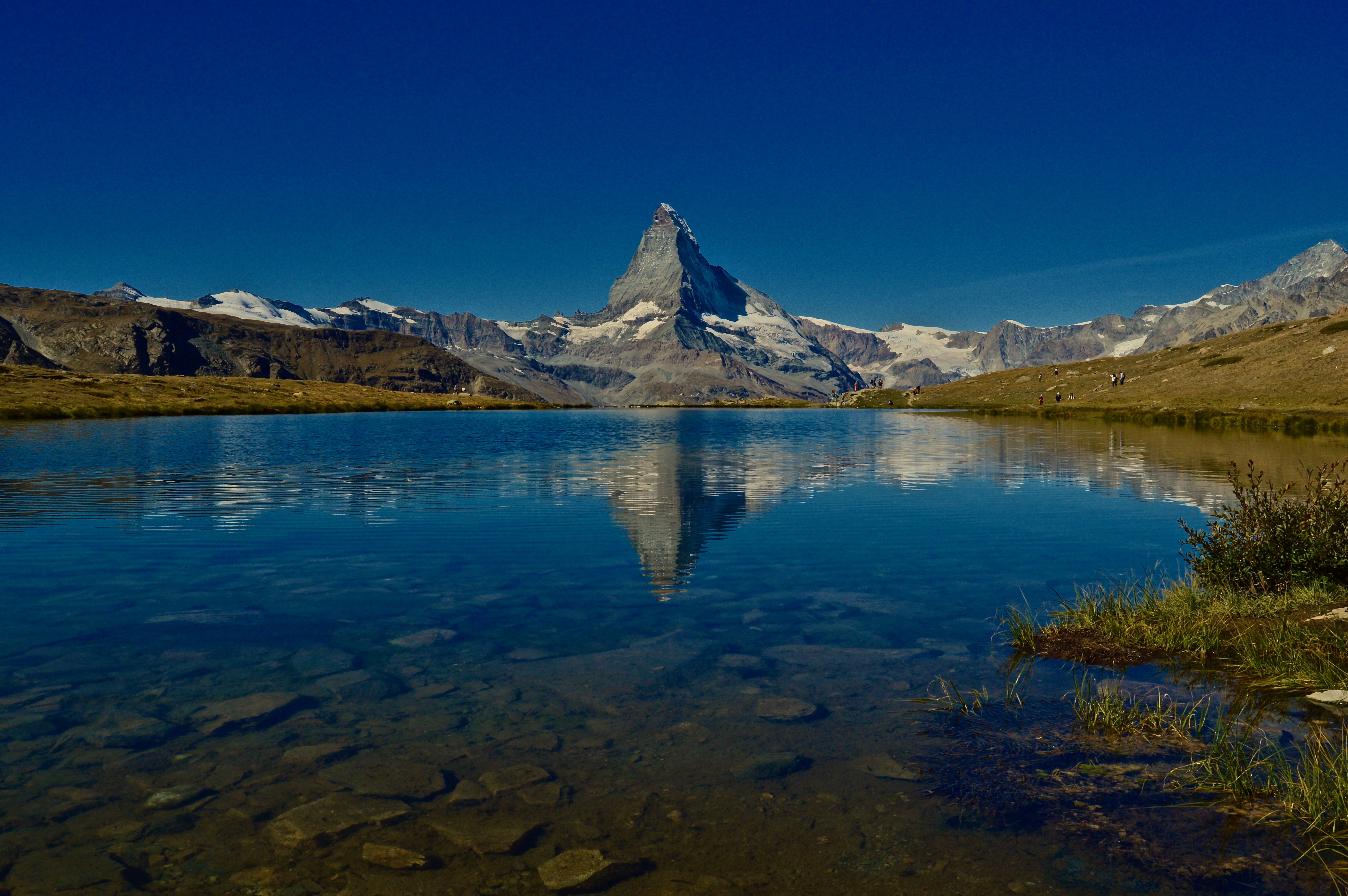
Featured: The high alpine lake Stellisee reflects the image of the Matterhorn on a clear sunny morning.
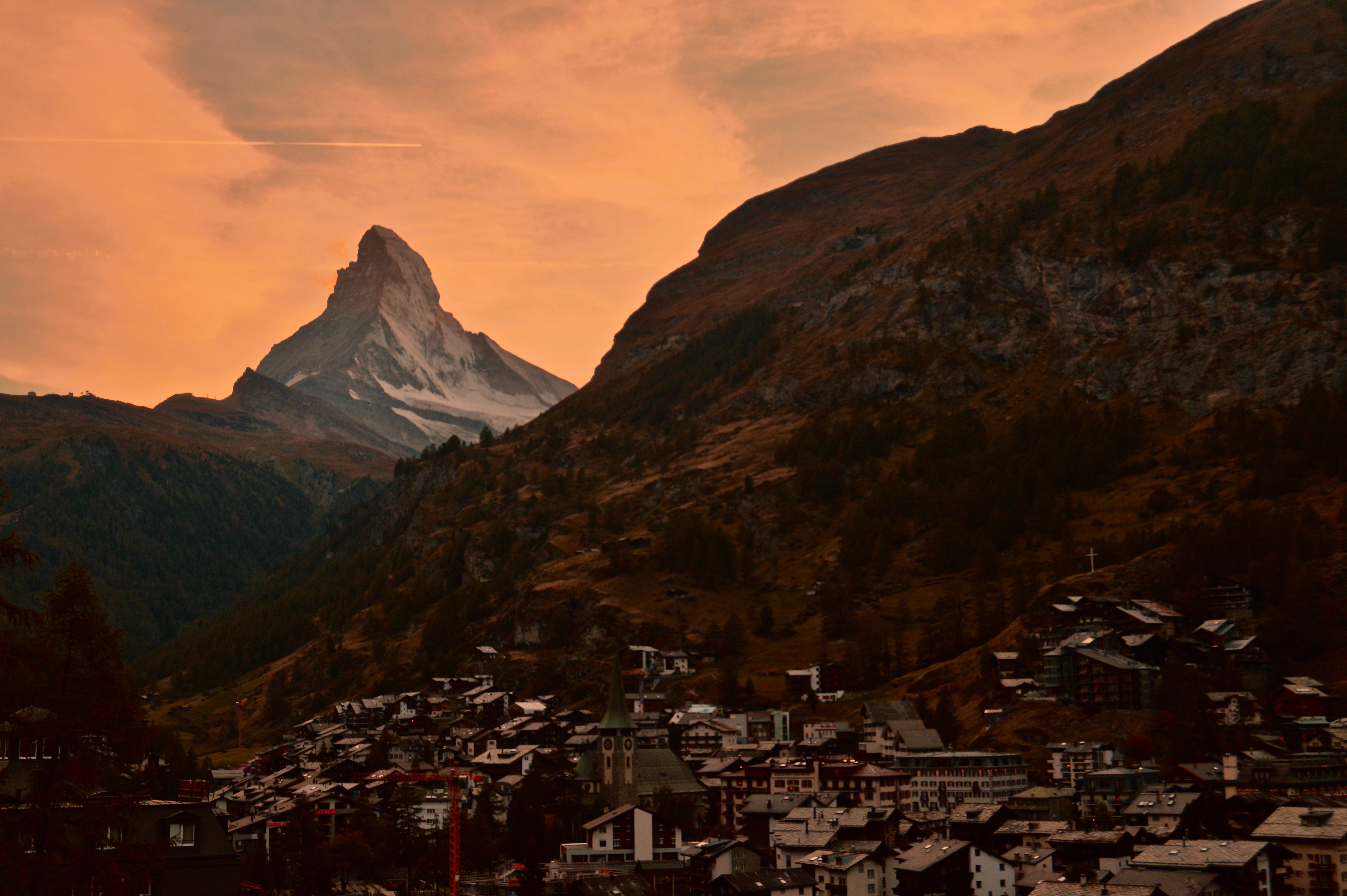
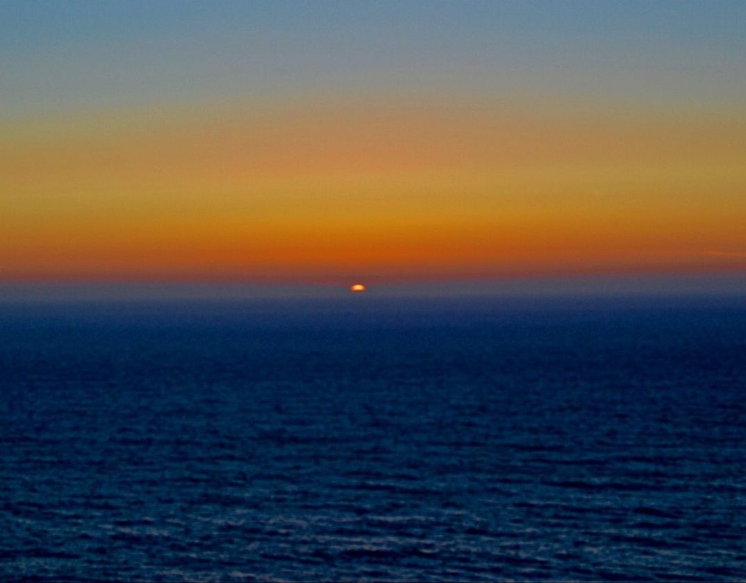
1. The sun sets over Zermatt as the Matterhorn looms above.
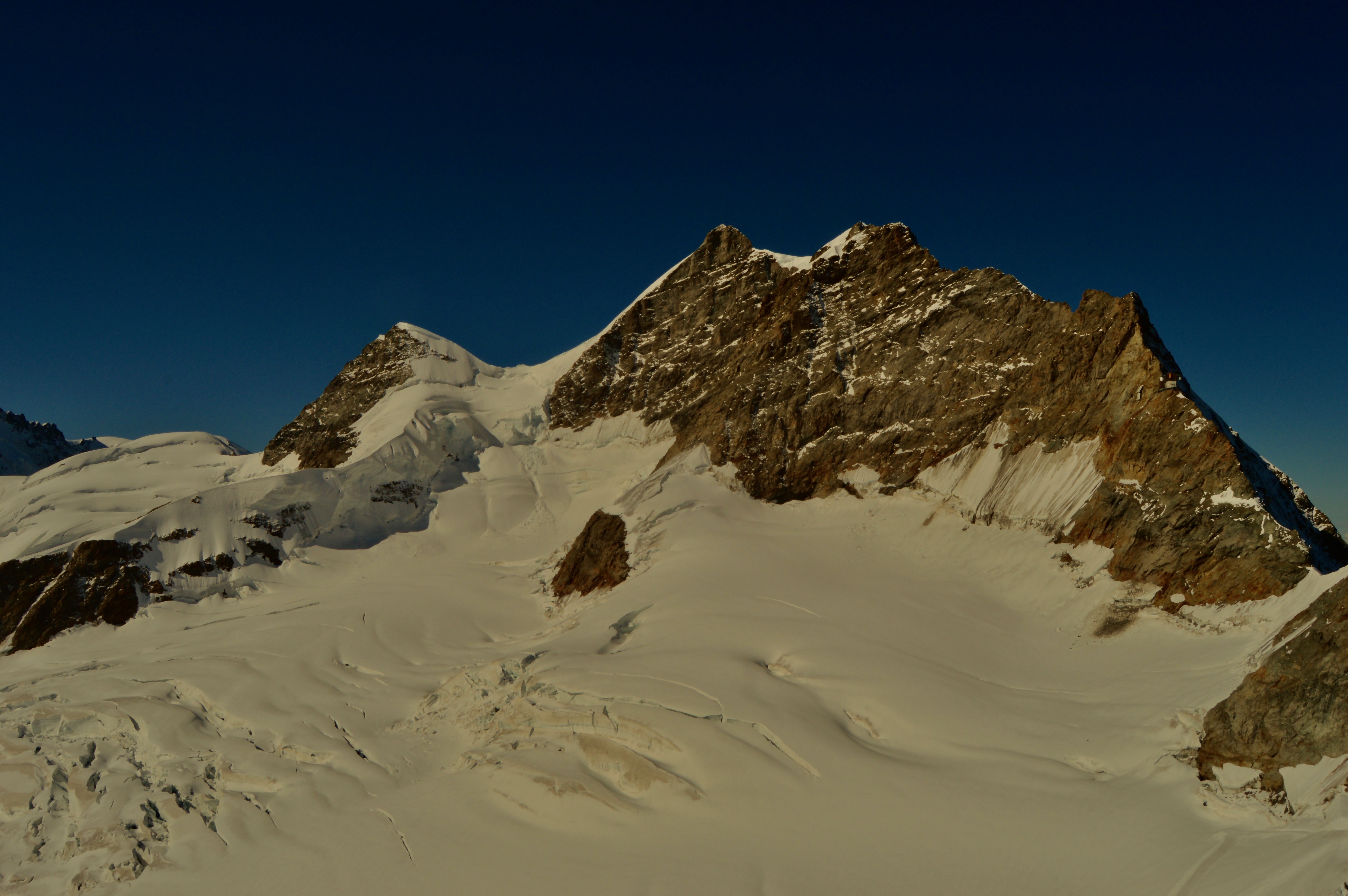
2. Jungfrau, one of the main summits of the Bernese Alps, and the highest peak of the massif that includes Mönch and Eiger.
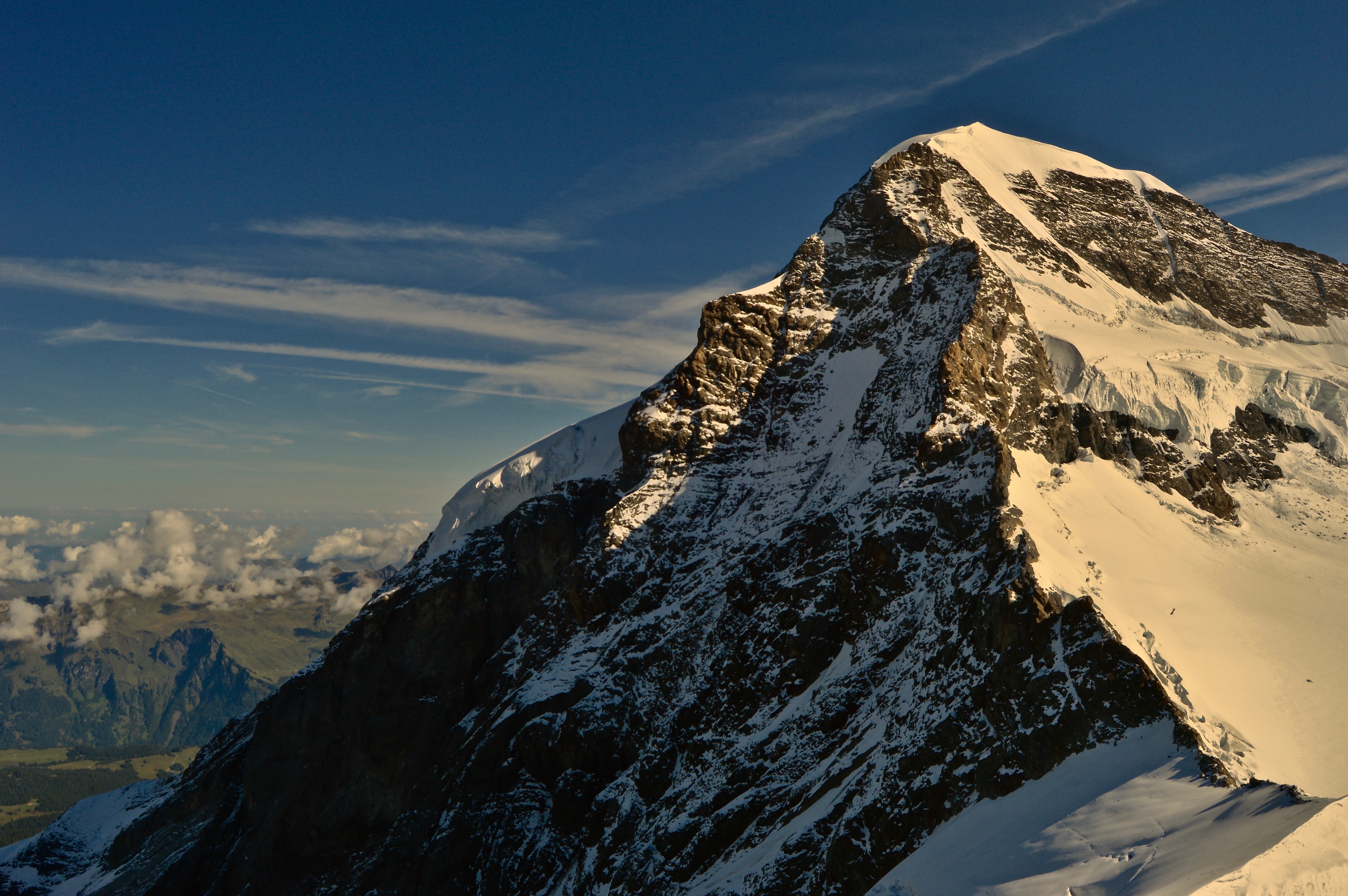
3. Mönch sits adjacent to Jungfrau, towering over Grindelwald below.
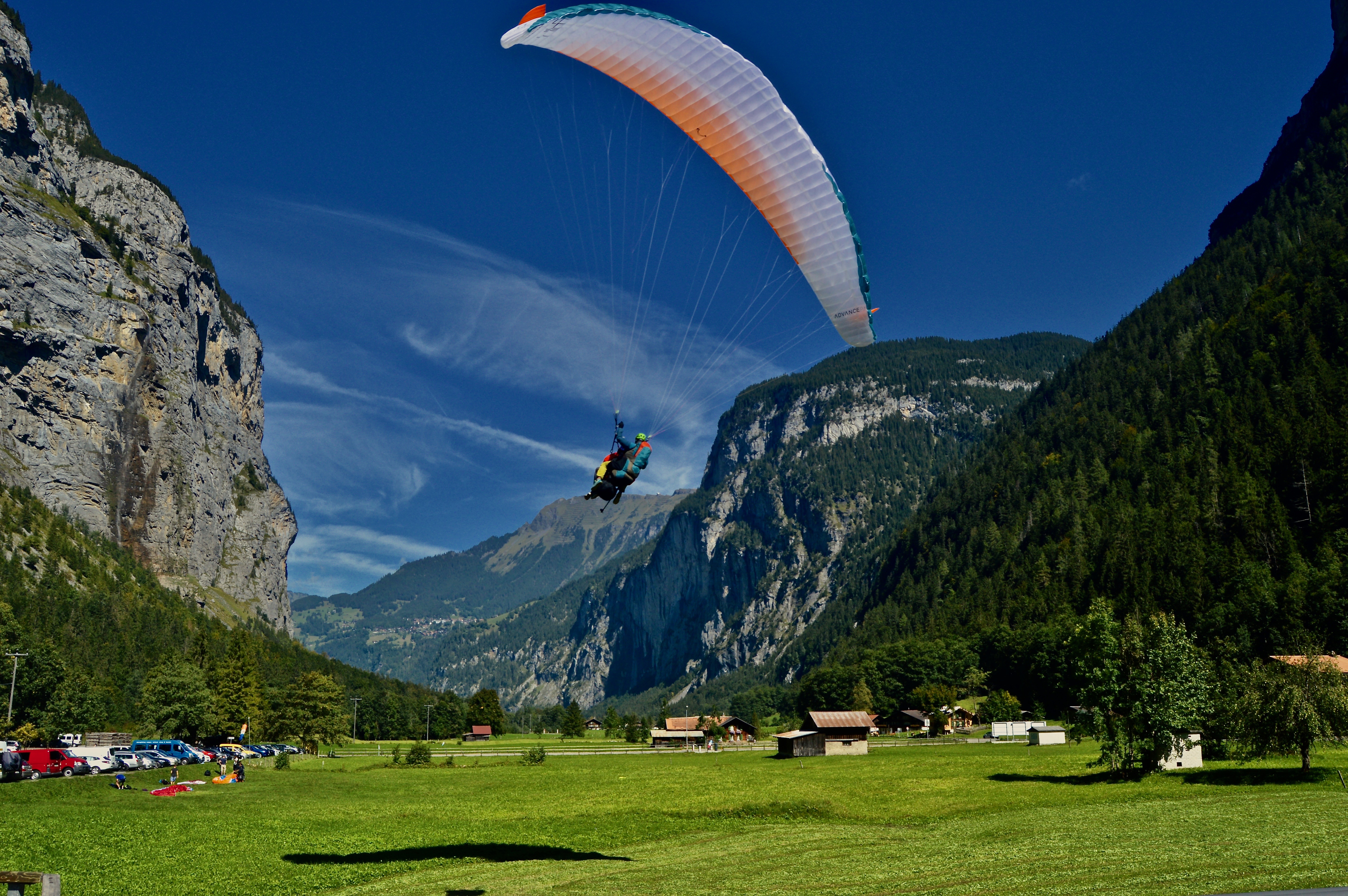
4. A paraglider prepares to land after soaring over the Lauterbrunnen valley.
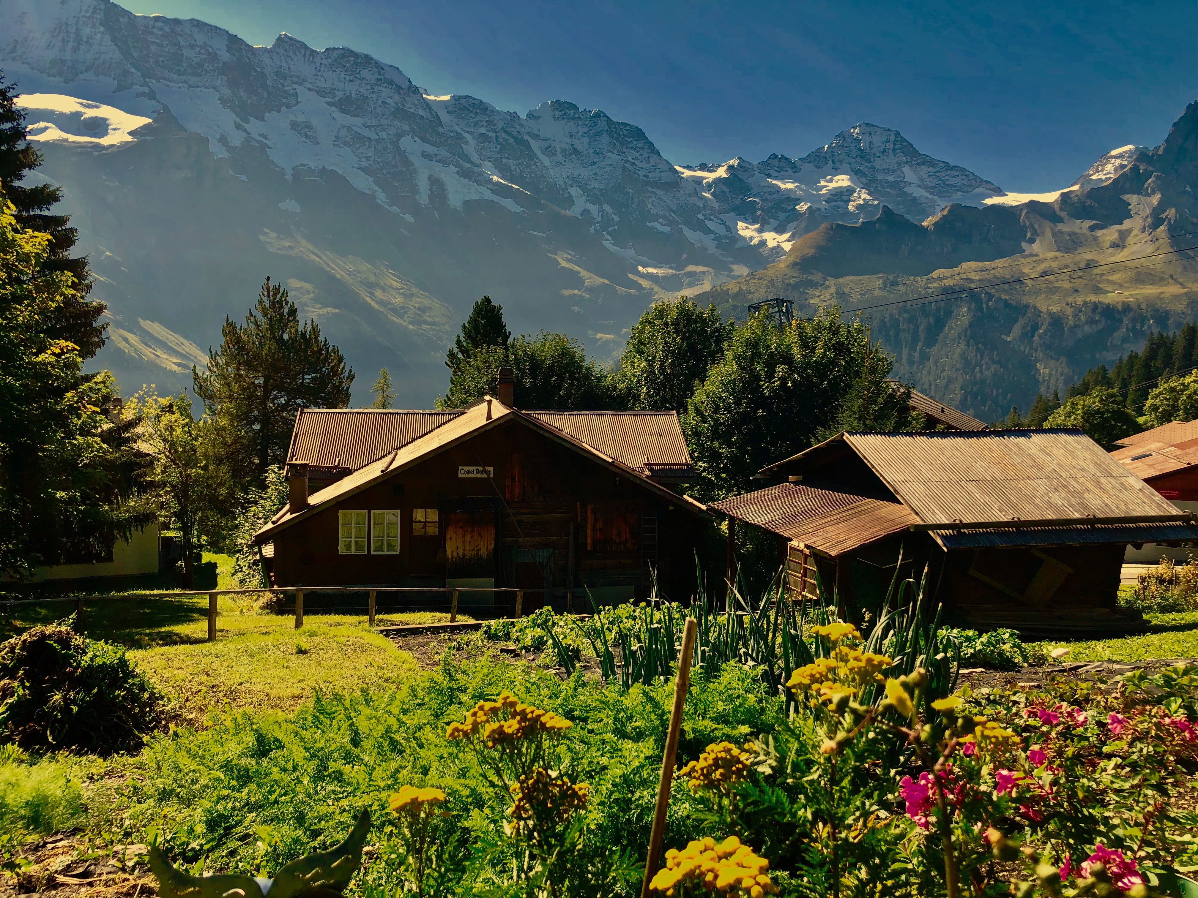
5. The village of Mürren exemplifies the best in traditional Swiss architecture with amazing mountain views.
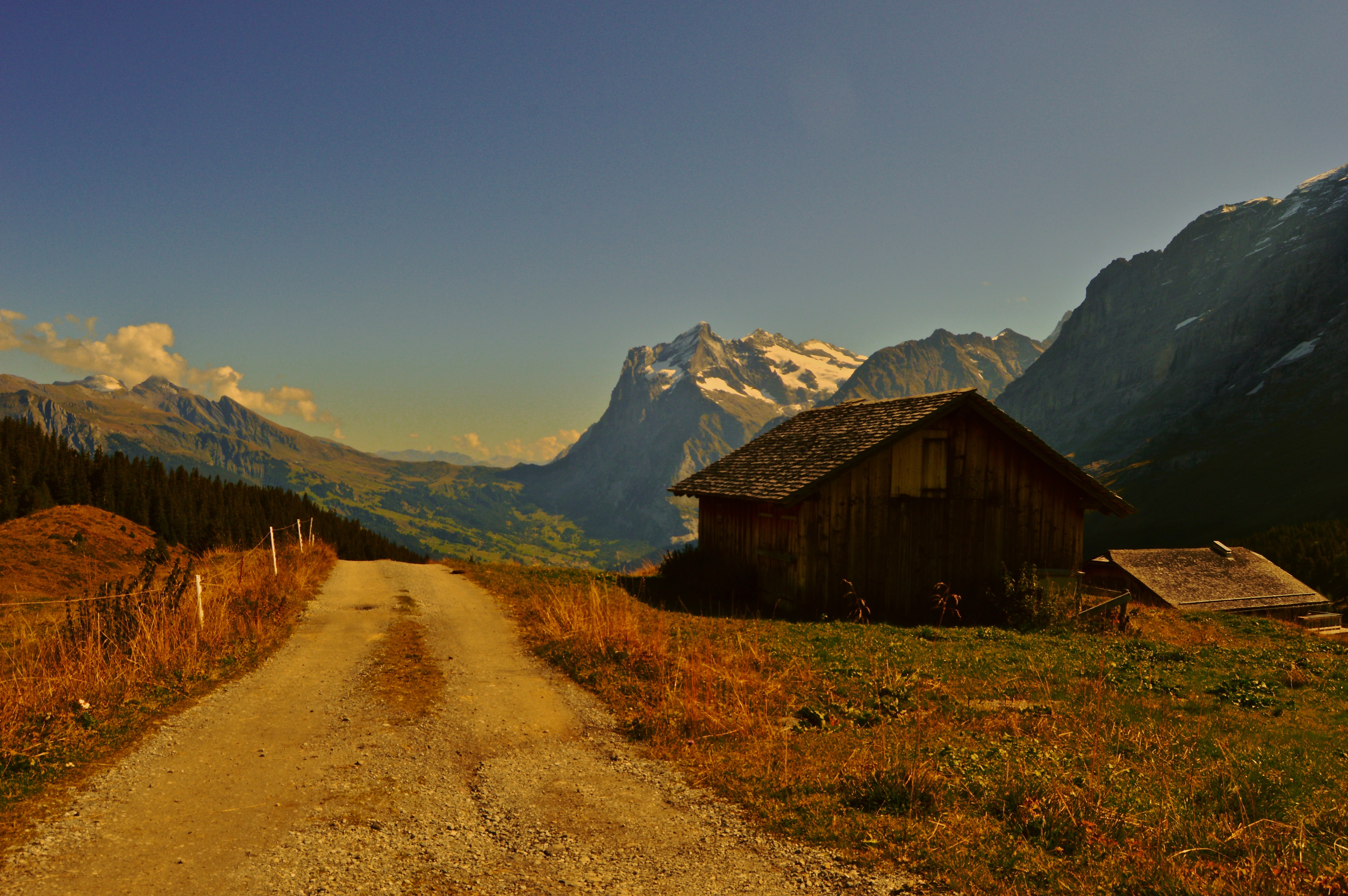
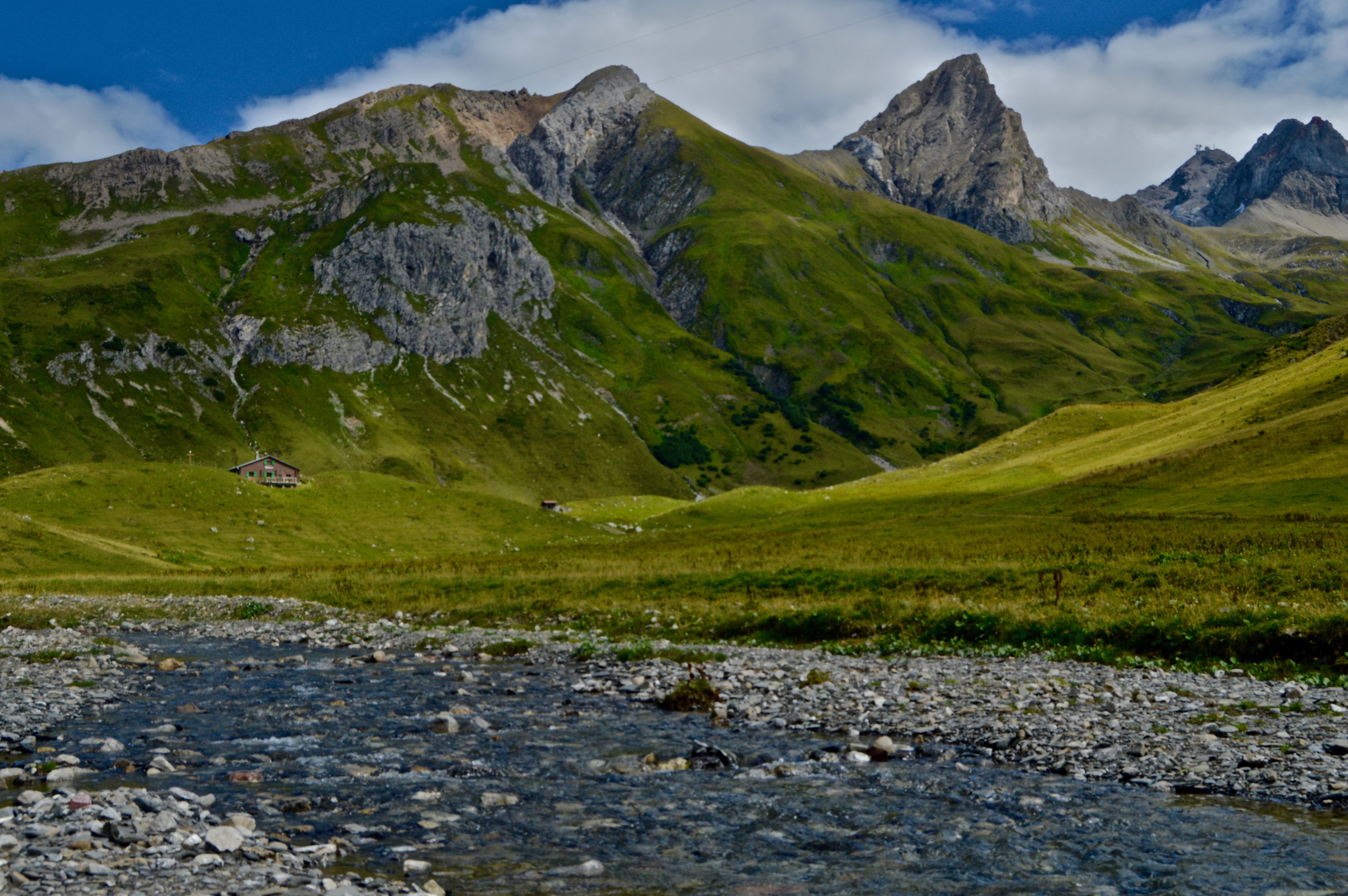
6. A small farmhouse sits on the slopes above Grindelwald with a view of the valley.
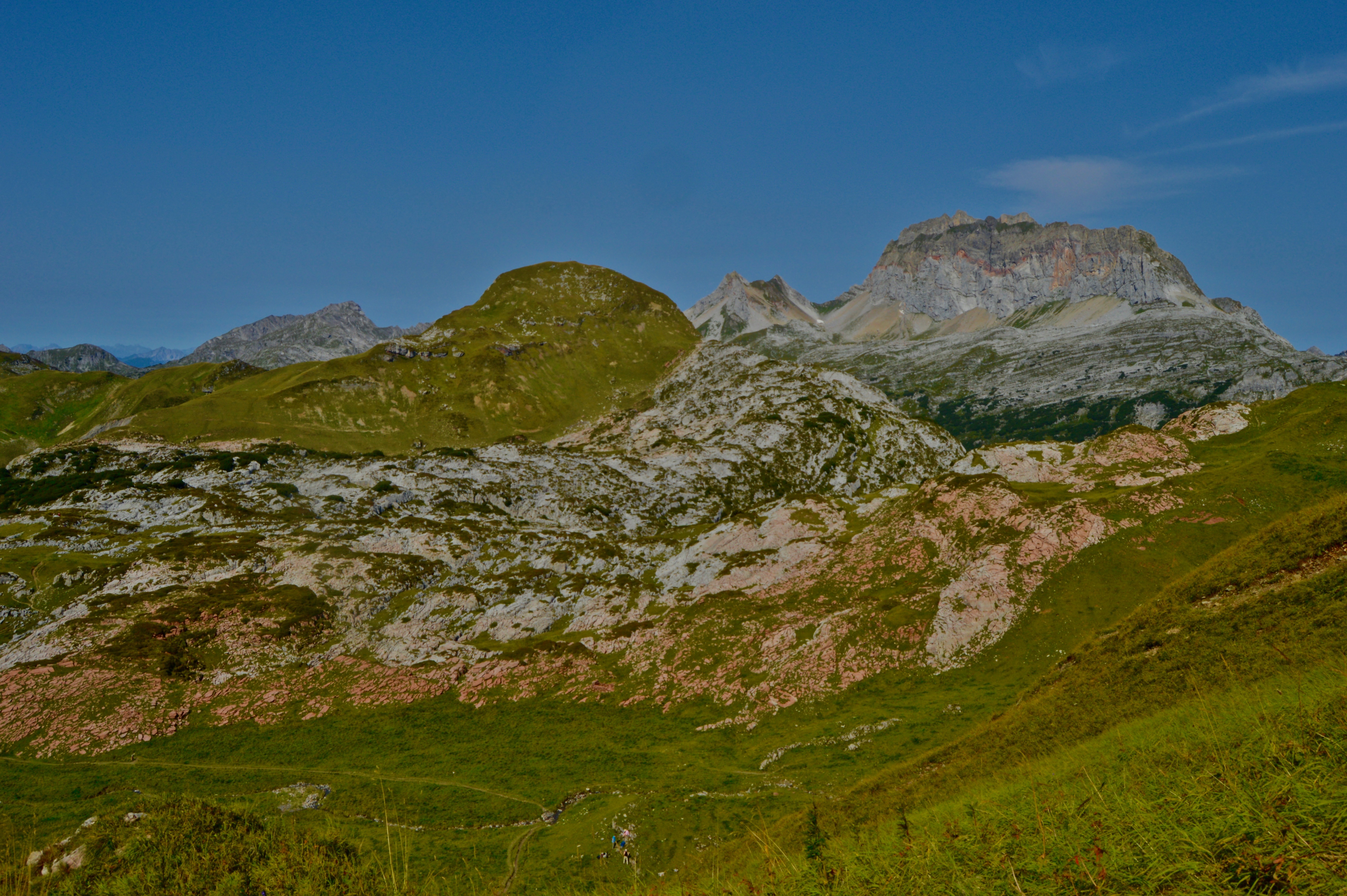
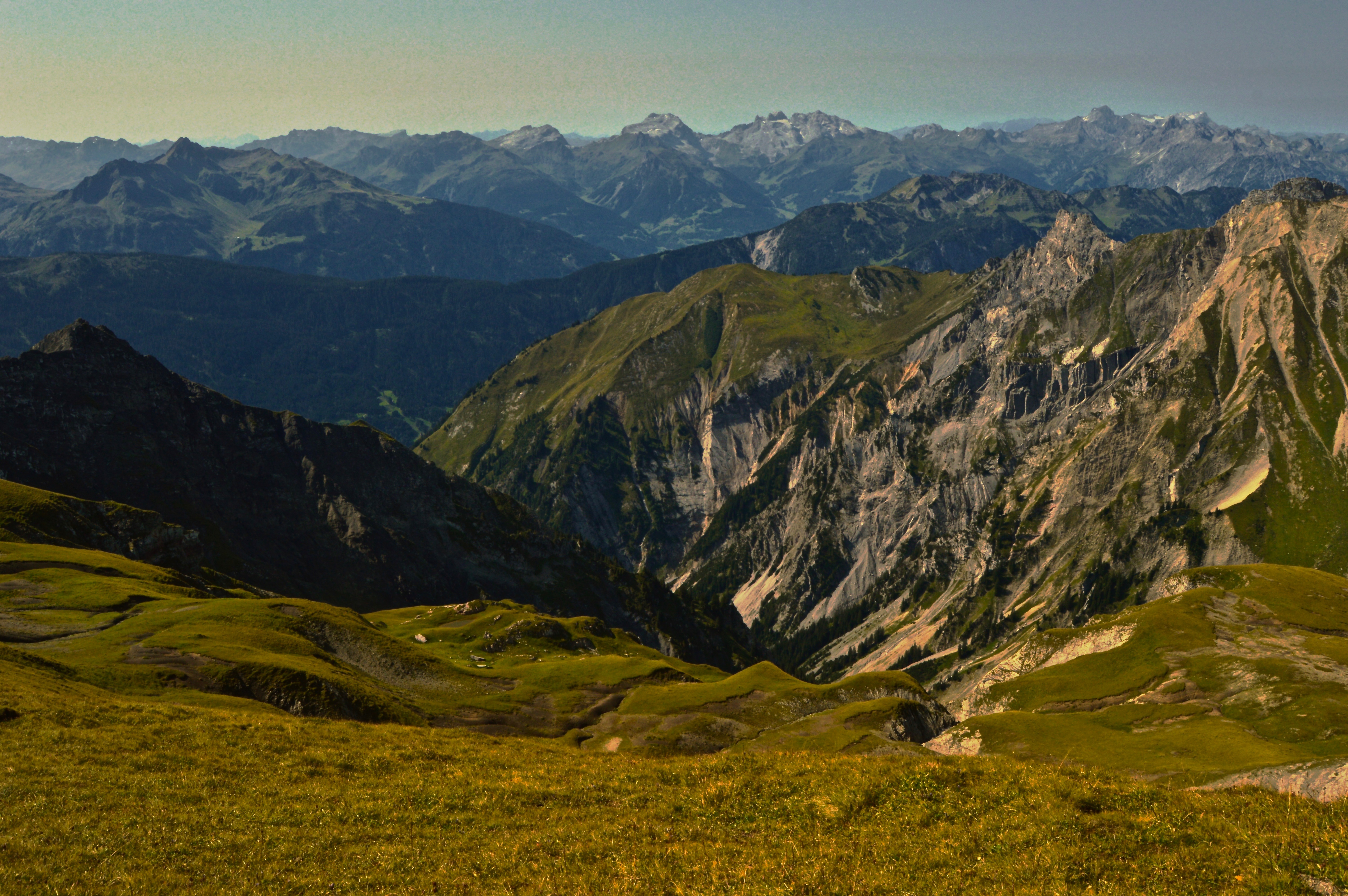
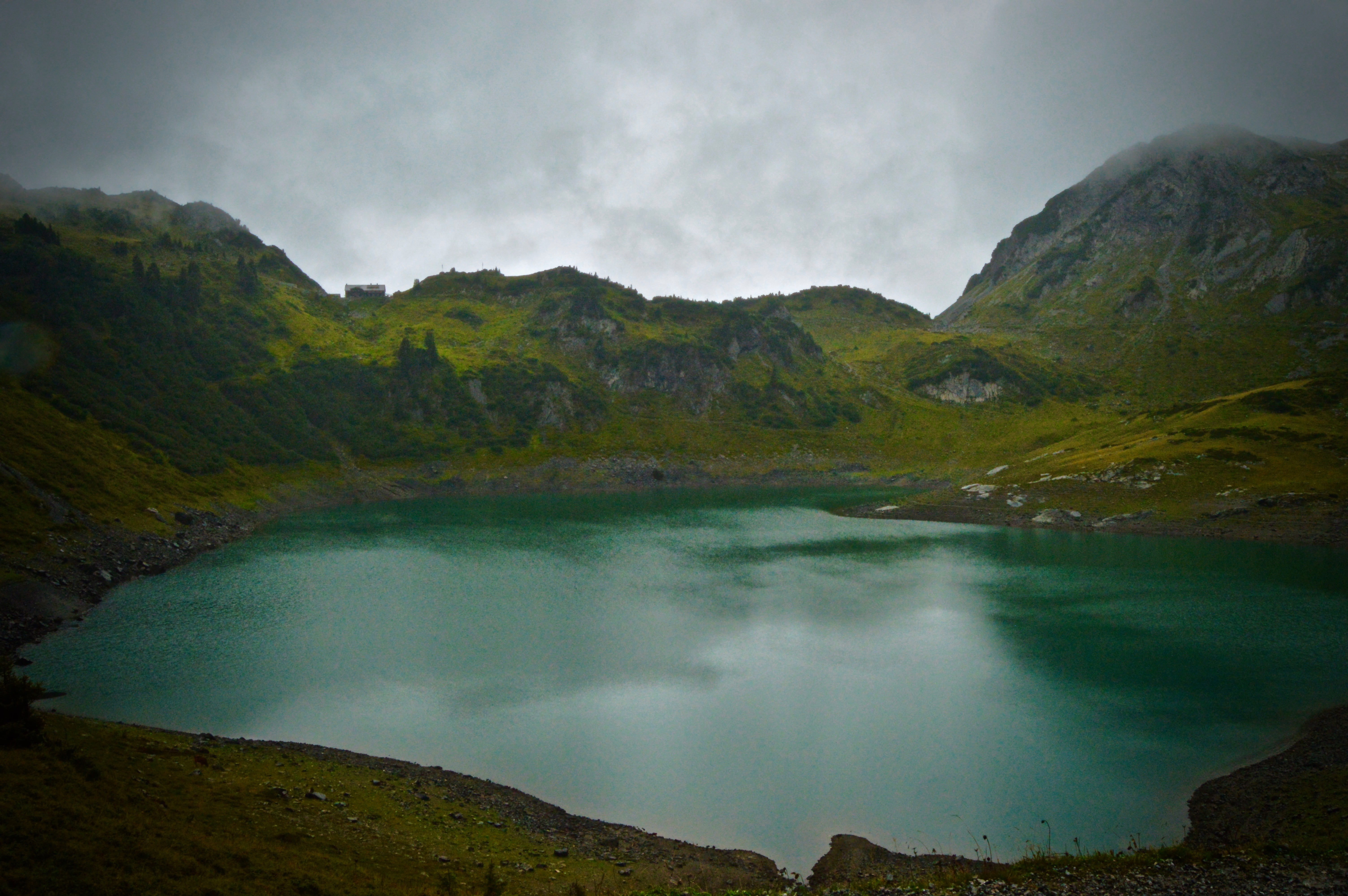
Lech, Austria is a picturesque tourist town situated at the base of the Arlberg massif of the Austrian Alps. Known more as a winter ski destination, Lech, and the surrounding towns, still offer ample opportunities for recreation in the summer months as well. I spent my week in Lech hiking several of the many trails in the area, ranging from “easy valley hikes” to “very difficult mountain hikes.” A sophisticated bus and gondola/chairlift system provides easy access to the high elevation trails, saving the legs a couple thousand feet of climbing.
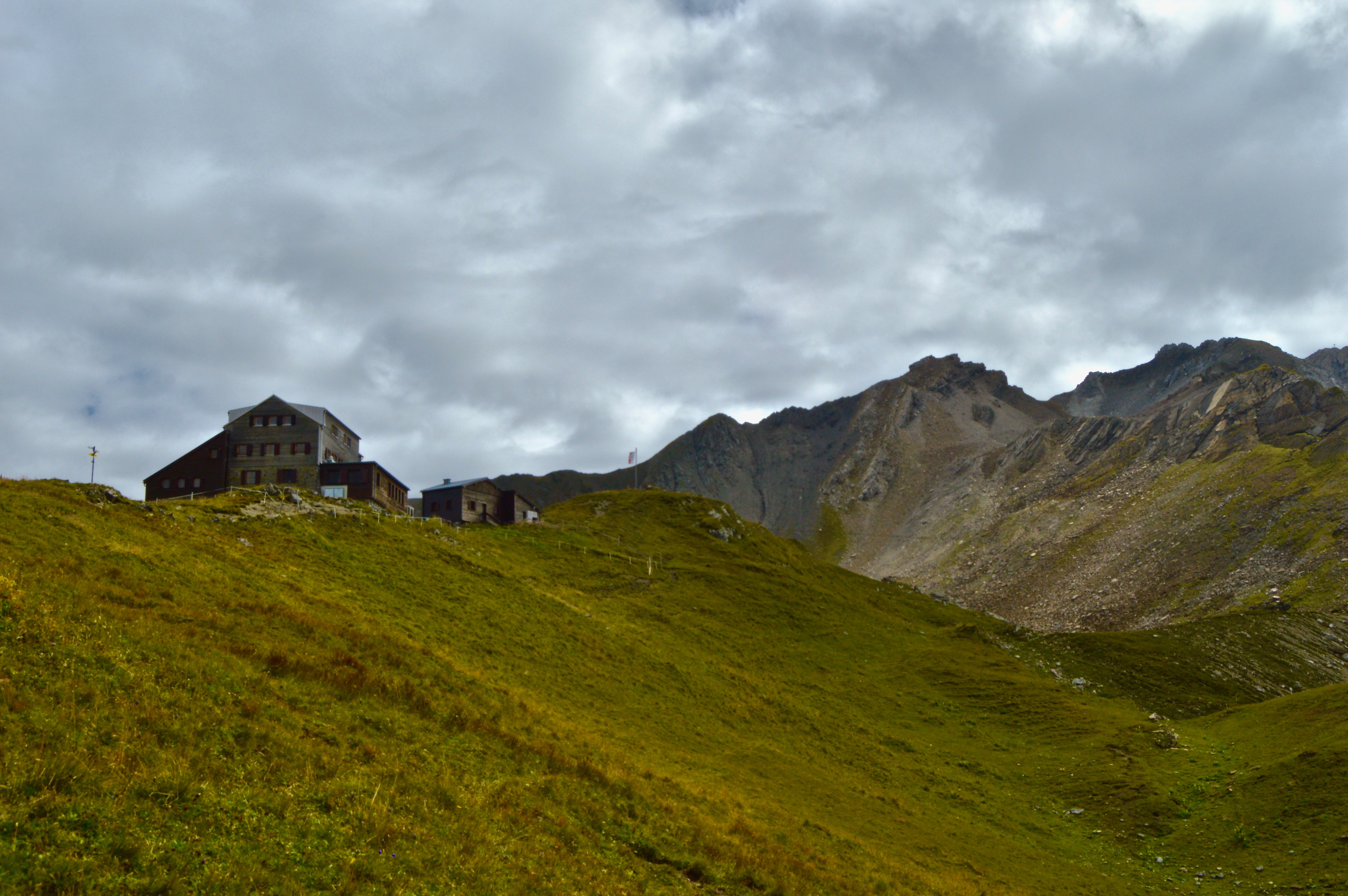
The best part–in my opinion–of hiking in Austria (and the Alps in general) is that the majority of trails leads to a mountain hut fit with electricity, flush-toilets, warm food, cold beer, and of course, scenic views. While not exactly a true ‘wilderness experience,’ having luxury is nice every now and then. There certainly aren’t many places in the States that offer such deluxe accommodations on a hike. For meat lovers, most huts have the traditional dishes of sausage and sauerkraut, or my personal favorite, Wiener schnitzel, on the menu. For the best Wiener schnitzel you’ll ever have (Disclaimer: I did just hike 11+ miles, gaining and losing 2000 feet in elevation, and at that point, anything would have tasted delicious), go to Ravensburger Hut at Spullersee. The tender, breaded and golden-fried pork steak, accompanied by fresh cranberry jam, the crispiest, herb-topped, melt-in-your-mouth potato fries, and a cold Austrian lager to wash it all down, was the perfect way to end a long, demanding hike.
I hiked and exercised a lot in Austria, but I also ate so well I’m not sure if I lost or gained weight during my time there! Here’s a picture of the Wiener schnitzel below to wet your appetite…

I’m going to start out by mentioning that I try not to overuse the word beautiful, instead reserving it only for things I truly find beautiful, namely Natalie Portman, a plate of fresh sashimi, Ken Griffey Jr.’s left-handed swing, and now Iceland. Even though I only spent five days in Iceland and saw hardly a fraction of the country, the landscapes I were able to visit completely blew me away. From majestic waterfalls spilling over cliff sides, to volcanic black sand beaches, immense glaciers, and rainbow colored ridges, Iceland boasts a combination of natural landscapes that cannot be found anywhere else on Earth. This is due to the unique characteristics that have shaped the island, including volcanic activity, a latitude equal to parts of Greenland and Alaska, and the Gulf stream current that flows from the Gulf of Mexico up to the North Atlantic keeping Iceland’s climate more moderate than it otherwise would be.
The highlight of my short-lived trip was hiking in the central highlands, deep in the island’s interior, which I describe here. Enjoy!
Bus from Reykjavik to Landmannalauger
We caught a bus from the Harpa Concert Hall in downtown Reykjavik to Landmannalauger base camp with the Sterna Travel company. The bus departs Reykjavik at 7:15am and returns around 10pm (it’s a loooong day, but well worth it!). The drive takes about four-and-a-half hours, of which the last hour is spent on a dirt road that travels across an other-worldy landscape left in the wake of several eruptions from nearby Hekla volcano (the most active volcano in Iceland) and fords several river crossings (quite an experience in a 60 passenger coach bus!). The surface is covered by a deep black mixture of lava rock, sand, and ash, and prohibits the growth of any plant life, save for a few mosses and grasses. As a result, hardly any life survives in Iceland’s interior–flora, fauna, or human. Although, it is common local knowledge that trolls inhabit the hills and will capture and eat you if you wander off too far…


Landmannalauger Base Camp
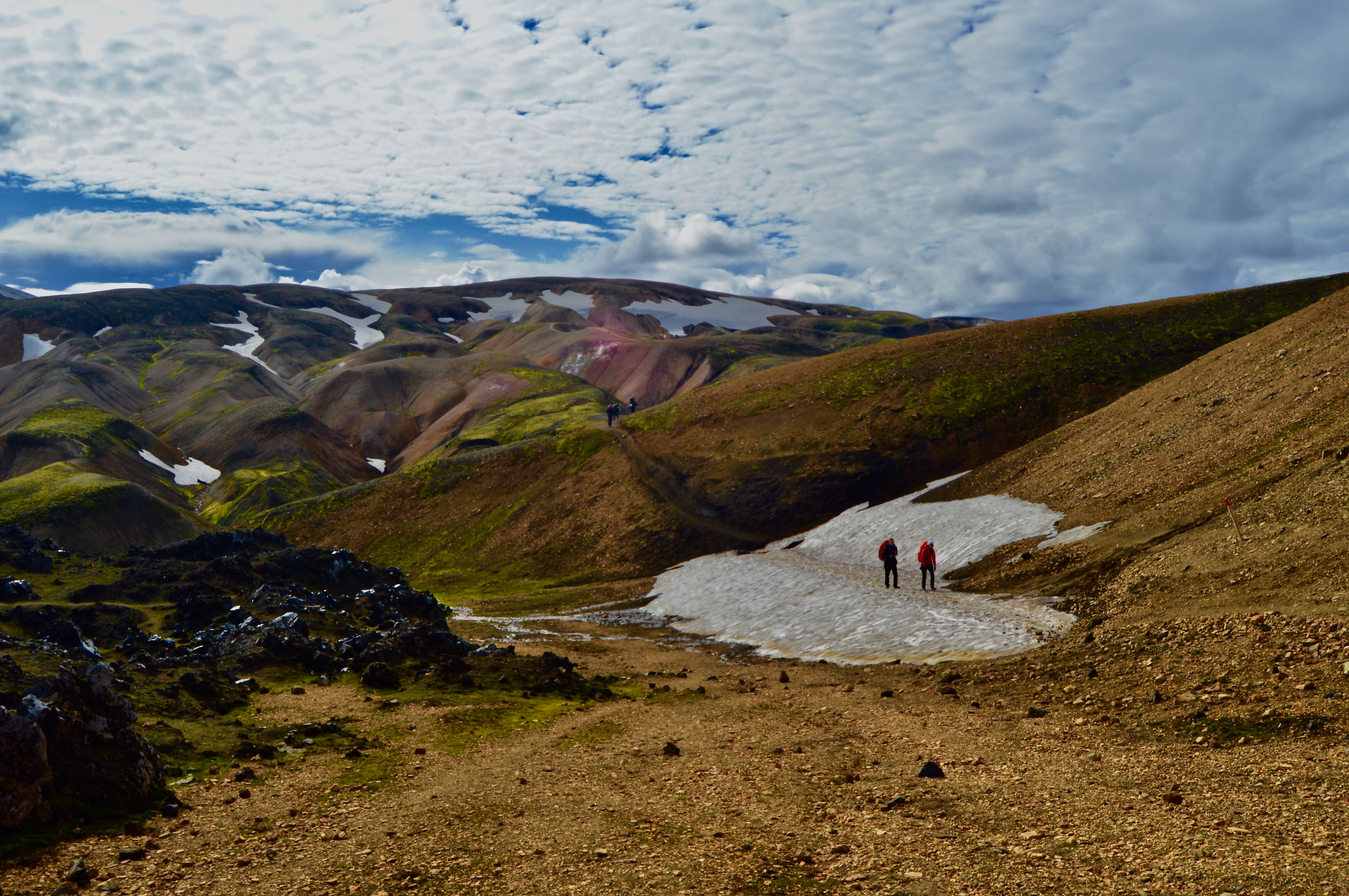
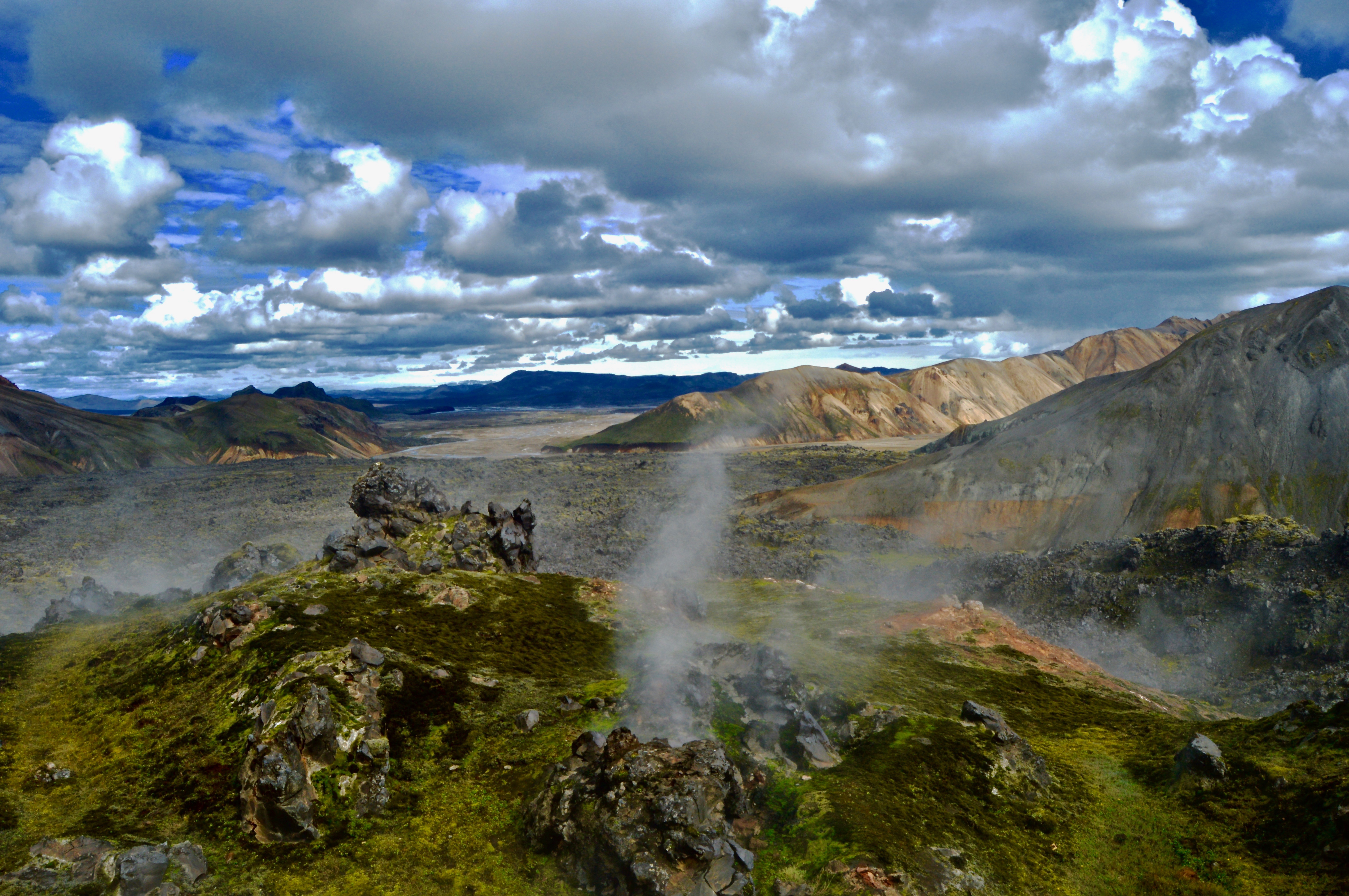
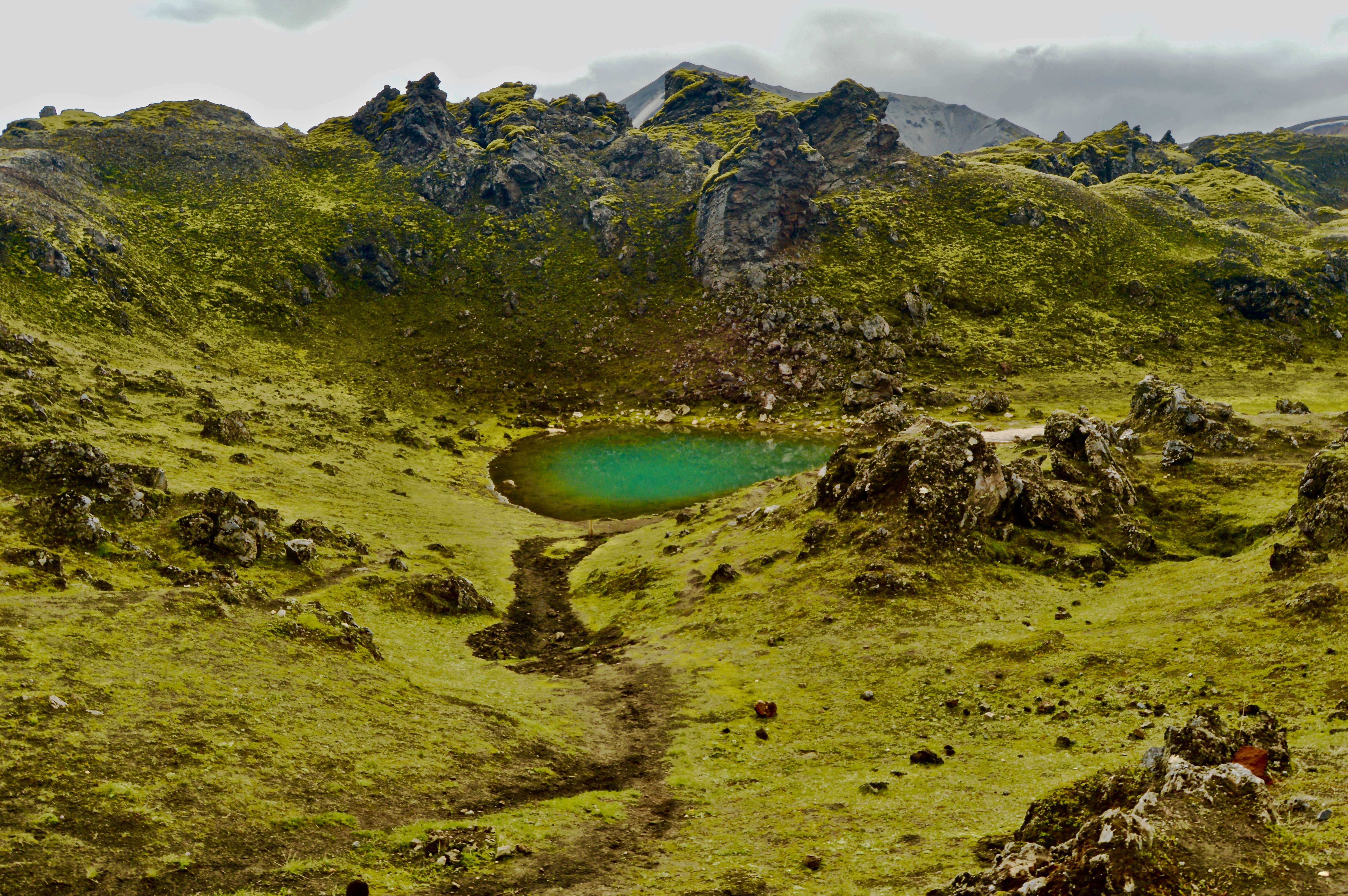
At noon, we arrived in Landmannalauger, located in the Fjallabak Nature Reserve and starting point for many hikes the area. The camp has a backpacker hut, campground, washrooms, and a natural hot springs, as well as information for the various hikes. There are several popular day hikes, ranging from easy strolls to climbing steep peaks, and a multi-day through hike on the Laugavegur trail. We decided on an intermediate four hour (5-6 miles) hike that climbed Mt. Brennisteinsalda.


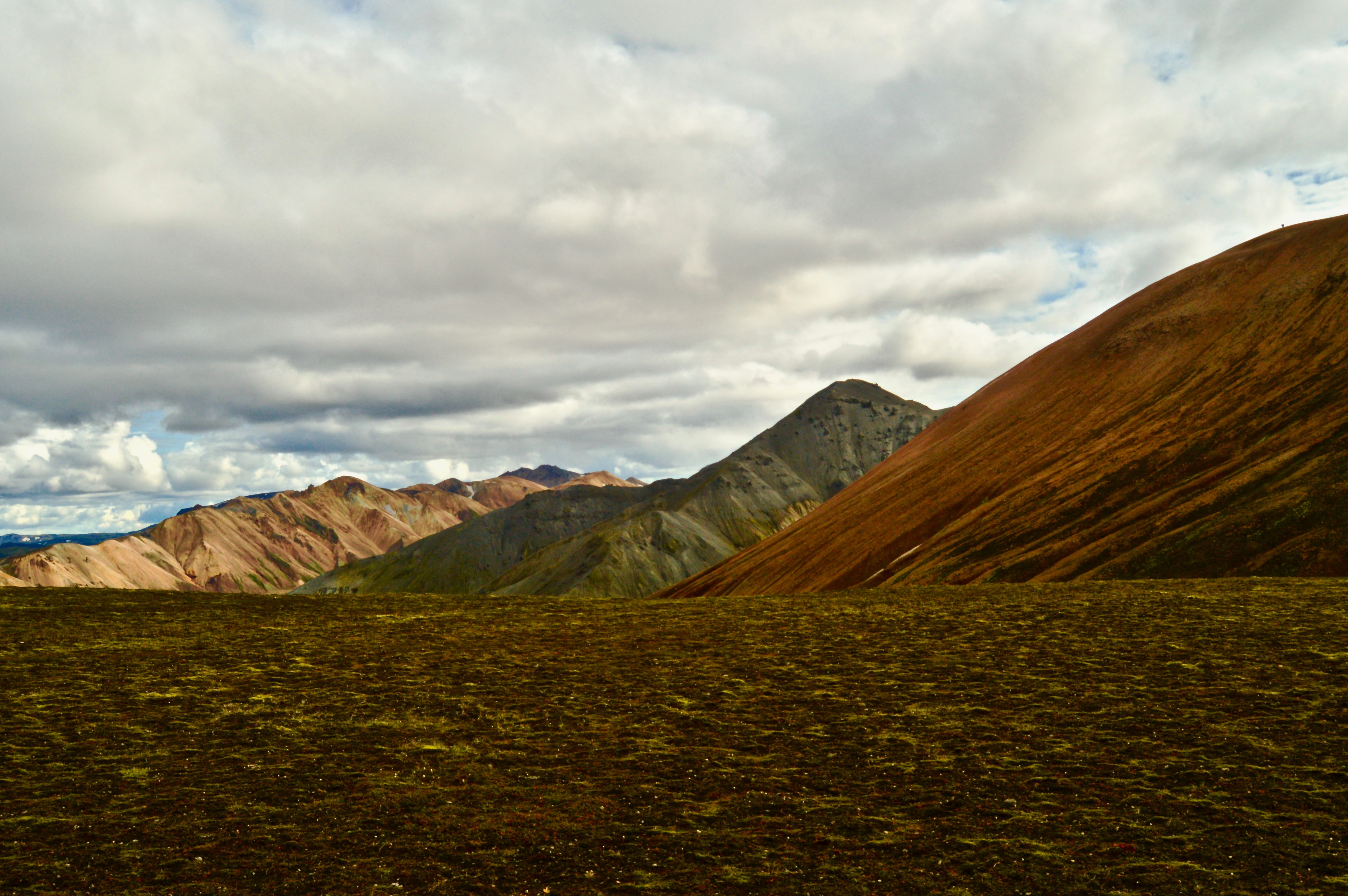
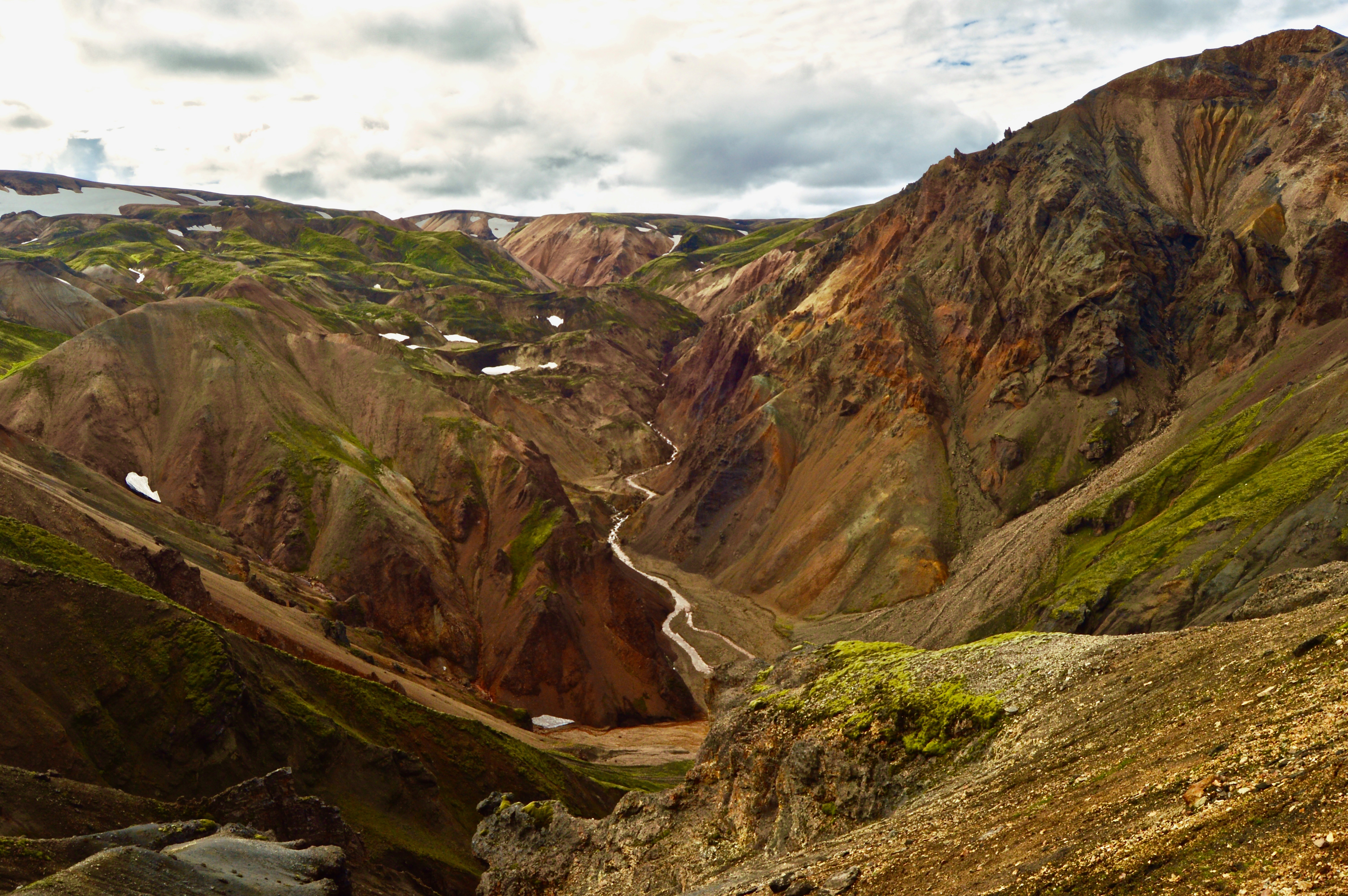
Hiking
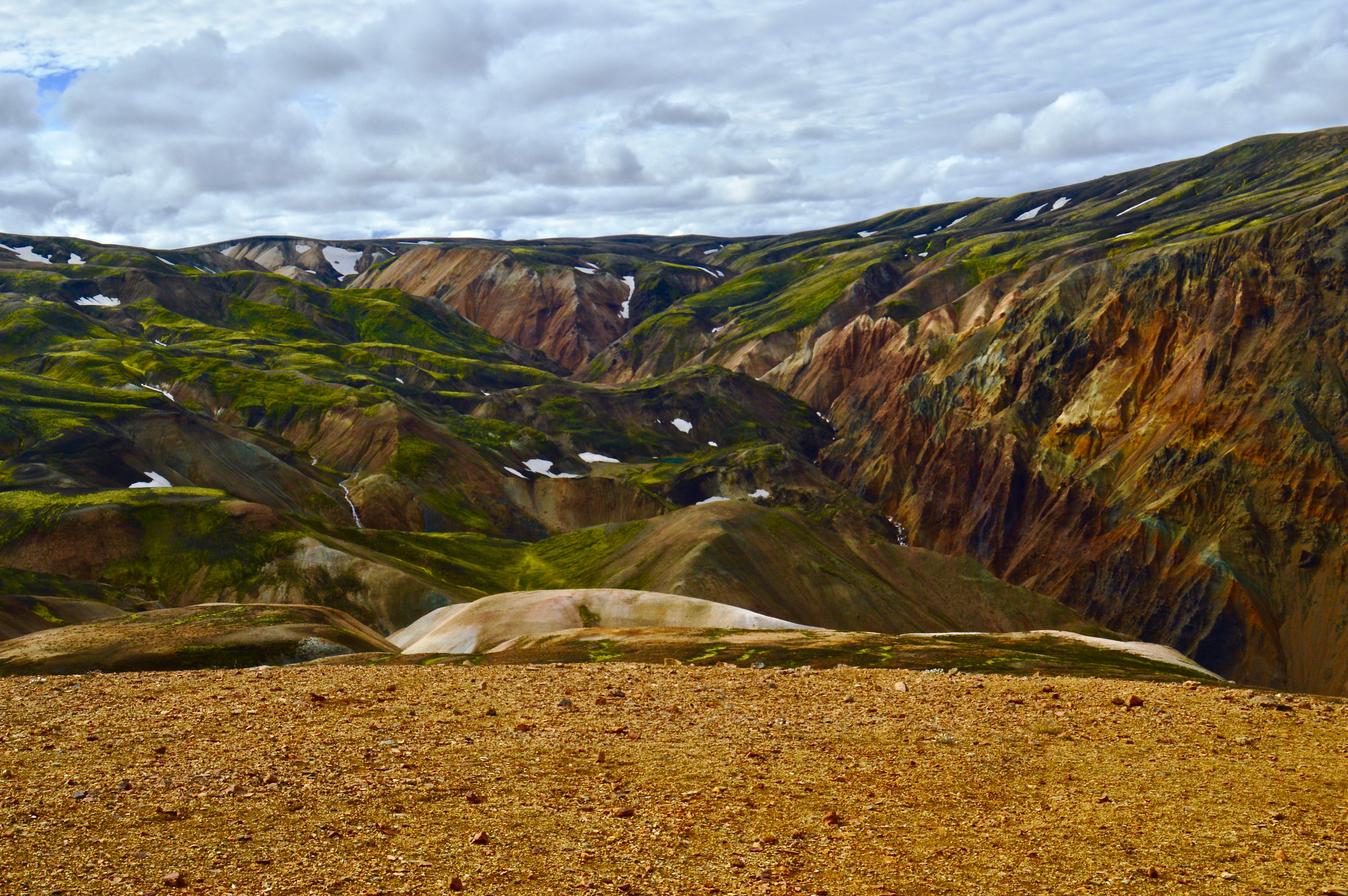
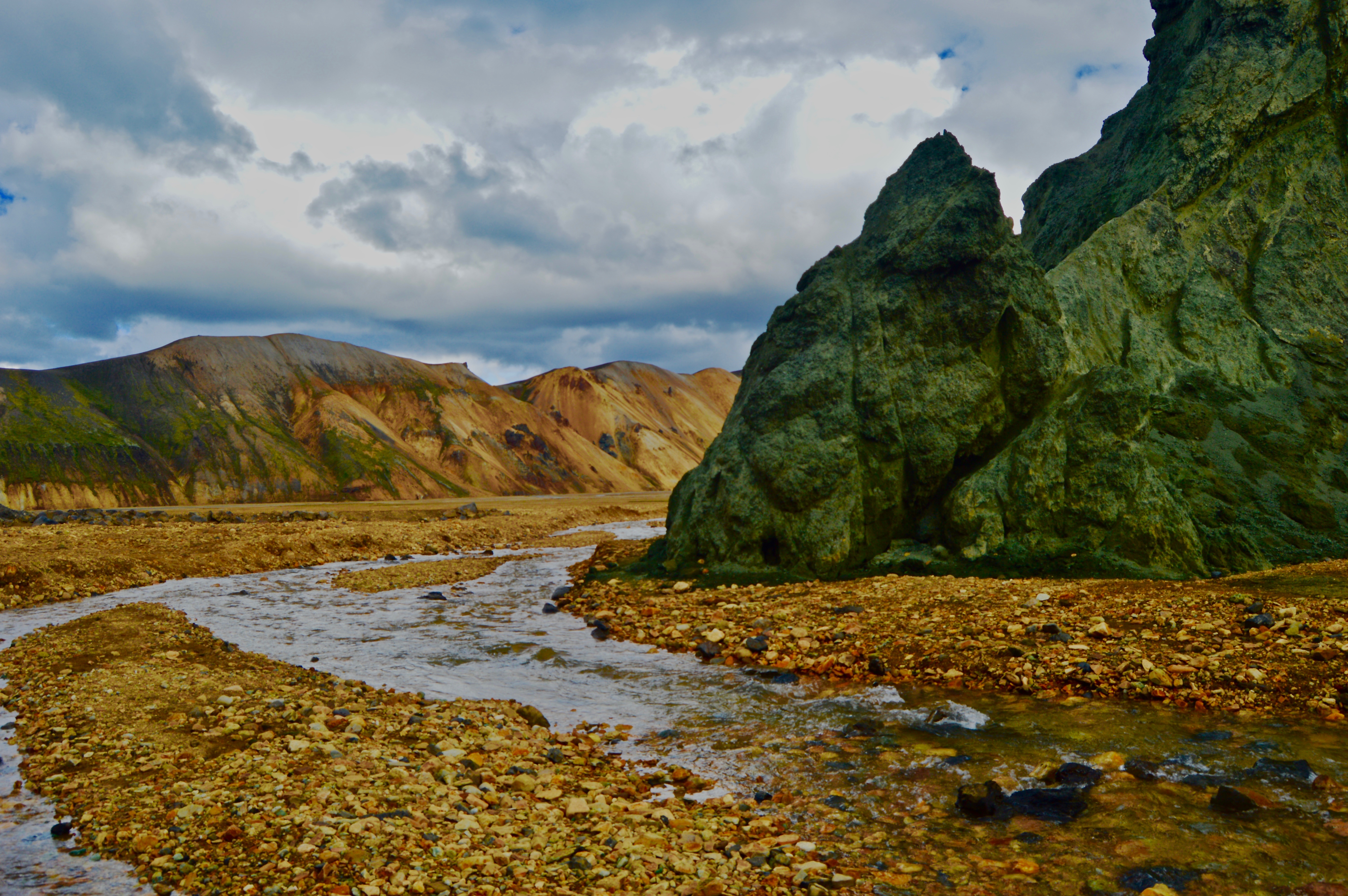
The hike we went on took us across lava fields, past geysers and geothermal springs, over glacial valleys, up the mountain, and down through a river canyon before ending back at the camp. We started along a path that winded through an immense lava field, where bright mossy Dayglo green contrasted sharply against the volcanic obsidian black. Sickly-grey glacial streams serpentined through the flat valleys below, like snakes in a sandbox. Colorful hills of reds and greens, painted by acidic sulfur and silica, rolled beneath a backdrop of snow covered peaks. Mt. Brennisteinsalda was the most brilliant of these painted peaks as a rainbow of loose rock spilled from the summit down to the valley below. The climb up to the summit was steep, but worth the reward of a 360 degree panoramic view of the area. We were extremely lucky with the weather as clear days are hard to come by in Iceland and we were able to see from horizon to horizon.


For a day trip, this hike was the perfect length and offered views of all the best Iceland has to offer. I am hoping to make it back to the country soon to hike and photograph even more.

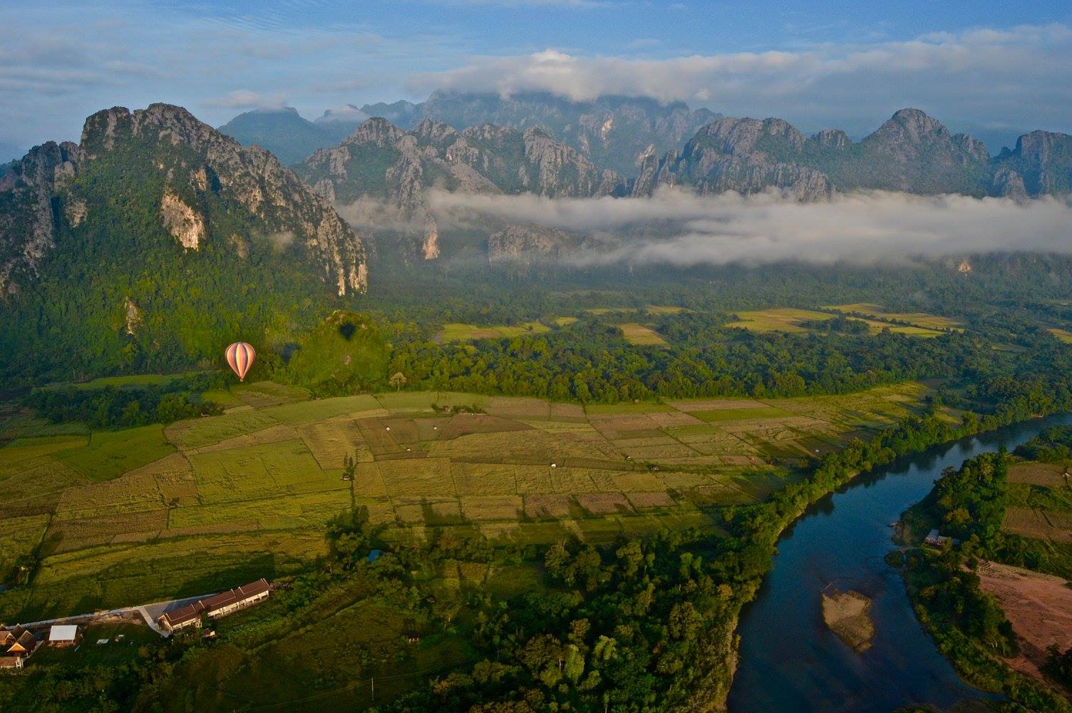
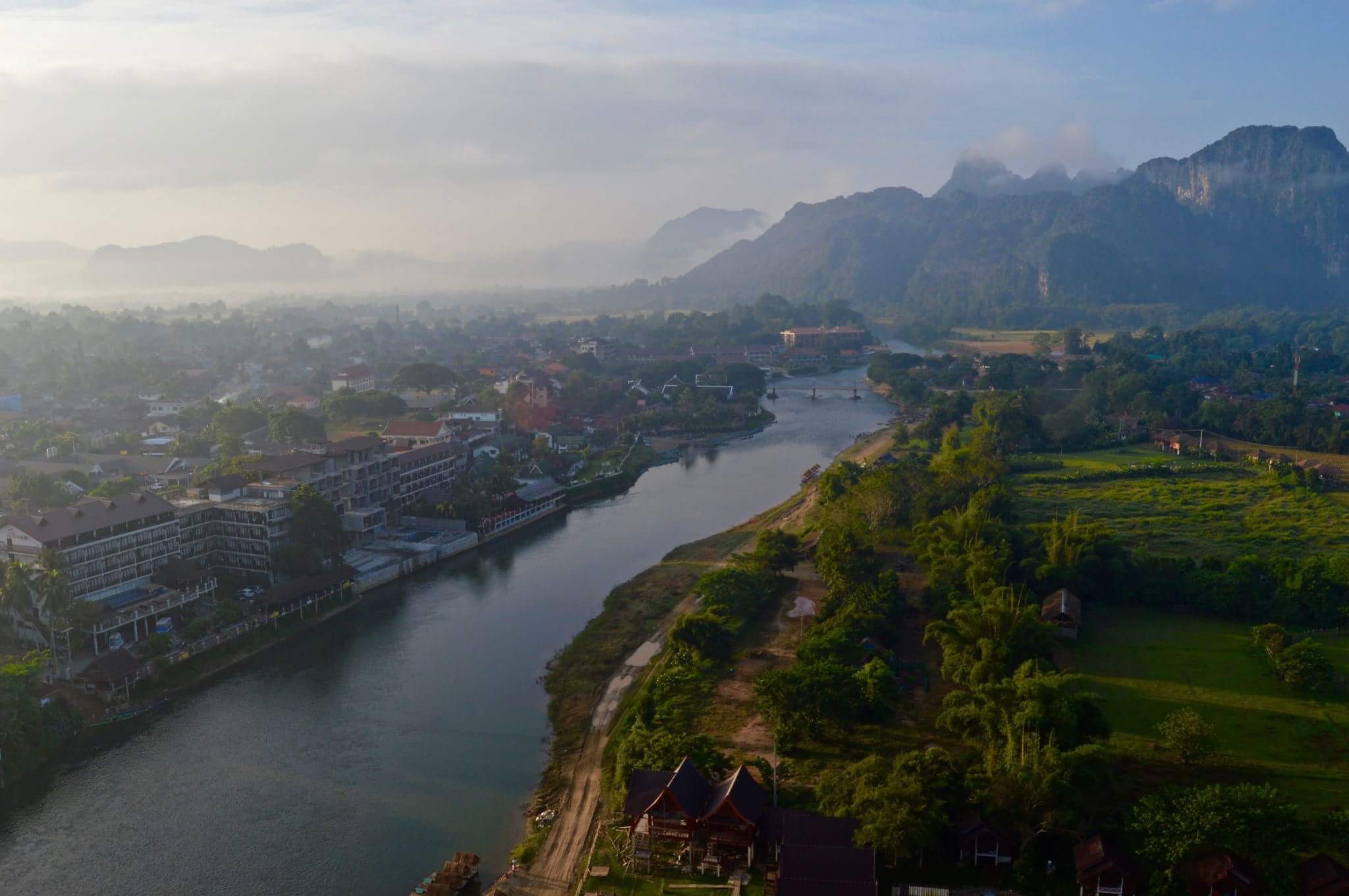
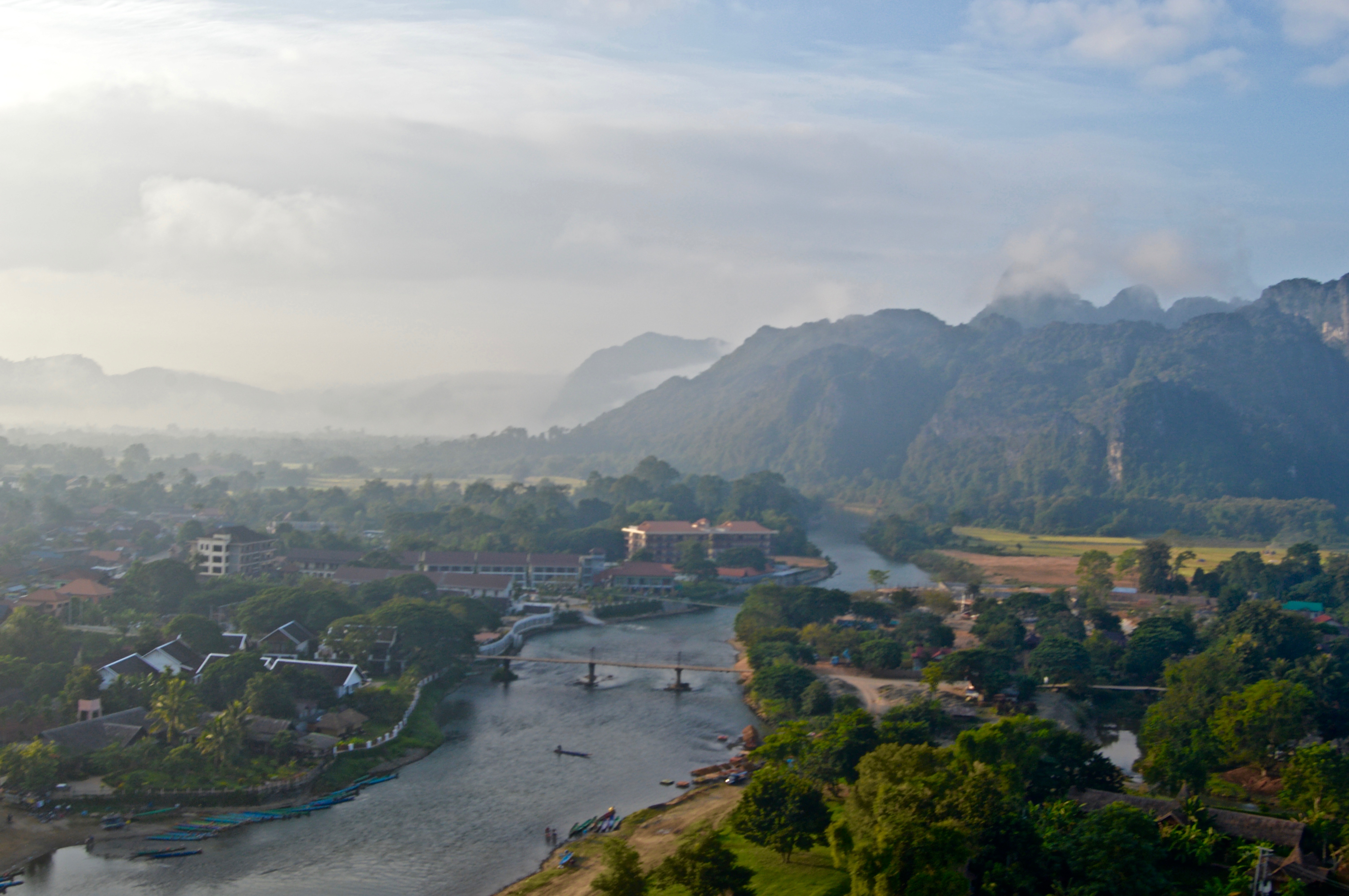
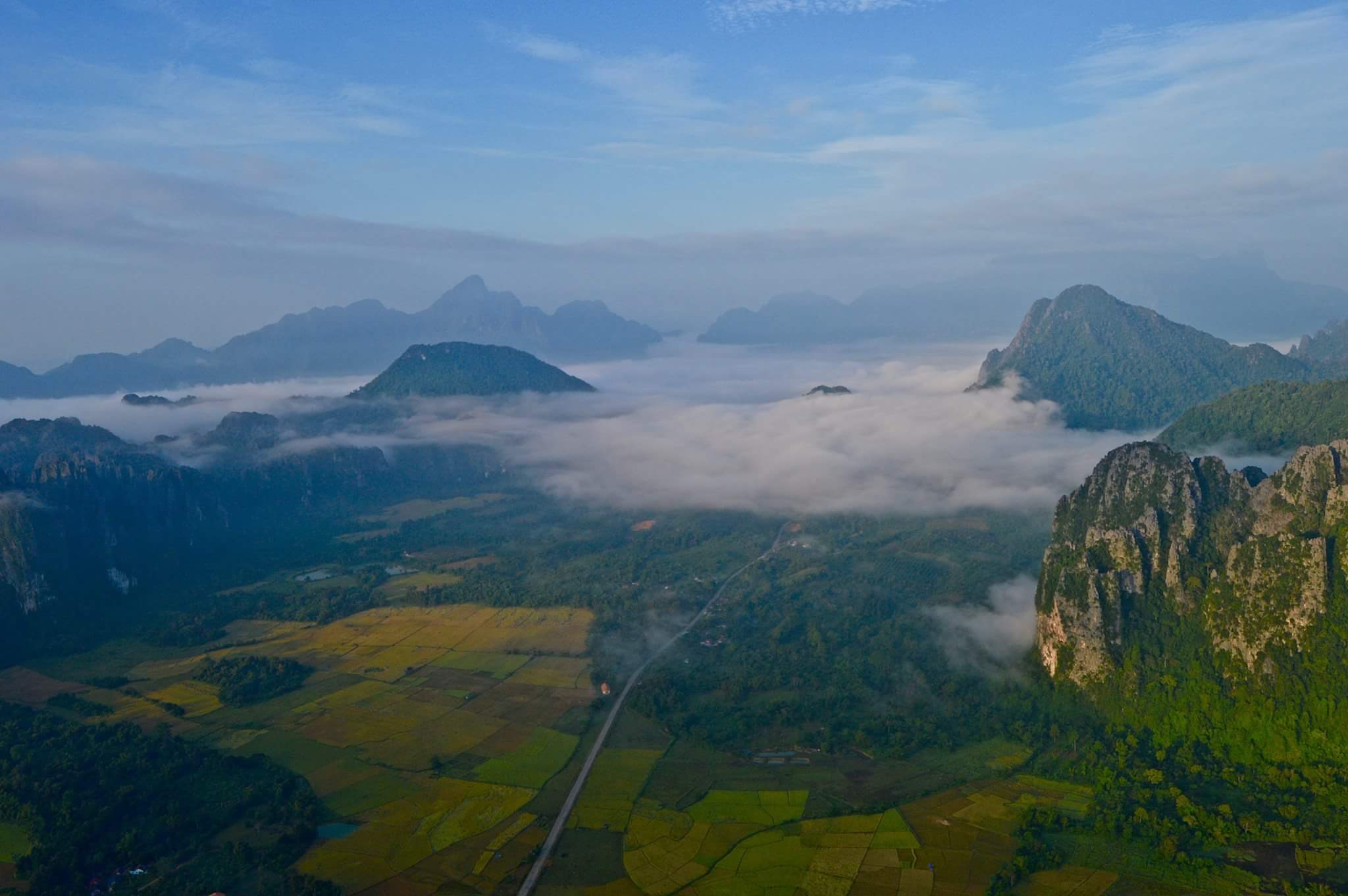
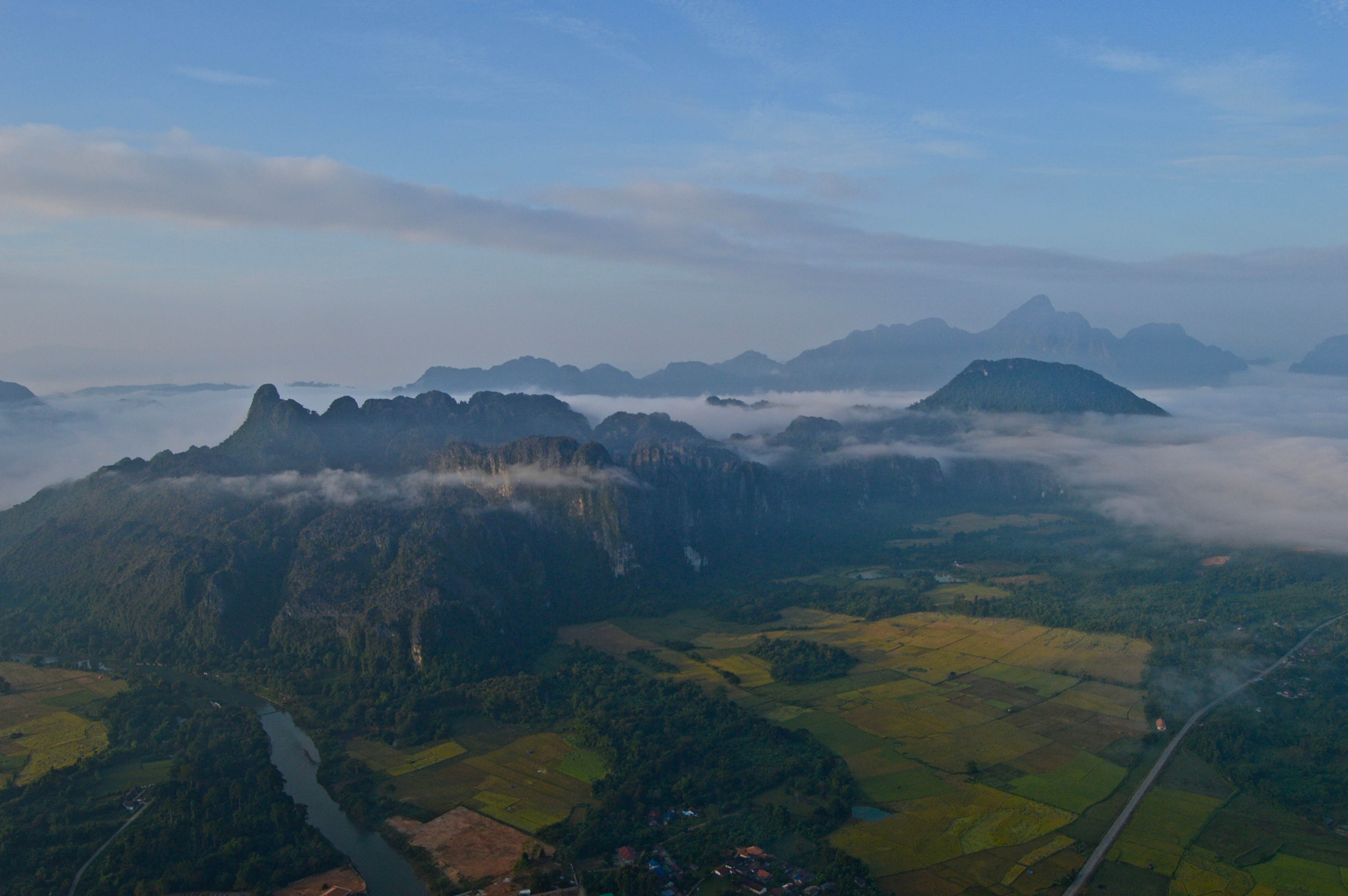
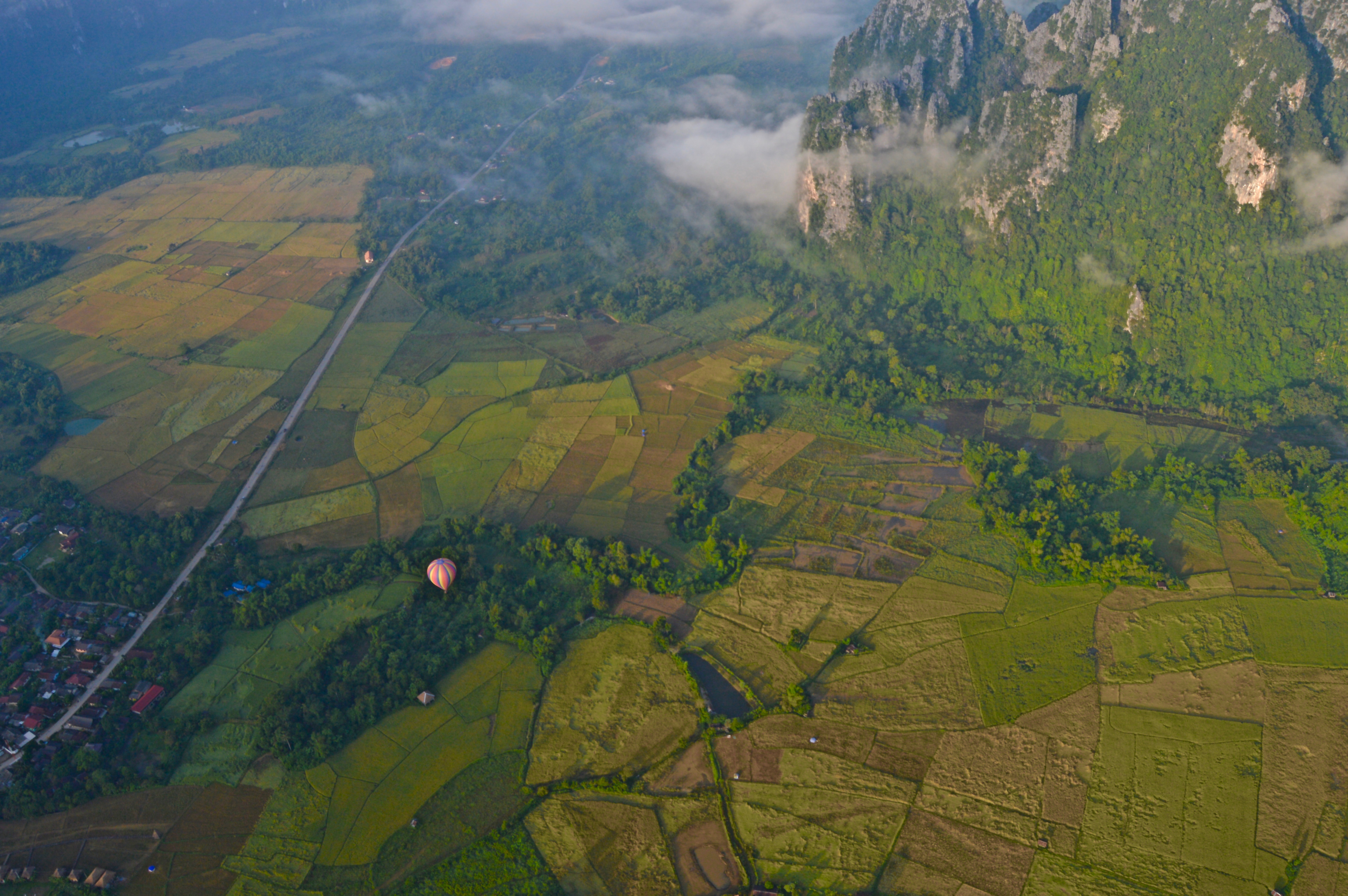
Vang Vieng is a small backpacker town located in the sleepy, land-locked, mountainous, and oft-forgotten on the Southeast-Asia-tourist-trail nation of Laos. This area, and Laos in general, boasts vast rural landscapes of rice fields stretching to all horizons, impressive steep mountainous terrain, and wild rivers cutting through narrow valleys and dense forests.
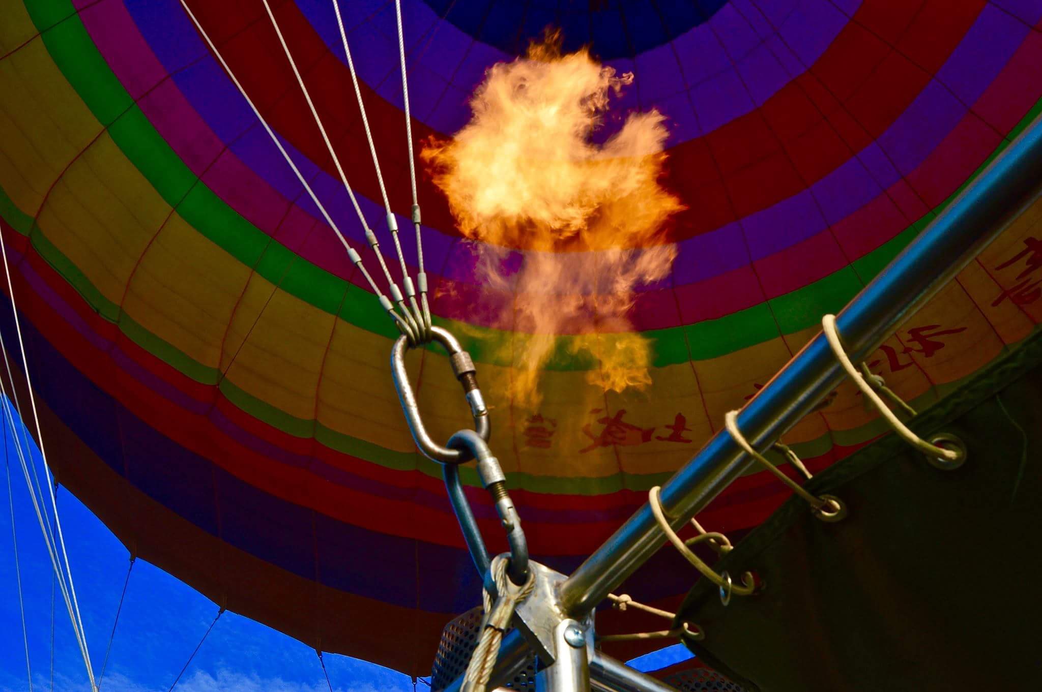
These natural landscapes have made Vang Vieng a center of outdoor recreation including hiking, climbing, and kayaking. It is also home to the cheapest hot air balloon rides in the world…which can either be a good or bad thing depending on your perspective and risk-tolerance.
I hopped on the early morning balloon ride for $90 dollars and spent the better part of an hour shooting and taking in the awe-inspiring views from 2000 feet high as the golden hues of sunrise spilled across the landscape.
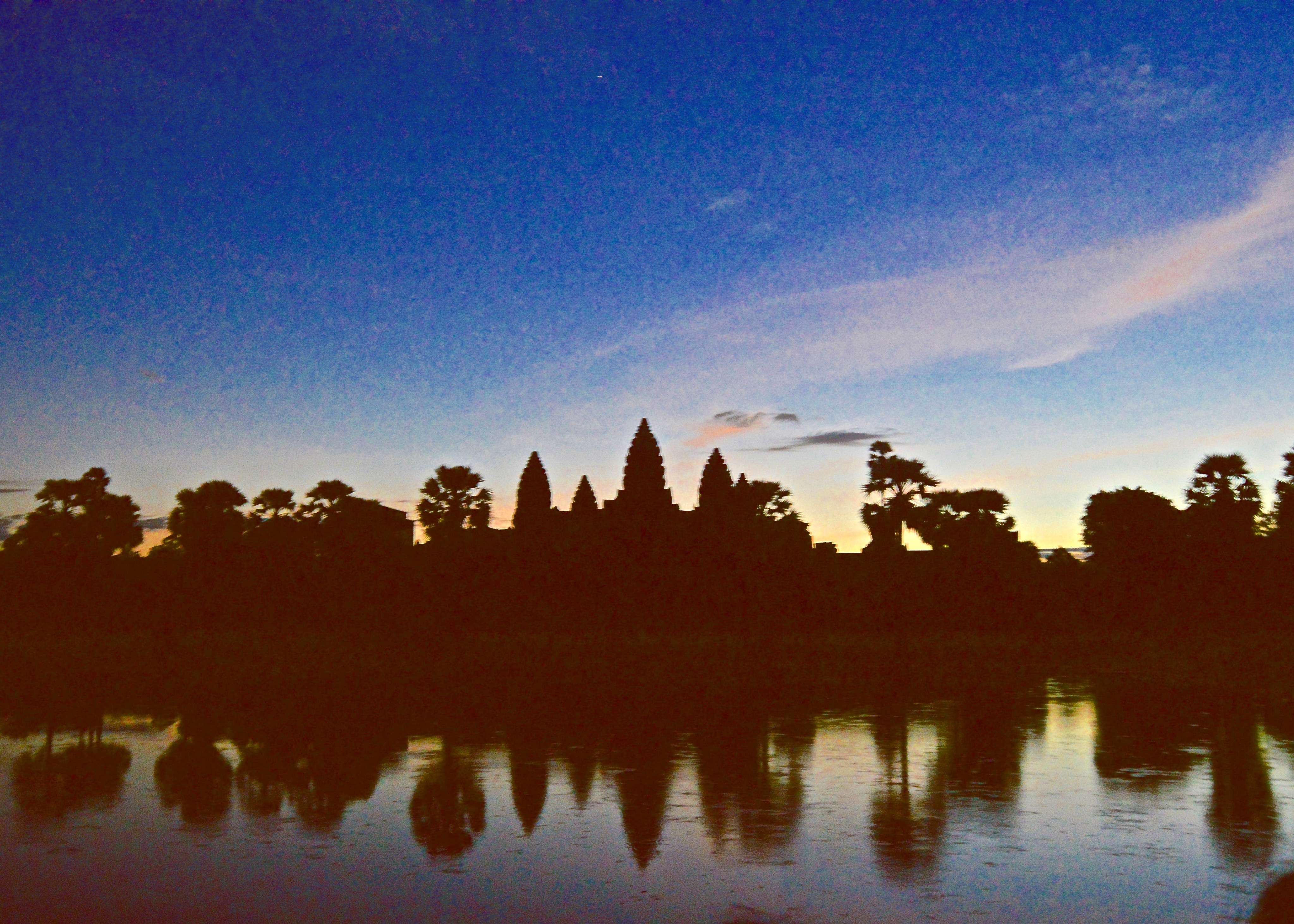
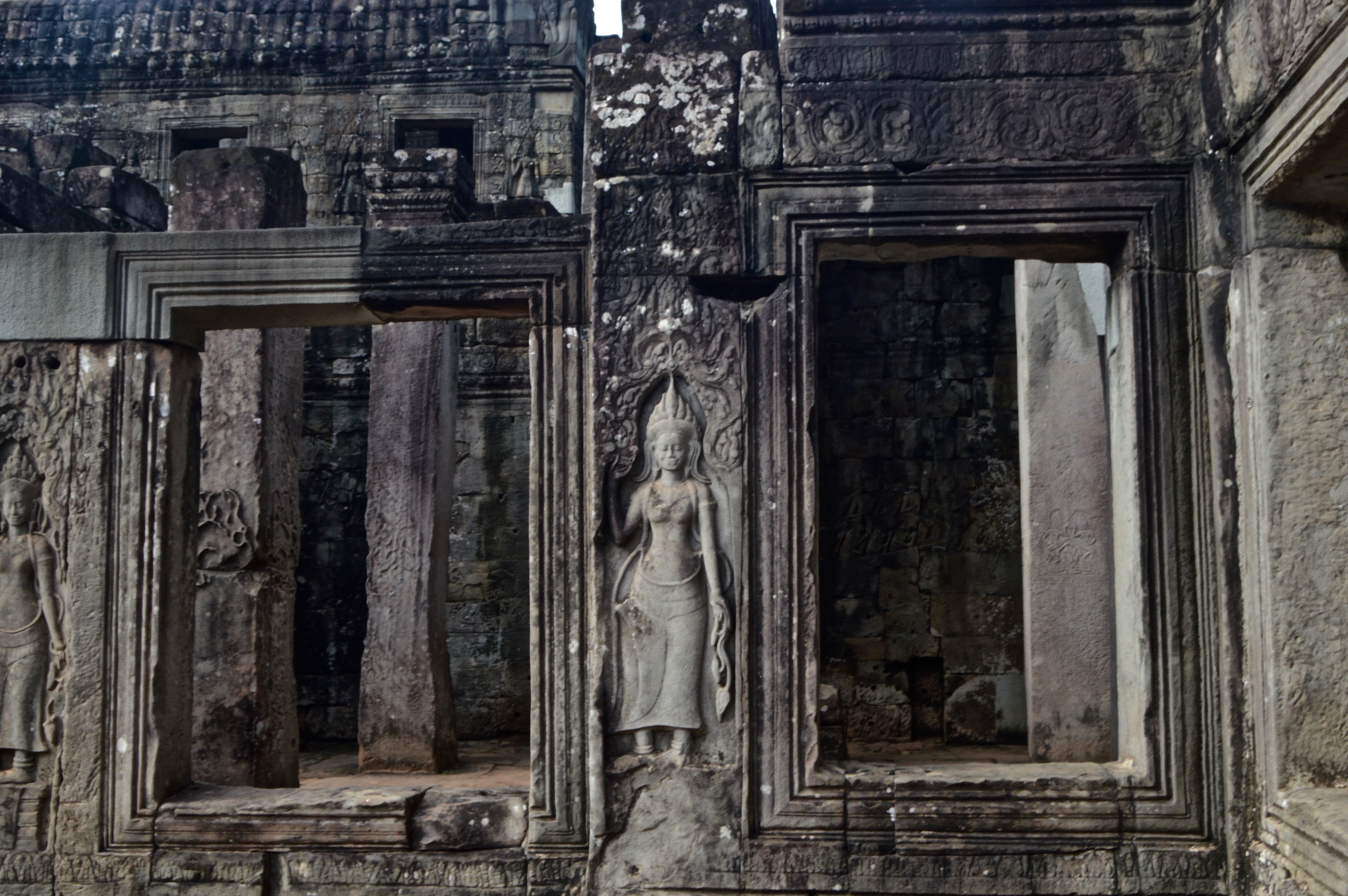
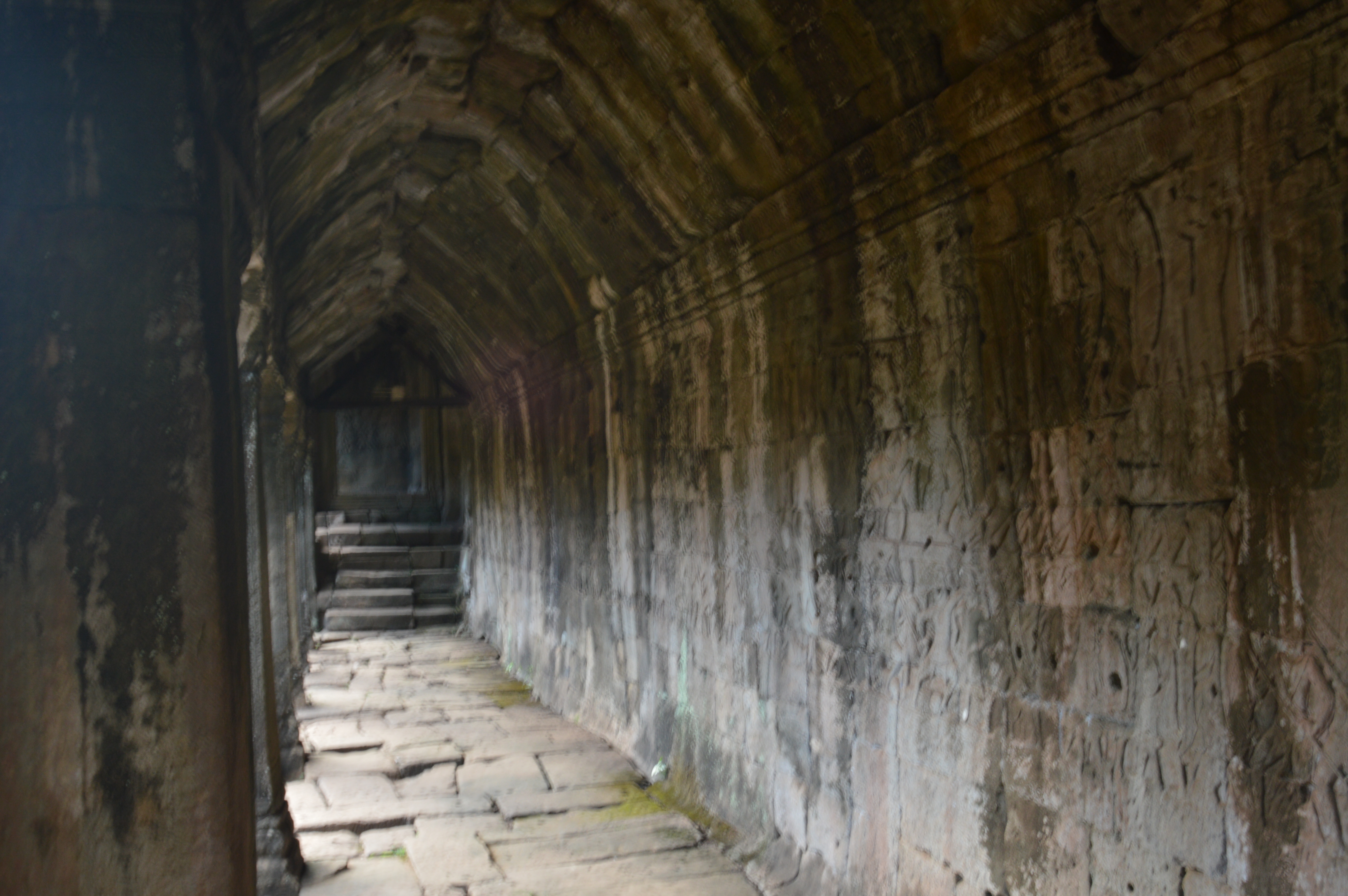
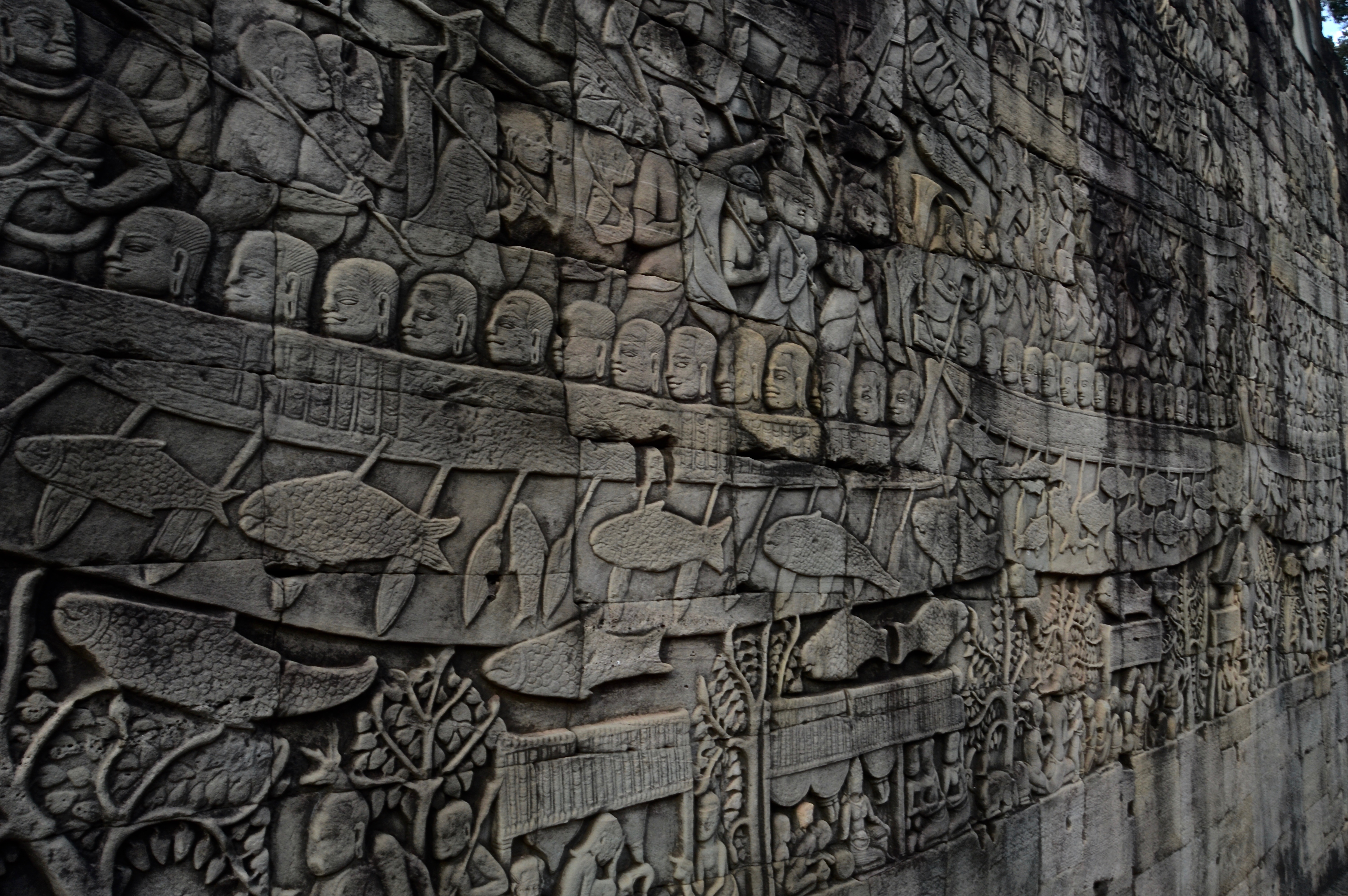
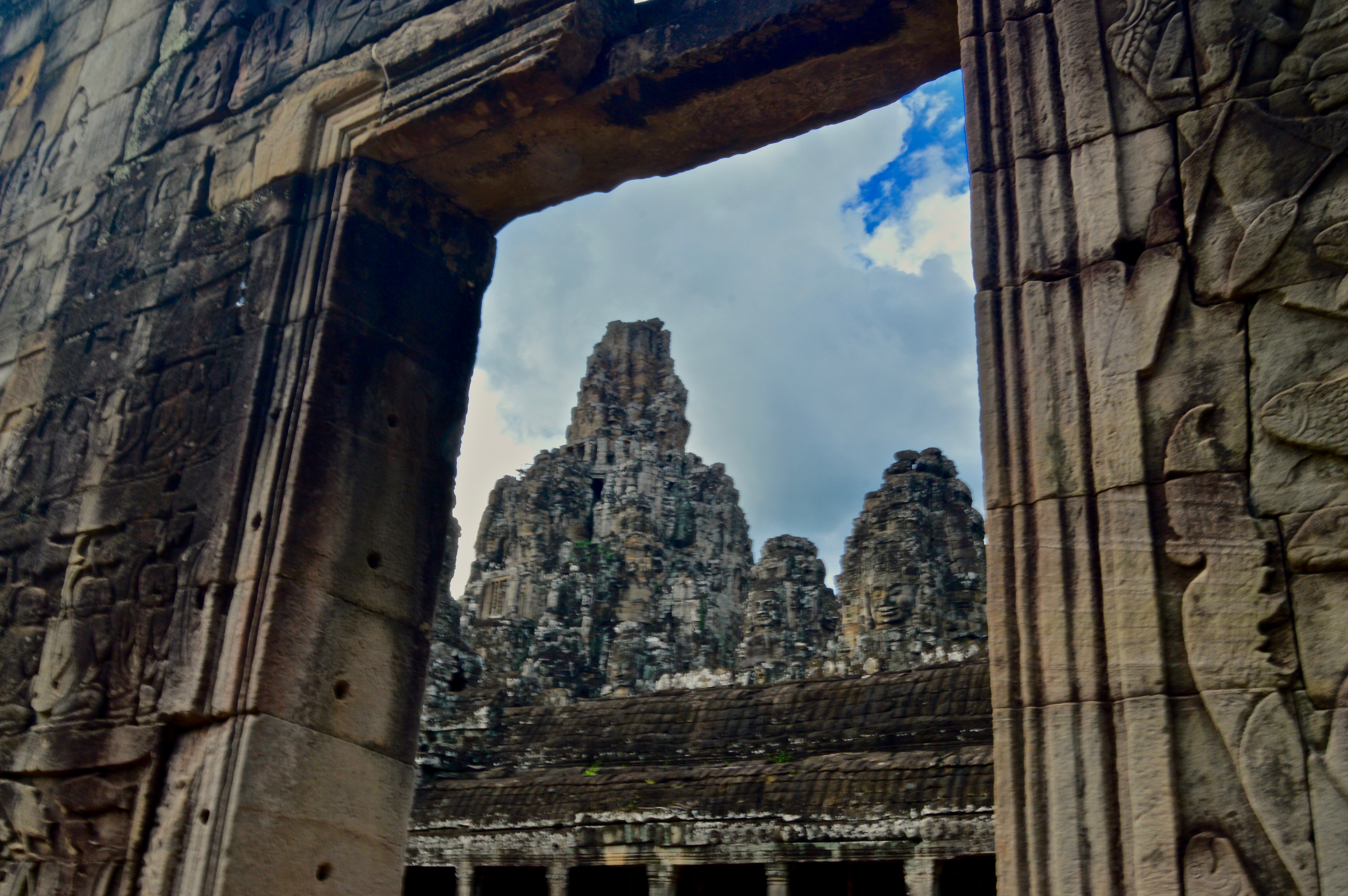
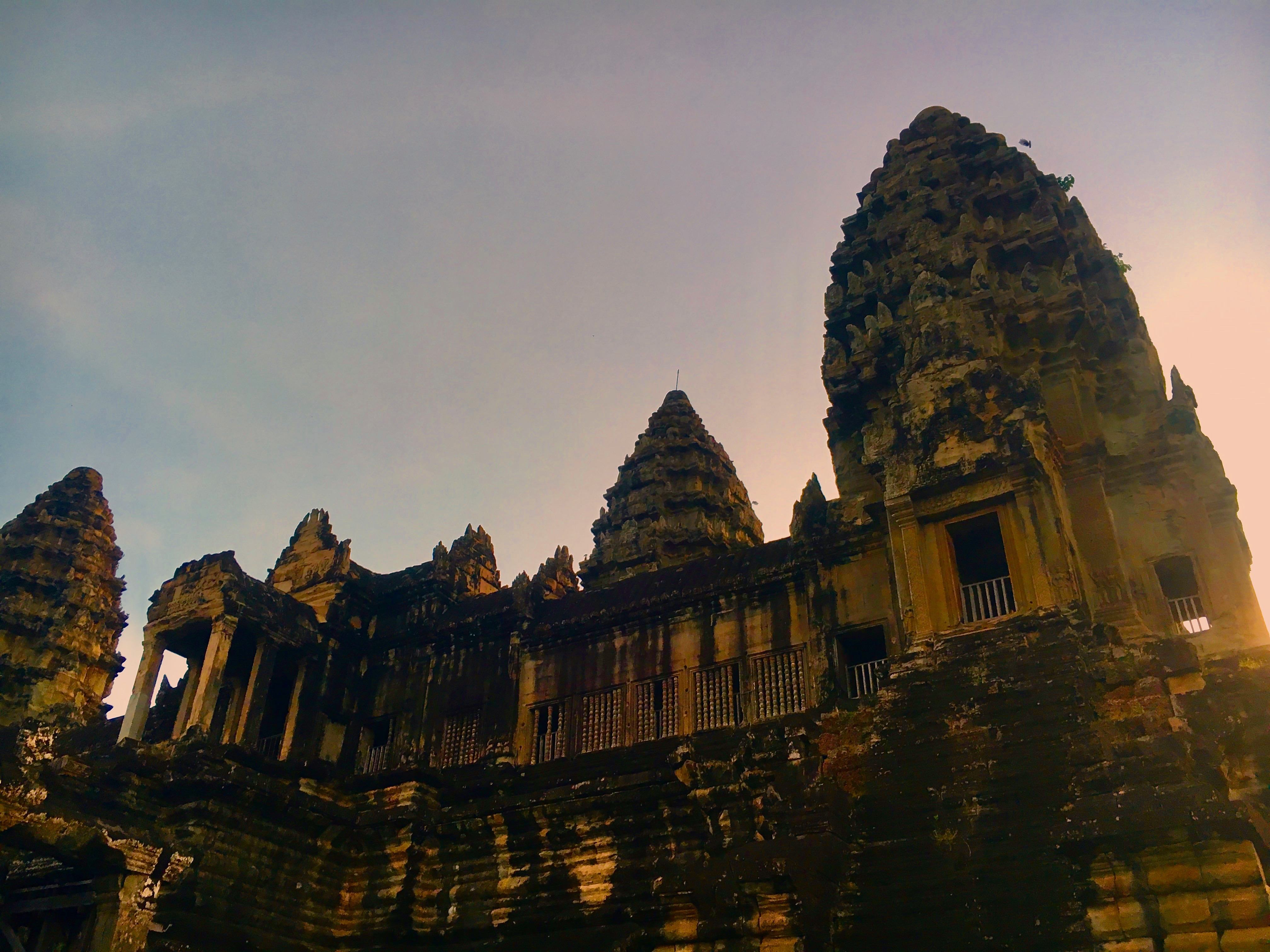
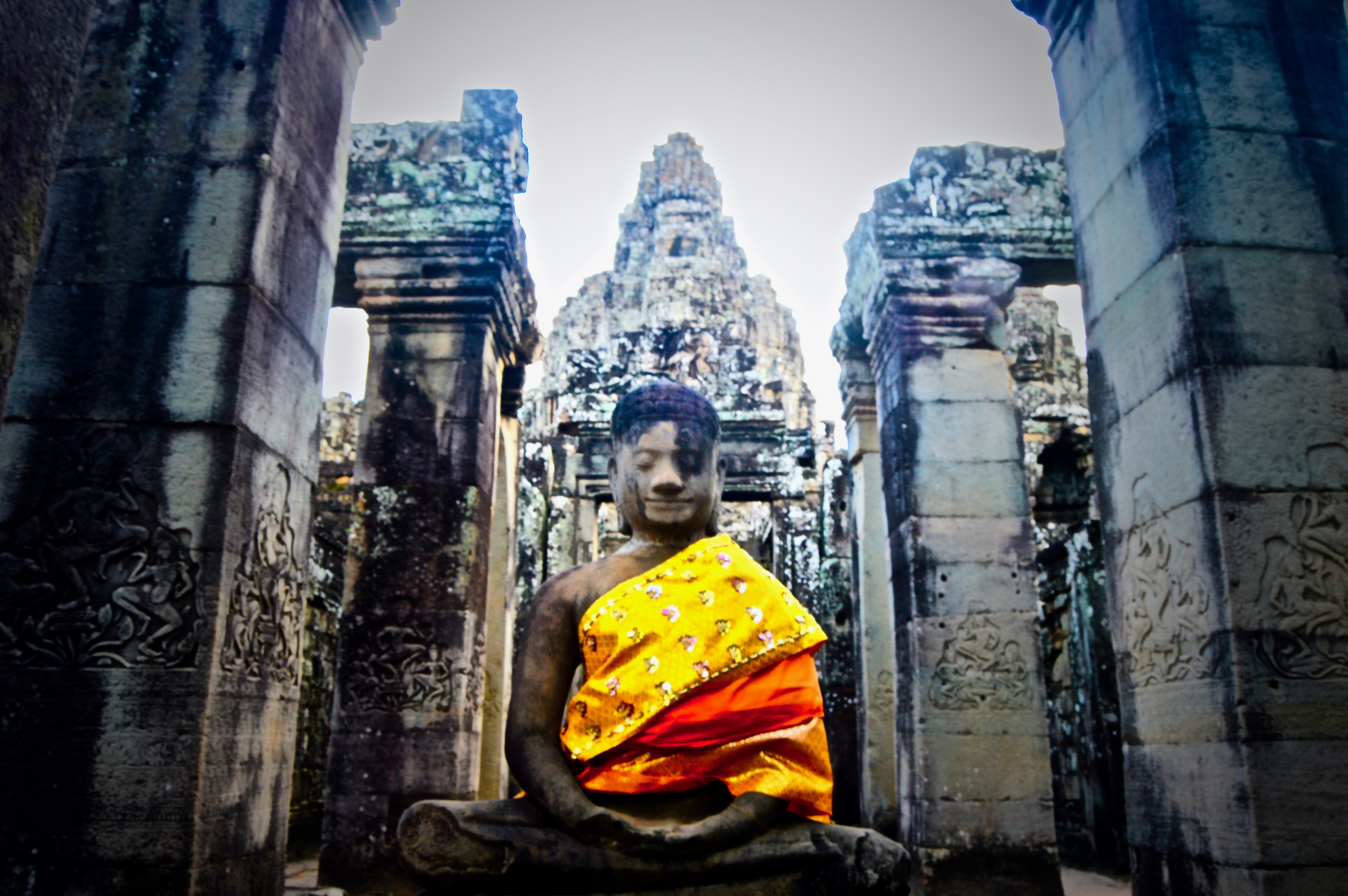
Angkor Wat is a complex of ancient temples located near Siem Reap, Cambodia. Originally built as a Hindu temple towards the end of the 12th century, it was later converted to a Buddhist temple, and is still to this day the largest religious monument in the world.
While over-run with tourists during open hours–resembling an almost Disney-esque experience of waiting in long lines under the hot, humid sun and innocent faces smiling into cameras held up by selfie-sticks–Angkor Wat is nonetheless an impressive sight boasting vast historical and architectural significance.
In order to beat the crowds, plan an early wake-up call and arrive at the temple’s opening while it’s still dark. I was one of the first to arrive when I visited and enjoyed nearly a full hour of exploring the temples in isolation and cool, dry temperatures. Oh, and I also witnessed a once-in-a-lifetime sunrise as the day’s first light rose over the main temple, pouring its golden rays across the grassy grounds and aged stone structures.
This comes from a post I wrote for the ISA Student Blog back when I was studying abroad in Bangkok, Thailand in 2016. Click here for the original post.
While always full of new sights and experiences, the bustling metropolis of Bangkok, Thailand can feel a bit overwhelming at times. Sometimes we just need to escape the smog and noise of the city and relax in nature. Thailand is full of natural beauty, but many of the common postcard-worthy locations are in the north or the southern islands and require multi-day trips. If you are a busy college student and only have a day or two to spare, no need to worry, there are many options to find fresh air and outdoor activities near Bangkok. The following three locations are all within a few hours of the city and provide one-of-a-kind views and unforgettable experiences with wildlife.
Khao Yai National Park
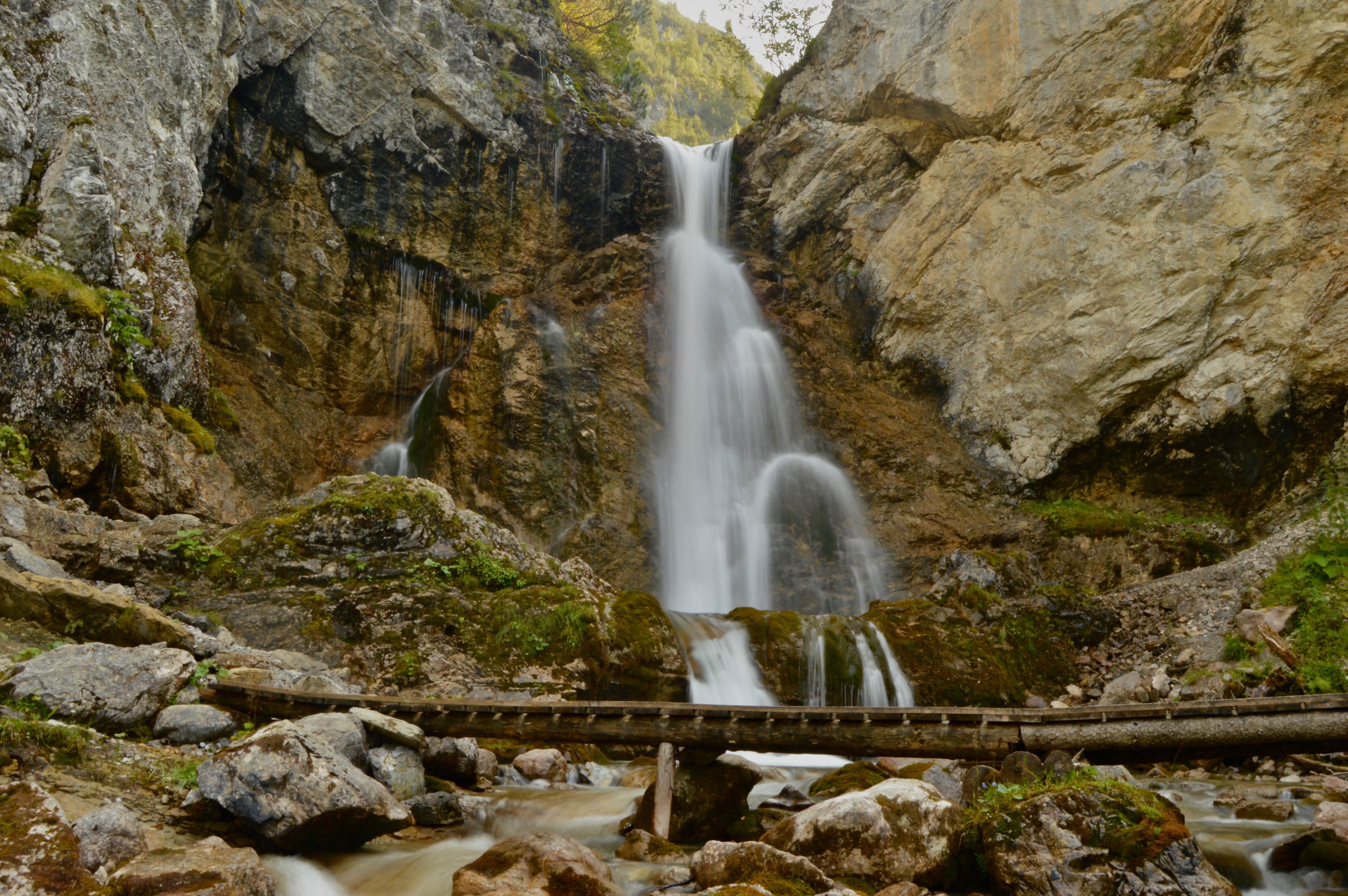
Located north of Bangkok, Khao Yai National Park is the largest national park in Thailand. Upon arriving at the park, you will likely be immediately greeted by large groups of macaques scavenging for food or grooming each other on the side of the road. Look more closely and the park’s other primate species, gibbons, can be seen gracefully swinging between trees and vines. Other wildlife commonly found include elephant, deer, and horn bills. According to our guide, there are only ten Tigers left in the park and you would have to be extraordinarily lucky (or unlucky!) to spot one. A guided day tour in the park will include jungle trekking and visiting several majestic waterfalls. The most famous being Haew Suwat waterfall, immortalized by the film ‘The Beach’ when Leonardo DiCaprio’s character leapt dozens of feet into the pool below. Make sure to bring long pants and proper shoes for Khao Yai, as leaches are common and river crossings are often unavoidable.

Erawan Falls National Park
To the west of Bangkok, near Kanchanaburi, lies another of Thailand’s many national parks. Despite its proximity to Bangkok and Kanchanaburi, Erawan Falls is rarely overcrowded with tourists and can be a nice place to relax and unwind. There is a series of waterfalls along an easily walk-able path that leads to several different emerald green pools where one can escape the heat. Make sure you walk all the way to the top, as there will be less people and you might even have your own private swimming hole!

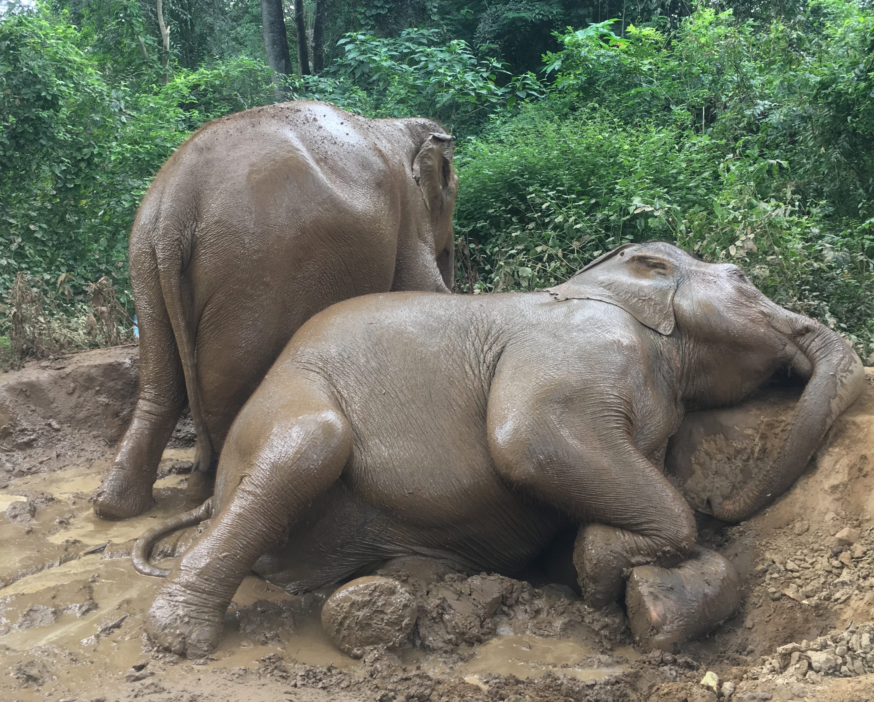
Elephant Haven Thailand
Also near Kanchanaburi is a quiet elephant sanctuary along the river called Elephant Haven. Elephants are an important symbol for Thailand and it is on almost every travelers bucket list to see one. However, many elephants have been mistreated for popular tourist activities like elephant riding and elephant shows (read why you shouldn’t ride elephants here). All the elephants at this sanctuary have been rescued from these types of events and now enjoy freedom. A day at Elephant Haven involves swimming with the elephants in the river and bathing and feeding them. Expect to completely fall in love with these magnificent creatures and to come away with an epic new profile picture!

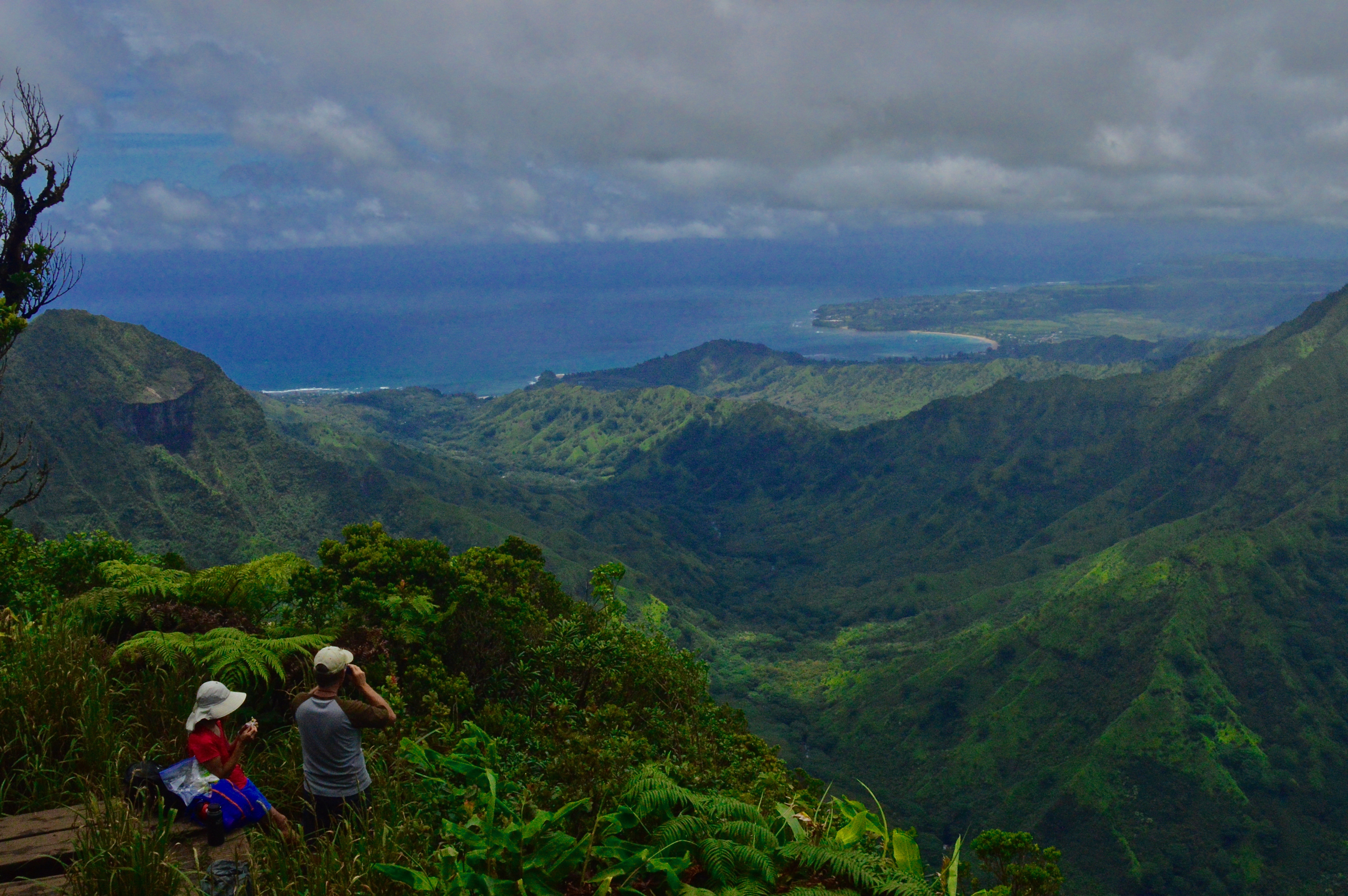
Featured: Overlooking Hanalei Bay
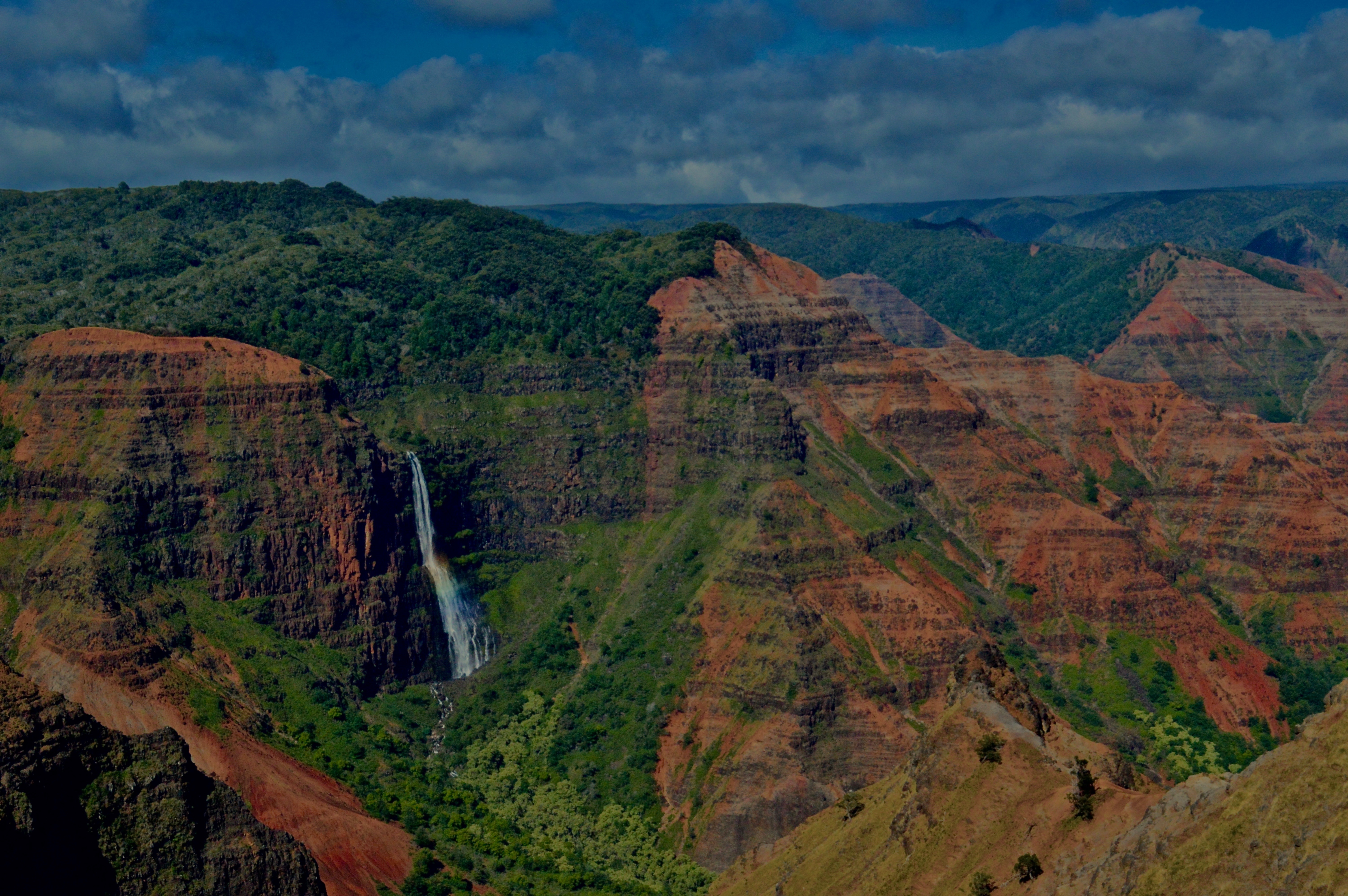
1. A waterfall glides over the cliffs of Waimea Canyon.
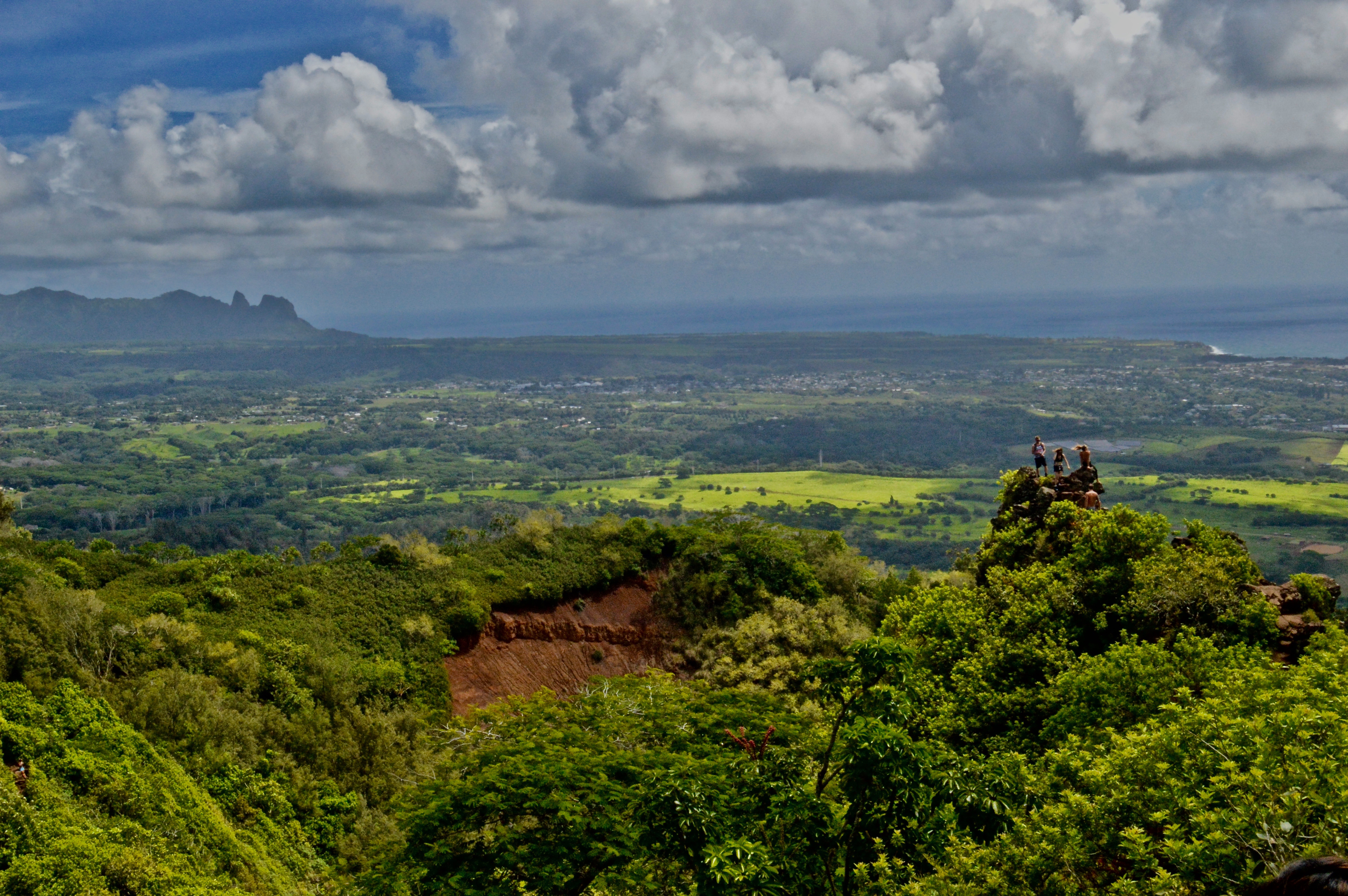
2. Hikers enjoy the view from the chin of the Sleeping Giant.
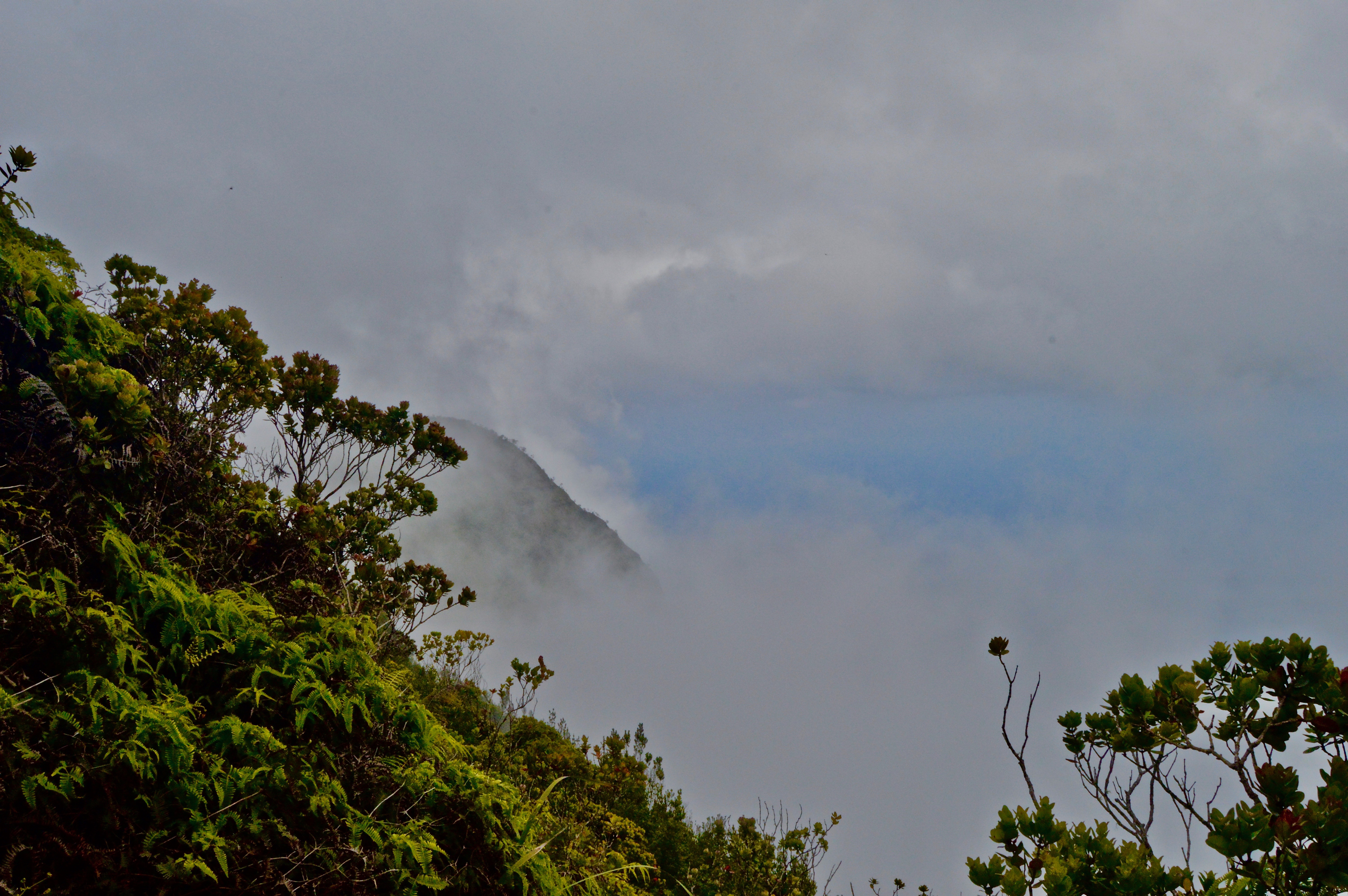
3. Morning fog on the Na Pali Coast.
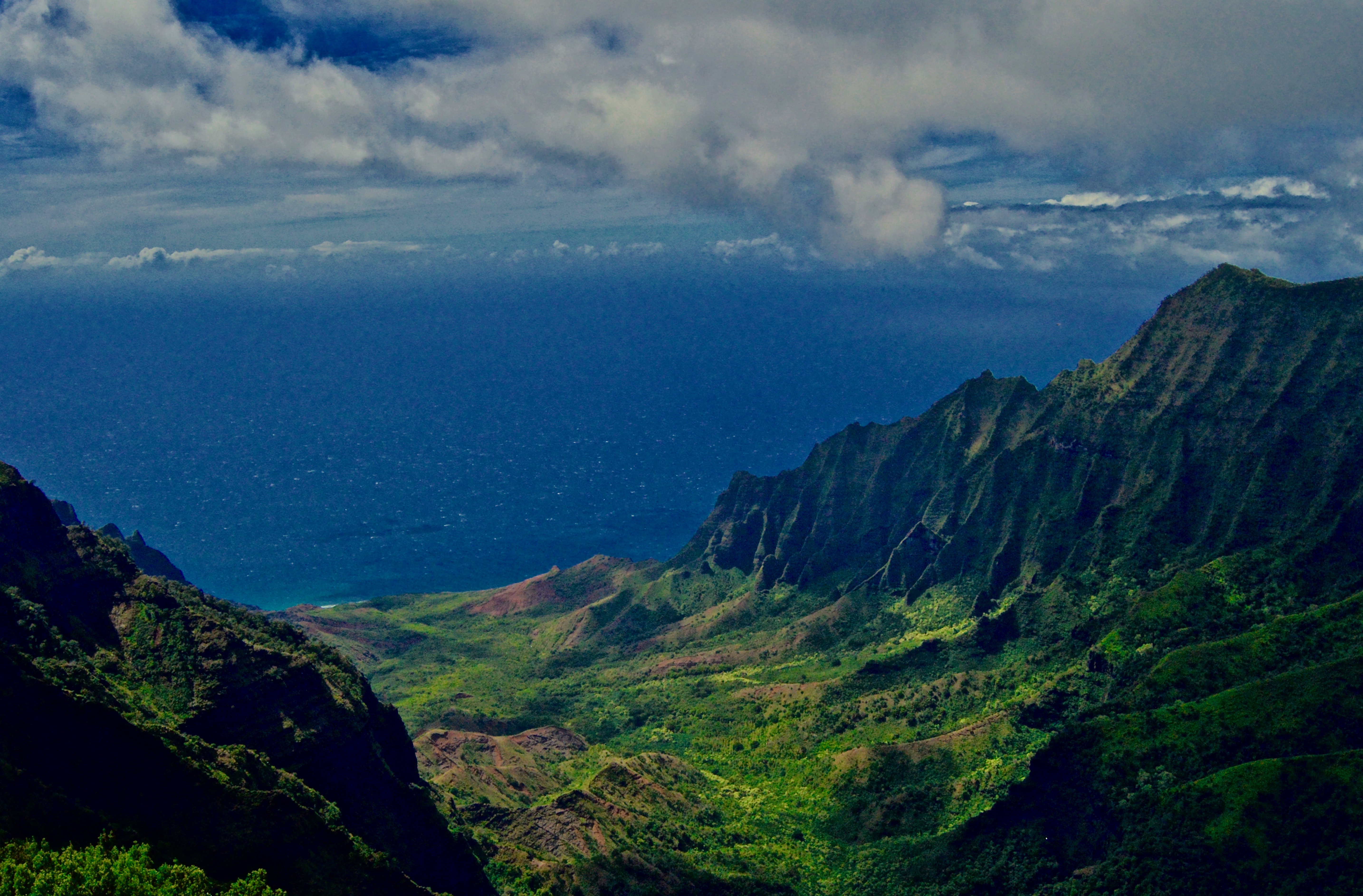
4. The view from above Kalalau Valley.
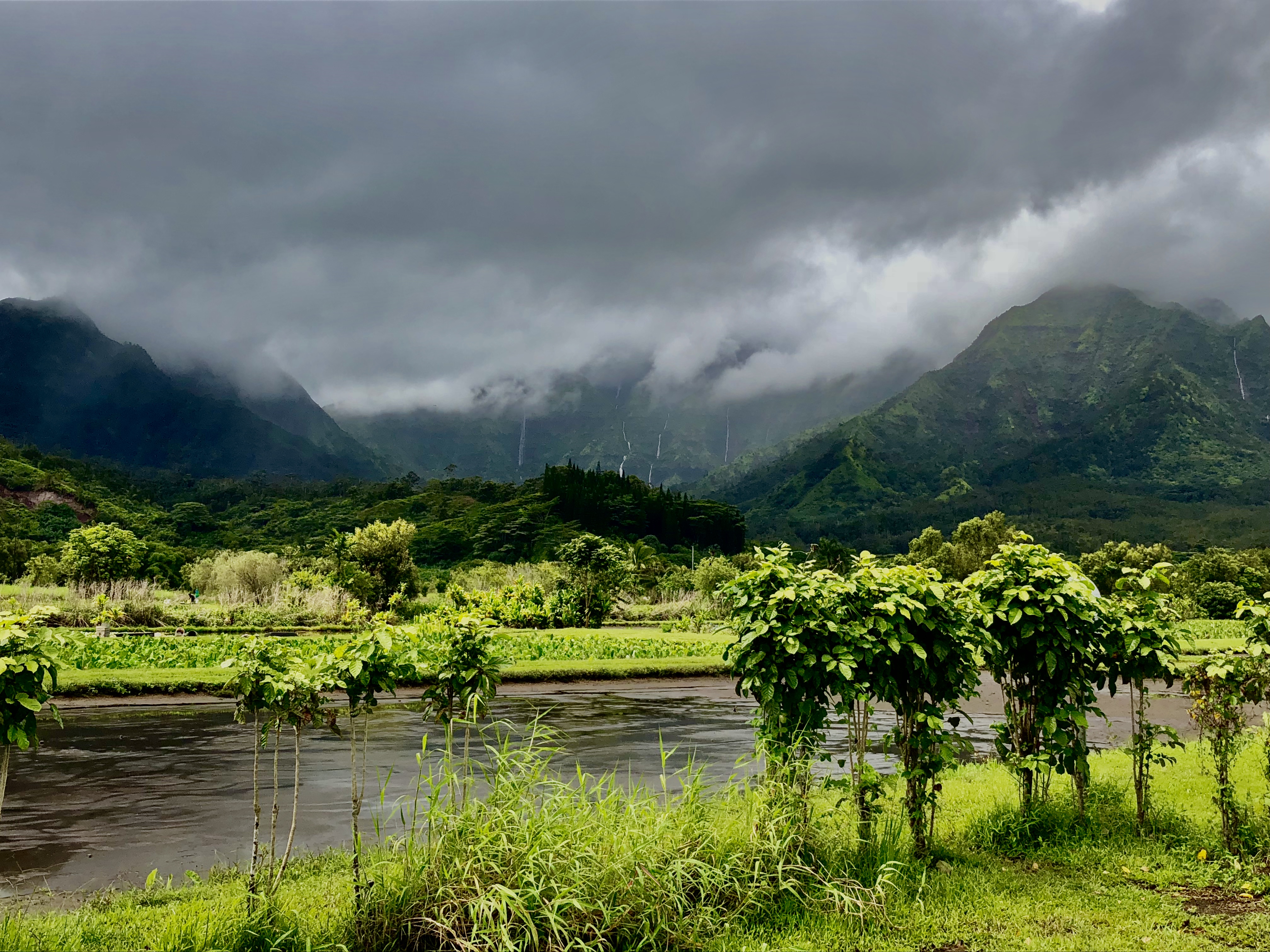
5. Looking towards the mountains from Hanalei.
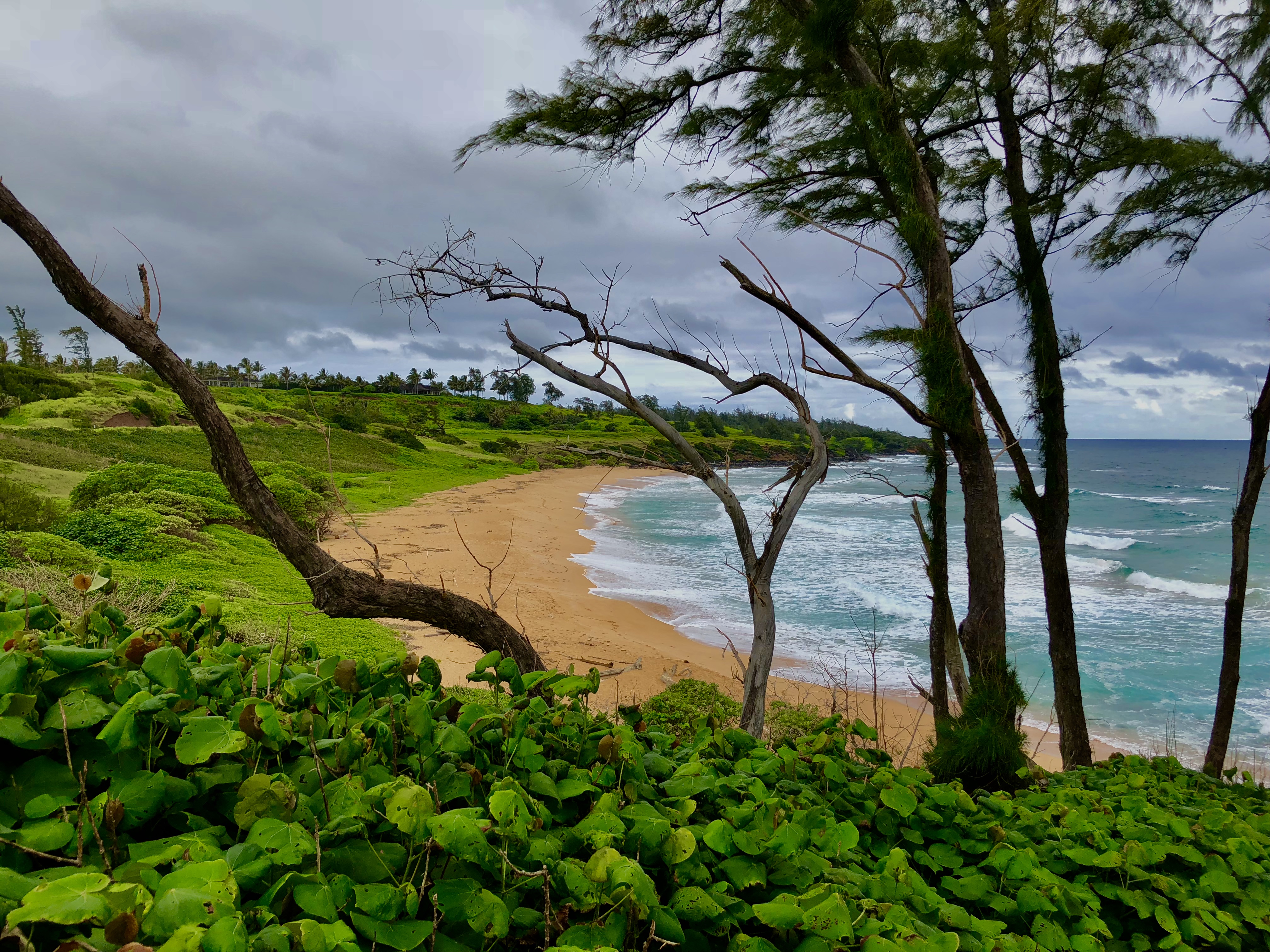
6. A secluded beach on Kauai’s eastern shore.
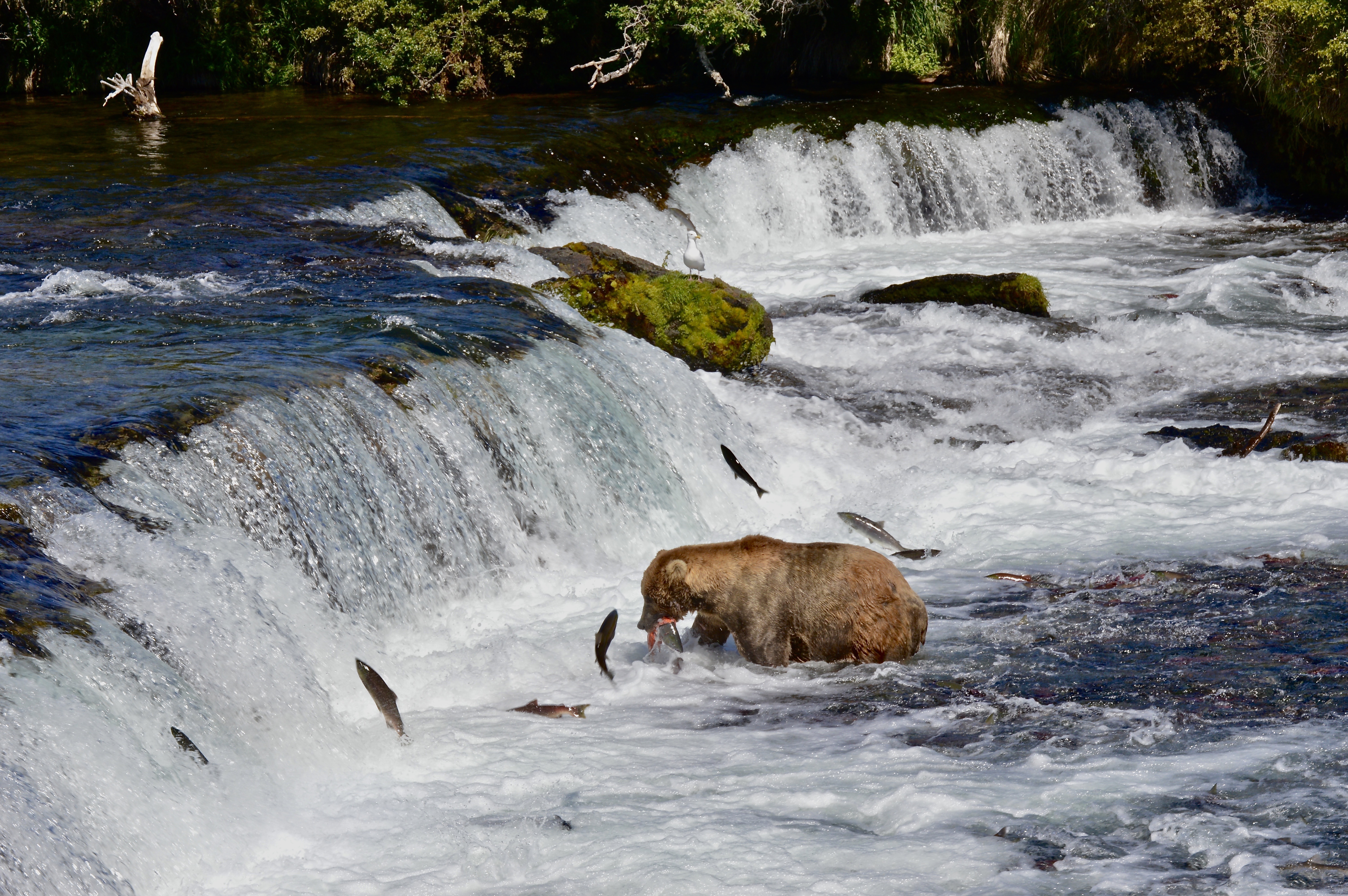
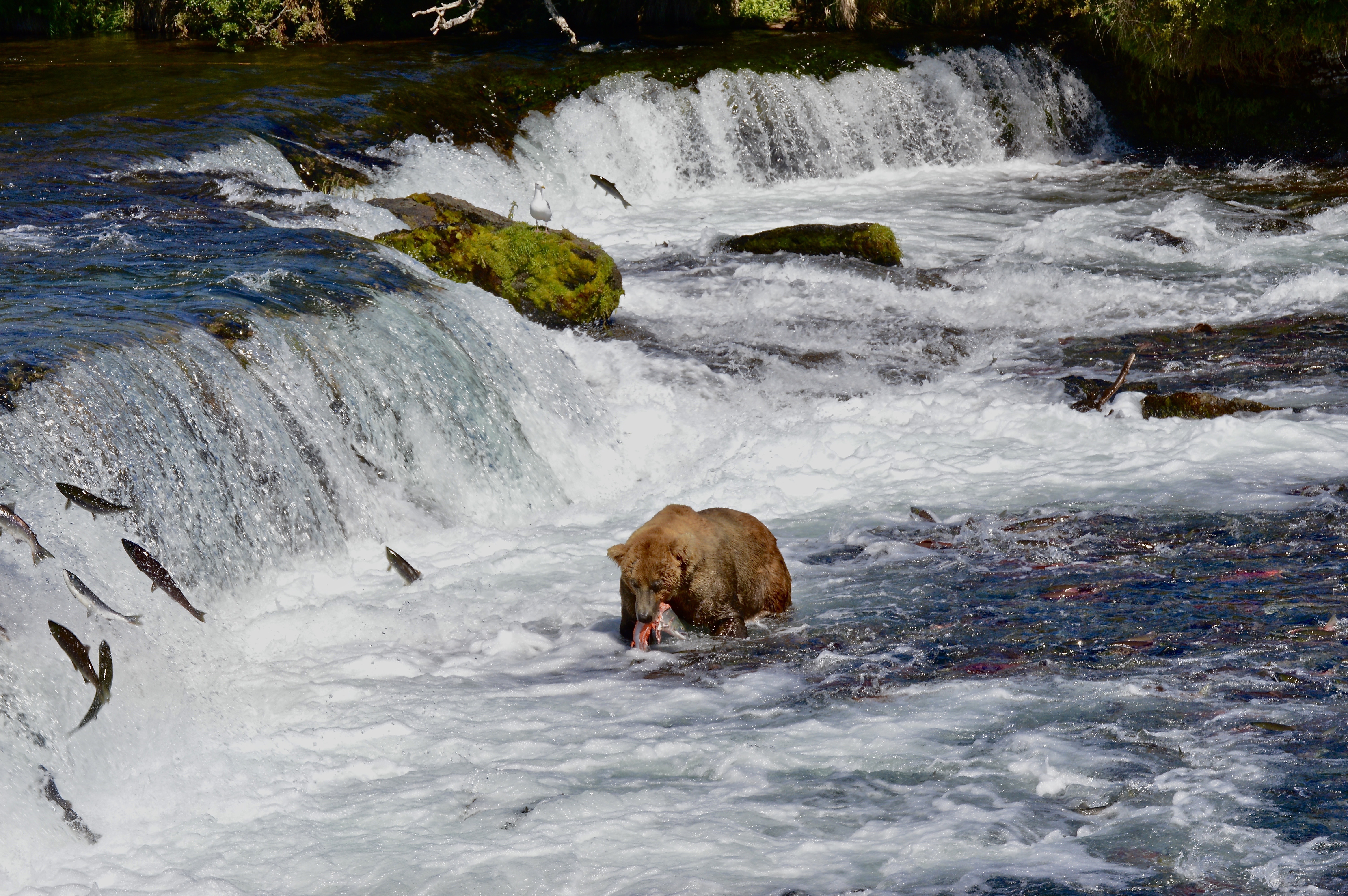
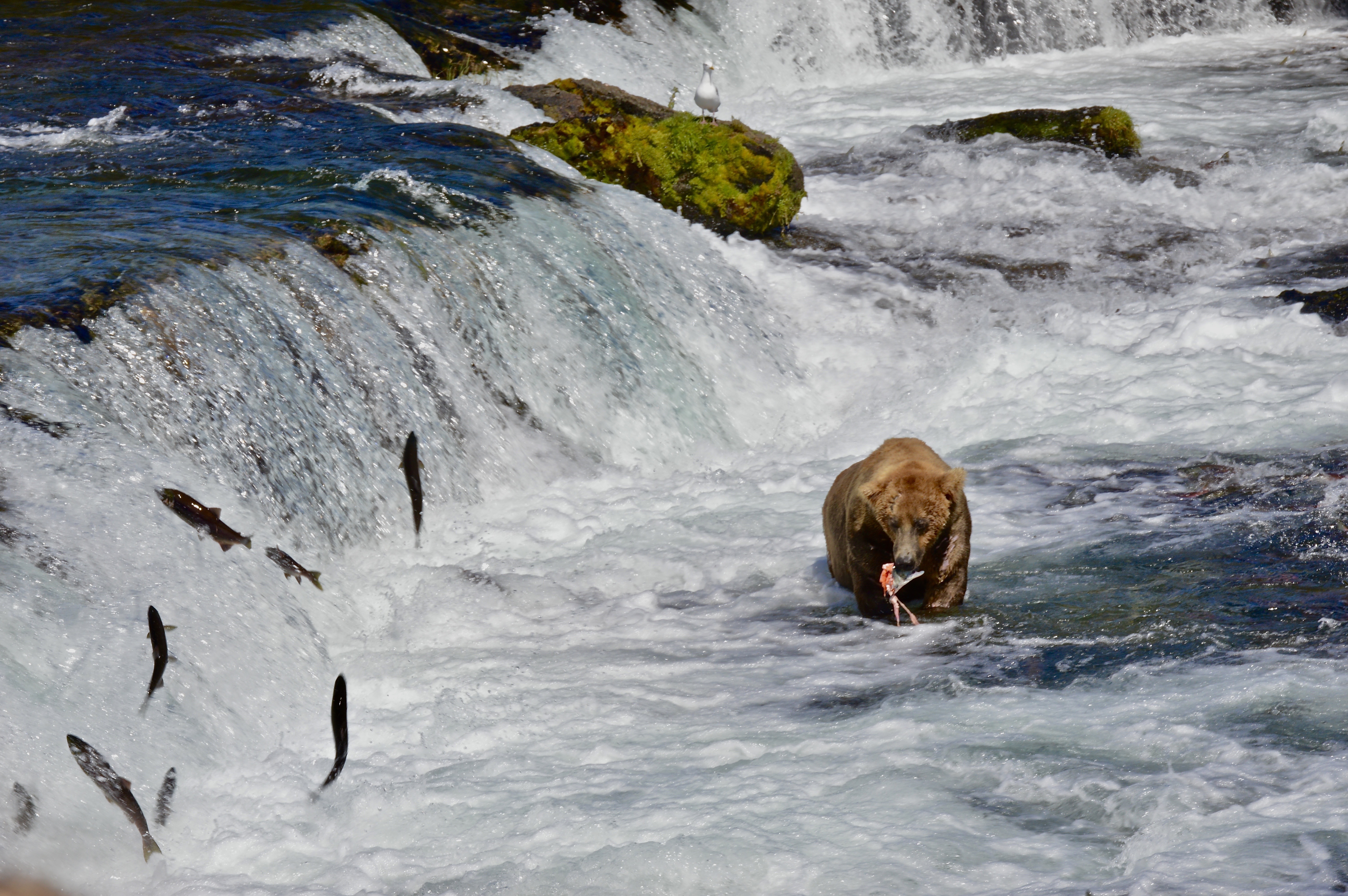
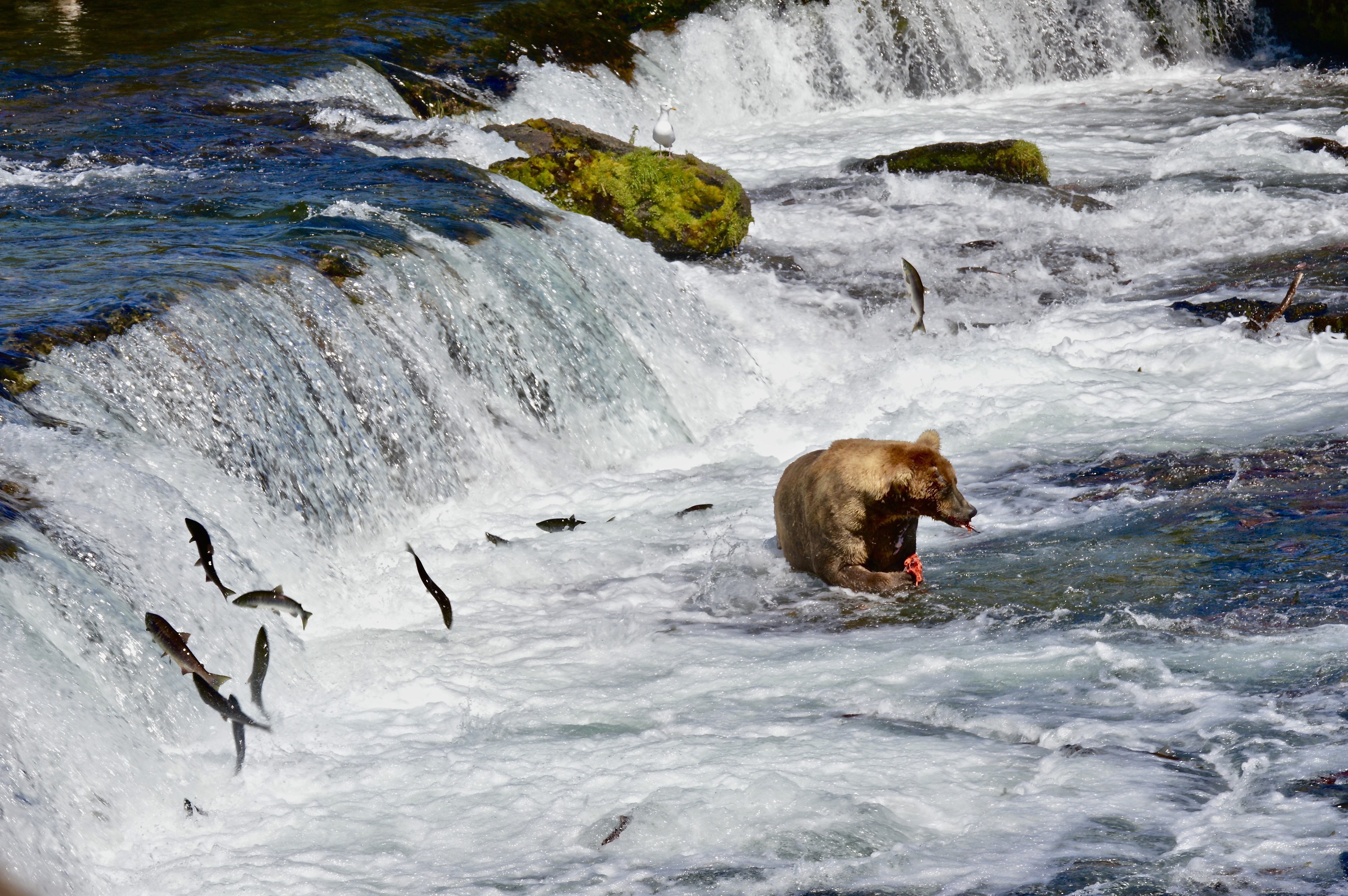
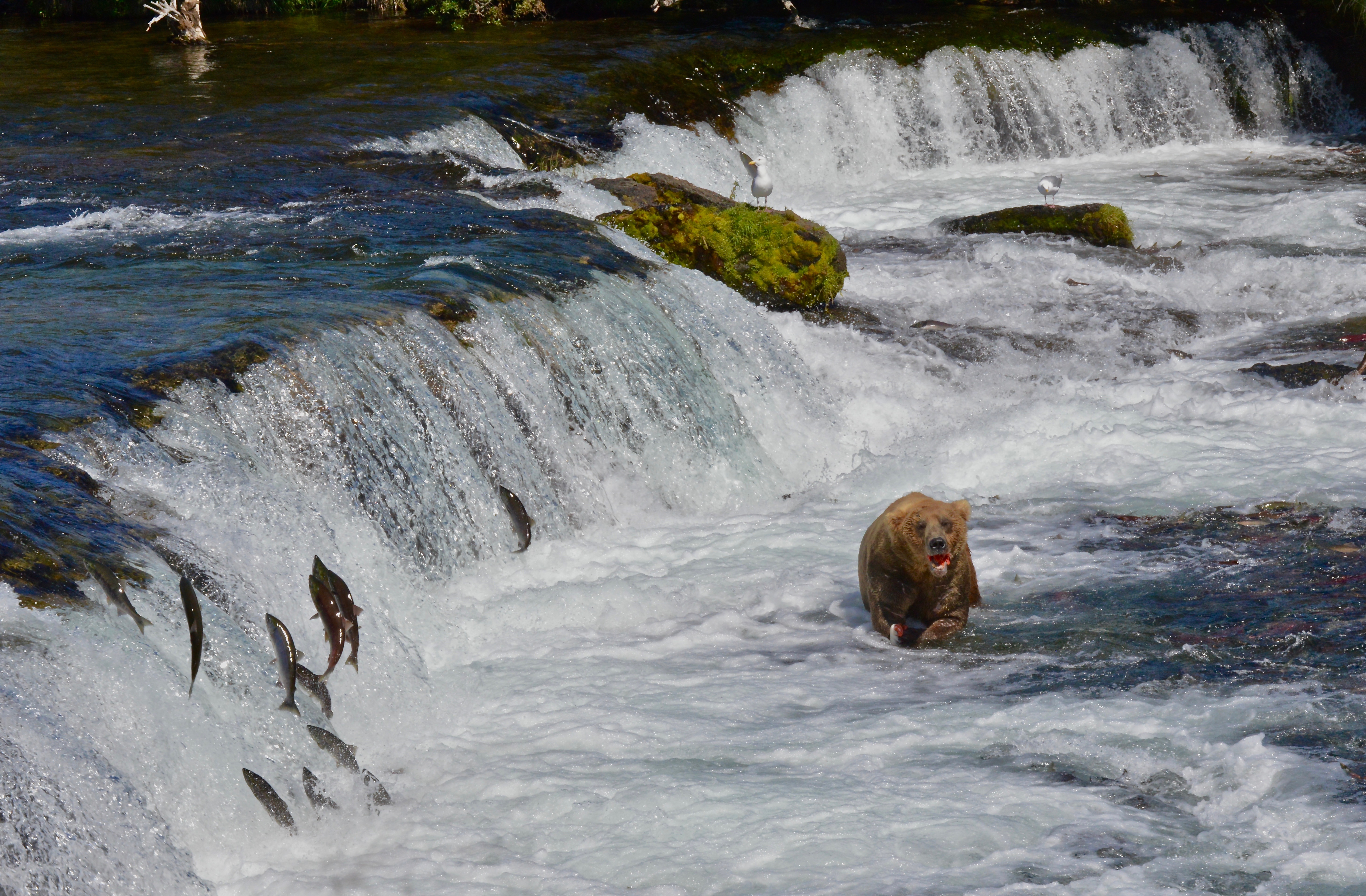
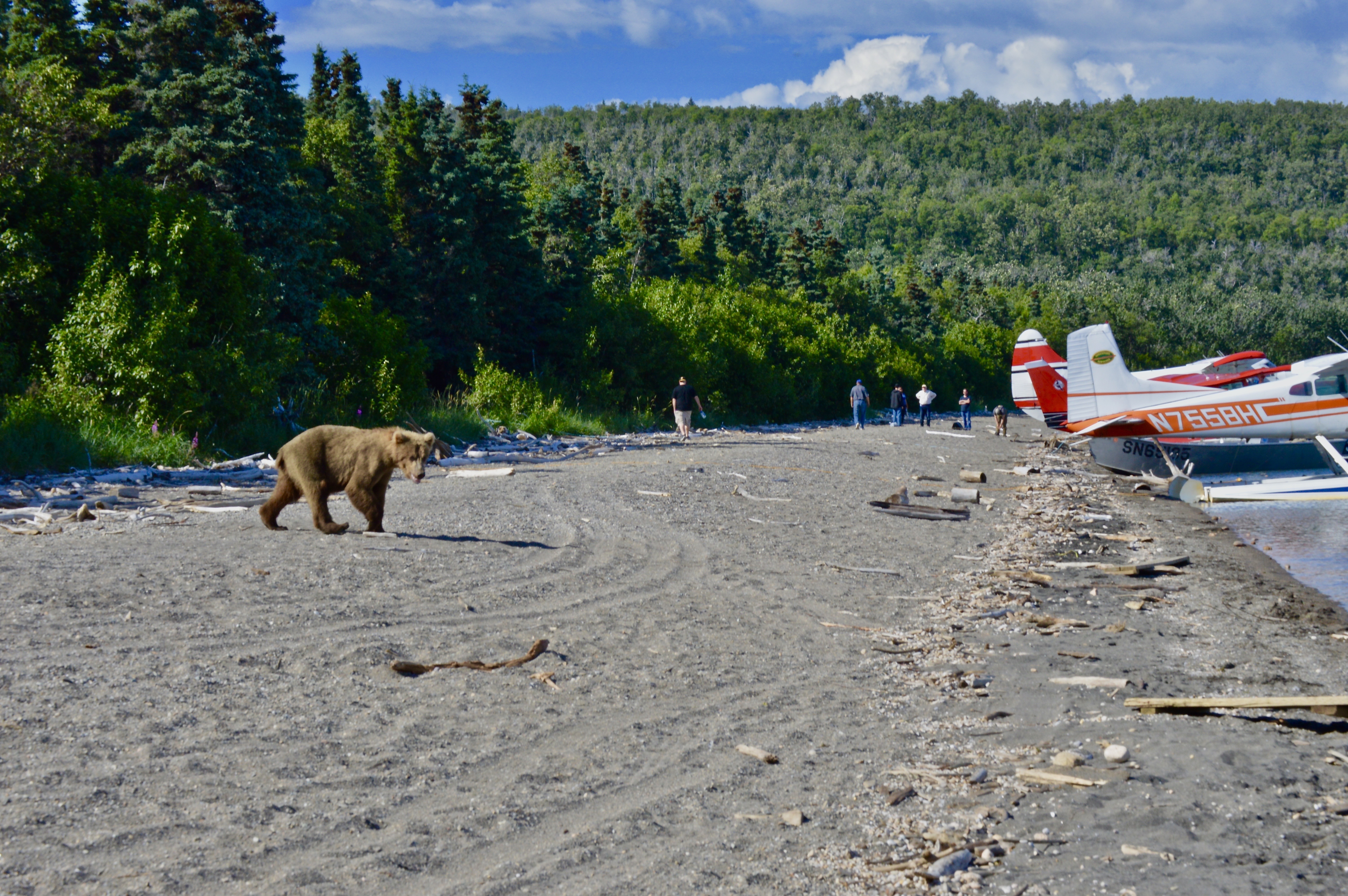
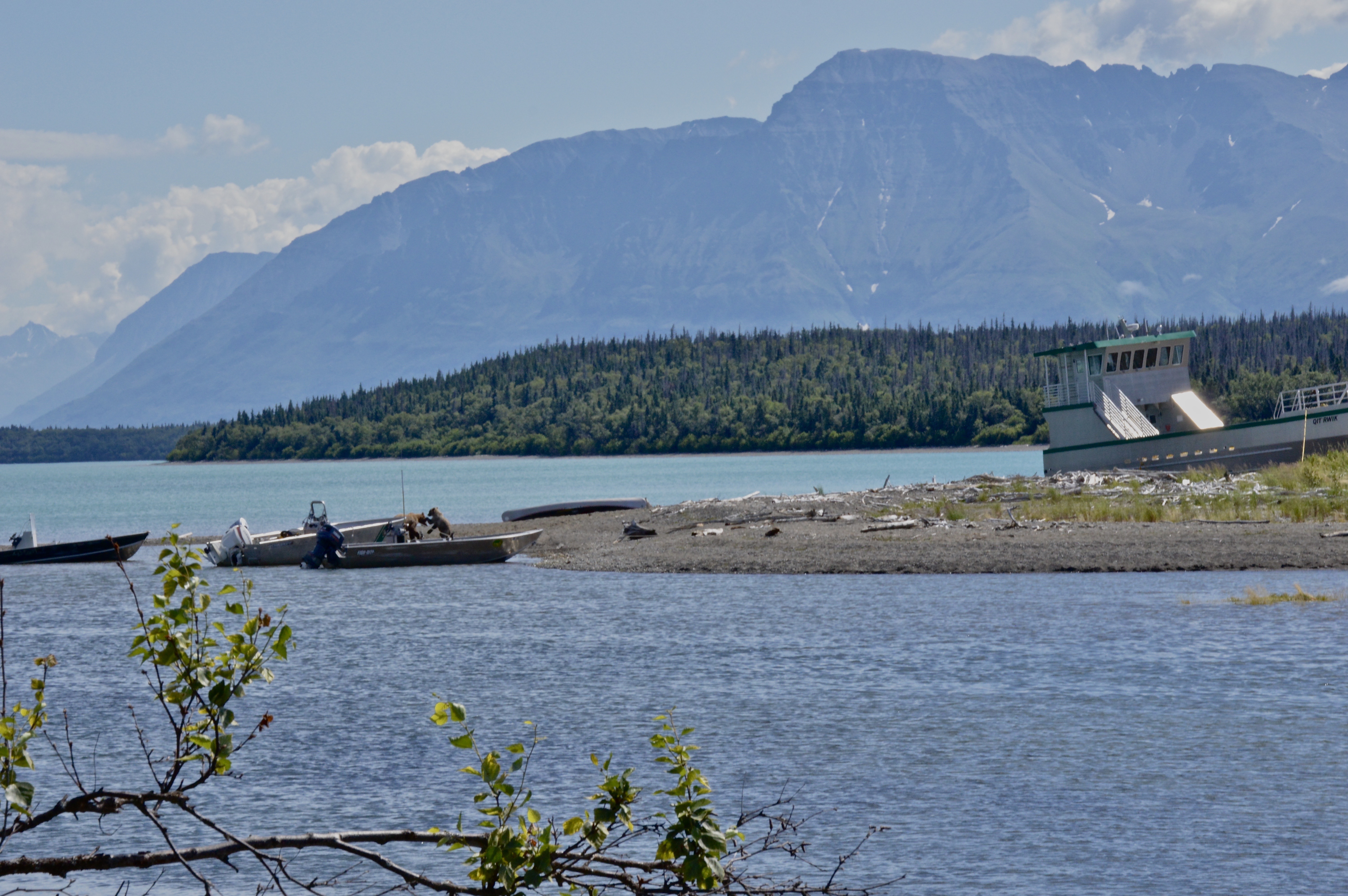
Tourism to Katmai National Park in southwest Alaska is driven by one factor: viewing Alaskan brown bears. The park’s expansive boardwalk system allows one to safely get within close proximity to these majestic beasts. These photos were taken towards the end of July–the end of the peak sockeye run that attracts so many bears to the area.
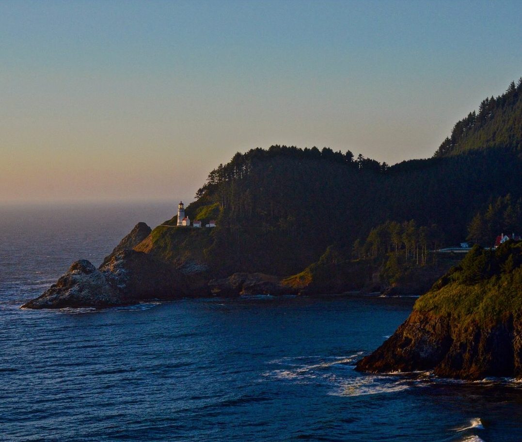
Featured: Heceta Head lighthouse overlooks the Pacific.
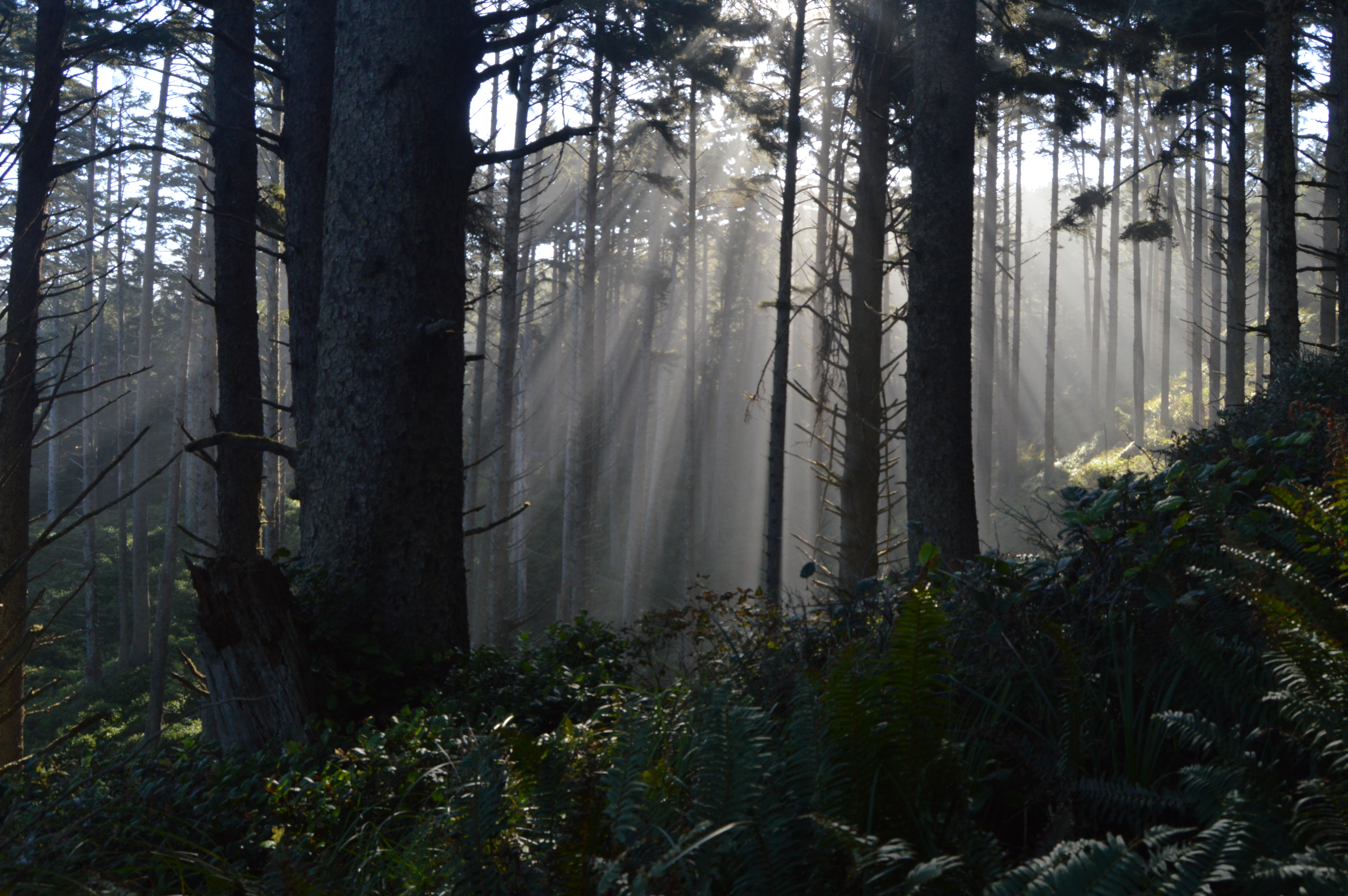
1. Morning light shines through the thick woods of the coast.
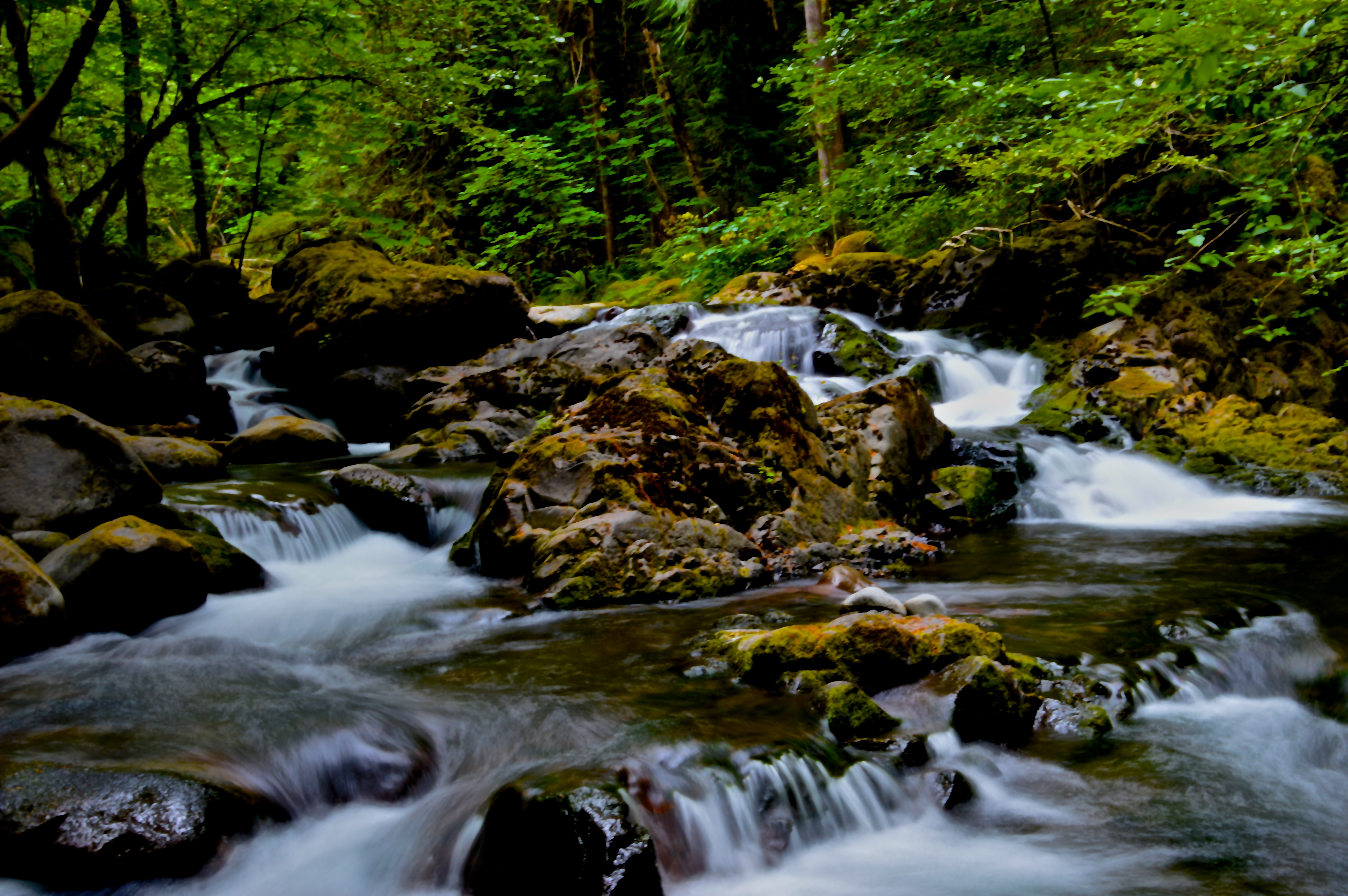
2. The Oregon Coast is a landscape shaped by water–salt and fresh.
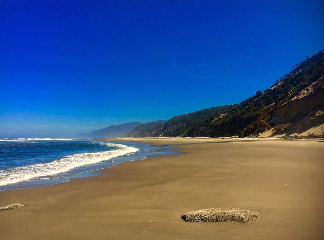
3. A secluded beach near Florence.
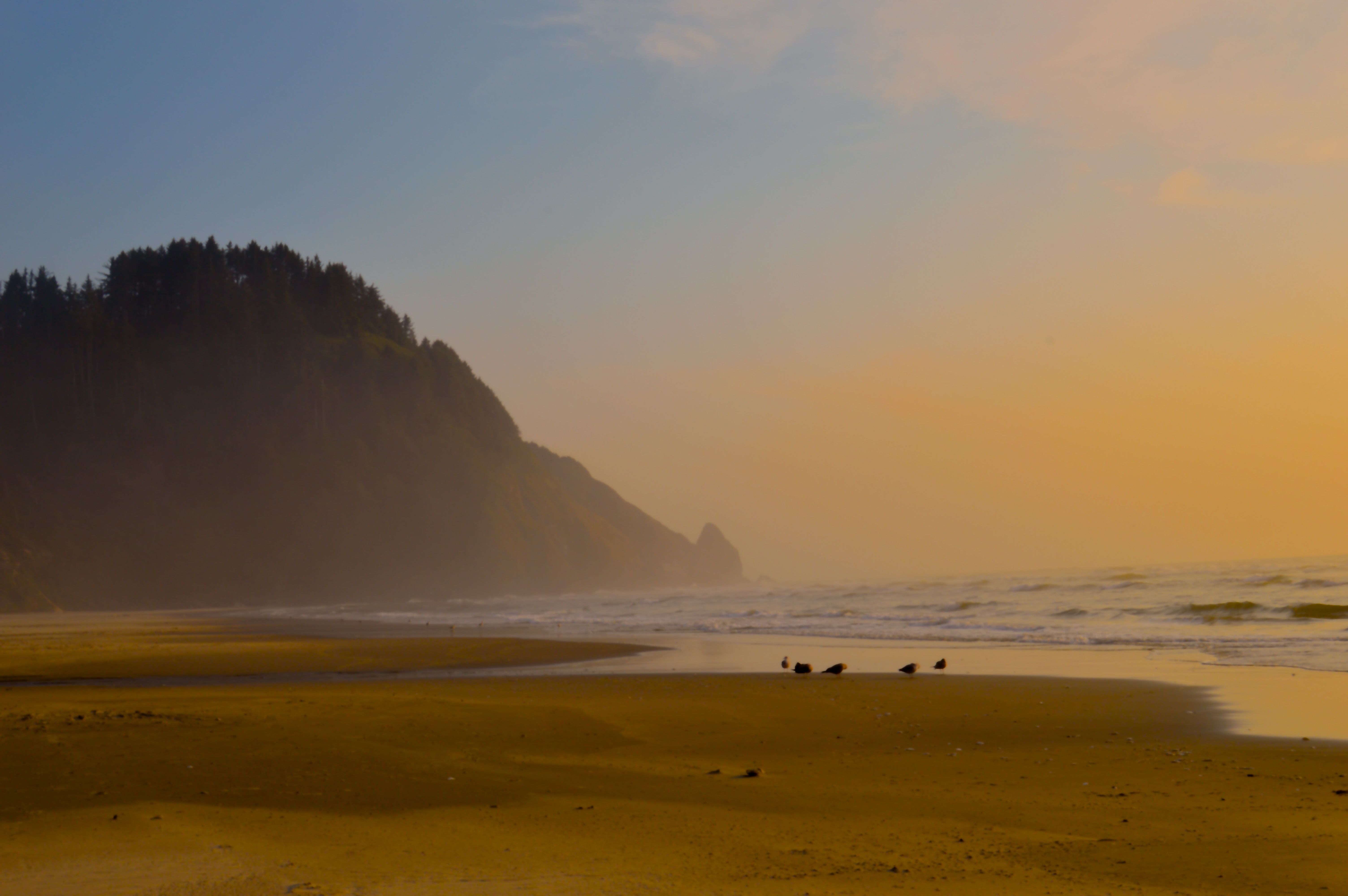
4. Few humans, but plenty of wildlife to be found.
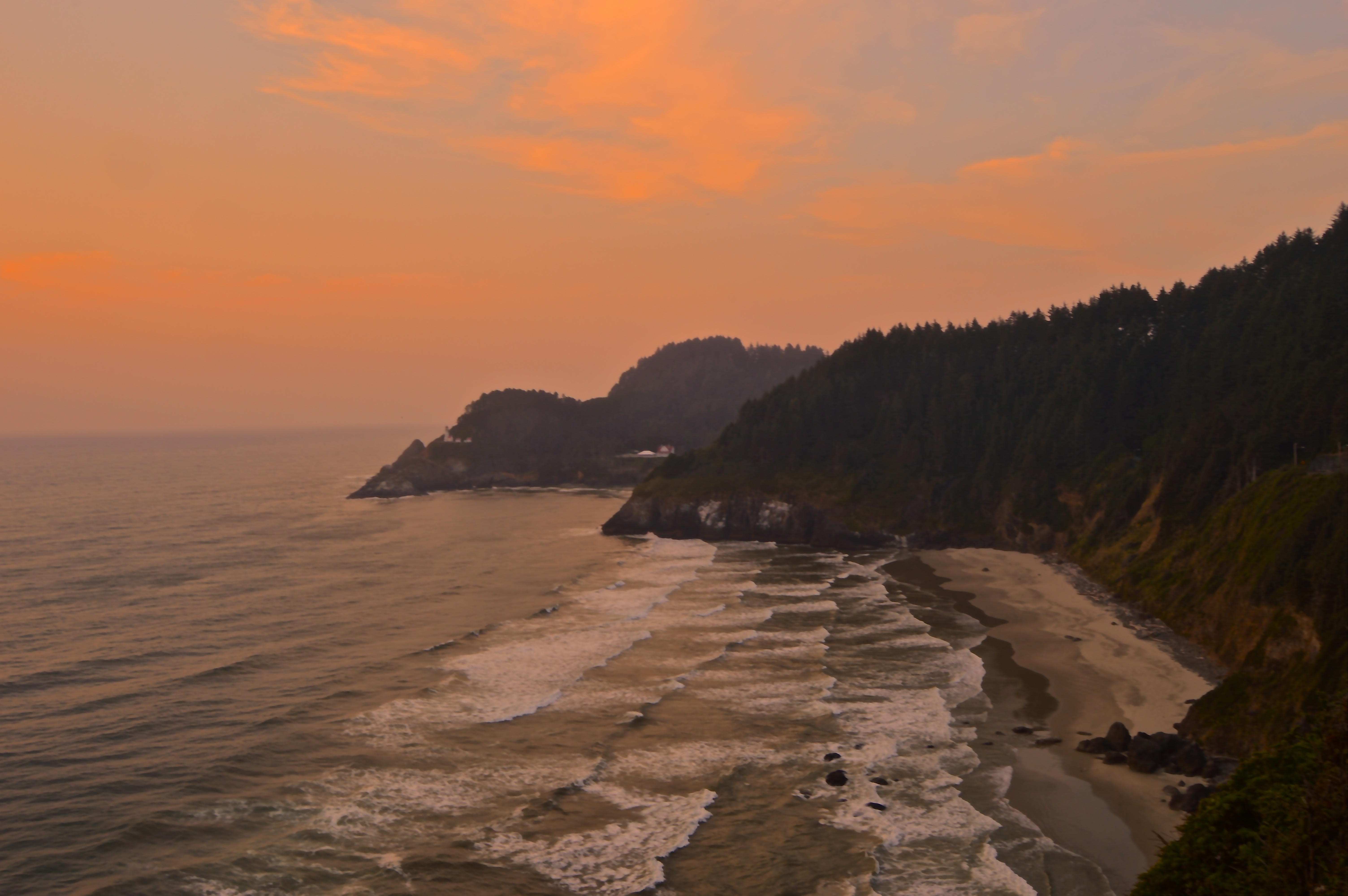
5. The iconic rugged coastline of Oregon.
6. The sun sets over the Pacific.


